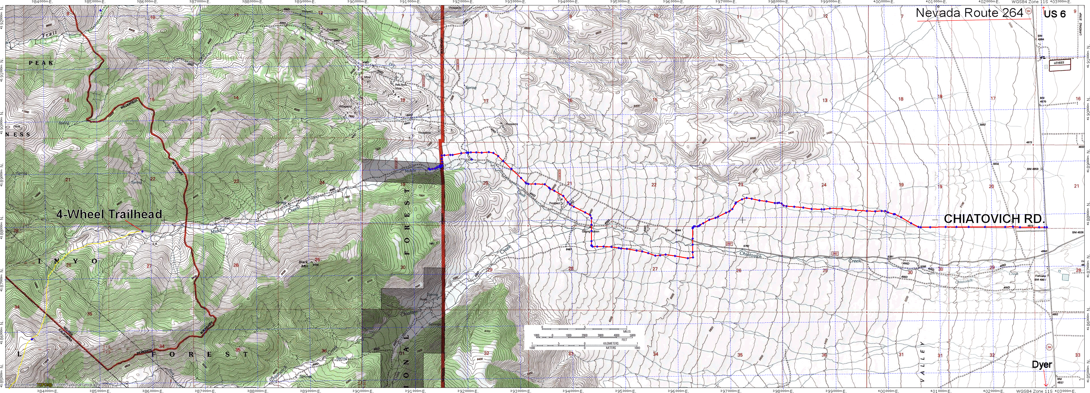
This is the road approaching Dubois from the East. The red line shows the new land developer's road connecting Nevada Route 264 to the upper Middle Creek Road. The Yellow dashed line shows how we started the hike (
OOPS - I left the yellow line off this picture, but you can see it
here ). The big loop shown by the USGS topo at the west end of the road does not exist. A high clearance 2WD vehicle might be able to get within a quarter mile of the 4wd trailhead. There was a little pullout on the left (south), about 20-30 feet around, where a couple of cars could park right before the 1st spot I had to go into 4WD (I even had to lock the rear differential) - it's not worth it to drive any further. The 4WD road ends at Lat/Lon North 37.83127 / West 118.29726 , 8,568 ft. altitude. Note that the 4WD road appears to extend into the Boundary Peak Wilderness, but the boundary is labeled "indefinite". The 1st "Boundary Peak Wilderness" sign posted is on the trail just
after the end of the road. I hope I wasn't violating the wilderness!


Comments
Post a Comment