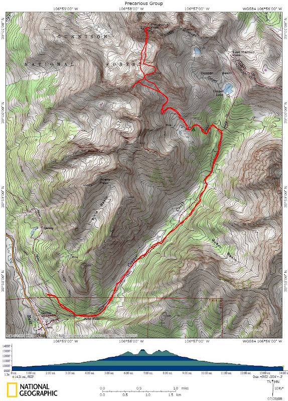
Intro/Stats
Precarious Pk (13380')
Pt 13232A
Pt 13260A
14.3 miles RT, 6200' gain
Via Copper Creek TH (9800')
July 25-26, 2008
Participants: Dominic Meiser, Sarah Thompson, Pete Krzanowsky, & Kevin Baker
Slideshow
Plans came together at the last minute for a trip to the Elks as I was looking to hit as many 13ers as the monsoon moisture would allow. There's only a few months out of the year to reasonably attempt the vast majority of the high peaks in the Elks, so this is the time to hit them! Sarah suggested the Precarious group late Thursday afternoon and I bit. A call to Pete was made and our hasty trip was set. Dominic and Sarah climbed White Rock and White BM on Friday, while we would meet up with them in camp Fri evening.
I have heard a little about Precarious, but I wasn't sure what I was getting into. There are just a few TR's out there for this loose choss pile, and we were able to get the key beta we needed thanks to Teresa Gergen and Kirk Mallory. I stumbled across some pics on Gerry Roach's website showing Jennifer clinging to an exposed downclimb into a nasty notch along the s.e. ridge. Teresa had to back off this notch in a hail storm, so we decided to go Kirk's way via the steep south face to save some time.
Pete and I met in Buena Vista and carpooled to the trailhead which is on the north end of the small town of Gothic north of Crested Butte. The road to the trailhead has been moved and is now 1/2 mile north of the road on the map along Schofield Pass Rd. I should have brought my 2WD, as I probably could have gotten it there with careful driving.
Pack In
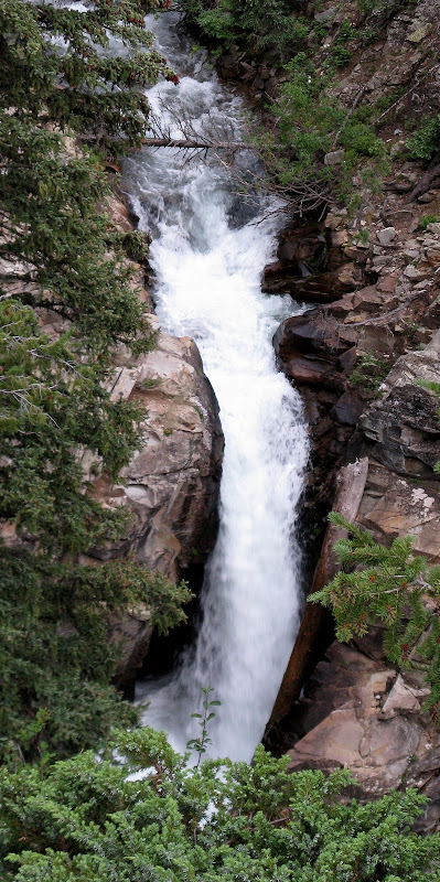
Pete and I set out at 7:15pm hoping there wouldn't be any late storms. The trail was wide and gradual for most of the way, so we made good time. Judd Falls was the highlight.
There were a few stream crossings that slowed us down, including the first one which we decided to put on our sandals for as it was close to knee deep in the middle. The rest of the stream crossings were minor.
Sarah and I had decided at the last minute to camp at a basin with 3 small ponds just s.e. of the 2 unnamed 13ers we were hoping to hit later in the day on Sat. This would put us in a better position to reach the south face of Precarious early in the day, totally avoiding the feared ridge difficulties. Pete and I found the mining road after a few minutes of searching in the dark leading to this basin. We found Dominic and Sarah' near treeline along the road despite my walkie talkie being dead. It was only about 4.5 miles/1700' of backpacking to camp and we arrived at 9:45.
Precarious Indeed
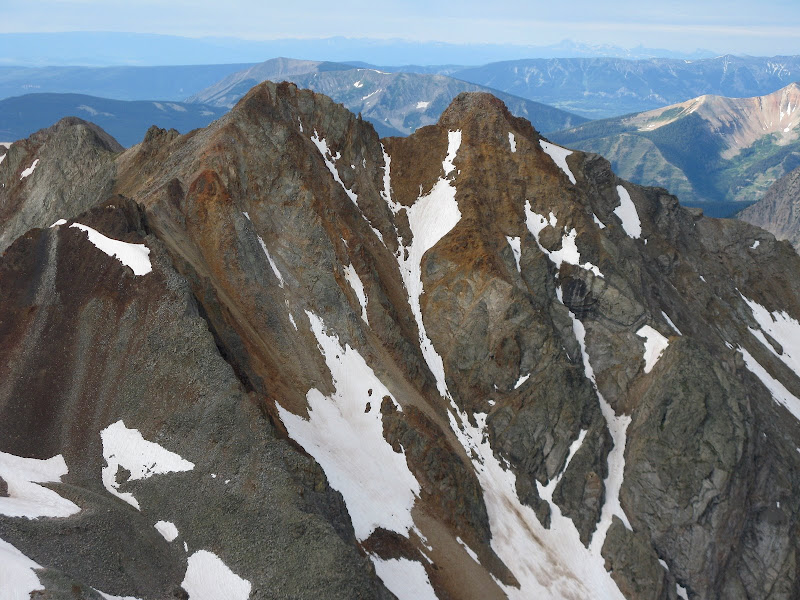
4:30am came quick after the short night and we were off at 5am under overcast skies. I was still optimistic that we could hit all 3 peaks with the short approach despite the weather looking gloomy. We followed the road as it switchbacked up the basin and left it at around 12100'. From here, we climbed fairly stable talus and utilized remaining snowfields when we could and were treated to an intimidating view at the saddle to Precarious.
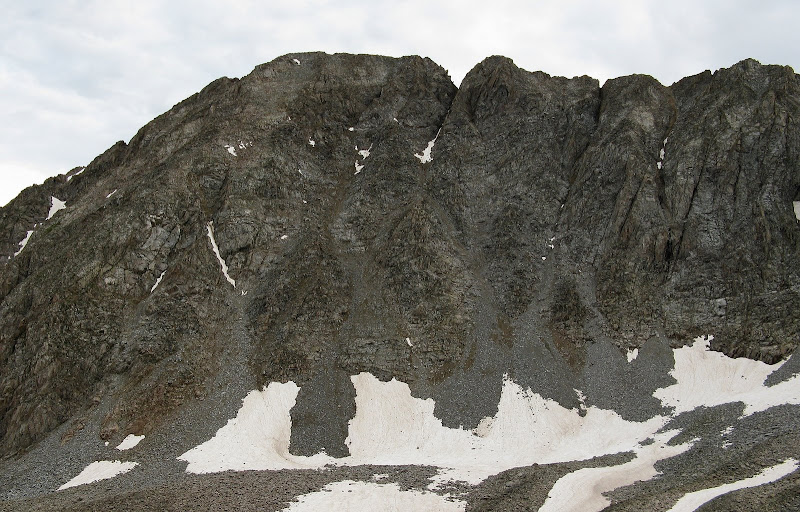
This saddle splits 13260 and 13232, our goals later in the day if the weather held. From here we had to descend over the saddle into Rustler Gulch. The stability of the talus worsened, and we knew we were in the Elks! The boulder hopping was tedious at times as there were many ups and downs to be had in the basin complete with some minor cliff bands to negotiate. Our only significant rockfall incident of the day was when Pete was climbing up some steep talus and the whole slope shifted on him!
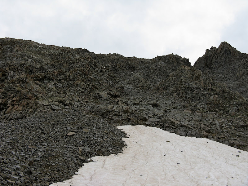
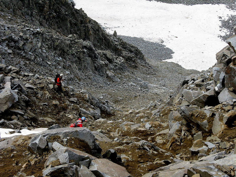
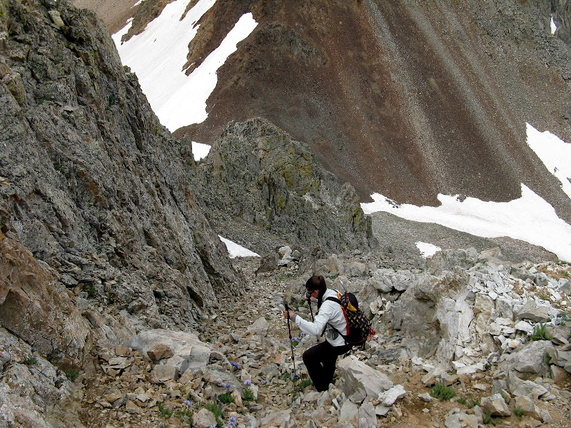
We made it down to the base of the obvious gully we would ascend on the south face of Precarious. From Kirk's TR, he said to take the first gully to the left of the notch on the s.e. ridge. The gully kind of blended into the face near the top, but it looked pretty reasonable albeit very loose! To give you an idea of the steepness, we would be climbing ~900 ft in 2/10th's of a mile!
The routefinding up the gully was pretty straightforward and could be kept at a very loose class 3. We would sometimes seek out a harder line if the rock was more stable.
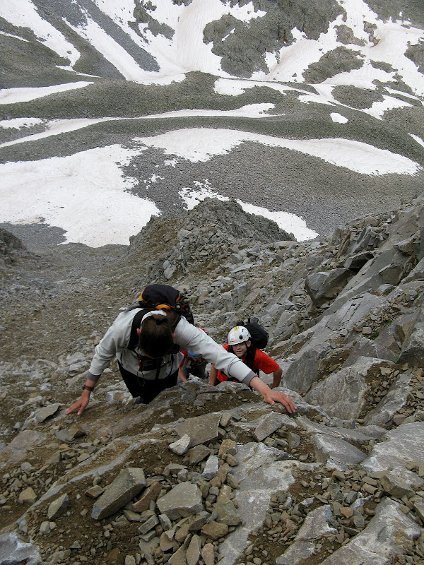
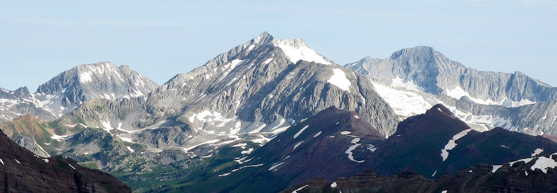
We stayed fairly close together or fanned out in case of rockfall, but everyone did a great job of watching where they were stepping. Near the top, I zigged to the left onto a rib where the slope finally relented above it. We were amazed at how quick this went and we topped out on the exhilirating summit at 8:20am. It was still cloudy, but it appeared that there wasn't going to be any rain for awhile. We were rewarded with some great views of the familiar Elks, although the lighting was poor today.
Snowmass and Capitol:
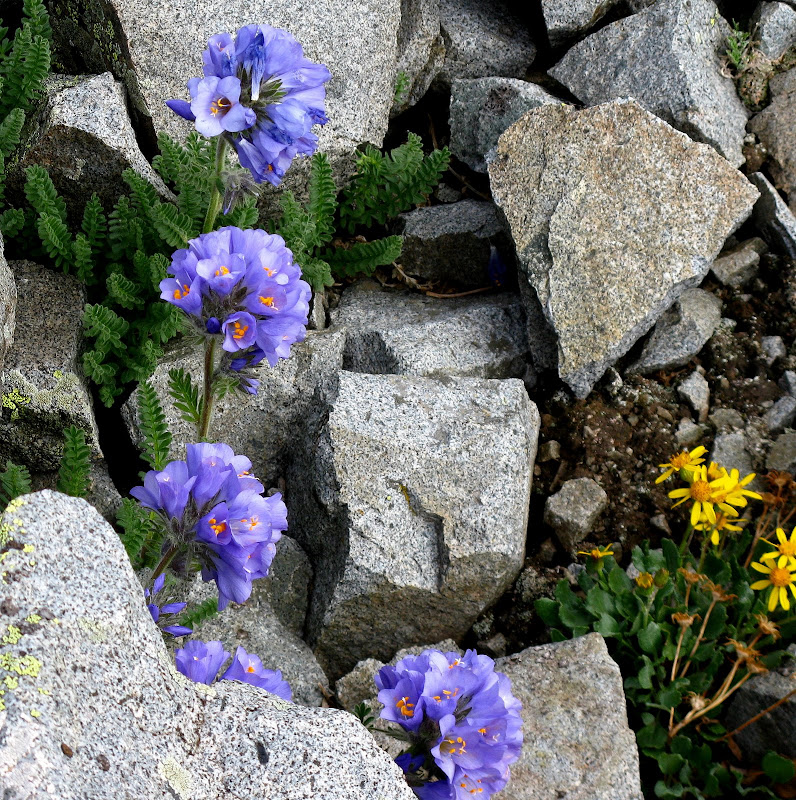
We also saw a lot of these purple flowers amidst the ruggedness.
This mountain sees few visitors, which is a good reason why the rock is questionable. We were all not looking forward to the descent, as it was a controlled slip-n-slide down the face. At times I wondered if we had came up certain steep sections as it was tough to follow the same line we had came up. I think the descent took just as long as the climb as we made sure to tread lightly on this loose mess.
13232, 13260, & Descent
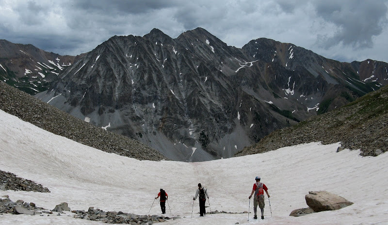
The next objective was 13232, which went nicely via its n.w. slopes. We retraced our steps through the boulder fields and cliff bands and followed a nice finger of snow to near 13K' along the north ridge.
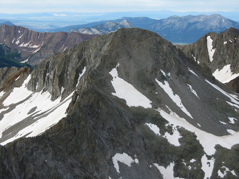
From there, it was an easy stroll to the summit. We topped out at 10:30, and it was looking like the weather would hold to add nearby 13260 to the south!
The descent of 13232 seemed to be just as loose if not more than Precarious. Pete dubbed this peak "Treacherous", although it was only like that on the west ridge. There are several gully choices along the north side of the ridge that will bypass some impossible towers. We went down one at a time on the first one, then fanned out and took different lines the rest of the way down.
Back at the saddle we ascended in the morning, all that was left was a 440 ft grunt up 13260. This climbed proved to be the most stable of the day and was straightforward. There was one minor ridge point on the way up that we just went over. This peak features dual summits, but it was obvious that the easier and closer east summit was higher. I was bummed that I hauled my hand level to camp and left it in the tent! We felt a few sprinkles on the way up, but nothing happened. Would the luck of Mr. Bluebird hold for the whole day?
For the descent, we bailed off the ridge down a fun scree chute at 13K' down to the basin. We boot surfed down some snowfields and were back at camp by 1:20pm after filtering some water.
Pete and I wanted to move camp down for an attempt at White Rock and White BM on Sunday, but it started raining just as we left camp. I didn't like the thought of setting up camp and cooking in the rain, so we decided to hike all the way out with Dominic and Sarah for a hike the next day of Taylor and Star near Taylor Park Reservoir.
GPS Track:
Comments
No comments posted yet.
