Toggle navigation
Mountains
Routes
Images
Trip Reports
Forum
What's New
People
Areas & Ranges
Articles
Trailheads
Canyons
Huts & Campgrounds
Albums
Logistical Centers
Fact Sheets
Lists
Custom Objects
Gear
Plans & Partners
WELCOME TO SUMMITPOST
SIGN IN
REGISTER
Montara Mountain
Additional Parents
Image
Montara Mountain trail map...
View High-Resolution Image
Montara Mountain trail map...
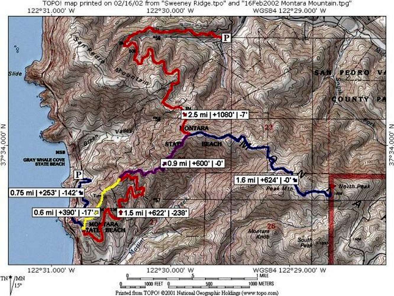
Montara Mountain trail map for the two common western approaches. The red "P" is the starting point within San Pedro Valley County Park, while the blue "P" is my preferred Mc Nee Ranch SP/Montara Beach SP starting point.
« PREV
NEXT »
mpbro
on
Feb 17, 2002 11:40 am
Comments & voting
Other parents
Lat/Lon:
37.56150°N / 122.4765°W
Image ID:
5074
11945 Hits
71.06
% Score
1
Votes
Log in to vote
Comments
No comments posted yet.
to post!
Don't have an account?
Montara Mountain
(Mountain/Rock)
« PREV
Viewing
#17 of 32
GALLERY
NEXT »
mpbro's Image Gallery
« PREV
Viewing
#254 of 305
GALLERY
NEXT »
×
You need to login in order to vote!
User Name
Password
Remember me
Forgot your password?
Log me out when I close my browser.
Keep me logged in all the time.
sign in as a user
Don't have an account?
Register now for FREE
Rating available
Suggested routes for you
People who climb the same things as you
Comments Available
Create Albums
Register Here


