Welcome to SP!  -   
 
 New features are here! - Read More... 
Areas & Ranges·Mountains & Rocks·Routes·Images·Articles·Trip Reports·Gear·Other·People·Plans & Partners·What's New·Forum

Monte Cristo Trail Head Route.

 
[ Sizes: Orig | Med | Small | Thumb ]
Monte Cristo Trail Head Route.


Comments

[ Post a Comment ]
Viewing: 1-1 of 1

mpbroMap shows all main approaches to Quandary Peak

mpbro

Hasn't voted

Highway 9 is the red line in the lower right hand corner of the map. The trailhead for the standard (East slopes) route is marked on this map. To access routes to the north (Inwood Arete, Quandary Couloir II), continue down the road (Summit County 851) to a locked gate and park your car.


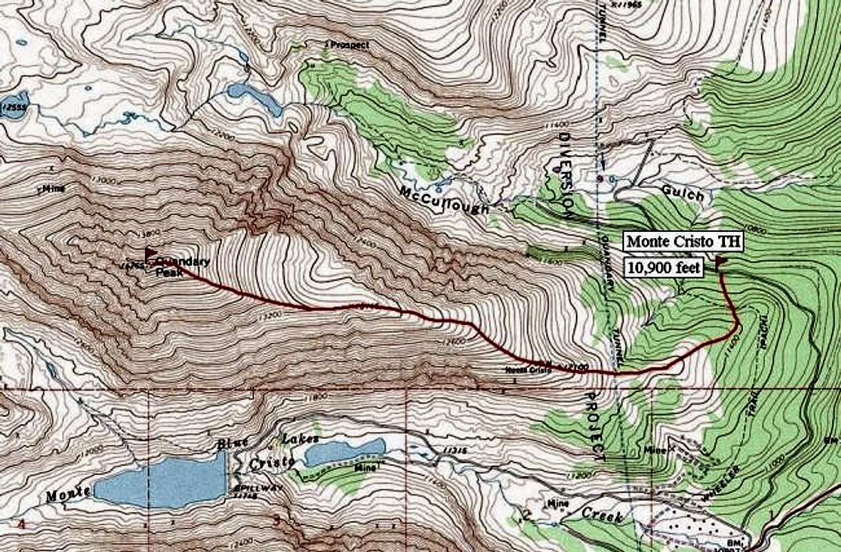
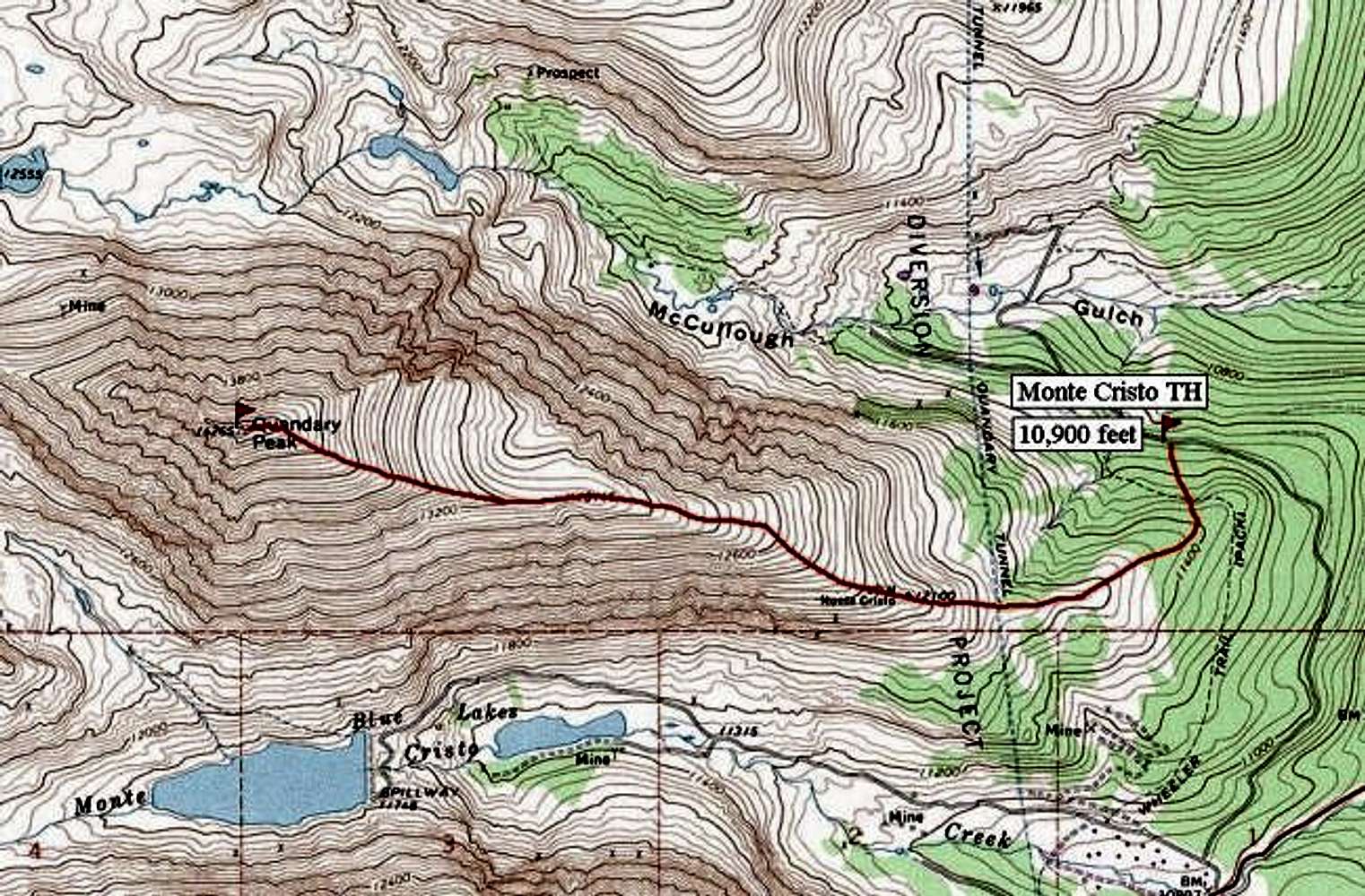
The West Ridge route is accessed via Blue Lakes. Park in the open dirt lot just below the spillway. The trail is marked on the map. After it "ends", just follow the small creek and climb the headwall at its source to reach the Fletcher/Quandary Col, access point for climbs of Quandary's West Ridge and Fletcher's southeast slopes.
Posted Apr 21, 2002 8:27 pm

Viewing: 1-1 of 1

Sign in to post!

Don't have an account? Register now.


Rate This Image
Current Score: 64.6

Log In To Vote
 Quandary Peak (Mountain/Rock)

Quandry from CR-9 below...
« PREV

Viewing
#331 of 436
GALLERY
Quandary Peak
NEXT »

 odysseus's Image Gallery

Evans elevation profile for...
« PREV

Viewing
#49 of 74
GALLERY
The visibility was about 100...
NEXT »
Image Data

odysseusSubmitted by odysseus
on Aug 23, 2001 2:47 pm

Image ID: 1573
Hits: 2842 

Lat/Lon: 39.39700°N / 106.1°W


"Common sense is what tells us the Earth is flat and and the Sun goes around it."

© 2006-2012 SummitPost.org. All Rights Reserved.