

Branko - Jul 7, 2009 2:54 am - Hasn't voted
How do you......make these wonderful maps Vid?
...do you have a program for that?
Brgds, Branko.

Vid Pogachnik - Jul 7, 2009 6:43 am - Hasn't voted
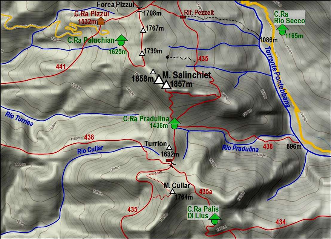
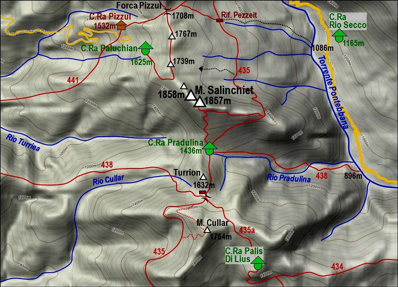
Re: How do you...I don't have any special program, I draw them in PowerPoint. It goes like this:
First, it's good to have a program (used to be shareware), called SnagIt. It enables you to capture any part of your screen to use it as a picture. So, first I go to Google Maps, get close to the area, then with SnagIt I cut the respective part of the screen. Then I open PowerPoint and paste the picture of terrain - the grey one, above. The rest is hand-drawing in PowerPoint. But when you have one map, you can use object for another map, for example huts, text labels, etc. However, you must draw paths, roads, rivers, using curve tool. And you need an original map to know where is something. When I'm satisfied with the map I save it in PowerPoint, but then also cut it with SnagIt again, and paste the whole picture in Photoshop. Just to save it again in jpg format. May be PowerPoint itself would allow me to save jpg as well. For such a map it's may be 30 min of work.


Comments
Post a Comment