
-
 7391 Hits
-
 82.55% Score
-
 17 Votes
|
|
Mountain/Rock |
|---|---|
|
|
39.58750°N / 105.84518°W |
|
|
Summit County |
|
|
Hiking |
|
|
Spring, Summer, Fall |
|
|
12474 ft / 3802 m |
|
|
Overview
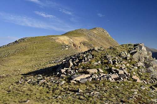
Morgan Peak is 12,474 ft / 3,791 m mountain peak near Montezuma, Colorado.
This un-ranked ''12er'', according to Listofjohn
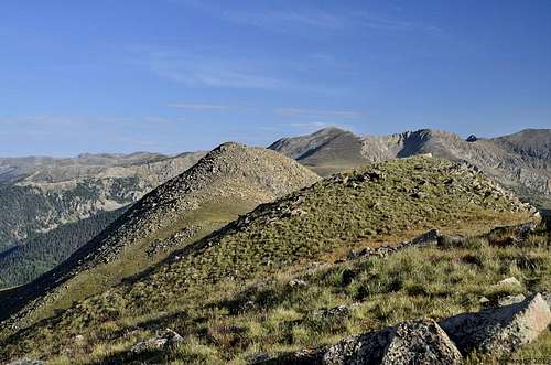
![Views from the ridge]()
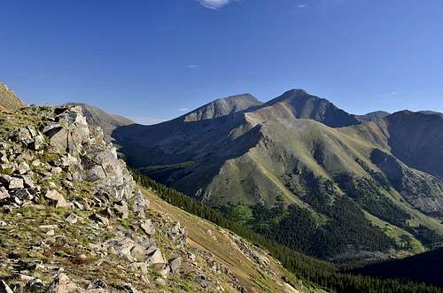
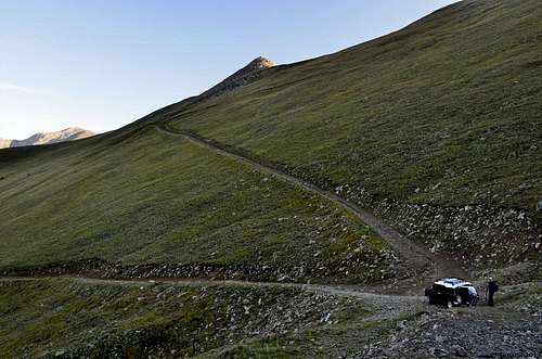
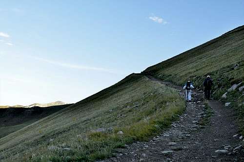
and Garry Roach list is 382 highest among ''12ers'' and 1019 highest peak in Colorado. Morgan Peak is not much of mountain, but it's nice complimentary peak on the way to more known 13ers in this area. I'm not sure if anyone want to hike this peak as a individual peak, but it makes nice hike together with Santa Fe Peak, Geneva Peak and others. Morgan Peak wont disappointed you with one thing, its views of Greys Peak and Torreys Peak and some other well know peak in the area such as Mount Edwards, Mc Clellan Mountain, Ruby Mountain and others. Getting to this mountain is very easy, with proper vehicle you can drive on Santa Fe Roadalmost to 12,300 feet, and from saddle it's only 30 minutes hike to the summit.
Elevation : 12,474'
County : Summit County
Quad : Montezuma
Saddle : 12, 300
Line Parent : Santa Fe Peak
Proximate Parent : Santa Fe Peak
Isolation : 1.32 miles
Quad : Montezuma
Coords : 39.5869°N, 105.8454°W
Rise: 174'Saddle : 12, 300
Line Parent : Santa Fe Peak
Proximate Parent : Santa Fe Peak
Isolation : 1.32 miles
Getting There
Trailhead:
From U.S. 6 west of Loveland Pass,exit at Keystone and drive to the Montezuma road near the east end of the ski area. Drive approx. 5.5 miles to the town of Montezuma and look for the 264 road on the left, at a stop sign near the middle of town. Turn left and drive about 1 mile or further to find good parking on the side of the road. The road is also known as the Santa Fe Peak road.
Parking ''spot"
Hiking the road
Route
|
|
|
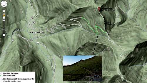 Hiking Map
Map
When to Climb
Spring, Summer, Fall
Camping
Off the Montezuma road there is an area on the right side of the road where there is camping. It is very visible from the road. There is a lot of trees and the Snake River runs on the west side of this area. It is about 2 to 2 1/2 miles from US 6.