Toggle navigation
Mountains
Routes
Images
Trip Reports
Forum
What's New
People
Areas & Ranges
Articles
Trailheads
Canyons
Huts & Campgrounds
Albums
Logistical Centers
Fact Sheets
Lists
Custom Objects
Gear
Plans & Partners
WELCOME TO SUMMITPOST
SIGN IN
REGISTER
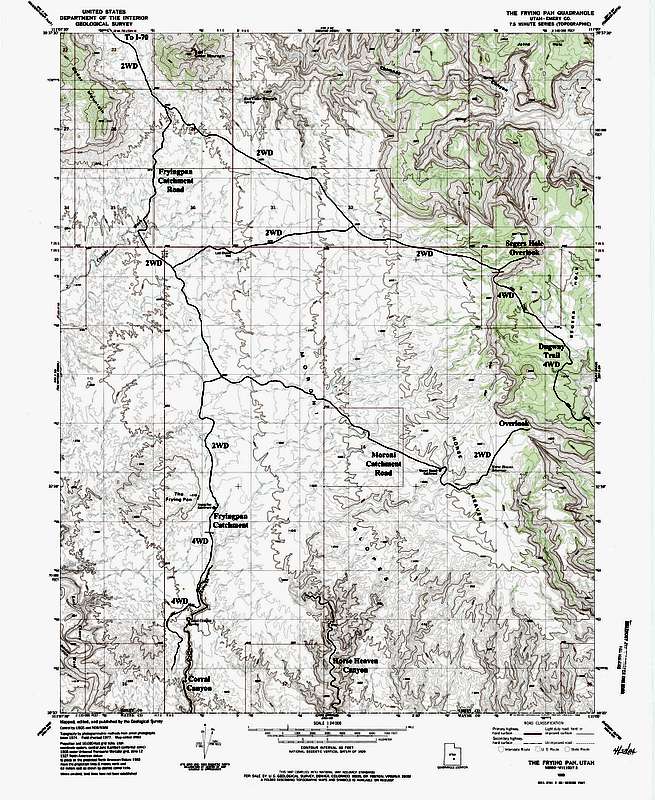
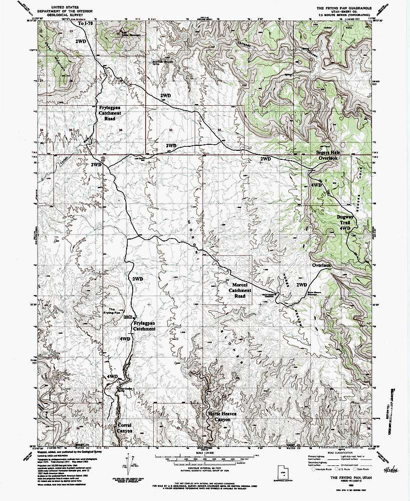
Moroni Slopes Topo Map
Moroni Slopes Topo Map
View High-Resolution Image
Moroni Slopes Topo Map
Topo map showing the roads to the Moroni Slopes from I-70 to the north. Also shows the Fryingpan and Moroni Slopes Catchments, Corral Canyon, Horse Heaven Canyon, the Segers Hole Overlooks and the Dugway Trail
« PREV
NEXT »
Matt Lemke
on
Dec 6, 2012 4:46 am
Comments & voting
Other parents
Image ID:
828689
1359 Hits
71.06
% Score
1
Votes
Log in to vote
Comments
No comments posted yet.
to post!
Don't have an account?
Matt Lemke's Image Gallery
« PREV
Viewing
#3556 of 4807
GALLERY
NEXT »
×
You need to login in order to vote!
User Name
Password
Remember me
Forgot your password?
Log me out when I close my browser.
Keep me logged in all the time.
sign in as a user
Don't have an account?
Register now for FREE
Rating available
Suggested routes for you
People who climb the same things as you
Comments Available
Create Albums
Register Here


