
|
|
Mountain/Rock |
|---|---|
|
|
44.62231°S / 168.40669°E |
|
|
Mountaineering |
|
|
9248 ft / 2819 m |
|
|
Overview
Probably most people who visit the South Island of New Zealand will find themselves at Queenstown at some point in their itinerary. There are many good reasons for this, as it is undoubtedly the adventure capital of New Zealand with it's jetboating, bungee jumping, paragliding and mountain biking (Not to mention Speight's Ale House)
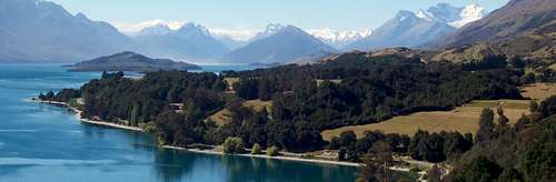
While many visitors enjoy the vistas of Lake Wakatipu from Queenstown, or even take a trip on the old steamer "TSS Earnslaw" many people miss the significance of the name of the ship and often also miss out on the opportunity to travel to the northern tip of Lake Wakatipu which is formed by the confluence of the Rees and Dart rivers.
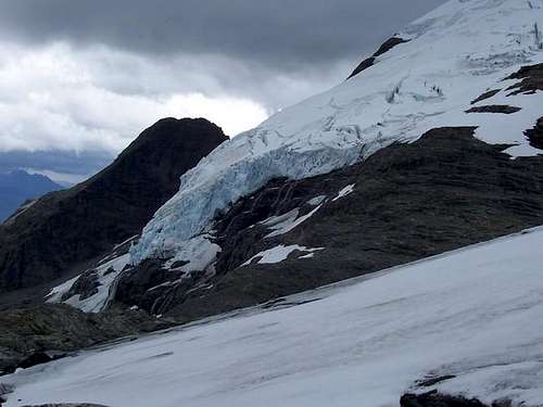
Sitting between the Rees and Dart rivers is an impressive horseshoe-shaped twin-peaked massif with an equally impressive glaciated south face which beckons as you drive the final few kilometres up to the head of the lake. This is Mount Earnslaw, after which the famous lake steamer is named.
Mount Earnslaw (Pikirakatahi in the Maori language) on the right of photo
A little bit of mountaineering history.
It is a little known fact that the Rev W.S. Green, who was the first person to attempt to climb Aoraki/Mt Cook,also made the first known attempt to climb Mount Earnslaw later in the same journey he made from the UK to New Zealand in 1882.
Green made a miserably unsuccessful attempt to climb the SE ridge from the Lower Rees Valley. The route was a bad choice, as anyone studying a modern topographic map would quickly conclude. The weather added to the difficulties while his party was still on the horizontal section of the ridge and the upper SE ridge was not attained.
Ironically Green ignored a certain Mr Harry Birley's advice to travel further up the Rees and access the mountain from what is now the standard approach route through Kea Basin, ascending the Birley Glacier and through Wright Col - a route which Birley pioneered and resulted in his FA of the summit on 16th March 1890. Birley summited solo, cutting steps up the upper reaches of the glaciated east face to East Peak, being the higher of the twin summits.
Even prior to the arrival of W.S. Green, the area around Mt Earnslaw had become the earliest recorded venue for recreational mountaineering in New Zealand with Frank Huddleston's ascent of Cleft Peak from the Rees Valley in 1874.
The second peak, being the West Peak, although 14 metres lower than East Peak is a more challenging objective, being much craggier and steeper than East Peak from pretty much every direction and it remained unclimbed until its eventual FA in 1914 by Frank Wright (after whom Wright Col is named) and John Robertson via the north face.
In 1932 the first traverse from East to West peak was achieved by Andy Jackson and Scott Gilkinson. This route, (especially in reverse, ascending the north-west ridge of West peak) is nowadays regarded as one of the classic climbs of New Zealand.
Getting There
From Christchurch or Auckland International airports, you can switch to a domestic flight direct to Queenstown, which is approximately 50 road kilometres from the Rees Valley trailhead at Muddy Creek where you can park your hire car or be dropped off by a shuttle bus from Queenstown.
(Direct flights from Australia are available Sydney-Queenstown and Brisbane-Queenstown).
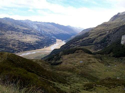
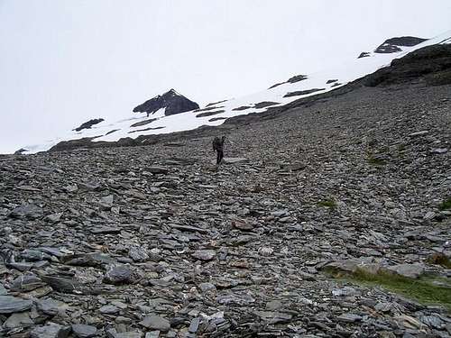
From the Muddy Creek trailhead it is about 8 kilometres walk along the Rees-Dart Valley trail, the first few km being a 4WD trail and the remainder a footpath in various states of bogginess and cattle contamination, largely depending on recent weather. At some point you need to cross the Rees River. This is usually best done in the vicinity of Twenty-Five Mile Hut (CMC) and across a reasonably obvious stretch of wide braided stream where the stream bed is relatively shallow.
After crossing the river in the vicinity of the Twenty-Five Mile Hut, you should see a wind sock in front of an old moraine bench just at the forest line. A bit of casting about from the top of the moraine bench(excellent campsite!) should reveal two orange triangular markers directing you to the start of the zig-zag track which ascends into the forest.
****A word of warning: The Rees floods quite readily after rains or in fast melt conditions. If trapped on the wrong side, there is no need to attempt a risky crossing. There is a footbridge a couple of km upstream of the base of the track up the mountain which, although time-consuming and inconvenient, is a much safer option.
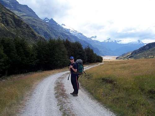
Just beyond Muddy Creek Trailhead, Rees Valley
Access to the harder approaches from the west (The Dart Valley) start from the general vicinity of Chinaman's Bluff. This is usually quite accessible by 2WD cars as is Muddy Creek (most of the time!)
Red Tape
No permits are needed.
You can leave your trip intentions at DOC office in Glenorchy (on the right as you head into town)
When To Climb
The best season is from December to the end of February.
Camping
An excellent campsite is located on the old moraine bench at the foot of the ascent track beyond the Rees crossing point - great if you had a lazy lunch-time start from Muddy Creek after a night in the fleshpots of Queenstown!
There are two huts available on the ascent:
1) Earnslaw Hut (at about 1000m - still below the tree line) It is owned by the DOC. Some describe its condition as "derelict" but I quite like it for its historic feel and rustic construction. This is where Frank Wright commenced his FA of West Peak back in 1914. Old hessian and beech bunks, a fireplace and a bench to cook on. What more do you want? - Mice? OK they have mice but they also have wire hooks to hang your pack on to the confound the little buggers.
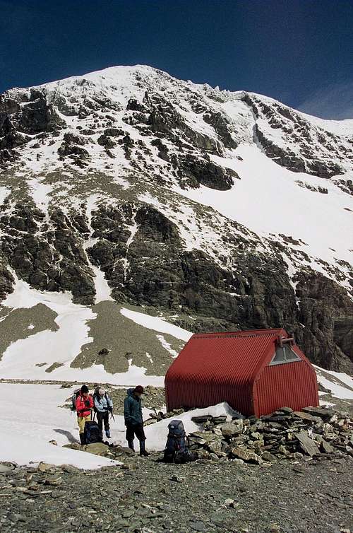
2). Esquilant Bivvy at Wright Col (Just beyond it actually) at 2150m owned by N.Z ALPINE CLUB - for more details click this link - http://www.nzalpine.org.nz/site_pages/main_navigation_bar/huts/esquilant/esquilant.htm
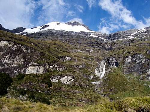
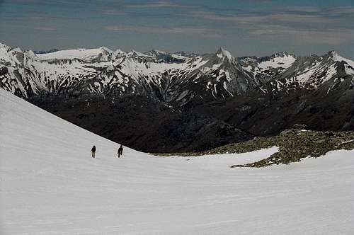
In addition to the huts, just above the treeline, the approach trail takes you past two excellent rock Bivvies in Kea Basin, which on a clear starry night, are an absolute joy, and are still quite tolerable in rainy conditions (with the added advantage of being able to lazily collect drips in your cooking pots for drinking/cooking water).
Kea Basin has to be one of the most beautifully peaceful places on the planet.
Mountain Conditions
1). for info about the mountain and climbing in n.z http://www.nzalpine.org.nz/
2). for weather conditions the Department of Conservation - http://www.doc.govt.nz/

Miscellaneous Info
A return trip from Muddy Creek TH to the summit takes 3 to 4 days if you are lucky with the weather. It's best to allow five days for a stress-free return trip (This should give you at least a day in hand to hole up in a bivvy or hut if the weather turns bad as it often does - once you poke your head up over Wright Col, you could be grinning straight into the roaring forties which means there's nothing between you and Tierra Del Fuego except your teeth.
At around 45 degrees south latitude, there are long daylight hours available in summer. It stays light until almost up to 21:00.
News:.
On a recent visit, we took a side trip, hiking up the Earnslaw Burn towards the glaciated south face.
We "discovered" a new bivvy which is not on the map and is located on the eastern side of the river (ie. on the true left)about a kilometre upstream from the bivvy marked on the map. Look for a rock outcrop, about 300 metres east of the river, with sloping ground in front of it (which hides the actual bivvy until you're almost in it). This saves a potentially hazardous crossing to the marked biv if the river is up.
This is a handy spot if planning a trip over the Lennox Pass.
Someone has christened it the "To The Max Bivouac"
dadndave - Nov 25, 2004 9:52 pm - Voted 8/10
Untitled CommentSome excellent photos of the walk in along the Rees valley and up to Kea Basin are available on th OTMC (Otago Tramping & Mountaineering Club) website. www.otmc.co.nz
dadndave - Feb 20, 2005 8:41 pm - Voted 8/10
Untitled CommentYou can (and should) register your intentions at the DOC office at Glenorchy before departing for the mountain. If you become overdue they will notify police, search and rescue (if necessary) and next of kin etc.
mattjohnson - Mar 7, 2005 8:50 pm - Hasn't voted
Untitled CommentRoads:
If you don't have your own car you can hire transport on a number of different shttles that operate between Queenstown- Glenorchy and the start & finish of many tracks in the area (Rees-Dart/Routeburn, etc.).
If you are driving yourself it is worth stopping in at the DOC in Glenorchy to see if there are any barriers to driving all the way to muddy flat. The road into the Rees valley 'fords' many streams that turn into real monsters after a prolonged heavy rain. It is possible that you and your car could be stuck at muddy flat or not even make it all the way there if the weather goes south.
Track:
The track in the Rees Valley is pleasant in dry weather, but prone to bog-like conditions after much rain and/or snowmelt. Once you get off the road and onto the actual track and have crossed the Rees for the first time you have the option of walking up onto the side hills to avoid the bog (and cows) below if it is really wet. Just head up onto the little hills on the right and sidle almost all the way to 25 mile creek where the ground again dries out. You will know when you reach the bog if it is really wet. This will save you much trouble and keep your feet dry for one more day.
To access the good bivy sites in Kea Basin and the route to the climb you will have to cross the Rees river. Your best bet for crossing will depend on how fast and deep the water is flowing at the time. Walk to where 25 mile creek spills into the river and begin assesing at that point. During low water the crossing is relatively simple and can be done just beyond 25 mile creek. During high water you need to be prepared to get wet and should look for the best possible crossing both before and after 25 mile creek. If the cows can get over there so can you.
Final word of advice: do not stay in the 25 mile hut. It is owned by the Otago tramping club and is in sad, sad shape; yet you will still be charged NZ$10 to stay there. if you can't make it to Kea Basin on day one, then be prepared to sleep out under the stars or a tarp in the flats near the hut.
gimpilator - Nov 29, 2015 10:29 am - Hasn't voted
CoordinatesPlease include the coordinates so this mountain appears on the map. (-44.622309, 168.41067)
dadndave - Dec 28, 2015 1:34 am - Voted 8/10
Re: CoordinatesDone! Cheers