
|
|
Mountain/Rock |
|---|---|
|
|
13.30990°N / 123.59755°E |
|
|
Hiking, Mountaineering |
|
|
4357 ft / 1328 m |
|
|
Overview
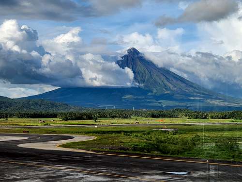
Mount Masaraga is a stratovolcano located northwest of the much more famous Mayon Volcano in the Legazpi area of the Philippines and on the island of Luzon. Since Mayon Volcano has been closed to climbing and hiking most of the time in recent years, I have included Mount Masaraga here and an alternative climb.
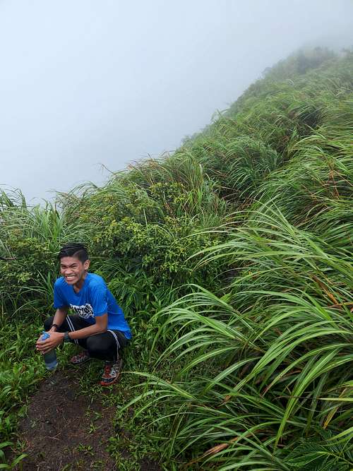
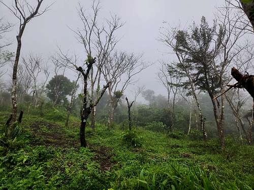
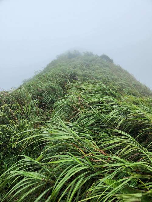
The views from Mount Masaraga looking over at Mayon Volcano are supposed to be incredible, but unfortunately during my trip we had nothing but torrential downpours.
This would be a great hike during dry weather, but the torrential downpours, lots of mud, and leeches on my attempt made for a trying experience and we only made it 2/3 of the way up.
Unforunately, in recent years there is a lot more red tape for climbing the volcanoes on Luzon. I arrived at the trailhead early in the morning, but was delayed for several hours since I wasn't allowed to proceed without a permit. A local went into town (Tobaco I think) to get a permit so I could make the climb. A certified guide is required as well and you won't be allowed on the mountain without one.
Since it was raining on my visit, my photos won't show what the mountain looks like, but see here for photos when it's not raining!:
Mount Masaraga Photos
Getting There
Your first destination is the city of Legazpi which can be reached by plane or bus. Legazpi is an interesting city with lots to do (caves, underground river, some hikes, etc.), so plan on spending a little time here. The airport has one of the best views of any airport in the world-if the weather is clear at least.
The beginning of the hike is at the Mount Masaraga campsite, which is off a side road of the Ligao-Tabaco Road. You can ride a bus part way, or take a taxi from Legazpi or Tabaco. The turnoff to the trailhead is near a restaurant known as "Pares sa Kurbada" and there is a sign pointing to the Mount Masaraga campsite. You will need to meet a certified guide at the campsite before you are allowed to climb the mountain.
If you have the time, I'd recommend arriving here the day before your climb in order to sort out the permit and guide situation. The campsite is a nice place and has tents and cabins to stay in as well as food avaiable.
Routes Overview
The route I am familar with is the steep and muddy trail from the Mount Masaraga up the south side of the mountain. The trail is pretty steep and can be really muddy and challenging during the rain. Since a guide is required, you won't need a written description, but plan on a hike lasting most of the day. Hopefully you will have good weather as the views will be spectacular.
Red Tape
Ug. A certified guide and permit is required to climb the mountain and is suprisingly a hassle to arrange. I'd recommend arriving at the Mount Masaraga campsite the day before your climb and sorting this all out.
When to Climb
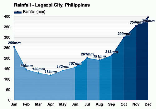
Anytime that it's not raining! This is a wet area. Weather charts show February through May as being the driest months in Legazpi, but I was told that June through August are the driest months on the mountain.
Camping
The Mount Masaraga Campsite at the trailhead is a great place to camp or stay in a cabin. Their Facebook Page is below:
Mount Masaraga Campsite