Bob Bolton - Dec 9, 2002 8:36 pm - Hasn't voted
Where did you shoot this?Fred,
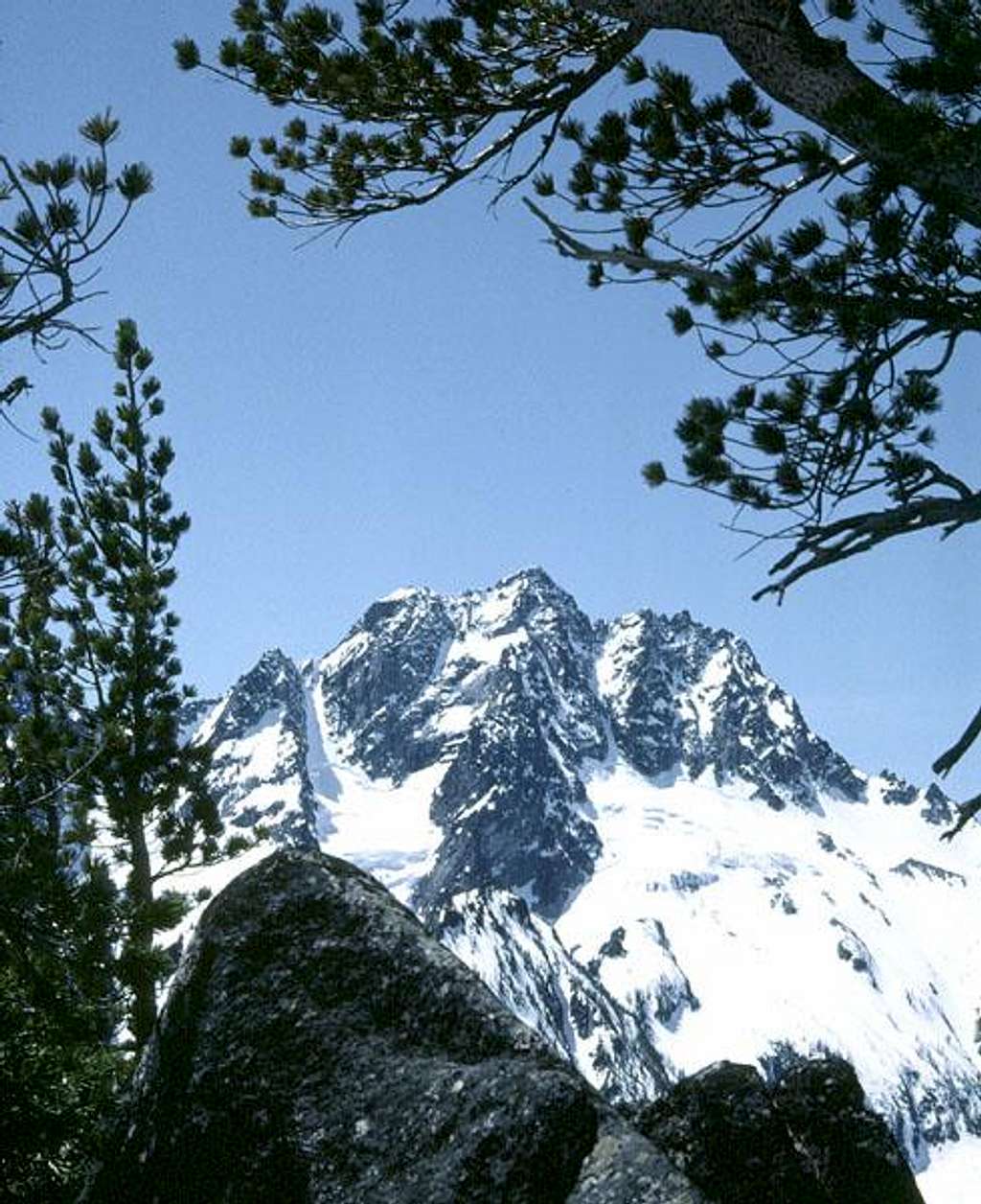
Cool shot of the north face. Where were you when you shot this?
Bob
Fred Spicker - Dec 10, 2002 5:14 pm - Hasn't voted
Re: Where did you shoot this?This was taken from near the top to the ridge between Lake Stuart and Eightmile Lake.
Bob Bolton - Dec 10, 2002 6:23 pm - Hasn't voted
Re: Where did you shoot this?John Roper, who I believe has been to more Washington summits than anyone else (over 2,700), wrote the following about that ridge. He claimed in a private e-mail that this is the second best view in the State, exceeded only by that from high on Luna Peak (Pickets).
But the reason I'm posting his trip report here is because you may wish to challenge his assertion that the first ascent was within the last couple of years - IF you summitted the peak. I'll be happy to put you in touch with John if you wish.
See the pic of this below taken from the summit ridge of Stuart. -Bob
MOUNTAINEER PEAK (USGS Mount Stuart)--This is the 6935’ (on the 15’ quad), now 6920+ high point of the multi-summited, complex “Mountaineer Ridge,” located between Lake Stuart and Mountaineer Creek.
Short story: Hike to Lake Stuart (4.7 miles, 1650’ gain) from the end of the Eight Mile Creek road/Colchuck Lake trailhead. At the lake, look up and identify Mount Stuart. The summit right in front of Stuart is the objective, even though it looks decidedly lower than the awful looking wall to the left. Identify two snow (rock, later) couloirs coming off the north face. Either one works, but the right one is easier and gets more sun. Best in May or early June when an ice ax is required; consider crampons.
Ian and I left [home] at 5:40 AM, driving 140 miles to the 3400’ park. We were hiking at 8:18 AM. It was one hour to Colchuck-Lake Stuart Y where we changed into boots at the 4500’ snow line. 2.2 hr to Lake Stuart 5064’. 5.7 hr to the top (even though the summit is only 1900 feet above the lake) because of icy snow. We relied on the good beta of alpha males Don G. and Mike T. whose party may have made the first ascent of this peak last year up the left couloir.
We approached relaxed, knowing it would be a straightforward climb, even though the three visible spikes on Mountaineer Ridge as you walk in past an open marsh are daunting. We took our time, and crampons would have been handy as the snow in the left couloir (which was hidden where we entered the open bowl above the inlet of Lake Stuart) was quite crisp in the shadowed gully, making for a cautious toe-banging ascent. The angle in the couloir is not severe, but steep enough to break bones if you lost it here on firm snow. Once out of the gully, we angled right on snow to the summit.
This is one of the best viewpoints in the state outside the North Cascades, especially this time of year on a glorious day, as we stared straight at the snow-plastered full North Ridge and icefall of Mount Stuart, only a mile to the south, and our seat was ideal for the big walls of the Big Boys of the Stuart Range, from Cannon to Enchantment, Colchuck, Argonaut, Sherpa, and the Back Court peaks, High Jack Ridge, Eightmile, and Axis.
We located and descended the western (right, from the bottom) couloir which was soft enough for comfortable plunge steps and joyous sitting glissades, making it back to the car in 2.7 hours.

Fred Spicker - Dec 11, 2002 6:05 pm - Hasn't voted
Re: Where did you shoot this?Bob,
We went to the top in 1976, but did not even consider this as a peak climb - just a conditioning trip. We went over the top from the Lake Stuart side and dropped down to Eightmile Lake and out that way. A nice 3/4 day trip. It is hard to believe that this was not climbed even prior to 1976.
Bob Bolton - Dec 11, 2002 8:23 pm - Hasn't voted
Re: Where did you shoot this?Fred, I just realized that I thought wrong about your reply - your shot was taken from the divide between Stuart Lake and Eightmile Lake, which would be north of Stuart Lake. I was thinking of the divide south of Stuart Lake. So that photo is the wrong ridge, and therefore might still only have been first climbed within the last couple of years. :-) The photo below is the ridge you traversed. Note that in this pic Stuart Lake is visible. Cool trip!
Bob


Comments
Post a Comment