


-
 3804 Hits
-
 82.48% Score
-
 15 Votes
|
|
Route |
|---|---|
|
|
45.70935°N / 7.31761°E |
|
|
Hiking, Mountaineering, Trad Climbing |
|
|
Spring, Summer, Fall |
|
|
A long day |
|
|
Enough easy |
|
|
Note
|
La montagna chiama i suoi figli, ed essi rispondono fedelmente al suo appello… Osvaldo Cardellina, Diario alpinistico, 1964-65 Page texts: @ OsvaldoCardellina "Osva", passed away on May 2, 2022. Page owners: Christian Cardellina e Osvaldo Cardellina. Any updates from September 12, 2022: Antonio Giani, page administrator, friend and climbing companion. Testi della pagina: @ OsvaldoCardellina "Osva", scomparso il 2 maggio 2022. Proprietari pagina: Christian Cardellina e Osvaldo Cardellina. Eventuali aggiornamenti dal 12 settembre 2022: Antonio Giani, amministratore della pagina, amico e compagno di salite. |
for Everyone Overview
The Valley of Aosta is a small Region in the size of the entire Alpine Arch from Ligurian Sea to the East and up the Adriatic Sea to the West, however, has a multitude of places where you can make beautiful and easy hikes. His thirteen Valleys and the many Vallons offer varied opportunities to attend and meet her and not cé need to climb Mont Blanc, the Grandes Jorasses, the Cervino or Matterhorn, Monte Rosa or the Gran Paradiso Ranges to achieve this result. Indeed these climbs, ranging over everything and everyone, often do not give a true knowledge of the same, often becoming unrealistic and out of the normality to be the Mountain and its most intrinsic particular features. In this little work, however, is meant to make known her to you completely, at least in all its main Valleys, proposing a series trips, ten for this first part, however, is meant to make known her to you completely, at least in all its main Valleys, proposing a series trips, one for each of them, with the primary objective of making you a 360° range across the complete Valley of Aosta. On the whole, but above all, because in all the same involve the taking of the whole direct vision.
![]()
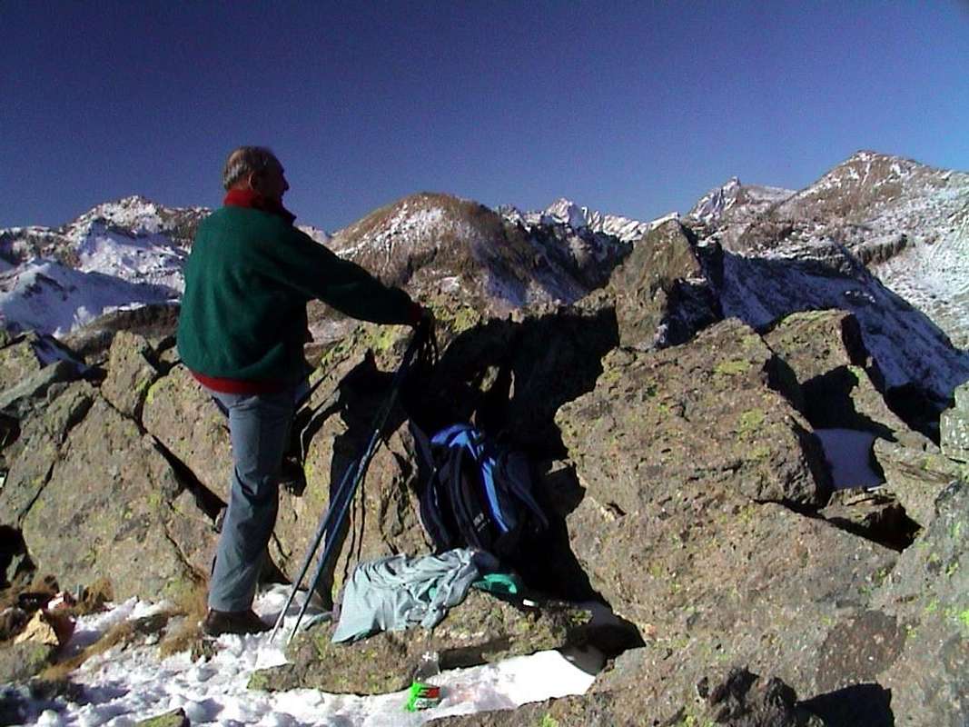
"A good break reflexive never hurts ...", by emilius
Can be, but is the certainty of feasibility of this arrival point, although with a single trip for each of them. For this raison this work is divided into three distinct parts or better areas that will give rise to three distinct pages and where, in this, we will visit the seven main Valleys South of Dora Baltea main Stream; starting as always from East to West, these are the Valleys interested: Champorcher, Cogne, Valsavarenche, Rhêmes, Valgrisenche, La Thuile and Little Saint Bernard, with the latter consisting of a secondary vallon to that of La Thuile but, by extension, attendance and historical and cultural past, has been regarded as valley in its own right. Seven are also considered the requirements for the routes description, with the elasticity of only two factors missing for each, which can be summarized in this way:
1) - : paths or marked trails, or failing this, simply always detectable both up during descent and where possible coincident. In any case always easy to identify and to follow.
2) - : easy route with itineraries aimed at E (Walkers) or EE (Expert Hikers), with the occasional use of the upper limbs; difficulties on rock from F (Easy) At the F+ ((middle intermediate grade more), with steps not greater than I°/I°+ (U.I.A.A. Scale or Union of the International Mountaineering and Climbing Federation)).
3) - : lack of glaciers or marginal traverses on thereof; snowfields or presence of glacial-snow-capped with a slope of no more than 30/35 degrees.
4) - : possibility of having at not great distances good support points as camps, bivouacs or shelters, generally always well marked along the way.
5) - : in the absence of these, there are points of cover from the elements as natural shelters, caves in the rock, Alps or "Casotti" (Cabins) by the Parks or Forest Rangers Huts.
6) - : absence of large and more or less obvious objective dangers over the path (falling stones, landslides, avalanches, snowslides or simply collapsing scaffoldings glacial).
7) - : vantage point of first order of the entire valley, possibly central and still to allow the full view on the same.
![]()
"From the trail that pass nearby Tsaplana towards Monte Creya" by Emilio Bertona aka emilius
A very huge or at least exaggerated claim?
1) - : paths or marked trails, or failing this, simply always detectable both up during descent and where possible coincident. In any case always easy to identify and to follow.
2) - : easy route with itineraries aimed at E (Walkers) or EE (Expert Hikers), with the occasional use of the upper limbs; difficulties on rock from F (Easy) At the F+ ((middle intermediate grade more), with steps not greater than I°/I°+ (U.I.A.A. Scale or Union of the International Mountaineering and Climbing Federation)).
3) - : lack of glaciers or marginal traverses on thereof; snowfields or presence of glacial-snow-capped with a slope of no more than 30/35 degrees.
4) - : possibility of having at not great distances good support points as camps, bivouacs or shelters, generally always well marked along the way.
5) - : in the absence of these, there are points of cover from the elements as natural shelters, caves in the rock, Alps or "Casotti" (Cabins) by the Parks or Forest Rangers Huts.
6) - : absence of large and more or less obvious objective dangers over the path (falling stones, landslides, avalanches, snowslides or simply collapsing scaffoldings glacial).
7) - : vantage point of first order of the entire valley, possibly central and still to allow the full view on the same.

La Valle di Aosta é una piccola Regione nella grandezza dell'intero arco alpino dal Mare Ligure a Levante e fino all'Adriatico a Ponente, però possiede una infinità di posti dove si posson effettuare belle e facili escursioni. Le sue tredici Valli ed i molteplici Valloni offrono variegate opportunità di frequentarla e conoscerla e non cé bisogno di scalare il Monte Bianco, Grandes Jorasses, Cervino, Monte Rosa od il Gran Paradiso per raggiungere questo risultato. Anzi queste salite, che spaziano sopra tutto e tutti, spesso non danno una vera conoscenza della medesima, diventando spesso irreali e fuori dal quotidiano essere della Montagna e delle sue più intrinseche peculiarietà. In questo piccolo lavoro, invece, si ha la pretesa di farvele conoscere completamente, almeno in tutte le sue principali Vallate, proponendo una serie di gite, una per ognuna d'esse, con l'obiettivo primario di farvi spaziare a 360° su tutta la Valle di Aosta. Su tutta ma, soprattutto, in tutta perché le medesime comportano la presa in visione diretta dell'intero territorio. Una pretesa decisamente enorme o perlomeno esagerata? Può darsi, ma esiste la certezza della fattibilità di questo punto d'arrivo, anche se con una singola gita per ciascuna d'esse. Per questo il lavoro viene diviso in tre distinte parti o meglio settori che daranno adito a tre distinte pagine e dove, in questa, andremo a visitare le sette principali Valli a Sud della Dora Baltea; partendo come sempre da Oriente verso Occidente queste sono quelle interessate: Champorcher, Cogne, Savarenche, Rhêmes, Valgrisenche, La Thuile e Piccolo San Bernardo, con quest'ultima consistente in vallone secondario a quella di La Thuile ma che, per estensione, frequentazione e passato storico-culturale, é stata considerata come valle a sé stante. Sette, inoltre, sono i requisiti per la descrizione degli itinerari, con l'elasticità di solo due fattori mancanti per ognuna, e così riassumibili:
1) - : sentieri o percorsi segnalati, oppure in mancanza, sempre semplicemente individuabili sia in fase di salita che in quella di discesa, laddove possibile coincidenti.
2) - : facilità della via con itinerari rivolti a E (Escursionisti) oppure a EE (Escursionisti Esperti), con l'utilizzo saltuario degli arti superiori; difficoltà su roccia da F (Facile) al massimo a F+ (Facile superiore), con passaggi che non vanno oltre il I°/I°+ (Scala U.I.A.A. o dell'Unione Internazionale delle Associazioni Alpinistiche).
3) - : mancanza di ghiacciai od attraversamento marginale dei medesimi; presenza di nevai o glacio-nevati con una pendenza non superiore ai 30°/35°.
4) - : possibilità di avere a non grandi distanze buoni punti di appoggio come accampamenti, bivacchi o rifugi, in genere sempre ben segnalati lungo il percorso.
5) - : in mancanza di questi, esistenza di punti di riparo dalle intemperie come ricoveri naturali, grotte nella roccia, Alpeggi o Casotti dei Parchi o della Forestale.
6) - : assenza di grandi e più o meno evidenti pericoli oggettivi sovrastanti il percorso (cadute di pietre, possibilità di frane, valanghe, slavine o semplicemente crolli glaciali).
7) - : punto panoramico di primo ordine sull'intera vallata, possibilmente centrale e comunque tale da consentire la vista completa sulla stessa.
![]()
Picture by Antonio
![]()
"If you are unsure stop and take some note ..." by emilius
![]()
"From here the whole Valley royally domains ..."
![]()
"Never bite off more than you can chew ... "by emilius
![]()
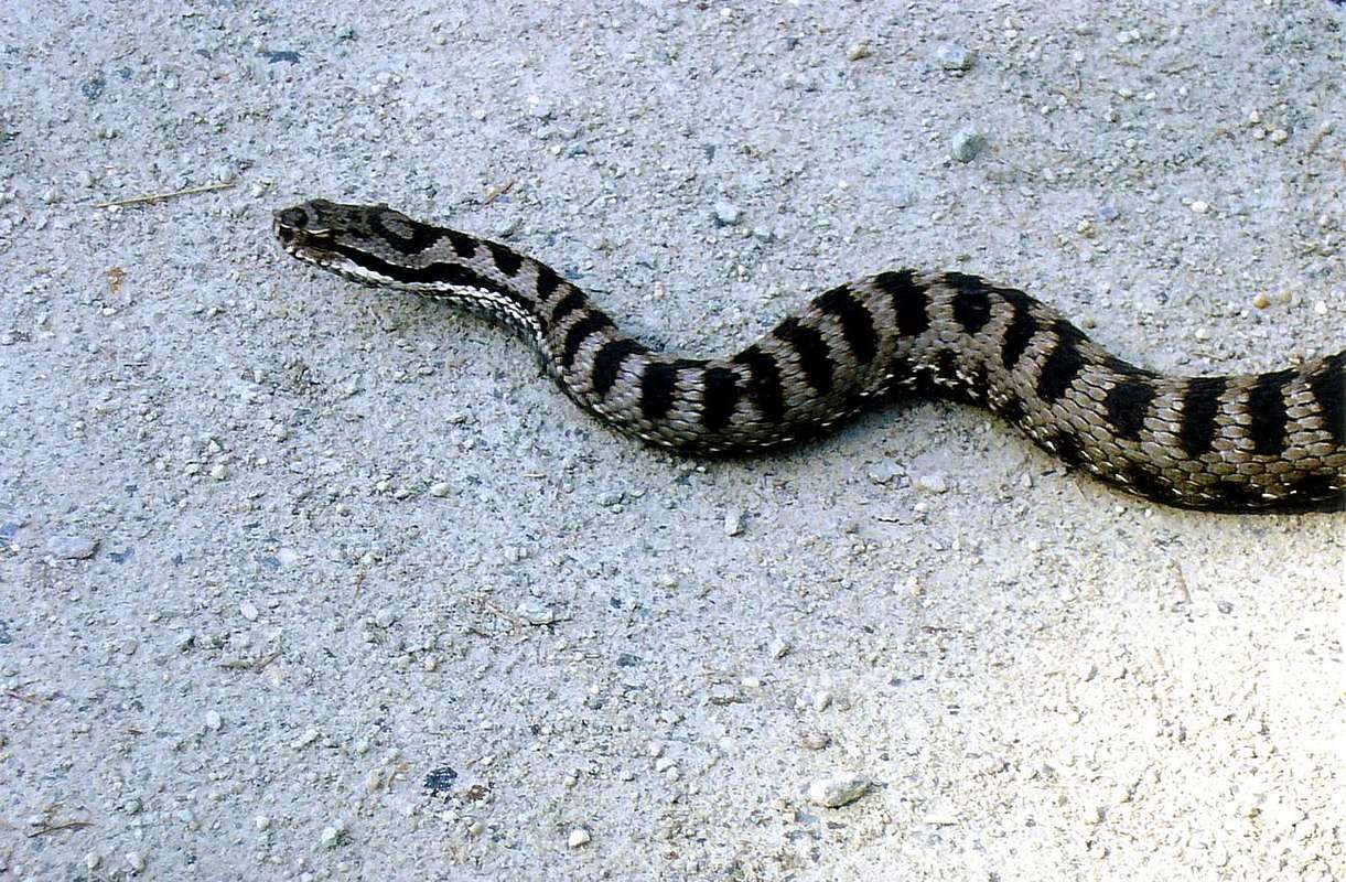
"Watch where you put your feet: is shy but bites ... " by Camillo Roberto Ferronato
![]()
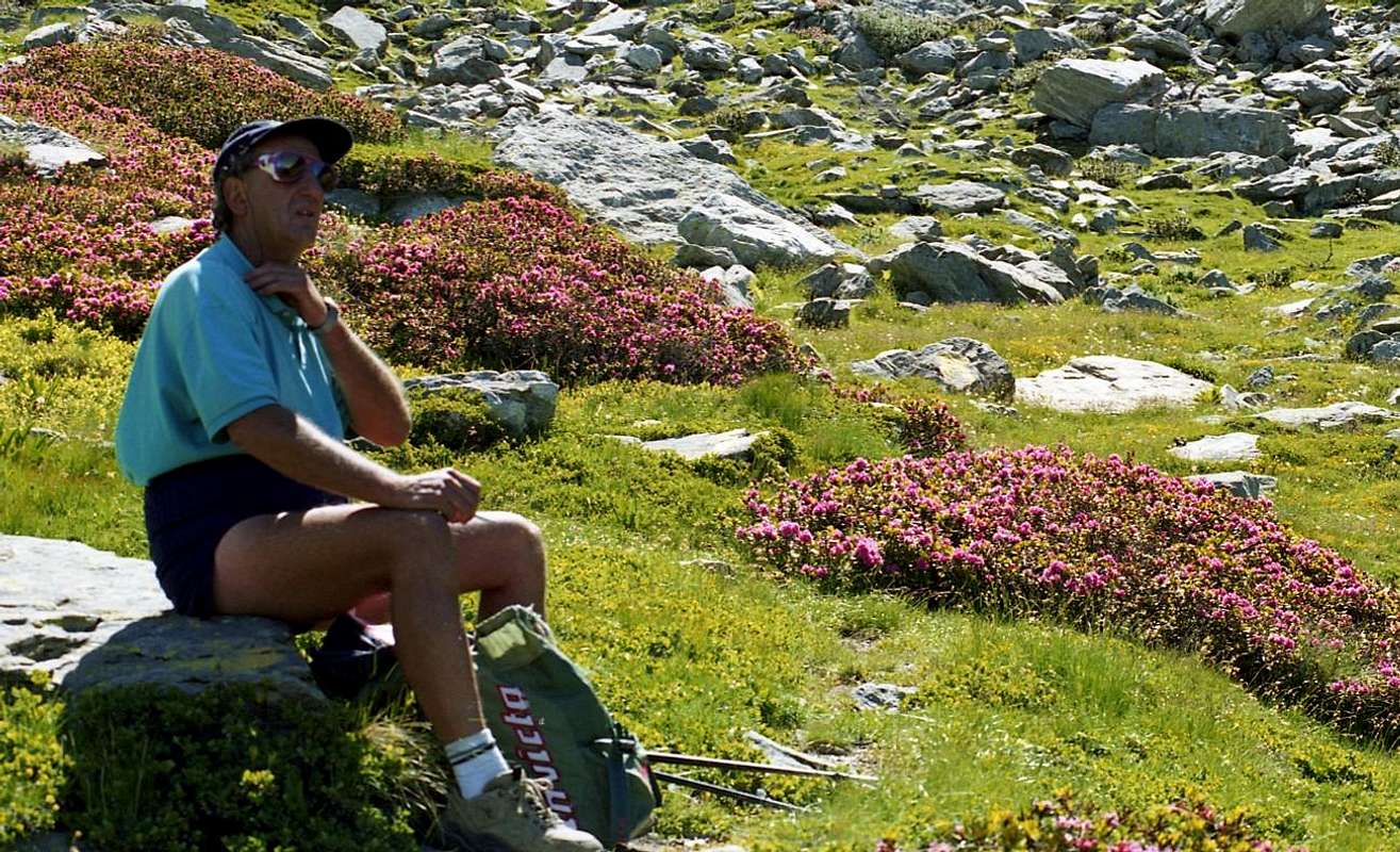
"If you are tired sit and smile to Life ... "by Marco Cossard "Crevassino"
![]()
"If you are "boiled" lying down and see the Map ... "by Marco Cossard "Crevassino"
![]()
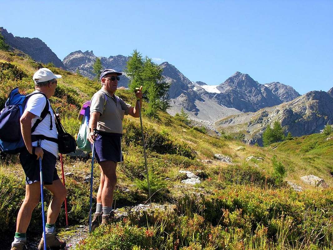
"If you do not know where you are control signs ... "by emilius
![]()
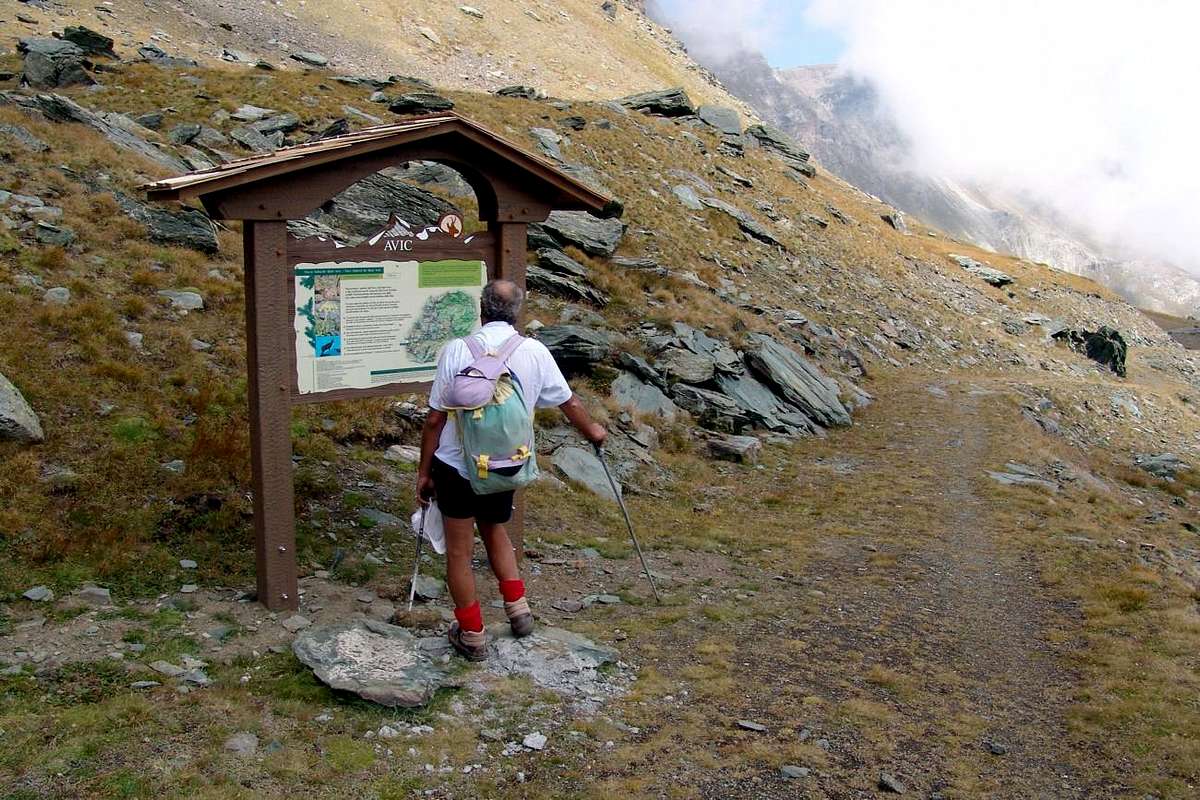
"Do not disturb Peace and not pollute Environment ... "by emilius
![]()
"Winter Sun always good, Summer not too much ... "by emilius
![]()
"Check always good tools: before, during and after ... "by emilius
![]()
"If you're thirsty you drink the water fresh and pure ... "by emilius
![]()
"Occasionally admires the Panorama & the Landscape, otherwise what you going to do in the mountains? ... "by Osw
![]()
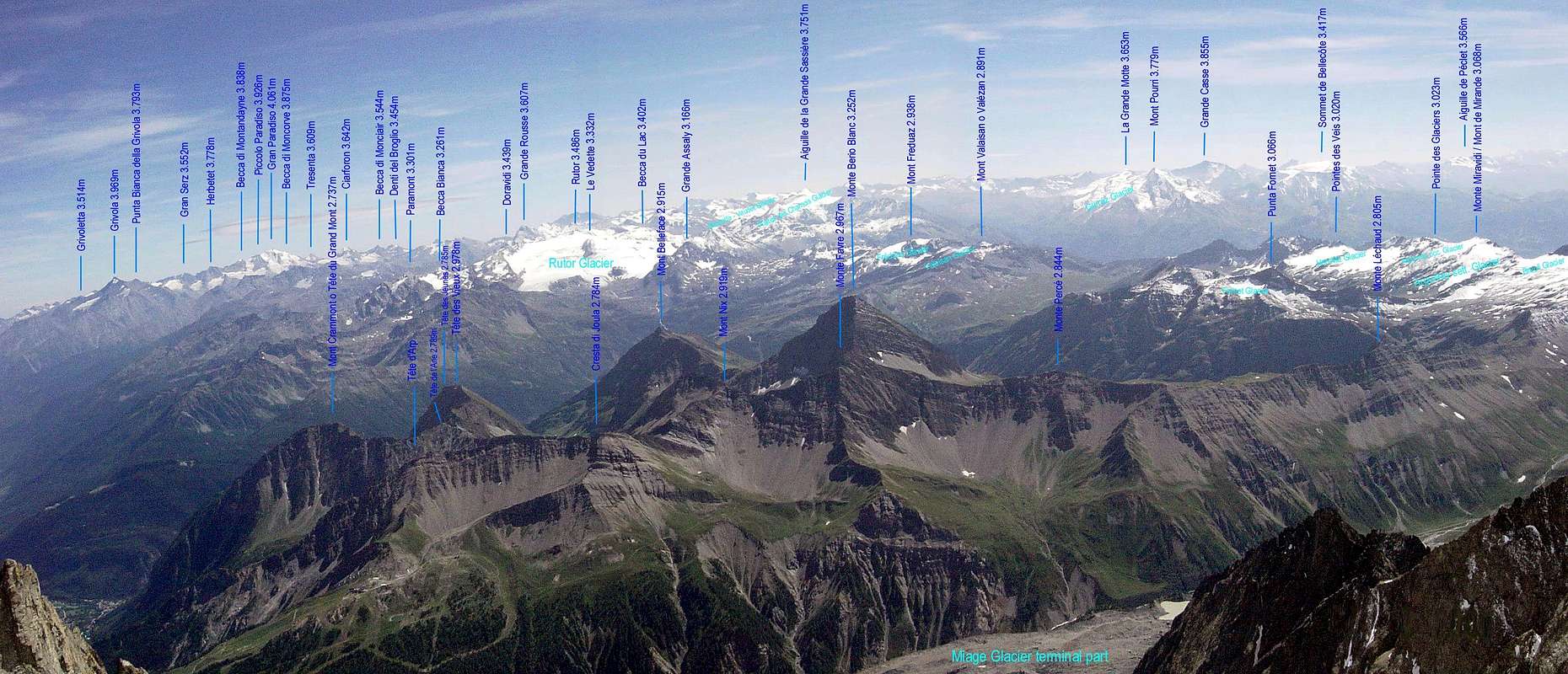
Southern Ranges amongst Valley of Aosta, Piedmont, Vanoise-Val d'Isère-Tarentaise, from East (left) toward Westby E. Allen & Hiltrud.Liu, marked by Antonio
1) - : sentieri o percorsi segnalati, oppure in mancanza, sempre semplicemente individuabili sia in fase di salita che in quella di discesa, laddove possibile coincidenti.
2) - : facilità della via con itinerari rivolti a E (Escursionisti) oppure a EE (Escursionisti Esperti), con l'utilizzo saltuario degli arti superiori; difficoltà su roccia da F (Facile) al massimo a F+ (Facile superiore), con passaggi che non vanno oltre il I°/I°+ (Scala U.I.A.A. o dell'Unione Internazionale delle Associazioni Alpinistiche).
3) - : mancanza di ghiacciai od attraversamento marginale dei medesimi; presenza di nevai o glacio-nevati con una pendenza non superiore ai 30°/35°.
4) - : possibilità di avere a non grandi distanze buoni punti di appoggio come accampamenti, bivacchi o rifugi, in genere sempre ben segnalati lungo il percorso.
5) - : in mancanza di questi, esistenza di punti di riparo dalle intemperie come ricoveri naturali, grotte nella roccia, Alpeggi o Casotti dei Parchi o della Forestale.
6) - : assenza di grandi e più o meno evidenti pericoli oggettivi sovrastanti il percorso (cadute di pietre, possibilità di frane, valanghe, slavine o semplicemente crolli glaciali).
7) - : punto panoramico di primo ordine sull'intera vallata, possibilmente centrale e comunque tale da consentire la vista completa sulla stessa.
Picture by Antonio
Getting There
BY CAR:
- From TORINO, MILANO, etc: Motorway A5. Exit at IVREA or Quincinetto (PIEDMONT) also Pont Saint Martin, Verrès, Châtillon, AOSTA East (Nus) and West (Aymavilles) Municipalities (AOSTA Valley).
- From IVREA Town to Hone-Bard, Pont Bozet, Champorcher, Aymavilles, Villeneuve, Arvier, La Salle, Derby, Morgex, Pré Saint Didier, Courmayeur.
- From Hône-Bard towards Pont Bozet Municipality and from this last to Champorcher Valley.
- From Hône-Bard (364m, 566m) to Pont Bozet (775m) towards Champorcher Valley: Château (1.427m), Petit, Grand Mont Blanc, La Cort Villages, to Dondena Village (2.092m), Dondena & Miserin Refuges, through Royal Road & secondary dirt roads; Barbustel Refuge, through Royal Road, path towards Champdepraz small Valley.
- From Aymavilles to Cogne and from Villeneuve to Valsavarenche Valleys.
- From Aymavilles (646m) towards Cogne Valley with Regional Main Road: Vieyes (1.132m) Fraction, Mario Gontier private Shelter, through small path in Nomenon Vallon. Continue to Silvenoire, Epinel & Crétaz Hamlets, Cogne (1.534m) Resort, through Main Road. To Valnontey (1.678m), through Municipal Road: to Money, Alessandro Martinotti, Stefano Borghi, Carlo Pol, Marcello Gerard & Ettore Grappein, Lionello & Lucio Leonessa, Mario Balzola, Luciano Gratton (this last from Epinel or Crétaz) Bivouacs, through paths, moraines and glacier, & Vittorio Sella Refuge, through muletrack). From Lillaz Fraction (1.607m) to Sogno di Berdzé, Denis Gérard & Guido Antoldi & Laura Malvezzi Refuges, by dirt road, muletrack or paths in Urtier and Valeille Vallon. To Gimillan Village (1.785m), Franco Nebbia Bivouac, with path in Upper Arpisson Vallon. All the three last through Regional Roads from Cogne.
- From Villeneuve (670m) to Savarenche Valley, Dégioz-Valsavarenche (1.541m) up to the Pont Valsavarenche (1.946m). From this or neighbor to Federico & Renato Chabod, below North Buttress of Gran Paradiso; Vittorio Emanuele II° (Old & New). Albergo Savoia & Città di Chivasso Refuges at the end of Nivolé, through muletracks and Renzo & Sebastiano Sberna Bivouac, through path, moraines of Montandayné Glacier and below the Herbetet.
- From Villeneuve (670m) to Rhêmes Valley: Introd (880m), Rhêmes Saint Georges (1.171m), Notre Dame (1.725m) Communes, through Regional Main Road, up to the Thumel Village (1.887m) with Municipal Road and to Gian Federico Benevolo Refuge (2.280m), through dirt farms road or underlying path.
- From Liverogne (Arvier) to Valgrisenche.
From Arvier to Liverogne Fraction (730m), from this to Valgrisenche Valley, up to the Valgrisenche Common (1.664m) and Mondanges, Surier, Us(s)eliéres Villages (1.785m, 1.770m), around the artificial Beauregard Dam, through Regional Road. Mario Bezzi at Vaudet and Chalet de l'Epée Refuges through paths.
From Pré Saint Didier to La Thuile & Little Saint Bernard Valleys.
From Pré Saint Didier (1.010m), with State Road, to La Thuile Valley: Elévaz, Balme Villages, La Thuile Commune, 1.441m; from this to Little Saint Bernard Vallon towards the Little Saint Bernard Hill (2.188m), through State Road. To Albert Deffeyes Refuge with muletrack from La Joux Fraction. It is not necessary to take Motorway A5: you can drive on SS.26, in the direction of AOSTA - IVREA - TURIN.
- Aeroporto "Corrado Gex" Saint Christophe (Aosta).
Any advice and recommendation ... small Decalogue


30 Routes Description
The choice of these 30 routes is always targeted to the 7 pre above requirements.
It is designed to identify the most suitable excursion to the parameters predicted and that the best way to represent a valley, in general all the proposals are aimed at ascents ranging on average between 2.750 to 3.350 meters with a few exceptions. However it has also tried to offer alternative opportunities, presenting on the single territory other two proposals; the same are more equally synthesized but always containing all the basic information you need. Or simply to provide more tips and suggestions, with the division into three bands enough diversified.
Band One: is the basic tour designed to represent the specific valley; is described in detail, numerous annotations, timing only indicative and various suggestions.
Band Two: Excursion similar to the previous one, with the same altitude but also in less differentiated (usually) or more; viewpoint completely different from the first proposal.
Band Three: Excursion of less effort and duration and also, more suited to the path even with children or boys, also to use as "backup" in case of uncertain weather.
La scelta di questi 30 Itinerari risulta sempre mirata ai 7 prerequisiti sopra esposti.
Si é pensato di individuare la Escursione più consona ai parametri predetti e tale da rappresentare nel modo migliore una valle, in genere tutte le proposte sono rivolte ad ascensioni che vanno mediamente tra i 2.750 ai 3.350 metri con qualche eccezione. Comunque s'é cercato d'offrire anche opportunità alternative, presentando all'interno del medesimo territorio altre due proposte; le stesse sono maggiormente sintetizzate pur contenendo ugualmente tutte le indicazioni di base necessarie. Oppure semplicemente per offrir ulteriori suggerimenti e proposte maggiormente variegate, con la suddivisione in tre fasce ben diversificate.
Fascia Uno: gita di base atta a rappresentare la specifica vallata; viene descritta con dovizia di particolari, numerose annotazioni, tempistica solo indicativa e suggerimenti varii.
Fascia Due: gita similare alla precedente, con altitudine uguale o differenziata in meno (generalmente) od in più; punto panoramico completamente diverso dalla prima proposta.
Fascia Tre: Escursione di minor impegno ed anche durata, più adatta al percorso anche con bambini o ragazzi, da utilizzarsi come "riserva" in caso di tempo incerto.
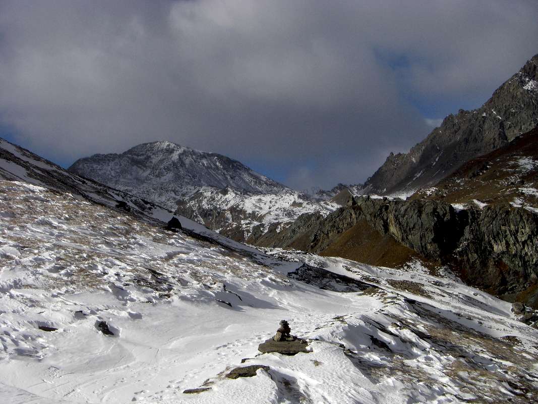
Champorcher Valley
![]()
1/A) - Mont Glacier (3.186m)
Si é pensato di individuare la Escursione più consona ai parametri predetti e tale da rappresentare nel modo migliore una valle, in genere tutte le proposte sono rivolte ad ascensioni che vanno mediamente tra i 2.750 ai 3.350 metri con qualche eccezione. Comunque s'é cercato d'offrire anche opportunità alternative, presentando all'interno del medesimo territorio altre due proposte; le stesse sono maggiormente sintetizzate pur contenendo ugualmente tutte le indicazioni di base necessarie. Oppure semplicemente per offrir ulteriori suggerimenti e proposte maggiormente variegate, con la suddivisione in tre fasce ben diversificate.
Fascia Uno: gita di base atta a rappresentare la specifica vallata; viene descritta con dovizia di particolari, numerose annotazioni, tempistica solo indicativa e suggerimenti varii.
Fascia Due: gita similare alla precedente, con altitudine uguale o differenziata in meno (generalmente) od in più; punto panoramico completamente diverso dalla prima proposta.
Fascia Tre: Escursione di minor impegno ed anche durata, più adatta al percorso anche con bambini o ragazzi, da utilizzarsi come "riserva" in caso di tempo incerto.
1/A) - Mont Glacier (3.186m)
Approach from Champorcher by the Savoias Royal Road to Dondena: Champorcher (Château; 1.427m) turn right (North) reaching upward and passing the Hamlets of Petit/Grand Mont Blanc (1.683m) through the asphalt road up to the and near the Village of La Cort (1.775m); going from here to the West there is a small parking lot ((around 1.805 meters; on the right way for the Regional Park of Mount Avic and the Refuge Barbustel, in the Champdepraz Walloon called Lakes Vallon). Instead continue on the "dusty" private road for Dondena (2.110m), crossing, after a junction for Chapy Alp and upper Raty Loch, through the Pastures of Brenvey, Long Champ (1.845m) and Leituerie (2.066m) up to a small parking lot followed by a short descent to the Torrent Ayasse. From this, passing near the homonym refuge (2.192m) to follow the dirt road, concomitant with the path n° 7B/7C, Haute or High Route Aosta Valley n° 2, as well as Historical Real Road built by the Savoias in 1862. There is a shortcut towards North after the bridge to the Village Dondena (2.171m) and to the following cross 2.242 meters for the Champorcher Fenêtre (Window); this reach actually to the small and attractive bridge that crosses the Ayasse to altitude 2.334 meters (1h'00 Dondena). Is generally not used because they are less known and requires minimal knowledge of the area to locate the development path; by contrast, in addition to a saving of time, has the advantage to perform a route more "clean and natural" than the dusty road beyond the Ayasse Torrent.
Standard Route from Dondena Village through Southwest Slope and South Crest:
Dondena to continue at the moment along the path n° 8B for the Moussaillon Pass (2.853m), leaving the same to the leftt (Northeast) and continue with that (path n° 8C) for the Pass Fussì and nearby Mount Glacier, with a double diagonal between two series of hairpin bends leading to a large saddle around 2.900 meters altitude on a rocky promontory at the base of the Eastern Face of Mont Delà (3.139m). Initially trace for a short time against the walls of this and later, Via a short diagonal down to North, move towards Fussì Pass (2.910m) passing high above Lake Gelato (2.824m) and arriving immediately below the same. From this point the path, with semi circular course under the Southwest Ridge, through an area of large, rotten and broken blocks alternating with stretches of fine debris and then, heading further East, climb a steeper slope, boring and tiring reaching the great Southwest Shoulder (3.003m) immediately on your left (North) of the same; this changing completely the direction towards the North-northwest through the terminal part of South Crest reaches the East Ridge, which rises from the two Hills of the Grande Rossa, in its final part and, through this, with easy rocks addressed West you can short time reach the Summit (EE/F; 3h'15). This path is easy, but in the case of snow, requires attention in the section between the saddle of entry into the vallon, the long crossing to the Col Fussì, that under the South Slope and ascent below the big shoulder (always with considerable avalanches and snowslides danger).
Valle di Champorcher
1/A) - Mont Glacier (3.186 m)
Avvicinamento da Champorcher tramite la Strada Reale dei Savoia per il Villaggio di Dondena: dal centro di Château (1.427 m) svoltare subito a destra (Nord) portandosi verso l'alto ed attraversando i Villaggi di Petit/Grand Mont Blanc (1.683 m) con la strada in asfalto fino nei pressi del Villaggetto di La Cort (1.775 m). Da qui, salendo verso Ovest, si raggiunge un piccolo parcheggio ((1.805 metri circa; a destra via per il Parco Regionale del Monte Avic ed il Rifugio Barbustel, nel Vallone di Champdepraz, conosciuto anche come Vallone dei Laghi). Continuare invece sulla "polverosa" strada poderale per Dondena (2.110 m), attraversando, dopo un bivio per l'Alpe Chapy ed il Lago Raty, verso gli Alpeggi di Brenvey, Champ Long (1.845 m) e Leituerie (2.066 m) fino ad un piccolo parcheggio seguito da una corta discesa verso il Torrent Ayasse. Dal piccolo villaggio, guadato l'Ayasse su d'un ponticello e passando subito dopo presso l'omonimo Rifugio (2.192 m), seguire verso Occidente la strada sterrata poderale, concomitante con il sentiero n° 7B/7C, Alta Via della Valle d'Aosta n° 2, nonché Storica Strada Reale costruita da Re "Toio" dei Savoia nel 1862. Inoltre esiste una scorciatoia a Settentrione dopo il ponte raggiungente Dondena (2.171 m) ed insino al successivo bivio 2.242 metri) per la Finestra di Champorcher; questa perviene al grazioso ponticello attraversante il Torrente Ayasse a quota 2.334 metri (1h'00 da Dondena). Meno utilizzata perché poco conosciuta, richiede minima conoscenza del territorio per l'individuazione del percorso; per contro, oltre ad un risparmio di tempo, presenta il vantaggio d'effettuare un itinerario più "pulito e naturalistico" rispetto alla polverosa strada poderale al di là dello Ayasse.
![]()
1/B) - Rosa dei Banchi (3.164m)
1/B) - Rosa dei Banchi (3.164 m)
![]()
1/C) - Mont Rasciàs (2.784 m)
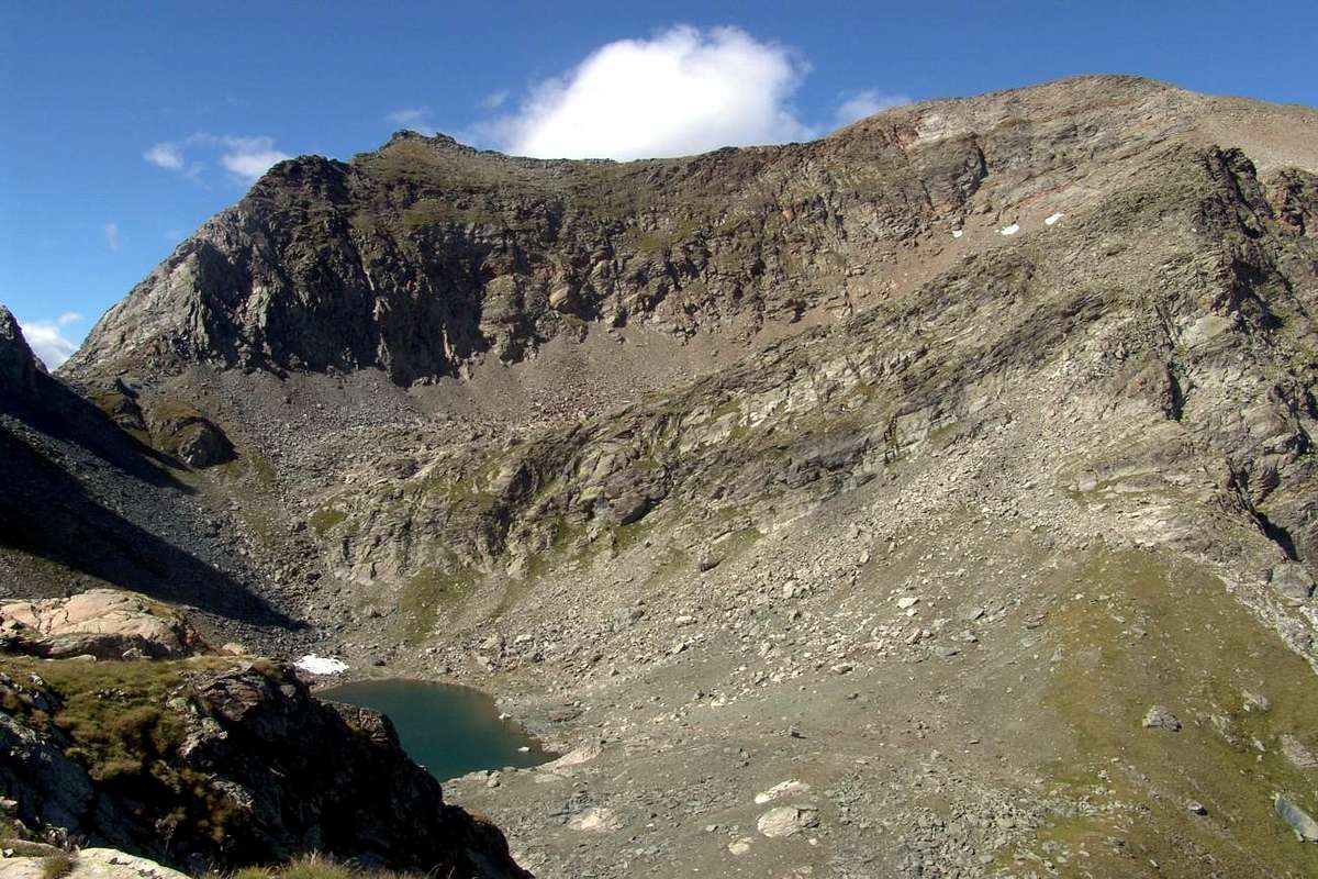
Miserin Via: by Southwest Slope with scarse traces; reached the summital plateau to cross various elevations to the South before the Lac Gelé (2.787m; EE; 0h'45/1h'00).
1/C) - Mont Rasciàs (2.784 m)
Via dal Miserin: con il Versante Sudovest su scarse tracce; raggiunto il plateau sommitale attraversare varie elevazioni a Sud prima del Lac Gelé (2.787 m; EE; 0h'45/1h'00).
![]()
1/D) - Tour Ponton (+; 3.101m)
Route by North-northeast Slope also along Northern Crest: from the hill through a small path or scarse traces in upper part between the slope and the ridge, after a rocky promontory with rotten blocks that will double left or East, reach the junction with West-northwest Edge just before the Top, reached out for fine debris (E/F; 0h'45/1h'00).
1/D) - Tour Ponton (+; 3.101 m)
Via dal Versante Nord-nordest o dalla Cresta Nord: dal colle con un sentierino e tracce nella parte superiore tra la cresta ed il versante, dopo un promontorio roccioso con blocchi rotti che s'aggira sulla sinistra od Est, raggiungere la congiunzione con lo Spigolo Ovest-nordovest a breve dalla Cima, raggiungibile su fini detriti (E/F; 0h'45/1h'00).
![]()
1/E) - Cima Piana (2.512m)
Route from Hill of the Cross: from the last hill to the East Cima Piana, by easy small path unnumbered or short rocky bands under the West Crest (EE; 0h'30/0h'45).
1/E) - Cima Piana (2.512 m)
Via dal Colle della Croce: da quest'ultimo ad Est verso la Cima Piana, con sentierino non numerato e brevi tratti di roccette al di sotto della Cresta Ovest (EE; 0h'30/0h'45).
Cogne Valley
![]()
2/A) - Punta Pousset (+; 3.045m)
Dondena to continue at the moment along the path n° 8B for the Moussaillon Pass (2.853m), leaving the same to the leftt (Northeast) and continue with that (path n° 8C) for the Pass Fussì and nearby Mount Glacier, with a double diagonal between two series of hairpin bends leading to a large saddle around 2.900 meters altitude on a rocky promontory at the base of the Eastern Face of Mont Delà (3.139m). Initially trace for a short time against the walls of this and later, Via a short diagonal down to North, move towards Fussì Pass (2.910m) passing high above Lake Gelato (2.824m) and arriving immediately below the same. From this point the path, with semi circular course under the Southwest Ridge, through an area of large, rotten and broken blocks alternating with stretches of fine debris and then, heading further East, climb a steeper slope, boring and tiring reaching the great Southwest Shoulder (3.003m) immediately on your left (North) of the same; this changing completely the direction towards the North-northwest through the terminal part of South Crest reaches the East Ridge, which rises from the two Hills of the Grande Rossa, in its final part and, through this, with easy rocks addressed West you can short time reach the Summit (EE/F; 3h'15). This path is easy, but in the case of snow, requires attention in the section between the saddle of entry into the vallon, the long crossing to the Col Fussì, that under the South Slope and ascent below the big shoulder (always with considerable avalanches and snowslides danger).
1/A) - Mont Glacier (3.186 m)
Avvicinamento da Champorcher tramite la Strada Reale dei Savoia per il Villaggio di Dondena: dal centro di Château (1.427 m) svoltare subito a destra (Nord) portandosi verso l'alto ed attraversando i Villaggi di Petit/Grand Mont Blanc (1.683 m) con la strada in asfalto fino nei pressi del Villaggetto di La Cort (1.775 m). Da qui, salendo verso Ovest, si raggiunge un piccolo parcheggio ((1.805 metri circa; a destra via per il Parco Regionale del Monte Avic ed il Rifugio Barbustel, nel Vallone di Champdepraz, conosciuto anche come Vallone dei Laghi). Continuare invece sulla "polverosa" strada poderale per Dondena (2.110 m), attraversando, dopo un bivio per l'Alpe Chapy ed il Lago Raty, verso gli Alpeggi di Brenvey, Champ Long (1.845 m) e Leituerie (2.066 m) fino ad un piccolo parcheggio seguito da una corta discesa verso il Torrent Ayasse. Dal piccolo villaggio, guadato l'Ayasse su d'un ponticello e passando subito dopo presso l'omonimo Rifugio (2.192 m), seguire verso Occidente la strada sterrata poderale, concomitante con il sentiero n° 7B/7C, Alta Via della Valle d'Aosta n° 2, nonché Storica Strada Reale costruita da Re "Toio" dei Savoia nel 1862. Inoltre esiste una scorciatoia a Settentrione dopo il ponte raggiungente Dondena (2.171 m) ed insino al successivo bivio 2.242 metri) per la Finestra di Champorcher; questa perviene al grazioso ponticello attraversante il Torrente Ayasse a quota 2.334 metri (1h'00 da Dondena). Meno utilizzata perché poco conosciuta, richiede minima conoscenza del territorio per l'individuazione del percorso; per contro, oltre ad un risparmio di tempo, presenta il vantaggio d'effettuare un itinerario più "pulito e naturalistico" rispetto alla polverosa strada poderale al di là dello Ayasse.
Via Normale da Champorcher-Dondena per il Versante Sudovest e la Cresta Sud):
Dal Villaggio di Dondena proseguire momentaneamente lungo il sentiero n° 8B per il Colle Moussaillon (2.853 m), lasciandolo poi a sinistra (Nordovest) e proseguire con quello (sentiero n° 8C) per il Col Fussì ed il vicino Mont Glacier, con un doppio diagonale tra due serie di stretti tornanti conducente ad una larga sella quota 2.900 metri circa su d'un promontorio roccioso alla base della Parete Est del Mont Delà (3.139 m). Dapprima risalire per breve tempo contro le pareti di questo ed in seguito, tramite un corto diagonale in discesa verso Nord, portarsi in direzione del Col Fussì (2.910 m) passando alti sopra al Lago Gelato (2.824 m) ed arrivando immediatamente al di sotto del medesimo. Da questo punto il sentiero, con percorso semi circolare sotto la Cresta Sudovest, attraversa una zona di grandi blocchi alternata a tratti di fine detrito per poi, dirigendosi maggiormente ad Est, risalire un pendio più ripido, noioso e faticoso raggiungendo lo Spallone Sudovest (3.003 m) subito sulla sua sinistra (Nord); da qui cambiando, completamente direzione verso Nord-nordovest, tramite la parte finale della Cresta Sud raggiunge la Cresta Est, che sale dal doppio Colle della Gran Rossa, nella sua parte finale e, tramite questa, con facili roccette spezzate si giunge in breve tempo alla Sommità (EE/F; 3h'15). Questa via é facile ma, in caso di neve alta, richiede attenzione nel tratto tra la sella d'ingresso nel vallone, la lunga traversata verso e sotto il Col Fussì, quella sotto il Versante Meridionale e nella salita al di sotto dello spallone (notevole pericolo di valanghe e slavine).
Dal Villaggio di Dondena proseguire momentaneamente lungo il sentiero n° 8B per il Colle Moussaillon (2.853 m), lasciandolo poi a sinistra (Nordovest) e proseguire con quello (sentiero n° 8C) per il Col Fussì ed il vicino Mont Glacier, con un doppio diagonale tra due serie di stretti tornanti conducente ad una larga sella quota 2.900 metri circa su d'un promontorio roccioso alla base della Parete Est del Mont Delà (3.139 m). Dapprima risalire per breve tempo contro le pareti di questo ed in seguito, tramite un corto diagonale in discesa verso Nord, portarsi in direzione del Col Fussì (2.910 m) passando alti sopra al Lago Gelato (2.824 m) ed arrivando immediatamente al di sotto del medesimo. Da questo punto il sentiero, con percorso semi circolare sotto la Cresta Sudovest, attraversa una zona di grandi blocchi alternata a tratti di fine detrito per poi, dirigendosi maggiormente ad Est, risalire un pendio più ripido, noioso e faticoso raggiungendo lo Spallone Sudovest (3.003 m) subito sulla sua sinistra (Nord); da qui cambiando, completamente direzione verso Nord-nordovest, tramite la parte finale della Cresta Sud raggiunge la Cresta Est, che sale dal doppio Colle della Gran Rossa, nella sua parte finale e, tramite questa, con facili roccette spezzate si giunge in breve tempo alla Sommità (EE/F; 3h'15). Questa via é facile ma, in caso di neve alta, richiede attenzione nel tratto tra la sella d'ingresso nel vallone, la lunga traversata verso e sotto il Col Fussì, quella sotto il Versante Meridionale e nella salita al di sotto dello spallone (notevole pericolo di valanghe e slavine).

1/B) - Rosa dei Banchi (3.164m)
Approach la Cort to Dondena refuge:
shelter reach the alternative to the Pendant Alps and from these continue through the dirt road, concomitant with trail n° 6 until the next fork to Alp Chila Désot (2.370m), reaching the same and the above Upper Alp Pendant, below Bec Pendant. Climb Southeast first through meadows with scattered blocks and then through a track that climbs the steep but easy North side of the Nozzle of the White Marble (2.901m); reached this large saddle, climb on the next watershed to the Quote 2.931 meters, or avoid it just to the left (Southeast). Continue easily along the ridge to the nearby Northern Cima Beccher (2.940m) through broken rocks and proceed to the next (2.973m, 3.038m, 3.068m; cairn) or Beccher Southern Summits with the same characteristics as the path above in a vertical wall facing West on the extreme appendages Glacier of Bantses. From this point, flexing slightly to the left or South, the ridge forms a fairly wide saddle characterized by large blocks. After a short descent and have passed through the same, you are returned to the primary direction reaching a secondary elevation above a small notch; crossing the same on large slabs and blocks, and then returned to the ridge by rocks you will come to the Cima delle Fontane (3.084m; arrival point for trips departing by Ski-Mountaineering Piamprato). Climbed over the hump after also rounded up later and another more pointed, with a view to the Summit at last, by a sudden more aerial and exposed to the East reach the final; this is exceeded, bypassing a section of steep rocks to the West (I°+/II°-) conclude more easily on Top (EEA/F+; 1h'15 "Bocchetta"; 2h'00/2h'15 Pendant; 3h'30/4h'00 refuge or Dondena).1/B) - Rosa dei Banchi (3.164 m)
Avvicinamento da la Cort al Rifugio di Dondena:
dal rifugio raggiungere il bivio per le Alpi Pendant donde continuare con la poderale, concomitante col sentiero n° 6 fino al bivio per l'Alpe Chilà Dèsot (2.370 m) raggiungendola e la sovrastante Alpe Pendant Superiore, sotto il Bec Pendant. Dirigersi a Sudest prima per prati con blocchi sparsi indi tramite una traccia risalente il ripido e facile Versante Nord della Bocchetta del Marmo Bianco (2.901 m); dalla larga sella salire sullo spartiacque la successiva Quota 2.931 metri, oppure evitarla a Sudest. Continuare facilmente verso la Cima Beccher Nord (2.940 m) con rocce rotte e proseguire verso le successive (2.973m, 3.038m, 3.068m; ometto di pietre) o Cime Beccher Meridionali con stesse caratteristiche sopra una parete verticale rivolta ad Ovest sulle appendici del Ghiacciaio dei Banchi; flettendo leggermente a Sud, la cresta forma un'abbastanza larga sella contraddistinta da grandi blocchi. Dopo breve discesa ed averla attraversata, si ritorna alla primaria direzione raggiungendo un'elevazione secondaria precedente un intaglietto; attraversando il medesimo su grandi lastre e blocchi per poi rientrare sul filo di cresta e tramite rocce sfasciate si perviene alla Cima delle Fontane (3.084 m; punto d'arrivo per le gite Sci-Alpinistiche con partenza da Piamprato). Scavalcata anche l'arrotondata gobba successiva ed un'altra più aguzza e minuscola, con finalmente in vista la Vetta, tramite un tratto più aereo ed esposto a sinistra o Est raggiungere la parte finale; questa si supera aggirando un muretto di roccette ripide ad Ovest (I°+/II°-) per concludere più facilmente nella parte terminale (EEA/F+; 1h'15 dalla Bocchetta; 2h'00/2h'15 dall'Alpe Pendant III°; 3h'30/4h'00 dal rifugio o da Dondena).
1/C) - Mont Rasciàs (2.784 m)
Approach from la Cort through Royal Road towards Dondena:
from Village (2.097 m) towards the nearby Dondena Shelter (2.196m) and Miserin Refuge, Sanctuary, Lake (2.578m), through dirt road, concomitant with the paths 7C/Haute Route n° 2//7B or through path n° 7 more in South below Mont de Dondena (2.548m; E; 1h'15/1h'30).Miserin Via: by Southwest Slope with scarse traces; reached the summital plateau to cross various elevations to the South before the Lac Gelé (2.787m; EE; 0h'45/1h'00).
1/C) - Mont Rasciàs (2.784 m)
Avvicinamento da la Cort con la Strada Reale verso Dondena:
dal Villaggio (2.097 m) verso il vicino Rifugio di Dondena (2.196 m) ed il Rifugio del Miserin presso Santuario e Lago (2.578 m), tramite poderale, concomitante coi sentieri 7C/Alta Via n° 2//7B o col sentiero n° 7 più a Sud e sottostante il Mont de Dondena (2.548 m; E; 1h'15/1h'30).Via dal Miserin: con il Versante Sudovest su scarse tracce; raggiunto il plateau sommitale attraversare varie elevazioni a Sud prima del Lac Gelé (2.787 m; EE; 0h'45/1h'00).
1/D) - Tour Ponton (+; 3.101m)
Approach from la Cort, Dondena and Pontonnet Hill:
from Dondena (2.097 m) towards the nearby shelter (2.196m) through dirt road, concomitant with the paths n° 8/8A/8B/8C/High Route n° 2 up to the fork 2.334 meters, near the small bridge on Ayasse Torrent; from this continue Northwest and, leaving right the paths n° 8A/8B/8C to Fussì and Moussaillon Hills, through a long diagonal to the West reach before the Fénis Hill (2.857 m) and immediately after the Pontonnet Hill (2.897m; E; 2h'30/3h'00).Route by North-northeast Slope also along Northern Crest: from the hill through a small path or scarse traces in upper part between the slope and the ridge, after a rocky promontory with rotten blocks that will double left or East, reach the junction with West-northwest Edge just before the Top, reached out for fine debris (E/F; 0h'45/1h'00).
1/D) - Tour Ponton (+; 3.101 m)
Avvicinamento da la Cort, Dondena e Col Pontonnet:
da Dondena (2.097 m) verso il vicino Rifugio di Dondena (2.196 m) tramite poderale, concomitante coi sentieri n° 8/8A/8B/8C/Alta Via n° 2 fino al bivio 2.334 metri, presso il ponticello sull'Ayasse; da qui continuare verso Nordovest e, lasciate a destra le deviazioni n° 8A/8B/8C per i Colli Fussì e Moussaillon, raggiungere tramite un lungo diagonale ad Occidente prima il Col Fénis (2.857 m) e subito dopo il viciniore Col Pontonnet (2.897 m; E; 2h'30/2h'00).Via dal Versante Nord-nordest o dalla Cresta Nord: dal colle con un sentierino e tracce nella parte superiore tra la cresta ed il versante, dopo un promontorio roccioso con blocchi rotti che s'aggira sulla sinistra od Est, raggiungere la congiunzione con lo Spigolo Ovest-nordovest a breve dalla Cima, raggiungibile su fini detriti (E/F; 0h'45/1h'00).

1/E) - Cima Piana (2.512m)
Approach from la Cort before through Royal Road, after path towards Colle della Croce:
from Château (1.427m), Arbussey, Mont Blanc, La Cort Villages, la Grand Cort Alp (1.944m) in North to Alp near Lake Muffé (2.019m), Croix Hill (2.287m; just above Barbustel Refuge in Champdepraz Vallon), with paths n° 10B/10C (E; 1h'30/1h'45).Route from Hill of the Cross: from the last hill to the East Cima Piana, by easy small path unnumbered or short rocky bands under the West Crest (EE; 0h'30/0h'45).
1/E) - Cima Piana (2.512 m)
Avvicinamento da la Cort con sentiero verso il Colle della Croce:
da Château (1.427m), Arbussey, Mont Blanc, La Cort, la Grand Cort Alp (1.944m) verso Nord all'Alpe presso il Lago Muffé (2.019 m) poi al Col de la Croix (2.287 m; appena sopra il Rifugio Barbustel nel Vallone di Champdepraz), con sentieri n° 10B/10C (E; 1h'30/1h'45).Via dal Colle della Croce: da quest'ultimo ad Est verso la Cima Piana, con sentierino non numerato e brevi tratti di roccette al di sotto della Cresta Ovest (EE; 0h'30/0h'45).
2/A) - Punta Pousset (+; 3.045m)
Approach from Epinel or Crétaz Fractions through paths to Pousset Pastures: a)- from the small built up area of Crétaz (1.499m), cross the two bridges over the Grand'Eyvia and on the Valnontey Torrent. On along the path n° 25/25C/TVC//26 in the wood and, after passing the sign of the Park National of Gran Paradiso border, walk slightly to the right up to the Les Ors Pasture (1.944m). Follow on the right side up to the big ridge dividing the Valmiana and the Pousset Vallons, once at the Rangers Hut down to the middle of the vallon, cross a bridge, follow bordering the torrent and after crossing again the same get out, along a smooth rocky slope, to the near Pousset Upper Alpages (2.529m). Or go up from Epinel (1.436m) with the path n° 27/TVC/26, immediately after the bridge on Grand'Eyvia, and, after a fork (1.694m) towards the Trajo Vallon, across the Grand Bois Forest to reach in Southeast the Lower Pousset Alp (2.146m; splendid wooden "rascards"), this rise to the Superior (E; 1h'30/2h'00).
Routes from Upper Pousset Pasture throgh the Southwest Slope or by Southern Ridge:
1) - Ascend on the right side, along steep paths reach on watershed the Northern Hill (3.058m). Start with the crack on the right to reach the South-Western Ridge (I°+) then, more easily, touch the smoke face (I°; easy but enough exposed) that leads to an easy last drop South ward after an exposed downhill route (EE/F+; 4h'00/4h'30 Crétaz).
2) - by Pousset Pass (marks for Gratton Bivouac (3.198m) and down along the easy watershed ridge leading, after passing on the left side a rock (quota 3.058m), to the Top.
Valle di Cogne
2/A) - Punta del Pousset (+; 3.045m)
Routes from Upper Pousset Pasture throgh the Southwest Slope or by Southern Ridge:
1) - Ascend on the right side, along steep paths reach on watershed the Northern Hill (3.058m). Start with the crack on the right to reach the South-Western Ridge (I°+) then, more easily, touch the smoke face (I°; easy but enough exposed) that leads to an easy last drop South ward after an exposed downhill route (EE/F+; 4h'00/4h'30 Crétaz).
2) - by Pousset Pass (marks for Gratton Bivouac (3.198m) and down along the easy watershed ridge leading, after passing on the left side a rock (quota 3.058m), to the Top.
2/A) - Punta del Pousset (+; 3.045m)
Avvicinamento dalle Frazioni di Epinel o Crétaz tramite sentieri verso le Alpi del Pousset: a)- dalla piccola Frazione di Crétaz (1.499 m), nel Comune di Cogne, oltrepassare i due ponti uno sulla Gran Eyvia e uno che scende dal Torrente della Valnontey. Risalire il sentiero n° 25/25C/TVC//26, che s'inoltra nel bosco e, superato il cartello che segnala i confini del Parco Nazionale del Gran Paradiso proseguire leggermente a destra sino a raggiungere l'Alpeggio di Les Ors (1.944 m). Continuare sempre, stessa direzione, e raggiungere la dorsale che separa i Valloni di Vermiana da quello del Pousset, dove s'incontra il Casotto del Guardaparco; proseguire in leggera discesa sino al centro del vallone, attraversare il ponte e continuare a salire costeggiando il torrente. Dopo aver riattraversato il Torrent de Pousset uscire su d'un dosso di rocce levigate e raggiungere il vicino Alpeggio del Pousset Superiore (2.529 m). Oppure salire da Epinel (1.436 m) con il sentiero n° 27/TVC//26, subito dopo il ponte sulla Grand'Eyvia, e, attraversata la Foresta di Grand Bois verso Sudest raggiungere il Pousset Inferiore (2.146 m; splendidi "rascards" in legno), da questo salire all'Alpe Pousset Superiore (E; 1h'30/2h'00).
Vie dall'Alpe Superiore del Pousset tramite il Versante Sudest o la Cresta Sud:
1) - salire a destra per ripidi sentieri sin a raggiungere il colletto subito a Nord della Quota (3.058 m) continuando sulla Cresta Sud-Ovest con un canale/camino sulla destra (I°+), poi più facilmente raggiugere una placca (I°) che, con percorso in discesa esposto, porta contro l'ultimo salto, facile ma esposto a Meridione (EE/F+; 4h'00/4h'30 da Crétaz).
2) - proseguire la salita sino a raggiungere il Colle del Pousset dove è posto il Bivacco Luciano Gratton (3.198 m). Dal bivacco scendere in leggera discesa la facile cresta spartiacque che conduce, dopo aver superato a sinistra lo spuntone quotato (3.058 m), alla parte finale del precedente itinerario e quindi alla Vetta (EE/F+; 4h'30/5h'00).
![]()
2/B) - Mount Creya (3.015m) with the Loadstone Mines
Routes through South or North Slopes 1) - South: from Colonna continue with trail n° 5 to the Northeast climbing to the overlying Liconi Mines (2.495m); continue towards the North, again on a comfortable path and passed three bends, reaching the South-southwest Crest. By this easily to reach the Summit (E; 1h'00 from Colonna Mines Village; 2h'45/3h'00 Champlong). Also from 2) - North: from Grauson Vieux turn right (Southeast) and via the route n° 8C, passing under some benches of rock, and reach over across the torrent which descends from Lake of Money (2.550m), at his emissary to the South of that. Rounding to the right (West) to come up with the lake heading Southwest via a small path not numbered, and the same, gradually turns into a track between steep grassy slopes. Follow it up to 2.910 meters, where it disappears just below the Crest Northwest near the 2.968 meters altitude. Along this among endless meadows of edelweiss, you will soon reach the Top (E; 1h'30/1h'45 Grauson Vieux).
2/B)- Monte Creya (3.015 m) con le Miniere di Magnetite
Via da Sud o da Nord. 1) - da Sud: da Colonna continuare con il sentiero n° 5 verso Nordest salendo alle soprastanti Miniere di Liconi (2.495 m) e, sempre su comodo sentiero raggiungere la Cresta Sud-sudovest collegantesi al Mont Salet. Con questa facilmente raggiungere la Sommità (E; 1h'00 dal Villaggio Minerario di Colonna; 2h'45/3h'00 in totale dalla Frazione Champlong). 2) - Da Nord: dal Grauson Vieux deviare a destra (Sudest) e col sentiero n° 8C, passando al di sotto di alcune banconate, raggiungere ed oltrepassare il torrente che scende dal Lago di Money (2.550 m), presso il suo emissario a Sud. Doppiando sulla destra (Ovest) il lago salire con direzione Sudovest tramite un sentierino non numerato; lo stesso, progressivamente, si tramuta in traccia tra appena più ripidi pendii prativi. Seguirlo fino a 2.910 metri, ove scompare appena al di sotto della Cresta Nordovest nei pressi della quota 2.968 metri. Percorrendola tra prati sterminati di stelle alpine, in breve si raggiunge la Cima (E; 1h'30/1h'45 dal Grauson Vieux).
![]()
2/C) - Punta Arpisson (3.035m) bypassing Tsaplana (2.681m)
Via bypassing Tsaplana: from the Alpe Perché, rounding a band of rocks, reaching the Tsaplana and from this the easy Slope East of the Punta Arpisson (E; 1h'45/2h'15).
2/C) - Punta di Arpisson (3.035 m) scavalcando la Punta Tsaplana (2.681m)
Via tramite la Tsaplana: doppiando una fascia di rocce, raggiungere la Tsaplana, indi per il facile e semi erboso Versante Orientale la Punta di Arpisson (E; 1h'45/2h'15).
![]()
2/D) - Punta di Leppe (3.305m/6)
2/D) - Punta di Leppe (3.305/6 m)
![]()
2/E) - Bec Costazza (3.092m)
2/E) - Bec Costazza (3.092 m)
Valsavarenche
![]()
3/A) - Punta Bioula (+; 3.413m) through the old muletrack by "King Toio"
Vie dall'Alpe Superiore del Pousset tramite il Versante Sudest o la Cresta Sud:
1) - salire a destra per ripidi sentieri sin a raggiungere il colletto subito a Nord della Quota (3.058 m) continuando sulla Cresta Sud-Ovest con un canale/camino sulla destra (I°+), poi più facilmente raggiugere una placca (I°) che, con percorso in discesa esposto, porta contro l'ultimo salto, facile ma esposto a Meridione (EE/F+; 4h'00/4h'30 da Crétaz).
2) - proseguire la salita sino a raggiungere il Colle del Pousset dove è posto il Bivacco Luciano Gratton (3.198 m). Dal bivacco scendere in leggera discesa la facile cresta spartiacque che conduce, dopo aver superato a sinistra lo spuntone quotato (3.058 m), alla parte finale del precedente itinerario e quindi alla Vetta (EE/F+; 4h'30/5h'00).

2/B) - Mount Creya (3.015m) with the Loadstone Mines
Approaches from Cogne: 1) - reached Champlong/Saint-Pierre (1.596m) take the path towards Northwest n° 7A reaching Facette Pasture (1.662m). Continue to the North dominating from Torrent Liconi Vallon, reach the largest concentration which remains of miners homes of Colonna (2.386m; valuable loadstone Cogne; E; 1h'30/2h'00).
Also 2) - : from Gimillan Village (1.787m) towards Ecloseur Bridge (1.947m), Pila Pasture with Waterfall (2.025m), Grauson Vecchie Alps (2.273m); E; 1h'45/2h'00 Gimillan).Routes through South or North Slopes 1) - South: from Colonna continue with trail n° 5 to the Northeast climbing to the overlying Liconi Mines (2.495m); continue towards the North, again on a comfortable path and passed three bends, reaching the South-southwest Crest. By this easily to reach the Summit (E; 1h'00 from Colonna Mines Village; 2h'45/3h'00 Champlong). Also from 2) - North: from Grauson Vieux turn right (Southeast) and via the route n° 8C, passing under some benches of rock, and reach over across the torrent which descends from Lake of Money (2.550m), at his emissary to the South of that. Rounding to the right (West) to come up with the lake heading Southwest via a small path not numbered, and the same, gradually turns into a track between steep grassy slopes. Follow it up to 2.910 meters, where it disappears just below the Crest Northwest near the 2.968 meters altitude. Along this among endless meadows of edelweiss, you will soon reach the Top (E; 1h'30/1h'45 Grauson Vieux).
2/B)- Monte Creya (3.015 m) con le Miniere di Magnetite
Avvicinamenti da Cogne: 1) - nraggiunto Champlong/Saint-Pierre (1.596 m); prendere verso Nordovest il sentiero n° 7A per l'Alpe Facette (1.662 m). Continuare a Nord dominando il Vallone del Torrente Liconi e raggiungere l'agglomerato costituente i resti delle abitazioni dei minatori di Colonna (2.386 m; pregiata magnetite; E; 1h'30/2h'00).
Oppure 2)- : da Gimillan (1.787 m) verso il ponte di Ecloseur (1.947 m), Alpe Pila con bella Cascata (2.025 m) sino alle Alpi di Grauson Vecchie (2.273 m; E; 1h'45/2h'00).Via da Sud o da Nord. 1) - da Sud: da Colonna continuare con il sentiero n° 5 verso Nordest salendo alle soprastanti Miniere di Liconi (2.495 m) e, sempre su comodo sentiero raggiungere la Cresta Sud-sudovest collegantesi al Mont Salet. Con questa facilmente raggiungere la Sommità (E; 1h'00 dal Villaggio Minerario di Colonna; 2h'45/3h'00 in totale dalla Frazione Champlong). 2) - Da Nord: dal Grauson Vieux deviare a destra (Sudest) e col sentiero n° 8C, passando al di sotto di alcune banconate, raggiungere ed oltrepassare il torrente che scende dal Lago di Money (2.550 m), presso il suo emissario a Sud. Doppiando sulla destra (Ovest) il lago salire con direzione Sudovest tramite un sentierino non numerato; lo stesso, progressivamente, si tramuta in traccia tra appena più ripidi pendii prativi. Seguirlo fino a 2.910 metri, ove scompare appena al di sotto della Cresta Nordovest nei pressi della quota 2.968 metri. Percorrendola tra prati sterminati di stelle alpine, in breve si raggiunge la Cima (E; 1h'30/1h'45 dal Grauson Vieux).
2/C) - Punta Arpisson (3.035m) bypassing Tsaplana (2.681m)
Approach from Gimillan:
to reach the trail n° 3TVC towards Plan of Teppes Alp and the next crossroad 2.017 meters; from this, leaving to the left the same that continues into the following Vallon of Arpisson, with wide turn to the Northeast with trail n° 3B towards Perché old Alp (2.398m), in a nice grassy esplanade. (E; 1h'45/2h'15 Gimillan).Via bypassing Tsaplana: from the Alpe Perché, rounding a band of rocks, reaching the Tsaplana and from this the easy Slope East of the Punta Arpisson (E; 1h'45/2h'15).
2/C) - Punta di Arpisson (3.035 m) scavalcando la Punta Tsaplana (2.681m)
Avvicinamento da Gimillan:
raggiungere con sentiero n° 3TVC l'Alpeggio di Plan di Teppes ed il successivo bivio 2.017 metri; da questo, lasciando a sinistra il medesimo che prosegue verso l'Arpisson, con largo giro a Nordest con il n° 3B arrivare all'antica Alpe Perché (2.398 m) in una bella e panoramica spianata erbosa (E; 1h'45/2h'15).Via tramite la Tsaplana: doppiando una fascia di rocce, raggiungere la Tsaplana, indi per il facile e semi erboso Versante Orientale la Punta di Arpisson (E; 1h'45/2h'15).
2/D) - Punta di Leppe (3.305m/6)
Approach and Via from Gimillan by South-southeast Crest:
reach with path n° 8A/102 towards the Alps Grauson Vieux, New and Tzeséire (2.273m, 2.540m, 2.645m; E; 3h'15/3h'30). From this last with traces in Northeast arrive on Col Vallonet (3.062m) and from this by the easy Ridge South-southeast on Top (EE/F; 1h'30/2h'00 from alp).2/D) - Punta di Leppe (3.305/6 m)
Avvicinamento e Via da Gimillan per la Cresta Sud-Sudest:
raggiungere col sentiero n° 8A/102 le Alpi di Grauson Vieux, Nuove e Tzeséire (2.273 m, 2.540 m, 2.645 m, E; 3h'15/3h'30). Da questa ultima con tracce a Nordest raggiungere il Col Vallonet (3.062 m) e da questo per la facile Cresta Sud-sudest la Cima (EE/F; 1h'30/2h'00 dall'alpe).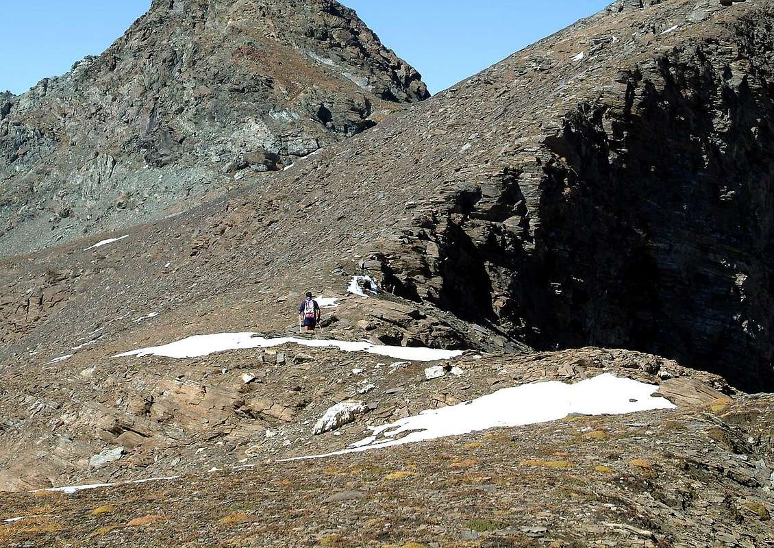
2/E) - Bec Costazza (3.092m)
Approach and Via from Lillaz to "Sogno di Berdzé" Shelter and South Crest:
reach through the trail n° 13/TVC/Alta Via n° 2 the shelter near Peradzà Alp (E; 3h'30/4h'00). From alp, climbing on rocky bands amongst snowfields, reaching the wide Saddle 2.948 meters and from this, by South Ridge, the Top (EE/F+; 1h'45/2h'15).2/E) - Bec Costazza (3.092 m)
Avvicinamento e Via da Lillaz per il Rifugio "Sogno di Berdzé" e la Cresta Sud:
raggiungere col sentiero n° 13/TVC/Alta Via n° 2 il rifugio presso l'Alpe di Peradzà (E; 3h'30/4h'00). Dall'alpe, salendo banconate rocciose e nevati, raggiungere la Sella 2.948 metri e da questa per la facile Cresta Sud la Cima (EE/F+; 1h'45/2h'15 dal rifugio).
3/A) - Punta Bioula (+; 3.413m) through the old muletrack by "King Toio"
Approach from Eaux Rousses Fraction: in Main Road (1.666m; parking above Savara Torrent), through path 8C/High Route n° 2 into le Grand Bois (forest; ferrous source) towards Rondzegou Pasture (1.974m), Orfeuille Alp (Royal Pavillon of Hunting; Cabin National Park; 2.168m), nearby Montagna (alpage) of Djouan (2.226m) (F+; 2h'30/2h'45).
Route through Southeast Slope: from Eaux Rousses to Orfeuille with preceding route; following, before to the North after Northwest, the old muletrack to a wide saddle between the triple Fourquins de Bioula and the indented Tour de Notre Dame, after passing a steep grassy headland-rocky; bypassing the same continue toward North through the same, now in many places disappeared or destroyed by landslides or avalanches, that going the easy and not more Southeast Slope leads to the Bioula (E; 3h'45/4h'15).
Valsavara
3/A) - Punta Bioula (+; 3.413m) da Eaux Rousses per l'antica mulattiera di "Re Toio"
Route through Southeast Slope: from Eaux Rousses to Orfeuille with preceding route; following, before to the North after Northwest, the old muletrack to a wide saddle between the triple Fourquins de Bioula and the indented Tour de Notre Dame, after passing a steep grassy headland-rocky; bypassing the same continue toward North through the same, now in many places disappeared or destroyed by landslides or avalanches, that going the easy and not more Southeast Slope leads to the Bioula (E; 3h'45/4h'15).
3/A) - Punta Bioula (+; 3.413m) da Eaux Rousses per l'antica mulattiera di "Re Toio"
Avvicinamento dal piccolo parcheggio della Frazione di Eaux Rousses: sulla Strada Regionale (1.666 m; parking sopra il Torrente Savara), tramite il sentiero 8C/Alta Via n° 2 a Nordovest dentro il Grand Bois (o grande bosco; sorgente ferrosa) verso l'Alpeggio di Rondzegou (1.974 m) e, passando sopra gli Alpeggi di Carré e Ruyez, raggiunge la bella spianata dell'Orfeuille (Royal Pavillon di Caccia di Re Vittorio Emanuele II°; Casotto Parco Nazionale; 2.168 m) con viciniora Montagna di Djouan (2.226 m; E; 2h'30/2h'45).
Via per il Versante Sudest: da Eaux Rousses all'Orfeuille con la precedente via; seguendo dapprima a Nord, poi a Nordovest, l'antica mulattiera del Re per i Fourquins de Bioula si raggiunge, dopo aver superato un ripido promontorio erboso-roccioso, un'ampia sella tra questa e la Tour de Notre Dame; oltrepassatala si continua a Nord con la mulattiera, ora in molti tratti scomparsa o semi distrutta dalle frane e dalle valanghe, che percorrendo il facile e non molto ripido Versante Sudest conduce alla Cima (E; 3h'45/4h'15).
![]()
3/B) - Cima de la Rolay or Arollay (2.955m) through Roley Cross (+; 2.313m) and Nivolé Tableland
3/B) - Cima de la Rolay o Arollay (2.955m) per la Croce dell'Arollay (+; 2.313 m) ed il Pian del Nivolé
![]()
3/C) - Mont Taou or Tout Blanc (3.438m)
3/C) - Mont Taou o Tout Blanc (3.438 m)
![]()
3/D) - Punta del Tuf (3.392/3m)
3/D) - Punta del Tuf (3.392/3 m)
Rhêmes Valley
![]()
4/A) - Cima di Entrelor (3.426m) to Federico Benevolo Refuge
Via per il Versante Sudest: da Eaux Rousses all'Orfeuille con la precedente via; seguendo dapprima a Nord, poi a Nordovest, l'antica mulattiera del Re per i Fourquins de Bioula si raggiunge, dopo aver superato un ripido promontorio erboso-roccioso, un'ampia sella tra questa e la Tour de Notre Dame; oltrepassatala si continua a Nord con la mulattiera, ora in molti tratti scomparsa o semi distrutta dalle frane e dalle valanghe, che percorrendo il facile e non molto ripido Versante Sudest conduce alla Cima (E; 3h'45/4h'15).
3/B) - Cima de la Rolay or Arollay (2.955m) through Roley Cross (+; 2.313m) and Nivolé Tableland
Approach and route from Pont Valsavarenche:
from Pont (1.960m), through the muletrack n° 3 starts just behind the Hotel, in West through small vallon with beautiful waterfall of Nivolé Doire; along a ramp get the Roley Cross (+; 2.313m; panoramic point). Follow into the big banks of rock, polished by ancient glaciers, into the Nivolè or Nivolet Tableland, big highland long more than 6km ending, with two small lakes (2.526m, 2.537m; neighbor two Refuges Chivasso and Savoia) reaching the Nivolè Pass (2.610m), joining the Valsavarenche with the Ceresole Valley in Canavese (Piedmont). To cross this plain, up to the many twists of the Nivolé Doire, reach the Montagna Grand Collet (2.409m); start ascending in East with path n° 2A to Grand Collet Hill (2.832m) and from this, by easy Southern Crest with rotten rocks, on Summit (EE/F; 2h'30/3h'00).3/B) - Cima de la Rolay o Arollay (2.955m) per la Croce dell'Arollay (+; 2.313 m) ed il Pian del Nivolé
Avvicinamento da Pont Valsavarenche e via dal Grand Collet e Cresta Sud:
da Pont (1.960 m) con la mulattiera n° 3 dietro l'Albergo salire verso Ovest il valloncello con bella cascata e per una rampa finale raggiungere il punto panoramico con panche in legno della Croce. Continuare tra grandi banconate di roccia levigata dall'erosione glaciale nel Pian del Nivolè, altipiano d'oltre 6 km, utile al pascolo. Alla fine del medesimo l'omonimo colle (2.610 m), preceduto da due laghetti (2.526 m, 2.537 m; presso i Rifugi Chivasso e Savoia), conduce alla Valle di Ceresole in Canavese (Piemonte). Attraversarlo sin dove la Doire effettua numerose anse, raggiungendo la Montagna Grand Collet (2.409 m); risalire ad Oriente il Versante Occidentale con il sentiero n° 2A adducente al Grand Collet (2.832 m); da questo in Cima tramite rocce rotte della facile Cresta Sud (EE/F; 2h'30/3h'00).
3/C) - Mont Taou or Tout Blanc (3.438m)
Approach from Pont, Nivolé to Chivasso and Savoia Refuges:
Pont (1.960m), by muletrack n° 3 to the Roley Cross (+; 2.313m). Follow into the big banks of rock, polished by ancient glaciers, into the Nivolè Tableland reaching Refuges Chivasso and Savoia near the Nivolè Pass (2.610m); from these start ascending in Northwest with path n° 3B towards the Leynir Pass (3.084 m), passing the Lakes Rosset, Trebecchi and above Loch Nero; from the hill, through easy Southeast Slope, to the Summit (E/F; 4h'00/4h'30).3/C) - Mont Taou o Tout Blanc (3.438 m)
Avvicinamento da Pont, Nivolé ai Rifugi Chivasso e Savoia:
da Pont (1.960 m) con mulattiera n° 3 alla Croce della Roley (+; 2.313 m). Continuare tra banconate di roccia levigata dall'erosione glaciale nel Pian del Nivolè; al temine del medesimo e presso l'omonimo colle (2.610 m) raggiungere i Rifugi Chivasso e Savoia. Risalire a Nordovest col sentiero n° 3B al Colle del Leynir (3.084 m), passando per i Laghi Rosset, Trebecchi e sopra il Lago Nero; quindi in Cima tramite il facile Versante Sudest (E/F; 4h'00/4h'30).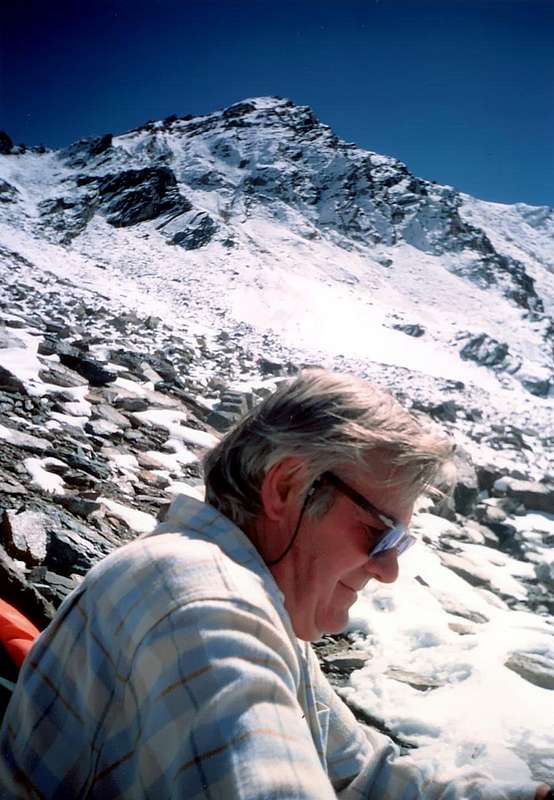
3/D) - Punta del Tuf (3.392/3m)
Approach from Eaux Rousses to Lauson Hill:
Eaux Rousses (1.666m), by muletrack n° 10/10B/High Route n° 2 towards Low and Middle Leviona(z) Alps. Continue Northeast through path n° 10 to the Lauson Hill (3.296m); from hill, after passing to the East a pinnacle, by the North Crest enough easily on Summit (EE/F+; 5h'00/5h'30).3/D) - Punta del Tuf (3.392/3 m)
Avvicinamento da Eaux Rousses al Col Lauson:
da Eaux Rousses (1.666 m) con mulattiera n° 10/10B/Alta Via n° 2 alle Alpi Leviona(z) Dèsott e du Meitin. Salire a Nordest col sentiero n° 10 verso il Colle del Lauson (3.296 m); quindi, dopo aver aggirato ad Est un pinnacolo, in Cima tramite l'abbastanza facile Cresta Nord (EE/F+; 5h'00/5h'30).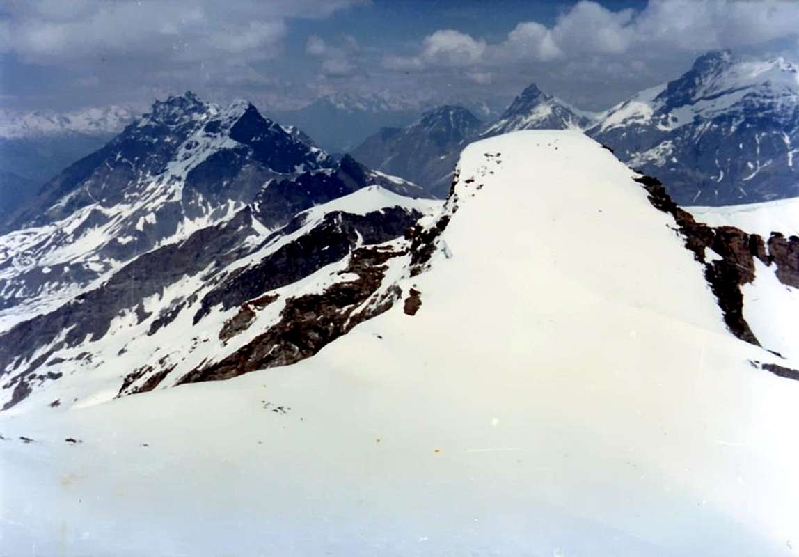
4/A) - Cima di Entrelor (3.426m) to Federico Benevolo Refuge
Approach from Villeneuve Municipality: towards the alternative between Valsavarenche and Rhêmes Valleys with Regional Road; from fork towards Introd, Brenloz/Tache Hamlets, Rhêmes-Saint Georges Commune, Proussaz (1.445m; Holiday Farms "Le Bâton d'Or" and "Le Vieux Creton" nearby Creton (1.447m, 1.548m) and"Edelweiss" (1.600m), below Melignon, Artalle (1.654m), Carré (1.664m) Villages to Main tourist center Rhêmes-Notre Dame (1.723m). Continue on asphalt road towards Bruil (1.723m), Moulin de Chaudanne/Pellaud (+; 1.811m) Villages to Thumel Villages neighbor the torrent into a grassy plaine (1.879m; great dirt parking immediately before the same in altitude 1.848m; signal no passage). From this, before with dirt farms road to winding road 1.901 meters (various signals, panels), after through path in South and towards Saint Pantaléon (2.010m; + chapel; *** fork paths to Grand Vaudala(z) Vallon) and immediately after a winding road North/South to following Barmaverain Pasture (2.037m). Continue through false level route with a long diagonal in South below a first waterfall (2.051m) and subsequent (2.087m); crossing Roman Bridge, by dirt road also with a shortcut of path, immediately to the right of the private road, towards Federico Benevolo Refuge (2.280m), above Lavassey Pasture near the Rhêmes Dora (2.227m; E; 3h'30/4h'15).
Via the Western Slope of the Hill or so ensure Pertcha and North Ridge: Bruil Village, just after Rhêmes Notre Dame, at the Farm "Lo Sabot", move towards East-southeast with trail n° 10/High Via n° 2, reaching Plan de Feie (highland sheep; 2.143m); from this point, or just before, leave the same, which continues to Entrelor Hill (3.007m), bending more towards Southeast, enter the same name vallon, by traces on the moraine, where it reaches more steeply so ensure Col (3.148m). Get back on track amid debris and rocks insignificant easy Northern Ridge, after an elevation followed by a small ante top (3.272m, 3.391m), easily leads to the true Summit (E; 5h'00/5h'30).
Valle di Rhêmes
4/A) - Cima di Entrelor (3.426m) al Rifugio Federico Benevolo
Via the Western Slope of the Hill or so ensure Pertcha and North Ridge: Bruil Village, just after Rhêmes Notre Dame, at the Farm "Lo Sabot", move towards East-southeast with trail n° 10/High Via n° 2, reaching Plan de Feie (highland sheep; 2.143m); from this point, or just before, leave the same, which continues to Entrelor Hill (3.007m), bending more towards Southeast, enter the same name vallon, by traces on the moraine, where it reaches more steeply so ensure Col (3.148m). Get back on track amid debris and rocks insignificant easy Northern Ridge, after an elevation followed by a small ante top (3.272m, 3.391m), easily leads to the true Summit (E; 5h'00/5h'30).
4/A) - Cima di Entrelor (3.426m) al Rifugio Federico Benevolo
Avvicinamento da Villeneuve: verso il bivio tra le Valli di Valsavarenche/Rhêmes con la Strada Regionale; dall'incrocio verso i Comuni e Villaggi di Introd, Brenloz/Tache, Rhêmes-Saint Georges, Proussaz (1.445 m; Agriturismo "Le Bâton d'Or", "Le Vieux Creton" il vicino Creton (1.447 m, 1.548 m) ed "Edelweiss" (1.600 m), sotto ai Villaggi di Melignon, Artalle (1.654 m), Carré (1.664 m) in direzione del Centro Turistico di Rhêmes-Notre Dame (1.723 m). Continuare sulla strada asfaltata verso i Villaggi di Bruil (1.723 m), Moulin de Chaudanne/Pellaud (+; 1.811 m) e Thumel presso il torrente all'interno d'una pianura erbosa (1.879 m; grande parcheggio in terra battuta subito precedente la stessa a quota 1.848 metri con divieto di transito ai mezzi. Da qui, dapprima tramite poderale verso il tornante 1.901 metri (varie segnalazioni e pannelli), indi con sentiero a Sud in direzione di Saint Pantaléon (2.010 m; + cappellina; *** incrocio sentieri verso il Vallone della Grand Vaudala(z)), nonché subito appresso verso il tornante Nord/Sud precedente l'Alpe Barmaverain (2.037 m). Continuare con un lungo diagonale in falsopiano a Sud sotto ad una serie di cascate (2.051 m, 2.087 m) e, attraversato il Ponte Romano tramite la poderale oppure tramite breve scorciatoia sulla destra, raggiungere in breve il Rifugio Benevolo (2.280 m), appen sopra l'Alpe di Lavassey (2.227m; E; 3h'30/4h'15).
Via per il Versante Occidentale del Colle Percià o Pertcha e la Cresta Nord: da Notre Dame-Bruil, presso lo Agriturismo "Lo Sabot", indirizzarsi verso Est-sudest con il sentiero 10/Alta Via n° 2 raggiungendo Plan de Feie (2.143 m); da qui, od appena prima, abbandonare il medesimo, che prosegue per il Colle di Entrelor (3.007 m), piegando maggiormente verso Sudest, entrando nell'omonimo vallone, ove tramite tracce sulla morena si raggiunge più ripidamente il Col Percià (3.148 m). Risalire su tracce tra detriti e roccette insignificanti la facile Cresta Settentrionale che, dopo una elevazione seguita da una antecima (3.272 m, 3.391 metri), facilmente adduce alla Sommità (E; 5h'00/5h'30).
![]()
4/B) - Gran Vaudala(z) (3.270m) through Basei Hill (3.176m) and by Northern Crest
4/B) - Gran Vaudala(z) (3.270 m) per il Col Basei (3.176 m) e Cresta Nord
![]()
4/C) - Punta Basei (+; 3.338m) through Basei Hill (3.176m) and by Northern Crest
4/C) - Punta Basei (+; 3.338m) per il Col Basei (3.176 m) e Cresta Nord
![]()
4/D) - Grande Traversière (3.496m)
Route through the South Slope and Southwest Crest: from refuge taking in West path n° 13D which leads to Comba Goletta and lake (2.699m; 1h'30/1h'45); abandoning this to the left, go up to the North passing a narrow passage with rocks between the altitudes 2.806/2.956 meters, reaching through steep stonyground and moraines what remains of Glacier Central Traversière, leaving West the Meridional. With path first in the North-northeast, then Northwest it surrounds or cross the same on his margin coming to a saddle (3.414m) on the Southwest Ridge; with this through easy, small and rotten rocks to the Summit (EE/F+; 3h'00/3h'15 by Lake Goletta; 5h'00/5h'30 Benevolo).
4/D) - Grande Traversière (3.496 m)
Via tramite il Versante Sud e la Cresta Sudovest: dal rifugio prendere ad Ovest il sentiero n° 13D che conduce alla Comba di Goletta e lago (2.699 m; 1h'30/1h'45); abbandonando questo a sinistra, salire a Nord superando una strettoia tra le quote 2.806/2.956 metri raggiungendo con ripide pietraie e morene ciò che rimane del Ghiacciaio Centrale di Traversière, lasciando subito ad Ovest quello Meridionale. Con percorso dapprima a Nordest e poi a Nordovest si contorna o si attraversa lo stesso sul suo margine arrivando ad una Sella (3.414 m) sulla Cresta Sudovest; con questa tramite facili roccette rotte in Cima (EE/F+; 3h'00/3h'15 dal Lago Goletta; 5h'00/5h'30 dal Benevolo).
Valgrisenche
![]()
5/A) - Becca di Tos (3.300 m)
Via per il Versante Occidentale del Colle Percià o Pertcha e la Cresta Nord: da Notre Dame-Bruil, presso lo Agriturismo "Lo Sabot", indirizzarsi verso Est-sudest con il sentiero 10/Alta Via n° 2 raggiungendo Plan de Feie (2.143 m); da qui, od appena prima, abbandonare il medesimo, che prosegue per il Colle di Entrelor (3.007 m), piegando maggiormente verso Sudest, entrando nell'omonimo vallone, ove tramite tracce sulla morena si raggiunge più ripidamente il Col Percià (3.148 m). Risalire su tracce tra detriti e roccette insignificanti la facile Cresta Settentrionale che, dopo una elevazione seguita da una antecima (3.272 m, 3.391 metri), facilmente adduce alla Sommità (E; 5h'00/5h'30).
4/B) - Gran Vaudala(z) (3.270m) through Basei Hill (3.176m) and by Northern Crest
Approach and Route from Benevolo:
from shelter follow the path n° 13B towards the Nivoletta and Basei Passes, leaving it at an altitude of about 2.570 meters and go up a small walloon to the East, reaching a pond (around 2.885/90 meters) m). Through the pastures and small snowfields reach the Gran Vaudala Pass, positioned on the Ridge Northwest between Northern Top of Gran Vaudala and Southeast of the Punta Paletta (2.968; E/F; 2h'15/2h'45). From this point there are two possible routes: a) - to climb on the easy Northwestern Crest by rotten rocks to the Summit (E/F; 1h'00 dal colle; 3h'15/3h'45 dal rifugio); b) - continue left on the Gran Vaudala Glacier and through moderate slopes (30°/38°) reach the North Top (EE/F+; 1h'00; overall 3h'30). Wanting, at 0h'15 by the South-southwest Ridge easily reach Southern Vertex (3.250m).4/B) - Gran Vaudala(z) (3.270 m) per il Col Basei (3.176 m) e Cresta Nord
Avvicinamento e Via dal Benevolo:
dal rifugio salire col sentiero n° 13B per i Colli di Nivoletta e Basei, lasciandolo a quota 2.570 metri circa e salire ad Oriente tramite un valloncello raggiungendo un mini laghetto. Per pascoli e piccoli nevai pervenire al Colle della Gran Vaudala, posto sulla Cresta Nordovest tra tra Punta Nord della Gran Vaudala e la Punta Sudest di quella di Paletta (2.968 m; E/F; 2h'15/2h'45). Da questo punto esistono due possibilità: a) - continuare sulla facile Cresta Nordovest per rocce rotte sino in Cima (E/F; 1h'00 dal colle; 3h'15/3h'45 dal rifugio); b) - proseguire sulla sinistra sul Ghiacciaio della Gran Vaudala e per pendii mediamente ripidi (30°/38°) raggiungere la Vetta Nord (EE/F+; 1h'00; in totale 3h'30). Volendo,in un quarto d'ora si raggiunge facilmente la Punta Meridionale (3.250 m), per mezzo dell'elementare Cresta Sud-sudovest.
4/C) - Punta Basei (+; 3.338m) through Basei Hill (3.176m) and by Northern Crest
Approach and route from Benevolo:
from deviation 2.707 meters in left (Southeast) with Galisia Point Route go up by path n° 13B along the moraine as far as upper crossroads towards Nivoletta (Northeast) and Basei (East) Hills in altitude around 3.000 meters, by a more steep terminal part arriving on the last pass (3.176m; E; 2h'30/3h'00). From this, climbing on easy Northern Crest or Standard Route, before bypassing an elevation 3.196 meters and after reaching the Top, paying attention to a passage in the final equipped with some lanynards (check the efficiency of the same; I°+/ II°-) and exposed on the Basei Glacier to the Northeast (EE/A; 0h'45/1h'00). 4/C) - Punta Basei (+; 3.338m) per il Col Basei (3.176 m) e Cresta Nord
Avvicinamento e Via dal Benevolo:
alla deviazione 2.707 metri verso Sudest, con la via della Punta Galisia, risalire con il sentiero n° 13B lungo la morena sino alla superiore biforcazione a circa 3.000 metri per i Colli di Nivoletta (Nordest) e Basei (Est) raggiungendo con parte finale più ripida quest'ultimo colle (3.176 m; E; 2h'30/3h'00). Risalire alla Punta Basei per la facile nonché breve Cresta Nord o Via Normale, scavalcando od aggirando dapprima la quota 3.196 metri e facendo attenzione nella parte finale ad un passaggio attrezzato con alcuni cordini (controllarne lo stato d'efficienza; I°+/ II°-) ed alquanto esposto sul Ghiacciaio di Basei a Nordest verso il Pian del Nivolé (EE/A; 0h'45/1h'00).
4/D) - Grande Traversière (3.496m)
Approach from Thumel Village towards the Benevolo Refuge:
from Thumel (1.879m), with path n° 13 towards Benevolo, as the itinerary 4A) - for the Cima of Entrelor.Route through the South Slope and Southwest Crest: from refuge taking in West path n° 13D which leads to Comba Goletta and lake (2.699m; 1h'30/1h'45); abandoning this to the left, go up to the North passing a narrow passage with rocks between the altitudes 2.806/2.956 meters, reaching through steep stonyground and moraines what remains of Glacier Central Traversière, leaving West the Meridional. With path first in the North-northeast, then Northwest it surrounds or cross the same on his margin coming to a saddle (3.414m) on the Southwest Ridge; with this through easy, small and rotten rocks to the Summit (EE/F+; 3h'00/3h'15 by Lake Goletta; 5h'00/5h'30 Benevolo).
4/D) - Grande Traversière (3.496 m)
Avvicinamento da Thumel al Rifugio Benevolo:
dal Villaggio di Thumel (1.879 m) con il sentiero n° 13 insino al Benevolo, come all'itinerario 4A) - per la Cima d'Entrelor.Via tramite il Versante Sud e la Cresta Sudovest: dal rifugio prendere ad Ovest il sentiero n° 13D che conduce alla Comba di Goletta e lago (2.699 m; 1h'30/1h'45); abbandonando questo a sinistra, salire a Nord superando una strettoia tra le quote 2.806/2.956 metri raggiungendo con ripide pietraie e morene ciò che rimane del Ghiacciaio Centrale di Traversière, lasciando subito ad Ovest quello Meridionale. Con percorso dapprima a Nordest e poi a Nordovest si contorna o si attraversa lo stesso sul suo margine arrivando ad una Sella (3.414 m) sulla Cresta Sudovest; con questa tramite facili roccette rotte in Cima (EE/F+; 3h'00/3h'15 dal Lago Goletta; 5h'00/5h'30 dal Benevolo).
5/A) - Becca di Tos (3.300 m)
Approach and Route Valgrisenche by Southwestern Slope: from the Center of Valgrisenche (1.664m) rising to Southeast with the path 6 to the junction 2.156 meters at the end of the private dirt road; from here turn left shortly reaching the Alpe Maison Forte (2.365m; E; 1h'30/1h'45). Continue for a short time with the upper branch of the same coming below the quota 2.649 meters at the torrent and to the entrance of the wild walloon that leads to Tzaboc Pass (3.082m). Go up a few traces in the moraine to the altitude of 2.800/20 meters about, where you turn to go North to cross the long ridge of the great Western Shoulder 3.275 meters or Southern Summit, coming into the next walloon. "Cutting" the boring stony grounds progressively towards the Northeast to reach the base of the slope in the Southwest at the altitude of 3.200 meters around; through this, but painfully easy, reaching the Northwest Ridge in its final part, and by this easily on rotten rocks and debris on the Summit (EE/F+; 5h'30/6h'00 Valgrisenche).
Valgrisa
5/A) - Becca di Tos (3.300 m)
5/A) - Becca di Tos (3.300 m)
Avvicinamento e Via da Valgrisenche con il Versante Sudovest: dal Centro (1.664 m) salendo a Sudest con il sentiero 6 fino al bivio 2.156 metri ed al termine della soprastante strada poderale; da qui svoltare a sinistra raggiungendo in breve l'Alpe di Maison Forte (2.365 m; E; 1h'30/1h'45). Continuare per breve tempo con il ramo superiore della medesima arrivando sotto il punto 2.649 metri presso il torrente ed allo ingresso del selvaggio vallone che porta al Colle di Tzaboc (3.082 m). Salire per scarse tracce nella morena fino alla altitudine di 2.800/20 metri circa, dove si gira a Settentrione per andare a scavalcare la lunga Cresta Ovest dello Spallone 3.275 metri o Sommità Meridionale, entrando nel successivo vallone. "Tagliando" le noiose pietraie progressivamente verso Nordest raggiungere la base del Versante Sudovest in altitudine di 3.200 metri circa; tramite questo, facilmente ma faticosamente, raggiungere la Cresta Nordovest nella parte finale e con questa facilmente in Cima (EE/F+; 5h'30/6h'00 da Valgrisenche).
![]()
5/B) - Becca della Traversière (3.337m)
Route through Western Slope of Bassac Déré Hill and North Crest: from the shelter take trail n° 12C/Glacial High Route that gently rises through meadows to the Southeast. Turn South crossing a grassy slope below Vaudet Plan; to wade the Torrent La Cuire and the next one that flows from Bassac Glacier, below Grand Traversière, to reach a bench strewn with large boulders left by a rockfall. Climb South-southeast up ridges where grass alternates with scree. Following numerous cairns, surmount a broken rock band along a gully which is below the Glacier of Bassac Déré. The gully leads to a head with rocks and grass. From there, continue on level ground to pass three bends in the glacier with good views below. Once at the Northeast boundary of Gliairetta Glacier, below Grande Sassière (3.751m), with the trail n°12C/HRG turns East to Bassac Déré Hill, between Punta Bassac Déré (North) and Becca della Traversière (South). Follow the route with small path and traces a wide arc aiming Southeast toward the pass and continue to the South on easy Northern Crest, reaching, after the traverse in West on a first altitude and the following large saddle (3.191m, 3.158m), the Summit (EE; 3h'45/4h'15 from Mario Bezzi Refuge). From Bassac Déré Hill is possible an enough long but fine, and now classic, crossing, going down in the Vallon of Goletta at the namesake lake at the base of the glacier from which, with beautiful views of the Granta Parei (3.387m), towards the Federico Benevolo Refuge in the adjacent Val di Rhêmes.
5/B) - Becca della Traversière (3.337 m)
Via per il Versante Ovest del Col Bassac Déré e la Cresta Nord: dal rifugio prendere il sentiero n° 12C/Alta Via Glaciale che risale verso Sudest tra pendii prativi senza grandi pendenze. Svoltare a Sud attraversando un pendio erboso sottostante il Pianoro del Vaudet; guadare il Torrent La Cuire ed il successivo proveniente dal Ghiacciaio di Bassac, sotto la Grande Traversière, per raggiungere una piana cosparsa di grandi massi residuo d'una frana. Salire verso Sud-sudest sopra crestine dove i tratti erbosi s'alternano a ghiaioni. Guidati da numerosi ometti, s'oltrepassa una fascia rocciosa lungo una canaletta sottostantemente al Ghiacciaio di Bassac Déré. Questa conduce ad una testa rocciosa ricoperta d'erba. Da qui, continuare in falsopiano superando tre fasce sopra il ghiacciaio con belle vedute sottostanti. Giunti al margine Nordest col Ghiacciaio di Gliairetta, sotto la bella Grande Sassière (3.751 m), tramite il sentiero n°12C/HRG voltare decisamente più ad Est in direzione del Col Bassac Déré, posto tra la Punta Bassac Déré a Nord e la Becca della Traversière all'opposto. Seguir la via per mezzo d'un sentierucolo tra detriti oppur su tracce compiendo un ampio arco a Sudest verso il passo e continuare a Sud sulla facile Cresta Settentrionale, raggiungendo, dopo la traversata ad Ovest su d'una prima ed insignificante quota e la seguente ampia sella (3.191 m, 3.158 m), con non eccessiva pendenza la Vetta (EE; 3h'45/4h'15 dal Rifugio Mario Bezzi). Dal Colle Bassac Déré é possibile una bella, ed ormai classica traversata, scendendo nel Vallone di Goletta presso l'omonimo lago alla base del ghiacciaio donde, con belle vedute sulla Granta Parei (Grande Parete; 3.387 m), al Federico Benevolo in Val di Rhêmes.
![]()
5/C) - Pointe d'Archeboc (3.278m) bypassing Pointe de Serrù or de Maurin (3.227 m) and the two Ormelune (3.256m, 3.230m) from Vaudet Hill (2.836m)
5/C) - Pointe d'Archeboc (3.278 m) scavalcando Pointe de Serrù o de Maurin (3.227 m) ed i due Ormelune (3.256 m, 3.230 m) dal Col Vaudet (2.836 m)
Avvicinamento e Via dal Bezzi: dal rifugio prendere verso Nordovest il sentiero n° 12D/12E che, superati tre torrentelli, guada in altitudine di 2.500 metri circa quello più importante di Grapillon; lo stesso, flettendo progressivamente ad Ovest e lasciando sulla destra il ramo n° 12E per la Comba du Rocher Blanc, raggiunge il Col Vaudet, tra la Becca di Suessa e la becca de Pertcha (3.028 m). Dal colle, scavalcando le quote 2.929, 3.014 metri, raggiungere quest'ultima tramite la Cresta Sud-sudovest; con breve discesa raggiungere il Col du Lac Noir (2.872 m); superata un'altra quota 2.937, 2.961 metri s'arriva facilmente alla Pointe de Serrù o Maurin. Indi lo spartiacque piega decisamente a Nordovest raggiungendo in progressione e con identiche difficoltà, dopo la larga sella 3.169 metri, le Sommità Sudest, detta anche Pointe du Suzzei (del Soldato), e la Centrale dell'Ormelune e da ultimo per cresta innevata e detriti quella Nordovest o d'Archeboc, nonché la più elevata (EE/F+; 1h'45/2h'15 dal Col Vaudet; 4h'30/5h'00 dal Bezzi).
![]()
5/D) - Monte Colombo (1.854m)
5/D) - Monte Colombo (1.854 m)
La Thuile Valley
![]()
6/A) - Mont Paramont (3.300m)
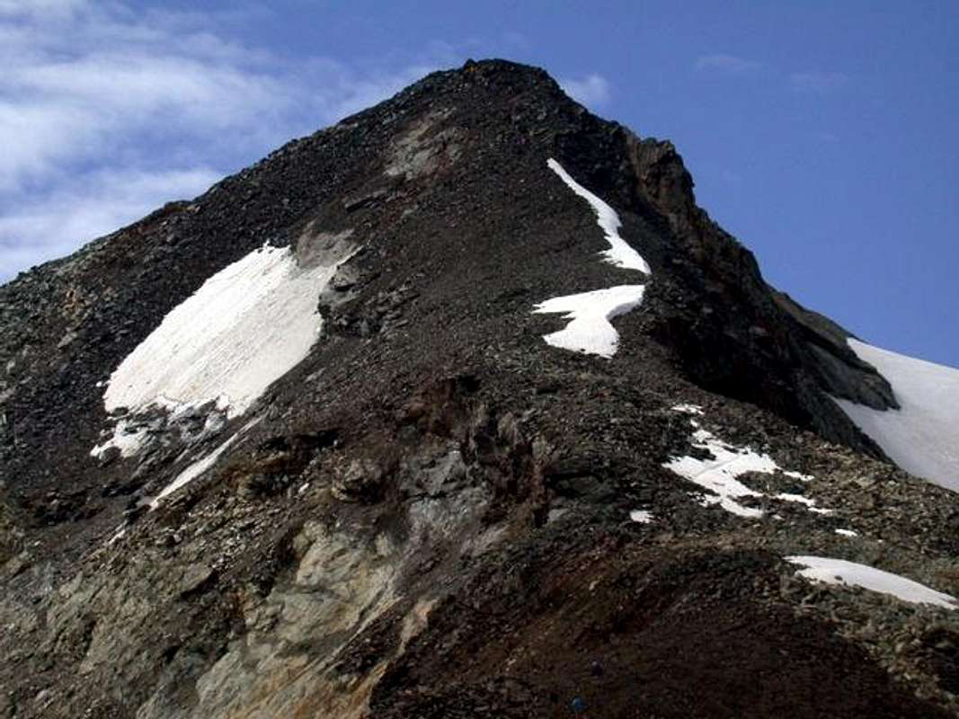
5/B) - Becca della Traversière (3.337m)
Approach from Mondanges Fraction (1.652m):
towards Surrier or Usellières (1.785m, 1.770m) small Villages and by those last to Bezzi Shelter (1.785m; panels and signals), through dirt farms road path concomitant in South above main torrent, to Tsalé (1.931m) and Saxe Savoie Alpages (2.036m); from pasture, leaving West the deviation on dirt private road to Saxe Ponton Alp (2.047m), continue through path n° 12, along the Valgrisenche Doire, reaching the point 2.172 meters just before the Vaudet Alp (about 2.260 meters) and the following shelter (2.284m; F+; 4h '00/4h '15), below Eastern Faces of Punta Plattes des Chamois (3.567m) and Becca de Suessa also de Schuetse (3.423m).Route through Western Slope of Bassac Déré Hill and North Crest: from the shelter take trail n° 12C/Glacial High Route that gently rises through meadows to the Southeast. Turn South crossing a grassy slope below Vaudet Plan; to wade the Torrent La Cuire and the next one that flows from Bassac Glacier, below Grand Traversière, to reach a bench strewn with large boulders left by a rockfall. Climb South-southeast up ridges where grass alternates with scree. Following numerous cairns, surmount a broken rock band along a gully which is below the Glacier of Bassac Déré. The gully leads to a head with rocks and grass. From there, continue on level ground to pass three bends in the glacier with good views below. Once at the Northeast boundary of Gliairetta Glacier, below Grande Sassière (3.751m), with the trail n°12C/HRG turns East to Bassac Déré Hill, between Punta Bassac Déré (North) and Becca della Traversière (South). Follow the route with small path and traces a wide arc aiming Southeast toward the pass and continue to the South on easy Northern Crest, reaching, after the traverse in West on a first altitude and the following large saddle (3.191m, 3.158m), the Summit (EE; 3h'45/4h'15 from Mario Bezzi Refuge). From Bassac Déré Hill is possible an enough long but fine, and now classic, crossing, going down in the Vallon of Goletta at the namesake lake at the base of the glacier from which, with beautiful views of the Granta Parei (3.387m), towards the Federico Benevolo Refuge in the adjacent Val di Rhêmes.
5/B) - Becca della Traversière (3.337 m)
Avvicinamento dalla Frazione di Mondanges ai Villaggi di Surrier/Usellières e al Rifugio Mario Bezzi:
(1.785 m; pannelli con segnalazioni), tramite la poderale concomitante col sentiero verso Sud ed al di sopra del torrente principale, verso le Alpi di Tsalé (1.931 m) e Saxe Savoie (2.036m); da questa, lasciata ad Ovest la deviazione verso l'Alpe Saxe Ponton (2.047m), continuare tamite il sentiero affianco alla Dora di Valgrisa raggiungendo il punto 2.172 metri appena prima dell'Alpe Vaudet a circa 2.260 metri ed il successivo rifugio (2.284 m; F+; 4h '00/4h '15), sottostante la Facce Orientali della Punta Plattes des Chamois (3.567 m) e della Becca de Suessa o Schuetse (3.423 m).Via per il Versante Ovest del Col Bassac Déré e la Cresta Nord: dal rifugio prendere il sentiero n° 12C/Alta Via Glaciale che risale verso Sudest tra pendii prativi senza grandi pendenze. Svoltare a Sud attraversando un pendio erboso sottostante il Pianoro del Vaudet; guadare il Torrent La Cuire ed il successivo proveniente dal Ghiacciaio di Bassac, sotto la Grande Traversière, per raggiungere una piana cosparsa di grandi massi residuo d'una frana. Salire verso Sud-sudest sopra crestine dove i tratti erbosi s'alternano a ghiaioni. Guidati da numerosi ometti, s'oltrepassa una fascia rocciosa lungo una canaletta sottostantemente al Ghiacciaio di Bassac Déré. Questa conduce ad una testa rocciosa ricoperta d'erba. Da qui, continuare in falsopiano superando tre fasce sopra il ghiacciaio con belle vedute sottostanti. Giunti al margine Nordest col Ghiacciaio di Gliairetta, sotto la bella Grande Sassière (3.751 m), tramite il sentiero n°12C/HRG voltare decisamente più ad Est in direzione del Col Bassac Déré, posto tra la Punta Bassac Déré a Nord e la Becca della Traversière all'opposto. Seguir la via per mezzo d'un sentierucolo tra detriti oppur su tracce compiendo un ampio arco a Sudest verso il passo e continuare a Sud sulla facile Cresta Settentrionale, raggiungendo, dopo la traversata ad Ovest su d'una prima ed insignificante quota e la seguente ampia sella (3.191 m, 3.158 m), con non eccessiva pendenza la Vetta (EE; 3h'45/4h'15 dal Rifugio Mario Bezzi). Dal Colle Bassac Déré é possibile una bella, ed ormai classica traversata, scendendo nel Vallone di Goletta presso l'omonimo lago alla base del ghiacciaio donde, con belle vedute sulla Granta Parei (Grande Parete; 3.387 m), al Federico Benevolo in Val di Rhêmes.
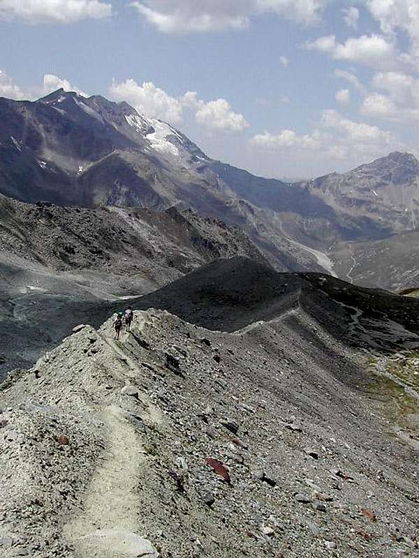
5/C) - Pointe d'Archeboc (3.278m) bypassing Pointe de Serrù or de Maurin (3.227 m) and the two Ormelune (3.256m, 3.230m) from Vaudet Hill (2.836m)
Approach by Bezzi:
from shelter in Northwest to take trail n° 12D/12E, that exceeded three secondary torrents, wading in altitude of about 2.500 meters the most important of Grapillon; the same, flexing progressively to the West and leaving right the branch n° 12E for Comba du Rocher Blanc, reaches the Col Vaudet, between the Becca of Suessa and Becca Pertcha (3.028m). From the hill, stepping over the elevations in 2.929, 3.014 meters, reaching the latter through the South-southwest Crest. With short not difficult descent reach the Col du Lac Noir (2.872m); another two altitudes 2.937, 2.961 meters you get easily to the Pointe de Serrù or Maurin. From this the watershed turn decidedly Northwest reaching in progression and same difficulties, after the wide saddle 3.169 meters, the Summit Southeast, also called Punta du Suzzei (Soldier), and the Central Ormelune and finally through a snowy ridge and debris the Northwest Top, even called Archeboc and the highest (EE/F+; 1h'45/2h'15 Col Vaudet; 4h'30/5h'00 by Bezzi). 5/C) - Pointe d'Archeboc (3.278 m) scavalcando Pointe de Serrù o de Maurin (3.227 m) ed i due Ormelune (3.256 m, 3.230 m) dal Col Vaudet (2.836 m)
Avvicinamento e Via dal Bezzi: dal rifugio prendere verso Nordovest il sentiero n° 12D/12E che, superati tre torrentelli, guada in altitudine di 2.500 metri circa quello più importante di Grapillon; lo stesso, flettendo progressivamente ad Ovest e lasciando sulla destra il ramo n° 12E per la Comba du Rocher Blanc, raggiunge il Col Vaudet, tra la Becca di Suessa e la becca de Pertcha (3.028 m). Dal colle, scavalcando le quote 2.929, 3.014 metri, raggiungere quest'ultima tramite la Cresta Sud-sudovest; con breve discesa raggiungere il Col du Lac Noir (2.872 m); superata un'altra quota 2.937, 2.961 metri s'arriva facilmente alla Pointe de Serrù o Maurin. Indi lo spartiacque piega decisamente a Nordovest raggiungendo in progressione e con identiche difficoltà, dopo la larga sella 3.169 metri, le Sommità Sudest, detta anche Pointe du Suzzei (del Soldato), e la Centrale dell'Ormelune e da ultimo per cresta innevata e detriti quella Nordovest o d'Archeboc, nonché la più elevata (EE/F+; 1h'45/2h'15 dal Col Vaudet; 4h'30/5h'00 dal Bezzi).
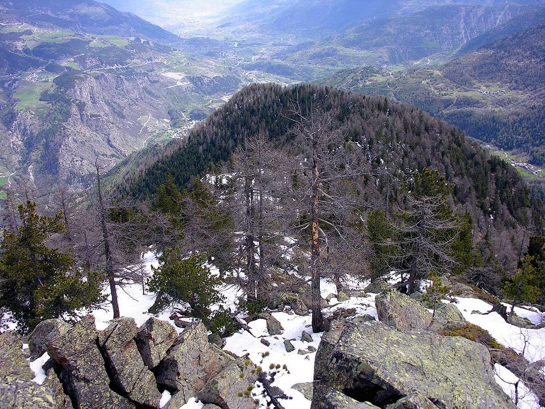
5/D) - Monte Colombo (1.854m)
Approach and Route from Planaval/Baulen (1.775m):
by Planaval reach Villages of La Clusaz and Baulen or Baulin with the paved road; A parking by taking the path 20A, which rises to the northeast toward Milliery (1.656m) and arrives through the forest to the grassy saddle 1.771 meters, from which in the short to Top (E; 1h'0/1h'15 Baulen).5/D) - Monte Colombo (1.854 m)
Avvicinamento e Via da Planaval/Baulen (1.775 m):
da Planaval raggiungere i Villaggi di La Clusaz e Baulen o Baulin con la strada asfaltata; dal percheggio prendere il sentiero 20A, che sale a Nordest verso Milliery (1.656 m) ed arriva attraversando il bosco alla sella erbosa 1.771 metri, donde in breve alla Cima (E; 1h'0/1h'15 da Baulen). 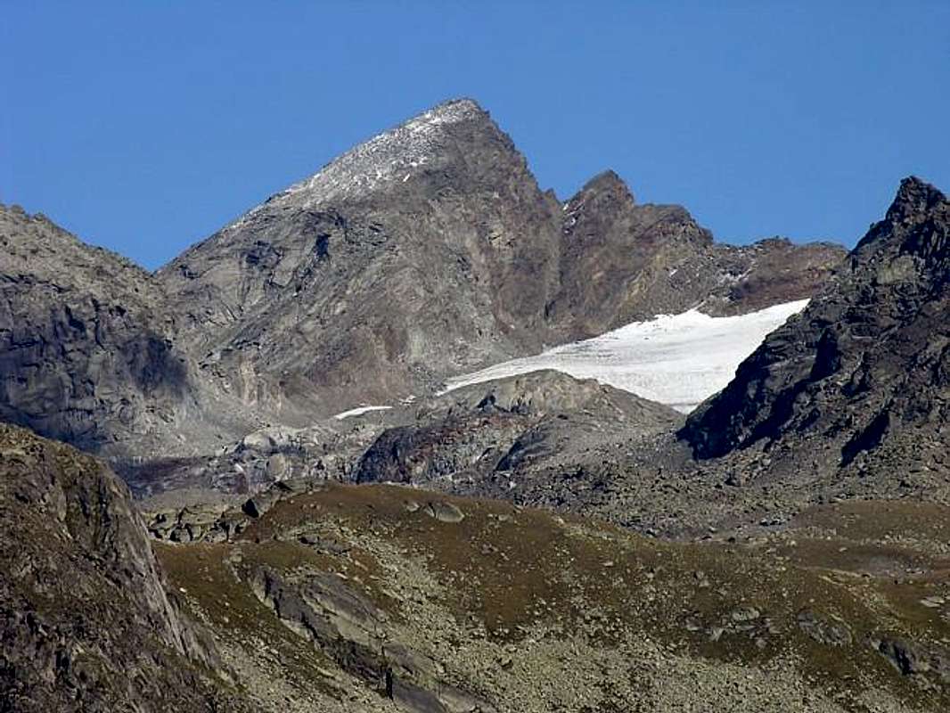
6/A) - Mont Paramont (3.300m)
Approach from Morgex towards La Thuile, La Joux, Refuge Albert Deffeyes: exit of Motorway A5 (921m), continue for about 3 km on SS.26 towards Pré Saint Didier (1.017m). After several hairpins, and past the Villages Elevaz (1.302m) la Balme (1.309m) reach the La Thuile Ski Resort (1. 441m). To begin the slope toward the refuge with the path n° 3/15/High Route n° 2 in front of the "Bar of the Falls", after having gone beyond a bridge in wood on the left and later around 0h'15 you'll come to the First of the three spectacular Rutor Falls. Continue along the path and go beyond (on the left) the Parchet Alp (1.770m) set on the right (South), a first brooklet, the Alp Plan Fruitier (2.810m) and another small torrent, deriving respectively from the Preuvé Comba and from Combassa. To always continue along the path what time it climbs him to terraces and, later 01h'00 the Second Fall is gone beyond, signalled by a panel, but not visible from the path). Later around as many 0h'15 the poster of the Third Fall meets him (1.996m); go up on the steep trail for other 0h'20/0h'30, here the path divides him. Take that on the left (East-northeast) well signalled that it conducts to the hut, after having left (Northeast) immediately towards the entrance into Ussellettes Vallon. To actually go up again to the Collar (2.130m), for then to slightly go down on the right and continue up to the Lake Glacier (2.143m); go beyond the bridge in wood that overhangs the emissary and, leaving on the right the homonym alp (2.158m), to start over decidedly climbing along ample and wide hairpins bends up to reach the plateau through a run first semicircular to of it (Northeast) and subsequently toward East-southeast, where site is the shelter (2.494m), not after having just abandoned first to the left (Northeast) the path n° 15/High Route n° 2 towards Ussellettes Vallon (E; 2h'45/3h'00 from La Joux).
Route by West-northwest Ridge (Normal Via): from refuge to return back shortly toward of it with the path of the shelter; to advance himself in the Comba (Basin) des Ussellettes with the path n° 15/High Route n° 2 and go up to a carving of the Passo Alto (2.859m). Continuous to, after having gone beyond a ruin, at first with the same direction then folding up more toward East, near the altitude 2.502 meters. Leaving left (North) the steep ramification for the hill, advance himself toward right in a small debris plateau, characterized by the presence of the eight Ussellettes Lochs (2.754m and 2.762m the most greater); after to go up again the inclusive walloon among the Punta d'Invergneures (3.019m) to Southwest and the Testa (Head) of Paramont (3.140m) to of it, but mostly holding herself against this last. With run, that increases in steepness, towards a nocht called Ussellettes's Pass (2.989m); 1h'20/1h'40 from shelter). From this get on the edge of the ridge with the first part consists of blocks broken and rotten rocks reaching a small wall that will double with a small traverse to the left, easy (I°/I°+), but enough exposed above the Northwest Wall, and then return to the same thread. After some easy plaques or through rock slabs of rock route, you will reach a characteristic hump-plateau just below the Vertex, with the remains of an ancient building perimeter and in short time to the signal and the stone cairn on the same (A/EE/F+; 00h'45/1h'00 by carving; 2h'30/3h'00 from Albert Deffeyes, ex Santa Margherita Refuge).
Valle di La Thuile
6/A) - Mont Paramont (3.300 m)
Route by West-northwest Ridge (Normal Via): from refuge to return back shortly toward of it with the path of the shelter; to advance himself in the Comba (Basin) des Ussellettes with the path n° 15/High Route n° 2 and go up to a carving of the Passo Alto (2.859m). Continuous to, after having gone beyond a ruin, at first with the same direction then folding up more toward East, near the altitude 2.502 meters. Leaving left (North) the steep ramification for the hill, advance himself toward right in a small debris plateau, characterized by the presence of the eight Ussellettes Lochs (2.754m and 2.762m the most greater); after to go up again the inclusive walloon among the Punta d'Invergneures (3.019m) to Southwest and the Testa (Head) of Paramont (3.140m) to of it, but mostly holding herself against this last. With run, that increases in steepness, towards a nocht called Ussellettes's Pass (2.989m); 1h'20/1h'40 from shelter). From this get on the edge of the ridge with the first part consists of blocks broken and rotten rocks reaching a small wall that will double with a small traverse to the left, easy (I°/I°+), but enough exposed above the Northwest Wall, and then return to the same thread. After some easy plaques or through rock slabs of rock route, you will reach a characteristic hump-plateau just below the Vertex, with the remains of an ancient building perimeter and in short time to the signal and the stone cairn on the same (A/EE/F+; 00h'45/1h'00 by carving; 2h'30/3h'00 from Albert Deffeyes, ex Santa Margherita Refuge).
6/A) - Mont Paramont (3.300 m)
Avvicinamento partendo da Morgex verso La Thuile, la Frazione di La Joux ed il Rifugio Albert Deffeyes: dall'uscita dell'Autostrada A5 (921 m) continuare per circa 3 km sulla SS.26 in direzione di Pré Saint Didier (1.017m). Da questo tramite numerosi tornanti e, passati i Villagi di Elevaz (1.302m) e la Balme (1.309 m), s'arriva al rinomato Centro Turistico di La Thuile (1.441 m), famoso per la pratica dello Sci. Iniziare la salita verso il Rifugio Deffeyes sul sentiero n° 3/15/Alta Via n° 2 davanti al "Bar delle Cascate", dopo aver oltrepassato un ponte in legno sulla sinistra e dopo circa 0h'15 s'incontra la Prima del tre spettacolari Cascate del Rutor; proseguire lungo il sentiero oltrepassando a sinistra l'Alpe di Parchet, situata a destra o Sud (1.770 m), l'Alpe di Plan Fruitier (2.810m) ed un successivo torrentello provenienti rispettivamente dalla Comba Preuvé e dalla Combassa. Procedere sempre lungo il sentiero innalzalzantesi a gradoni e, dopo 01h'00, superare la Seconda Cascata, segnalata da cartello non visibile. Dopo un altro quarto d'ora circa s'incontra il cartello della Terza Cascata (1.996 m); continuare sul ripido sentiero per altri 0h'20/0h'30 ove questo si sdoppia. Risalire sino al Colletto 2.130 metri, per poi discendere di poco a destra proseguendo fino al Lago del Ghiacciaio (2.143 m); oltrepassato il ponticello in legno sull'emissario del lago e, lasciando a destra l'omonimo alpeggio (2.158 m), riprendere a salire decisamente lungo ampi tornanti fino a raggiungere l'altipiano tramite un percorso semicircolare prima a Nordest e poi ad Est-sudest, dove è posizionato il rifugio (2.494 m), lasciando appena prima e a sinistra (Nordest) il sentiero n° 15/Alta Via n° 2 per il Vallone des Ussellettes (E; 2h'45/3h'00 da La Joux).
Via per la Cresta Ovest-nordovest (Normale): dal rifugio tornare brevemente indietro a Nordest inoltrandosi nella Comba des Ussellettes con il sentiero n° 15/Alta Via n° 2 e salire col medesimo per il Passo Alto (2.859 m). Continuare, dopo un rudere, dapprima con la stessa direzione poi piegando più ad Oriente, nei pressi della quota 2.502 metri, abbandonando a Settentrione la più ripida deviazione pel colle, ed inoltrarsi verso destra in un piccolo altipiano detritico caratterizzato dalla presenza degli otto Laghi di Ussellettes ( 2.754 m, 2.762 m, i più importanti). Oltrepassatili, salire il vallone compreso tra la Punta di Invergneures (3.019 m) a Sudovest e la Testa del Paramont (3.140 m) a Nordest tenendosi maggiormente contro quest'ultima. Con percorso progressivamente più ripido pervenire ad un netto intaglio, detto Colle des Ussellettes (2.989m); 1h'20/1h'40 dal rifugio). Salire sul filo di cresta il primo tratto con blocchi e rocce rotte raggiungendo un muretto che si doppia con una piccola traversata a sinistra, facile (I°/I°+), ma delicata e con esposizione sulla Parete Nordovest, per poi rientrare sullo stesso. Superate alcune facile placche o lastronate di roccia rotta, si raggiunge una gobba-plateau appena sotto la Vetta coi resti perimetrali d'un'antica costruzione, donde in breve al segnale (A/EE/F+; 00h'45/1h'00 dall'intaglio; 2h'30/3h'00 dal Rifugio Deffeyes, ex Santa Margherita).
![]()
6/B) - Mont Fréduaz (2.938m)
6/B) - Mont Fréduaz (2.938 m)
![]()
6/C) - Grand Assaly (3.172/4m)
6/C) - Grand Assaly (3.172/4 m)
![]()
6/D) - Mont Crammont (2.737m) and Tête du Grand Mont (2.749m)
6/D) - Mont Crammont (2.737 m) e Tête du Grand Mont (2.749m)
Little Saint Bernard Vallon
![]()
7/A) - Mont Berio Blanc (3.252m)
Via per la Cresta Ovest-nordovest (Normale): dal rifugio tornare brevemente indietro a Nordest inoltrandosi nella Comba des Ussellettes con il sentiero n° 15/Alta Via n° 2 e salire col medesimo per il Passo Alto (2.859 m). Continuare, dopo un rudere, dapprima con la stessa direzione poi piegando più ad Oriente, nei pressi della quota 2.502 metri, abbandonando a Settentrione la più ripida deviazione pel colle, ed inoltrarsi verso destra in un piccolo altipiano detritico caratterizzato dalla presenza degli otto Laghi di Ussellettes ( 2.754 m, 2.762 m, i più importanti). Oltrepassatili, salire il vallone compreso tra la Punta di Invergneures (3.019 m) a Sudovest e la Testa del Paramont (3.140 m) a Nordest tenendosi maggiormente contro quest'ultima. Con percorso progressivamente più ripido pervenire ad un netto intaglio, detto Colle des Ussellettes (2.989m); 1h'20/1h'40 dal rifugio). Salire sul filo di cresta il primo tratto con blocchi e rocce rotte raggiungendo un muretto che si doppia con una piccola traversata a sinistra, facile (I°/I°+), ma delicata e con esposizione sulla Parete Nordovest, per poi rientrare sullo stesso. Superate alcune facile placche o lastronate di roccia rotta, si raggiunge una gobba-plateau appena sotto la Vetta coi resti perimetrali d'un'antica costruzione, donde in breve al segnale (A/EE/F+; 00h'45/1h'00 dall'intaglio; 2h'30/3h'00 dal Rifugio Deffeyes, ex Santa Margherita).
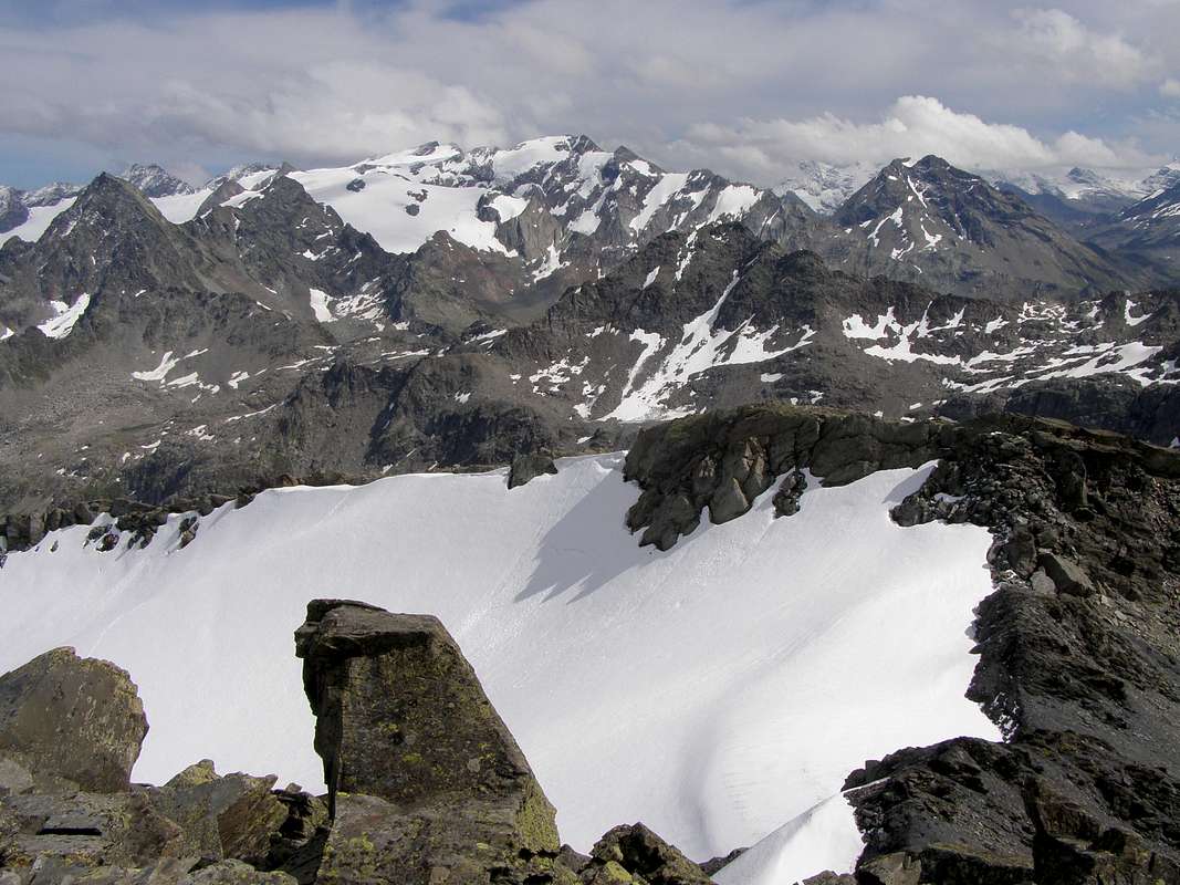
6/B) - Mont Fréduaz (2.938m)
Approach from La Joux with Route on South-southeastern Slope:
from the junction 2.100 meters with the trail to Deffeyes Shelter take the path n° 8/ Alta Via n° 2 to the right (West), which leads to the two beautiful Lakes of Bella Comba, the largest of which at an altitude 2.379 meters and the other just below at an altitude of 2.378 meters; the first, located in the West, is typical for a large rock in its center-shaped mouse curled (E; 2h'00/2h'15 from La Joux). From West Lake climb for about half a Kilometer to the above Col de la Lex Blanche (2.570m) through small path not numbered; then abandon the same and follow the emissary to the North of the tiny Lac du Mont Fréduaz (2.660m), located in a plateau at the summit of a small vallon. From here, flexing more left (Northwest), reach through the moraines and the remains of the Glacier of Fréduaz Occidental, which surrounds it on its Southern margin coming on the ridge to the right of the South Ante summit (2.902m); through the final part of the easy Southeast Ridge, which rises from the Col de Serre (2.705m), in a short time you get to the Central Top, the highest of three (E/F; 2h'30/2h'45 by Lakes Bellecombe; 4h'30/5h'00 La Joux).6/B) - Mont Fréduaz (2.938 m)
Avvicinamento da La Joux e Via per il Versante Sud-sudest:
dal bivio 2.100 metri con il sentiero per il Rifugio Deffeyes prendere il sentiero di destra (Ovest) n° 8/Alta Via n° 2 che porta ai due magnifici Laghi di Bella Comba, il maggiore dei quali a quota 2.379 metri e l'altro appena sotto a quota 2.378 metri; il primo, posizionato ad Occidente, é caratteristico per un gran roccione nel suo centro a forma di topo rannicchiato (E; 2h'00/2h'15 da La Joux). Dal Lago Occidentale salire per circa mezzo Km. verso il soprastante Col de la Lex Blanche (2.570 m) tramite piccolo sentiero non più numerato; quindi abbandonare lo stesso e seguire a Nord l'emissario del Lac du Mont Fréduaz (2.660 m), posto dentro un pianoro al sommo di un piccolo vallone. Da qui, flettendo più a sinistra (Nordovest), raggiungere tramite morene i resti del Glacier Occidental del Fréduaz, che si contorna sul suo margine Meridionale arrivando sulla cresta spartiacque a destra della quota 2.902 metri; tramite la parte finale della Cresta Sudest, che sale dal Col de Serre (2.705 m), in breve tempo facilmente s'arriva alla Sommità Centrale, la più elevata delle tre (E/F; 2h'30/2h'45 dai Laghi di Bellecombe; 4h'30/5h'00 da La Joux). 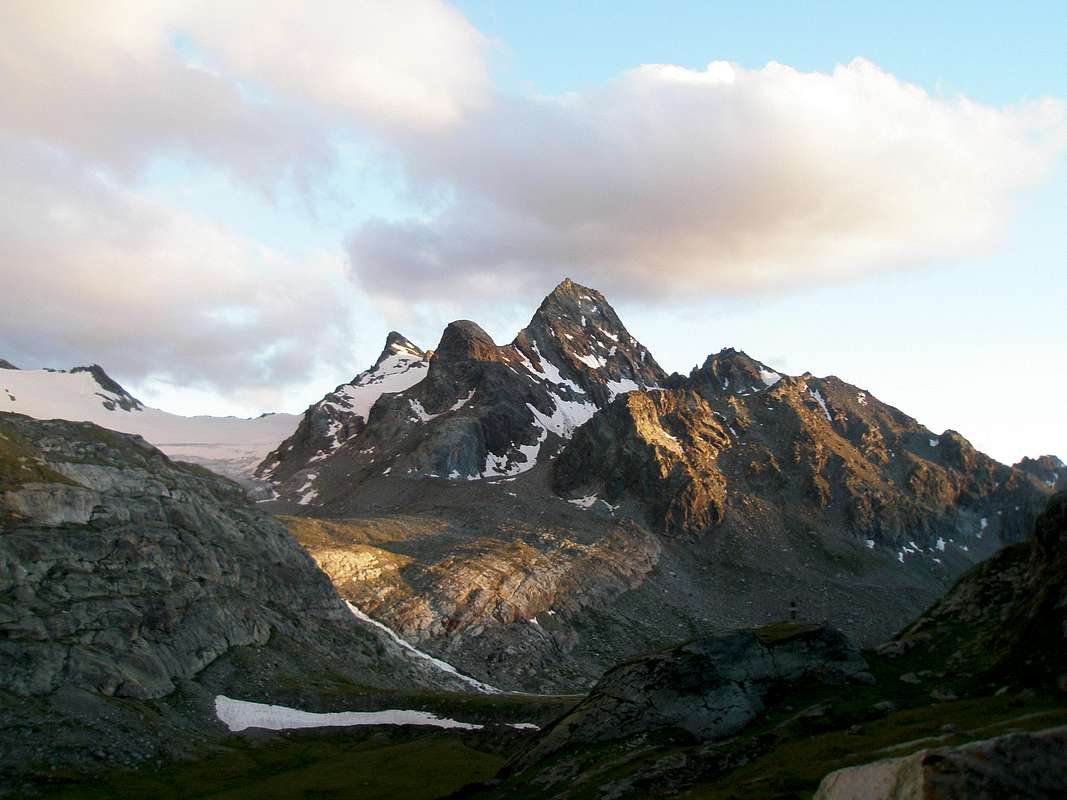
6/C) - Grand Assaly (3.172/4m)
Approach and Route from La Joux (1.646m):
junction 2.100 meters with the trail towards Deffeyes leave the path of right (West) n° 8/Alta Via n° 2, which leads to the two Bella Comba Lakes, at the next fork 2.108 meters; hence turn to the right along the path leading to the Valley of Bella Combe; after a few abandon it and go toward Southeast to reach the lake named Lac des Seracs (2.387m). Walk along the torrent, along tiring moraines, to get the Lacs Neuves (2.551m) Turning Southwest ascend for one hundred metres up to the Glacier Oriental du Grand Assaly, between the Tête d'Assaly and the Northeast Spur of Punta Loydon. Climb Southwest the bottleneck leading to the upper small basin and, in a few, to the Assaly Pass (3.002m), between Grand Assaly and Punta Loydon; follow the South Crest staying a little low on its alternately in the West East. Along slabs and rocks up to the Top; staying on the edge of the ridge (II°-/II°) you could climb various spikes requiring a not dificult climb (EE/A/F+/PD-; 3h'45/4h'15).6/C) - Grand Assaly (3.172/4 m)
Avvicinamento e Via da La Joux (1.646 m):
dal bivio 2.100 metri con il sentiero per il Deffeyes lasciare il sentiero di destra (Ovest) n° 8/Alta Via n° 2, che porta ai due magnifici Laghi di Bella Comba, presso il successivo bivio 2.108 metri; da qui svoltare verso destra sul sentiero lì conduce, abbandonandolo presto e, con direzione Sudest raggiungere il Lac des Seracs (2.387 m). Seguire l'immissario, con percorso faticoso su ripide morene, proveniente dai Lacs Neuves (2.551 m), raggiungendoli; volgendo a Sudovest, risalire per un centinaio di metri fino alla fronte del Glacier Oriental du Grand Assaly, tra la Tête d'Assaly e lo sperone Nordest della Punta Loydon. Affrontare verso Sudovest la strettoia conducente al superiore piccolo bacino e da questo in breve al Colle d'Assaly (3.002 m), tra la Grande Assaly e la Punta Loydon; seguire la cresta Sud tenendosi alternativamente sotto ad Ovest od Est. Per rocce rotte e placche si raggiunge la Vetta; volendo percorrere la cresta sul filo II°-/II° (EE/A/F+/PD-; 3h'45/4h'15).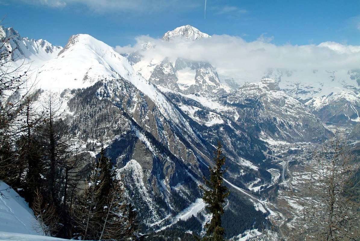
6/D) - Mont Crammont (2.737m) and Tête du Grand Mont (2.749m)
Approach and Route from Torrent:
from Pré Saint Didier towards Elevaz and from this villagge to Torrent with asphalt road (1.344m; prohibition signal for cars), after through the muletrack n° 3, to Chanton (1.817m), Mialay (1.868m) and finally Plan Praz (2.099m). Continue with the path n° 3A that through the easy grassy Southeast Slope leads on Crammont Summit, near Madonna statue; by a short downhill, but enough exposed in final part (I°+), crossing Southwest reach the Tête (E/F; 3h'30/4h'00 da Torrent). 6/D) - Mont Crammont (2.737 m) e Tête du Grand Mont (2.749m)
Avvicinamento e Via da Torrent:
da Pré Saint Didier ad Elevaz e da questo villaggio a quello di Torrent con strada in asfalto (1.344 m; divieto di transito), quindi con la mulattiera n° 3, che porta a Chanton (1.817 m), Mialay (1.868 m) ed infine a Plan Praz (2.099 m). Proseguire col sentiero n° 3A che attraverso il facile Versante Sudest porta al Crammont, presso la statua della Madonna; una breve, ma esposta in discesa sulla parte finale (I°+), traversata a Sudovest raggiunge la Tête (E/F; 3h'30/4h'00 da Torrent ).
7/A) - Mont Berio Blanc (3.252m)
Approach from La Thuile (1.441m) by the State Road to Little St. Bernard: turn left (West) on the bridge that crosses Dora of La Thuile, and go on along the same road continue to rise along the SS.26, which leads to the Little Saint Bernardo Hill to Lake Verney (2.088m), just below the pass. From this start different routes with paths to the North in the direction of various vallons from East to the West towards Little Saint Bernard Hill (2.185m) or those of Orgères, Chavannes, Breuil, Tormotta (z).
Routes from Chavannes (West) or Orgères (Est) Vallons: 1) - from State Road at fork just after Monquet tiny Village, on foot along the dirt road attendant with the path n° 11/High Route n° 2 in the Vallon of the Chavannes (huts) and, after passing Chavannes Pastures (2.128m), toward North up to Berio Blanc di Sopra Alpages (2.439m), just at the base of the Southwestern Side. Cross in plan toward East to get the wide rocky-debris couloir coming down left of the big spur ending on the Central Summit. On along it on debris and big slabs, often dirty with mould, till a little under the Central Summit. From the high part of the channel cross to the left to get a small gully that goes on to a notch on the Southern Ridge. Follow the same on slabs and unstable, but enough safe rocks (EE/F+/PD-; 2h'15/2h'45 from base; 4h'30/5h'00 Pont Serrand Hamlet).
Route 2) - downhill on Orgères Vallon: through the East Slope with a rocky steep couloir high about 750 meters), which leads to a large grassy-stony plateau in the Vallon of Orgères at the namesake lake (2.389m) and through the path n° 12, first toward the South and then Southwest to SS.26 just before the small Village of Orgère (1.884m; Farmhouse "Le Lapin"; EE/F+; 2h'45/3h'15 from Summit). Logically the path can be approached in opposite direction, however, in this case, it is advisable to always carry the descent through the Eastern slope, because West, in our humble opinion, too steep and dangerous descent, due to be made in the too frequent fall of stones.
Vallone del Piccolo San Bernardo
7/A) - Monte Berio Blanc (3.252 m)
Routes from Chavannes (West) or Orgères (Est) Vallons: 1) - from State Road at fork just after Monquet tiny Village, on foot along the dirt road attendant with the path n° 11/High Route n° 2 in the Vallon of the Chavannes (huts) and, after passing Chavannes Pastures (2.128m), toward North up to Berio Blanc di Sopra Alpages (2.439m), just at the base of the Southwestern Side. Cross in plan toward East to get the wide rocky-debris couloir coming down left of the big spur ending on the Central Summit. On along it on debris and big slabs, often dirty with mould, till a little under the Central Summit. From the high part of the channel cross to the left to get a small gully that goes on to a notch on the Southern Ridge. Follow the same on slabs and unstable, but enough safe rocks (EE/F+/PD-; 2h'15/2h'45 from base; 4h'30/5h'00 Pont Serrand Hamlet).
Route 2) - downhill on Orgères Vallon: through the East Slope with a rocky steep couloir high about 750 meters), which leads to a large grassy-stony plateau in the Vallon of Orgères at the namesake lake (2.389m) and through the path n° 12, first toward the South and then Southwest to SS.26 just before the small Village of Orgère (1.884m; Farmhouse "Le Lapin"; EE/F+; 2h'45/3h'15 from Summit). Logically the path can be approached in opposite direction, however, in this case, it is advisable to always carry the descent through the Eastern slope, because West, in our humble opinion, too steep and dangerous descent, due to be made in the too frequent fall of stones.
7/A) - Monte Berio Blanc (3.252 m)
Avvicinamento da La Thuile (1.441 m), tramite la Strada del Piccolo San Bernardo: voltare a destra (Ovest) sul ponte che attraversa la Dora di La Thuile e continuare a salire lungo la SS.26 che conduce al Colle del Piccolo San Bernardo fino al Lago di Verney (2.088 m), sito appena sotto il colle. Da questa partono diverse vie con sentieri verso Nord in direzione di vari valloni da Oriente verso Occidente in direzione del Colle del Piccolo (2.185 m) ovvero di Orgères, Chavannes, Breuil, Tormotta (z).
Vie dal Vallone di Chavannes (Ovest) o da quello di Orgères (Est): 1) - dalla SS al bivio subito dopo il Villaggetto di Monquet, proseguire a piedi sulla strada poderale 11/Alta Via n° 2 nel lungo Vallone di Chavannes; dopo aver superato l'Alpeggio di Chavannes di Sotto (2.128 m) continuare verso Nord sino a raggiungere quello di Berio Blanc di Sopra (2.439 m), alla base del Versante Sud-Ovest. Da qui attraversare ad Est quasi in terreno pianeggiante e per pascoli raggiungere il largo canalone roccioso-detritico discendente sulla sinistra del grande costolone terminante sulla Punta Centrale. Risalirlo su detriti e grandi placche inclinate, sovente coperte da terriccio, sin sotto la Punta Centrale. Dalla fine del canalone, qui più ristretto, traversare in diagonale sulla sinistra o Nord sino a un valloncello che continua a salire raggiungendo un colletto sulla Cresta Sud. Da qui, sempre in cresta, si perviene alla Vetta su lastroni e rocce instabili, ma abbastanza sicure ((EE/F+/PD-; 2h'15/2h'45 dalla base; 4h'30/5h'00 da Pont Serrand).
Via 2) - in discesa sul Vallone di Orgères: tramite il Versante Orientale lungo un canalone alto circa 750 metri, conducente ad un grande altipiano erboso nel Vallone d'Orgères presso l'omonimo laghetto (2.389 m) e tramite il sentiero n° 12 dapprima verso Sud e poi Sudovest alla Strada Statale subito prima del villaggio di Orgère (1.884 m, Agriturismo "Le Lapin"; EE/F+; 2h'45/3h'15 dalla Vetta). Logicamente il percorso può essere affrontato nel senso opposto, però, in questo caso, é consigliabile effettuare la discesa sempre tramite il Versante Orientale, poiché quello Occidentale, a nostro modesto avviso, troppo ripido e pericoloso da effettuarsi in discesa, causa la frequente caduta di pietre.
![]()
7/B) - Mont Valaisan (2.891m) bypassing Bella Valletta (2.811m)
7/B) - Mont Valaisan (2.891 m) scavalcando Bella Valletta (2.811 m)
![]()
7/C) - Punta Léchaud (3.127/8m)
Via South Slope: from the saddle to cross Northwest on the edge of the Southern Glacier Léchaud and through the easy slope South-southeast above the same, at first on the snowfields of average slope (30°/32°) and then blocks and debris with some easy and small rocks in the final part, reaching the Summit (EE/F; 3h'45/4h'15 Lac Verney).
7/C) - Punta Léchaud (3.127/8 m)
Via dal Versante Meridionale: dalla sella traversare a Nordovest ai margini Meridionali del Ghiacciaio di Léchaud e tramite il facile Versante Sud-sudest soprastante il medesimo, dapprima su nevai di media pendenza (30°/32°) e poi su blocchi e detriti con qualche facile roccetta nella parte finale, raggiungere la Cima (EE/F; 3h'45/4h'15 dal Lac Verney).
7/D) - Mont Laytire (2.727m)
7/D) - Mont Laytire (2.727 m)
Vie dal Vallone di Chavannes (Ovest) o da quello di Orgères (Est): 1) - dalla SS al bivio subito dopo il Villaggetto di Monquet, proseguire a piedi sulla strada poderale 11/Alta Via n° 2 nel lungo Vallone di Chavannes; dopo aver superato l'Alpeggio di Chavannes di Sotto (2.128 m) continuare verso Nord sino a raggiungere quello di Berio Blanc di Sopra (2.439 m), alla base del Versante Sud-Ovest. Da qui attraversare ad Est quasi in terreno pianeggiante e per pascoli raggiungere il largo canalone roccioso-detritico discendente sulla sinistra del grande costolone terminante sulla Punta Centrale. Risalirlo su detriti e grandi placche inclinate, sovente coperte da terriccio, sin sotto la Punta Centrale. Dalla fine del canalone, qui più ristretto, traversare in diagonale sulla sinistra o Nord sino a un valloncello che continua a salire raggiungendo un colletto sulla Cresta Sud. Da qui, sempre in cresta, si perviene alla Vetta su lastroni e rocce instabili, ma abbastanza sicure ((EE/F+/PD-; 2h'15/2h'45 dalla base; 4h'30/5h'00 da Pont Serrand).
Via 2) - in discesa sul Vallone di Orgères: tramite il Versante Orientale lungo un canalone alto circa 750 metri, conducente ad un grande altipiano erboso nel Vallone d'Orgères presso l'omonimo laghetto (2.389 m) e tramite il sentiero n° 12 dapprima verso Sud e poi Sudovest alla Strada Statale subito prima del villaggio di Orgère (1.884 m, Agriturismo "Le Lapin"; EE/F+; 2h'45/3h'15 dalla Vetta). Logicamente il percorso può essere affrontato nel senso opposto, però, in questo caso, é consigliabile effettuare la discesa sempre tramite il Versante Orientale, poiché quello Occidentale, a nostro modesto avviso, troppo ripido e pericoloso da effettuarsi in discesa, causa la frequente caduta di pietre.
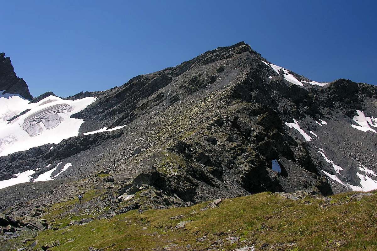
7/B) - Mont Valaisan (2.891m) bypassing Bella Valletta (2.811m)
Approach from La Suche-Cantamont with Route through Bella Valletta and East Slope:
from the alternative 1.972 meters on SS.26 for Little St. Bernard take the detour of left (Southeast) for the Ski Tourist Center La Suche (2.084m); this with the trail n° 9, concomitant with the private dirt road to the Mont Belvedere Hill until the Pian della Betalla (E; 0h'30/0h'45 from La Suche). From this (2.465m; signal in yellow) coming to South reach the next Ponteilles Vallon and always with the military trail n° 9D reach the North Ridge Bella Valletta; after a broad saddle, go to the West and, first below the crest, then through the Eastern Slope, reach the Top (E/F+; 1h'30/2h'00 La Suche).7/B) - Mont Valaisan (2.891 m) scavalcando Bella Valletta (2.811 m)
Avvicinamento da La Suche e Via tramite Bella Valletta e Versante Est:
dal bivio 1.972 metri della SS.26 per il Piccolo prendere la deviazione di sinistra (Sudest) per il Centro Turistico dello Sci di La Suches (2.084 m); da questo con sentiero n° 9, concomitante con la poderale verso il Colle del Mont Belvedere, fino al Pian della Betalla (E; 0h'30/0h'45 da La Suche). Da qui (2.465 m; cartello in giallo) volgendo a Sud pervenire al successivo Vallone di Ponteilles e sempre con la mulattiera militare n° 9D raggiungere con la Cresta Nord Bella Valletta; dopo una larga sella, dirigersi ad Ovest e, dapprima sottocresta, poi tramite il Versante Orientale raggiungere la Cima (E/F+; 1h'30/2h'00 da La Suche).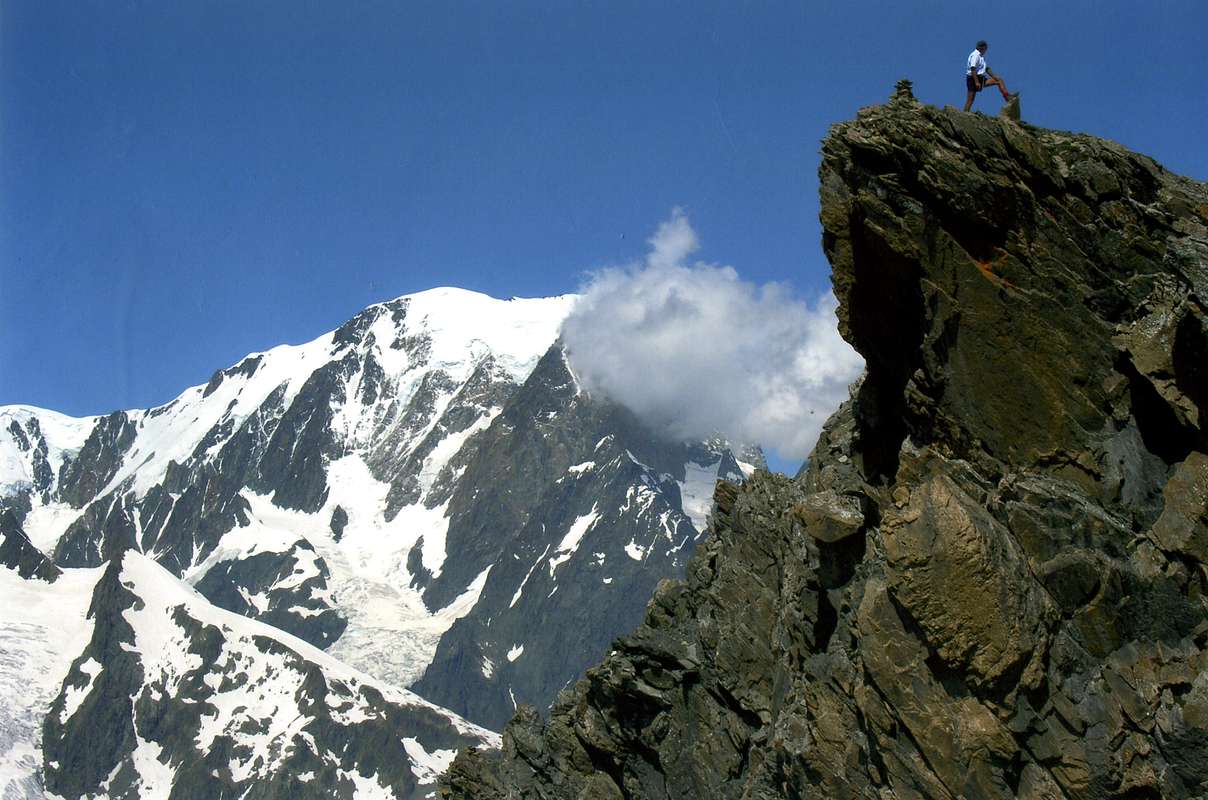
7/C) - Punta Léchaud (3.127/8m)
Approach from Lake Verney Dessous through Tormotta Vallon:
from the alternative 2.098 metres on SS.26 for Little St. Bernard take the detour of left (Northeast) with the small path unnumbered, reaching the Lake Verney Dessus (Upper; 2.280m); along Northward the Tormotta Vallon, arriving to homonyms lakes (2.486m). From these reach, after a short descent on small traces, the next of Arguerey (2.436m) in the Vallon of Breuil; along the same Northwest, after a debris esplanade with tiny springs and leaving left the Glacier du Breuil, reach the wide saddle detrital 2.900 meters about or Western Hill Bassa Serra, above the Vallon of Chavannes (E; 2h'50/3h'10 Lower Loch).Via South Slope: from the saddle to cross Northwest on the edge of the Southern Glacier Léchaud and through the easy slope South-southeast above the same, at first on the snowfields of average slope (30°/32°) and then blocks and debris with some easy and small rocks in the final part, reaching the Summit (EE/F; 3h'45/4h'15 Lac Verney).
7/C) - Punta Léchaud (3.127/8 m)
Avvicinamento dal Lago Verney per il Vallone della Tormotta:
dal bivio 2.098 metri della SS.26 per il Piccolo prendere la deviazione di destra (Nordest) col sentierino non numerato raggiungendo il Lago Verney Dessus (2.280m); percorrendo il Vallone della Tormotta verso Nord, arrivare agli omonimi laghi (2486 m). Da questi raggiungere, dopo corta discesa su tracce, i successivi di Arguerey (2.436 m) nel Vallone del Breuil; percorrendo il medesimo a Nordovest, dopo una spianata detrica con piccole sorgenti e lasciando a sinistra il Ghiacciaio del Breuil, pervenire alla larga sella detritica 2.900 metri circa o Colle Ovest di Bassa Serra, sopra il Vallone di Chavannes (E; 2h'50/3h'10 dal Lac Verney). Via dal Versante Meridionale: dalla sella traversare a Nordovest ai margini Meridionali del Ghiacciaio di Léchaud e tramite il facile Versante Sud-sudest soprastante il medesimo, dapprima su nevai di media pendenza (30°/32°) e poi su blocchi e detriti con qualche facile roccetta nella parte finale, raggiungere la Cima (EE/F; 3h'45/4h'15 dal Lac Verney).
7/D) - Mont Laytire (2.727m)
Approach and Route from Plan Veyle (2.080m):
from several forks of the SS.26 to reach the Chanté Pasture (1.993m) and the subsequent Plan Veyle, where the dirt farm road ends; then take the detour to the right (Northeast) with the path 10B reaching Les Côtes (2.227m). Immediately after crossing the path 10A, rising from Southeast starting from Arpettes (1.760m), and conclude with the Southern Slope on the Top, with the possibility in the final amusing climb on easy ridge (E; 1h'50/2h'10 Plan Veyle).7/D) - Mont Laytire (2.727 m)
Avvicinamento e Via da Plan Veyle (2.080 m):
da diversi bivi della SS.26 raggiungere le Alpi Chanté (1.993m) e la successiva di Plan Veyle, ove termina la poderale; da qui prendere la deviazione di destra (Nordest) col sentiero 10B raggiungendo Les Côtes (2.227 m). Subito dopo incrociare il sentiero 10A, che sale da Sudest partendo da Arpettes (1.760 m), e concludere tramite il Versante sud sulla Sommità, con la possibilità nel finale d'arrampicare divertendosi su d'una facile crestina (E; 1h'50/2h'10 da Plan Veyle).Campings
Remember that free camping is forbidden (except for emergency reasons, over 2.500m, from darkness until dawn).Mountain Condition
- Meteo: you can find all the needed informations at the official site of the Valle d'Aosta Region:
- Valle d'Aosta Meteo
Important Information
- REGIONE AUTONOMA VALLE D'AOSTA the official site.
- FONDAZIONE MONTAGNA SICURA Villa Cameron, località Villard de la Palud n° 1 Courmayeur (AO) Tel: 39 0165 897602 - Fax: 39 0165 897647.
- A.I.NE.VA. (Associazione Interregionale Neve e Valanghe).
Useful numbers
- Protezione Civile Valdostana località Aeroporto n° 7/A Saint Christophe (Ao) Tel. 0165-238222.
- Bollettino Meteo (weather info) Tel. 0165-44113.
- Unità Operativa di Soccorso Sanitario Tel. 118.