
-
 48226 Hits
-
 85.55% Score
-
 21 Votes
|
|
Mountain/Rock |
|---|---|
|
|
36.44783°N / 105.00805°W |
|
|
Hiking, Mountaineering, Scrambling |
|
|
9003 ft / 2744 m |
|
|
Overview
Note: Unfortunately, hiking into the Philmont backcountry is reserved for Scouts and Scouters on official itineraries. It is not generally open to non-Scouts/non-Scouters, or to Scouts and Scouters who aren't on official itineraries.
"… He said, “The Tooth of Times’ been chewin’ on me”
The Tooth of Time been chewin’ on me
I’ve been here 30 years, now I just can’t leave
Cause the Tooth of Times’ been chewin’ on me
I said, “The Tooth of Time, old timer, what’s that?”
He looked over yonder and he tipped his hat
It’s that igneous intrusion of dacite porphyry
It’s that molar in the sky, that just won’t let you be"
– Lyric to "Tooth of Time (Been Chewin’ Me)" by
Peter Bingen, sung by the Tobasco Donkeys
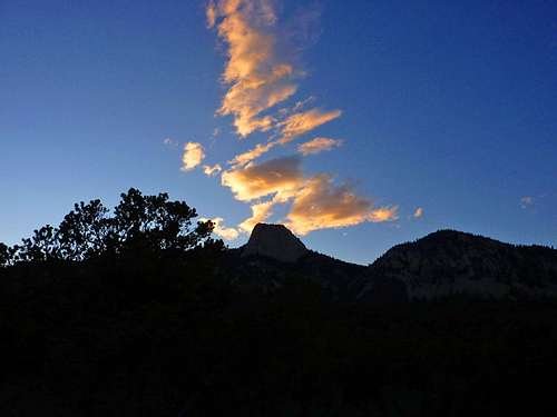
The Tooth of Time ("The Tooth") is a very prominent feature at the Philmont Scout Ranch in Northern New Mexico. During the days of wagon trains, The Tooth served as a major landmark for guides, who used it to determine the cut-off for heading to Santa Fe, or to the Oregon Trail. It is located in the Sangre de Cristo Mountains. As the highest point along the Tooth Ridge, it is also a very rewarding climb and offers some of the best views in the local area. The Tooth rises over 1700 feet above the base of the ridge and reveals sweeping views of the eastern horizon, Urraca Mesa to the south, Black Mountain to the west and Baldy Mountain and Touch-Me-Not (not a part of Philmont) to the northwest.
The Tooth is considered to be the official icon of the Philmont Scout Ranch national high adventure base of the Boy Scouts of America. It is featured on souvenir belt buckles, which those who have participated in Philmont activities are proud to wear with their Scout uniform. Virtually everyone attending any official activity (backcountry activities and training) at Philmont will have a group picture taken with The Tooth in the background. As part of a Boy Scout national high adventure base, the Tooth is not open to the public. Only those on official backcountry itineraries are allowed to climb The Tooth--even those on front country programs at the Philmont Training Center are generally not allowed to climb it (Urraca Mesa is offered as an alternative for them). Regardless, it is frequented by many of the 25,000 Scouts and Scouters who hike Philmont each year, and often serves as a last-day climb before heading into base camp for those on backcountry treks.
 The Tooth of Time as seen from The Stockade. Imaged by Woodzy.
Getting There
The closest town to Philmont is Cimarron. From either Denver or Albuquerque, it will be about a four hour drive. Take I-25 to exit 446 Cimarron/Taos. Then head west on Highway 64 until you reach Cimarron. If you're on an official itinerary, you'll be lodged at Philmont. If not, or if you're arriving early, there are several lodging options available in Cimarron, including the infamously haunted Saint James Hotel. If you're on an official itinerary, you can follow the signs from the center of Cimarron (it's a very small town) and take NM Highway 21 to Philmont Scout Ranch main camp, about four miles south of town.A word to the wise: The Cimarron police department drives very nice, all new vehicles. They are paid for by the folks attending Philmont activities who don't realize that local speed laws are strictly enforced.
 Classic view of The Tooth from Philmont base camp.
Red Tape
 The Tooth as seen from along the trail to the east.
Camping
While there are campsites a short distance east on Tooth Ridge from the Tooth itself, called "Tooth Ridge Camp", and at the Stockade, which is accessed via the Stockade trail on the south side of the ridge, the camp you stay at will be determined by your itinerary.Mountain Conditions
The Stockade Trail is very rocky and steep, but it offers the quickest ascent up The Tooth from the base of the ridge. From Shaefer's Pass, the trail along Tooth Ridge is also very rocky and comprised of many large boulders, but offers excellent views. Once above the tree line on the Tooth, it is all large boulders, but generally an easy class 3 climb from the north face. From Philmont main camp, the trail is a long, switchback-filled, class 1 hike. While not particularly steep or difficult, it can be hot--take plenty of water.Water
During any hike of Philmont water will be a primary consideration. This is especially true along Tooth of Time Ridge. While in the past Shaefer's Camp has had water, it often is dried up. Don't count on it, and be certain to ask at the camp that you're departing where the last water will be before you reach ridge (you may have been told ten days earlier at main camp about the water situation, but still double-check the morning of your hike because main camp has been known to be mistaken). Fill up there, and consider carrying a dromedary with extra water--the hike from The Tooth down to base camp is mostly exposed to the sun and you'll want plenty to drink.External Links
- Philmont Scout Ranch
The official Philmont website. This page has descriptions of all staffed camps at Philmont along with a list of typical itineraries and links to sites with photos of Philmont.
JScoles - Aug 7, 2002 4:00 am - Hasn't voted
Untitled CommentAccording to the USGS they define a mountain as any height or prominance of land that rises more than 500ft above its surrounding valley. No doupt the Tooth qualifies in this rather broad definition.
Philkid3 - Aug 1, 2003 2:04 am - Hasn't voted
Untitled CommentThe Ridge Trail up the side is extremely easy, but very long. A series of switchbacks seem to take you back and forth along the ridge without any real climb at all, but it's not anywhere near grueling.
The Pasture Trail is much like the Stockade, going steep up the mountain. It's not as rocky, but does take longer.