
-
 11850 Hits
-
 80.49% Score
-
 12 Votes
|
|
Mountain/Rock |
|---|---|
|
|
41.73750°N / 103.60931°W |
|
|
Scotts Bluff |
|
|
Hiking |
|
|
4610 ft / 1405 m |
|
|
Overview
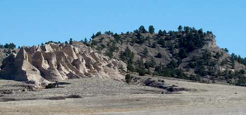
Northwest view of Bead Mountain
Bead Mountain is the centerpiece for one of the largest public areas for hiking, climbing and exploring in Nebraska’s Wildcat Hills. It was named for findings at an ancient Native American burial ground nearby. Located in Scotts Bluff County, just a few miles southeast of Gering and Scottsbluff, the 3,100-acre Bead Mountain Ranch borders the Buffalo Creek Wildlife Management Area to the southeast, the Murphy Ranch Nature Conservancy to the south, and the Wildcat Hills State Recreation Area to the southwest.
These adjacent areas combine with Bead Mountain Ranch for over 10,000 acres of public access and offer access opportunities not available at nearby Scotts Bluff National Monument. The area around Bead Mountain offers hikers and climbers miles of canyons, pine juniper forests, numerous unnamed buttes, rock formations, small mountains, ridges, and small springs. Photo opportunities are abundant here. Nebraska Game & Parks reminds visitors of the “carry-in, carry-out” policy.
The area newspaper, The Scottsbluff Herald, posted this informative article about hiking Bead Mountain and the surrounding area:
Bead Mountain: Saddlebacked peak offers a photographer's paradise
Getting There & Route

Bead Mountain Map
To get to Bead Mountain, go south from Gering and Scottsbluff on Highway 71 to County Road W. Turn east and go about 3 miles to where there is a sharp bend in the road. At the bend, there is a small parking area where you can park. You will see Bead Mountain across a field to the east.
Route: All hiking in this area is off-trail, so you will have to determine your own route to reach the summit. The lack of trees on the mountain should make this not too difficult. Many hike in from the parking area to the northwest of Bead Mountain.
Red Tape
 Bead Mountain
This is public land, limited only to foot traffic. There are some restrictions on open fires, camping, and firearms. Some of the restrictions are seasonal, so you will want to call the Nebraska Game & Parks office at (308) 763-2940 to find out exactly what to expect for your planned outing.
When to Climb
This area is open year around, but in making your plans, you will want to consider weather extremes like summer lightning or winter blizzards. For the latest weather forecast and conditions for this area, click here:
Bead Mountain - Scottsbluff Area Weather
Safety
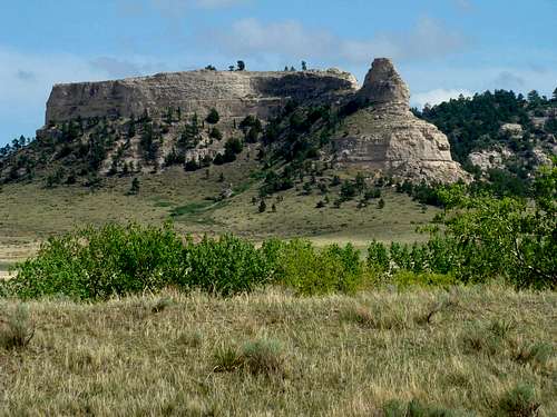
An un-named summit near Bead Mountain
Seasonal hunting is allowed in some, but not all of these areas, so be sure to be aware of these seasons before you schedule an outing. Rattlesnakes are occasionally seen in these rugged areas, as are rare sightings of mountain lions. Ticks are thick in brushy areas from March 1 to August 31.
The sandstone formations common in the area do not provide the most secure foundations for climbing, so please take appropriate precautions. Because of the lack of trails on Bead Mountain and adjacent areas, good topographic maps, plus a compass is essential for any explorations of remote canyons in this area. GPS units may be helpful.
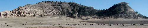
Cattle herds are grazing by the mountain at certain times. Be sure you are willing to wade through a cattle herd when you choose your bushwhack route.
Camping, Lodging, and Information Resources

Bead Mountain Parking Lot
Scottsbluff-Gering Chamber of Commerce
Wildlife Habitat Lands
Outdoor Nebraska