
-
 24097 Hits
-
 86.6% Score
-
 23 Votes
|
|
Mountain/Rock |
|---|---|
|
|
39.49417°N / 105.86595°W |
|
|
Hiking |
|
|
Spring, Summer, Fall |
|
|
13078 ft / 3986 m |
|
|
Overview
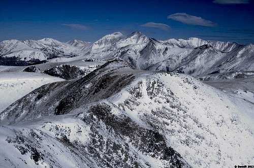
Winds of Whale Peak
Whake Peak (13078 ft / 3986 m)
Whale Peak lies on the Continental Divide, on the boundary between Pike and Arapahoe National Forest. The Hall Valley is named after Colonel William Jairus Hall, a local mine owner.
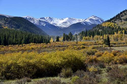
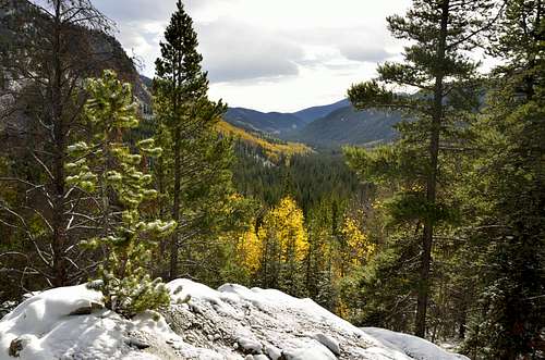
Whale peak is excellent hike in late September, when aspen stands of the Hall Valley are at their golden peak and the thundra above Gibson Lake turns to a deep, autumn crimson.
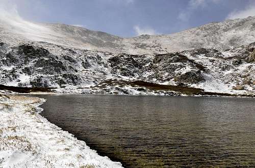
In the summer months the high alpine meadows and gentle peaks of the area make fine hiking destinations. Gibson Lake, nestled under Whale Peak during the summer is very popular destination, but only few continue to the top of Whale Peak.
From the lake it is only a moderate hike off-trail to the summit of Whale Peak and excellent views of Summit County.
13er Rank in Colorado: 533 of 584
13er Rank in Front Range:57 of 59
Distance: 4.0 miles each way
Starting Elevation: 10,316 feet
Top Elevation: 13,078f eet
Elevation Gain: 2, 832 feet (includes 35 feet extra each way)
Trail: Most of the way, faint in the places
Nearby City: Webster
Season: Early June to Early October
Jurisdiction: Pike National Forest
Maps: USGS 7 ½ - Jefferson; County – Park #1
USFS – Pike National Forest ; Trails Illustrated #104
Guide Book: Colorado Summit Hikes
Whale Peak from the road (October 2013)
Hiking bellow Gibson Lake (October 2013)
Getting There
Getting to the trailhead: Drive on U.S. 285 to the junctionof Park County Road 60 (Hall Valley Road), 4.3 miles north of Kenosha Pass and 3.1 miles south of the town of Grant.
From U.S. 285, drive northwest on County Road 60 (graded) for 5 miles to the Handcart Campground. At 0.2 miles beyond the campground is a junction with a four-wheel-drive road. Turn left at this junction, signed to the Hall Valley Campground and Gibson Lake trailhead. (Note:The road is not suitable for passenger cars, so look for parking immediately beyond the junction.)
Drive or hike up the four-wheel-drive road. Almost immediately pass the campground and continue straight on FSR 120C, fording a stream 0.3 miles beyond the start of the four-wheel-drive road and reaching the Gibson Lake Parking area on the left, 1.4 miles up this road.
Hike statistics: Trailhead to Gibson Lake:1,600 feet in 2.3 miles one way. Trailhead to the summit of Whale Peak(13,078 feet): 2,950 feet of total elevation gain in 3.3 miles one way.
Difficulty: A moderate trail hike to Gibson Lake,with moderate off-trail hiking to Whale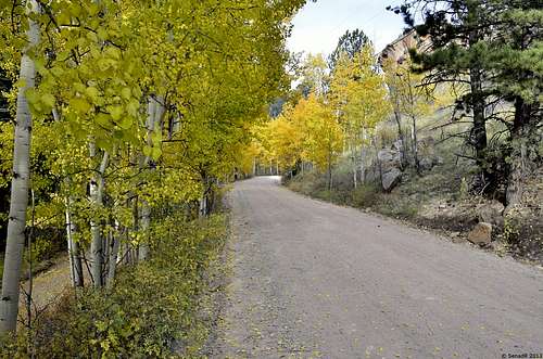
Hall Valley Road
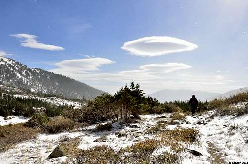
Hiking above Hall Valley Campground
Route
|
|
|
From the parking area, follow the trail as it drops down to and crosses the North Fork of the South Platte River.The trail quickly joins and then parallels Lake Fork as it climbs gently up to tree line, 1.5 miles from the trailhead. Here you gain your first glimpse of Whale Peak at the head of thevalley. Continue on the trail as it winds its way through alpine meadows full of wildflowers, reaching Gibson Lake after a total distance of 2.3 miles. (The trailhead sign indicates the lake to be 3 miles away, but I measured the trail to be considerably shorter.)
The lake makes a good lunch spot, but the hike up to thesummit of Whale Peak is quite reasonable and definitely worthwhile.
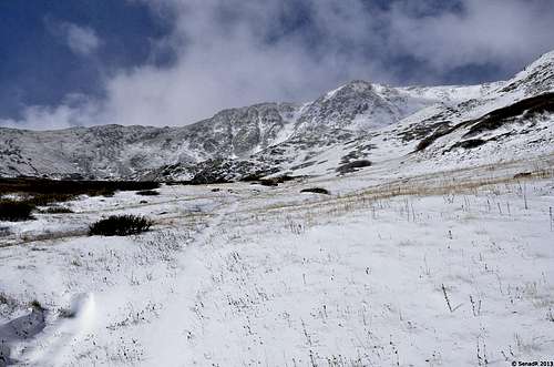
From Gibson Lake head up the grassy slopes to the right. A social trail becomes more distinct as you reach the broad ridge, which takes you up to the Continental Divide slightly north of Whale Peak.Once on the divide, turn south and follow the trail to the summit. Keep an eye peeled for some of the area's residents - a sizable herd of mountain goats. To descend, reverse your route.
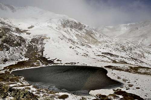
Gibson Lake
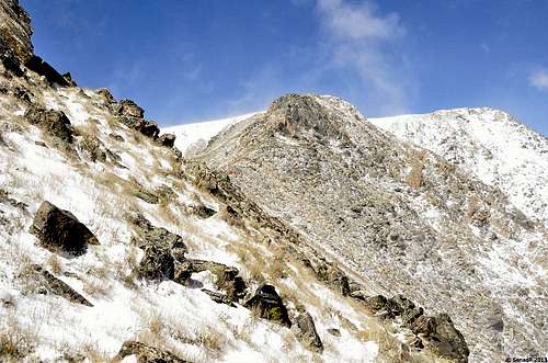
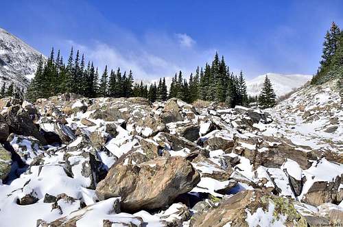
Getting to the ridge.
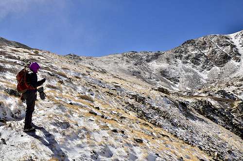 Sarah taking break bellow ridge.
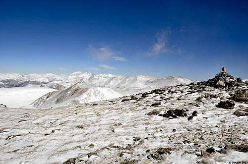
Summit cairn.
Greys and Torreys Peak from the summit.
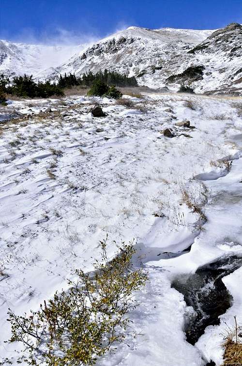
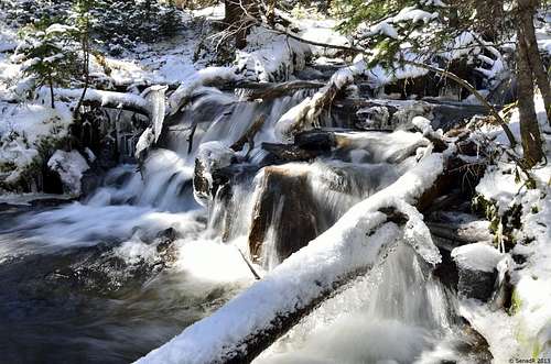 Creek bellow Gibson Lake.
Red Tape
Contactinformation for Pike National Forest:
South Park Ranger District
320 Hwy. 285, Box 219
Fairplay CO, 80440
719-836-2031
Contact Information for Arapaho National Forest:
Clear Creek Ranger District
101 Chicago Creek, Box 3307
Idaho Springs, CO 80452
303-567-2901
When to Climb
Season: Early June to Early October
Weather: Weather Channel
Camping
Forest Service Information Website.External Links
Trip Reports from other websites related to Whale Peak:External Links: