
-
 22327 Hits
-
 80.49% Score
-
 12 Votes
|
|
Mountain/Rock |
|---|---|
|
|
44.71830°N / 121.9194°W |
|
|
5434 ft / 1656 m |
|
|
Overview
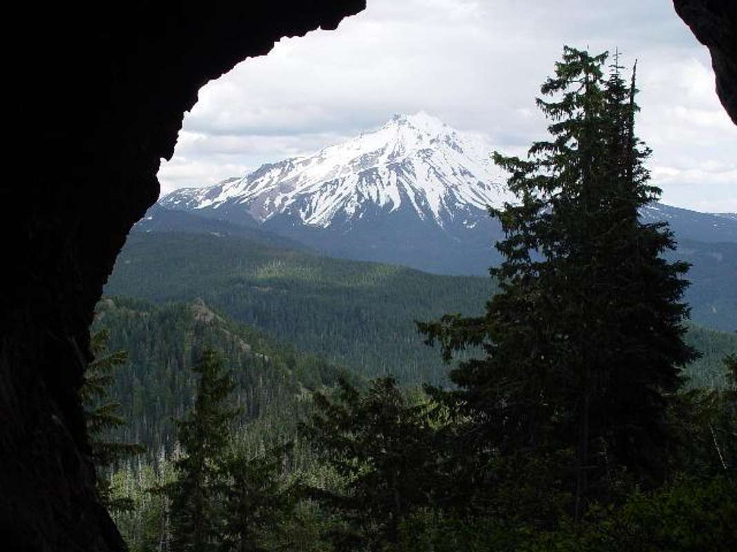
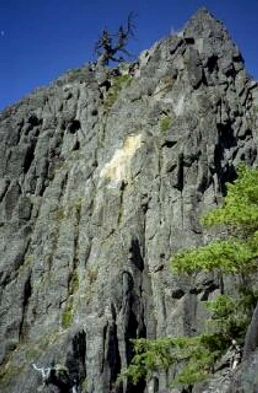
Triangulation Peak doesn't appear to be much more than a mid-size Cascade mountain with a great view of Hood and a monumental one of Jefferson (it's only 7 miles from this peak), but, it has two really neat features that make it an appealing summit. About a mile and a half from the trailhead, you come to Spire Rock, a large monolith jutting up from the side of the mountain. The other, Boca Cave is a large 60-foot-high cavern on the side of the mountain just below it's peak. It's a pretty easy hike to the top, somewhat steep near the top and you can see from Hood in the north to Diamond Peak in the south. You also can't get much closer to Jefferson without being on it.
Trail is 2.1 miles long and gains about 700 feet.
Getting There

Drive 56 miles east from Salem, Or on Santiam Highway 22. Just to the east of the town of Idanha, watch for McCoy Creek Road 2233 on the north side of the highway. (If you are coming from the Bend area, the road is just before Idanha between mileposts 56 and 57)
Turn onto McCoy Creek Road 2233 and follow it about 8 or 9 miles until the pavement ends and it becomes a gravel washboard. At any forks or junctions in the road, just keep following the signs for 2233 until about 1.3 miles after the particular junction where there is a small winter sports building. At this point, you pick up Road 635 which leads you shortly to the Triangulation Peak trailhead.
Red Tape
A Northwest Forest Pass is required to park at the trailhead and you need to fill out and take a wilderness permit (self-issued from a post about 50 yards into the trail).When To Climb
 July through October. Snow may close roads rest of the year.
Camping
Camping appears to be allowed, as there are campsites on the summit and I have come across campers in Boca Cave. Follow general rules posted at the trailhead. No camping fees.Mountain Conditions
Detroit Ranger District503-854-3366
beefyalby - Jun 18, 2004 6:21 pm - Hasn't voted
Untitled CommentIt is only about 4.3 miles to the end of the paved road, then another 3.8 miles up the gravel. On the gravel, you will come to a "Y" in the road at about 1.5 miles or so. Stay to the left. At 3.8 miles, there will be another "Y". Go right, and on the left you will see the Winter Sports Cabin.