
|
|
Mountain/Rock |
|---|---|
|
|
35.17400°N / 82.989°W |
|
|
4440 ft / 1353 m |
|
|
Overview

Cascade.
Shelton Pisgah is one of the high mountain peaks that encloses the wide, U-shaped Panthertown Valley. It is on the flanks of Shelton Pisgah that the congregation of streams and branches join to form the Tuckaseegee River which cuts a steep gorge called The Devil's Elbow. in addition, the only access from the Panthertown wilderness to Cold Mountain is either over the summit of Shelton Pisgah, or up the steep cove formed by Little Green Creek, and then on to Cold. In additon to being home to the Devil's Elbow, and lying close to the very conspicuous peak of Cold Mountain, Shelton Pisgah also bears a number of truly impressive cascades and waterfalls on its steep, forested slopes.
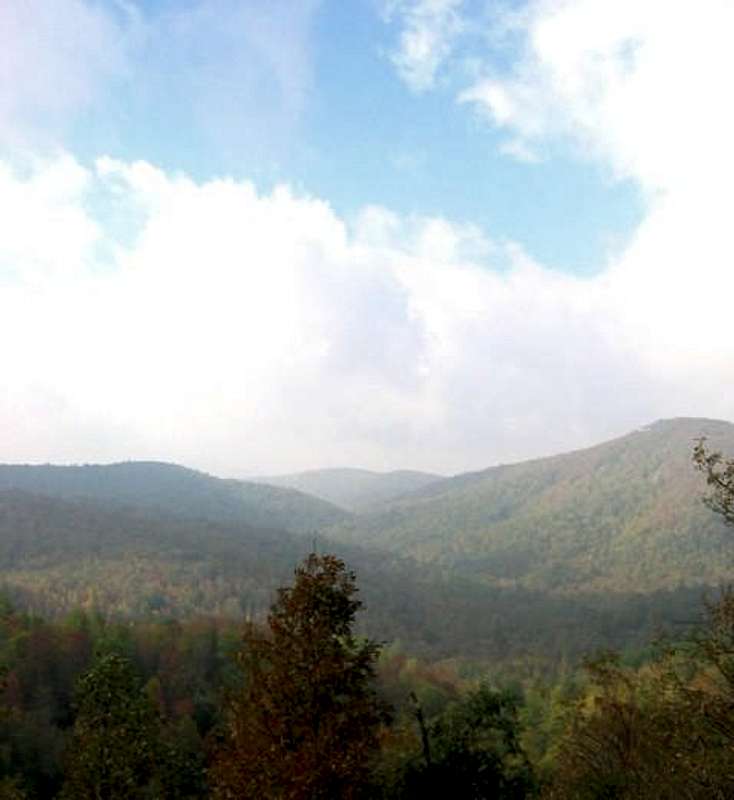 Shelton Pisgah and Panthertown Valley.
 |
Getting There

Along the trail.
From I-85, take 276 North to Brevard. Then take 64 West to 281 North. 8/10 of a mile later, take Cold Mountain Road (SR 1301) for 5.8 miles to a sharp left where you will find the parking lot for the trailhead at Cold Mountain Gap.
From I-26 take 64 W. through Hendersonville, to Brevard.
THERE IS NO OFFICIAL SYSTEM OF TRAILS IN THE PANTERTOWN VALLEY! NONE OF THE TRAILS ARE BLAZED. NONE OF THE TRAILS ARE NAMED! IF YOU DON'T WANT TO GET YOURSELF HOPELESSLY LOSt IN THE MAZE OF DOZENS OF UNOFFICIAL TRAILS, THEN BUY THE KORNEGAY MAP RIGHT HERE
 |
Red Tape
There is no red tape at all to enter or explore the Panthertown Valley and its mountains, streams, waterfalls, peaks, walls, forests, or trails. All applicable laws apply for hunting and fishing. Many of the plant communities in Panthertown, whether on the dry granite peaks, in the high elevation bogs, or on the splash zones at the waterfalls, are very rare and very fragile. Please tread here with care and respect the rare plants and animals that call Panthertown Valley "home". Pack in in, pack it out. Hoist your foodstuffs. Take care with fires. Blahblahblah.
There are some wonderful rock climbing opportunities in Panthertown Valley (although not on Shelton Pisgah of which I know). I am aware of no restrictions for this sport here. This is probably one of the better kept rock climbing secrets of the South, if not the East.
 |
When To Climb
Hiking, any time. It can get very warm in Panthertown Valley in the depth of summer. And the winter weather can be extremely severe. Don't let the southern latitude lull you into a sense of complacency. It can also get extremely cold, icy, and snowy.
 |
Camping
Camping is allowed, free of charge. The usual common sense and common courtesy rules apply. If heavy rain is a threat, do not camp near bogs or streams. Flash flooding is a prime concern. Please don't build any new fire rings. Don't burn deadwood that lies on the dry granite domes--let it lie. The plant communities on the domes are among the most sensitive in the area and take decades to grow and only seconds to kill.
Panthertown Valley is prime bear habitat. Be aware. There is also a healthy population of coyotes. Don't leave food around.
 |
Mountain Conditions
Check the weather for either Cashiers or Highlands. Cashiers is the closest town, but Highlands is at roughly the same elevation and only a few miles farther.
 |
External Links