
|
|
Mountain/Rock |
|---|---|
|
|
35.33137°N / 127.61993°E |
|
|
Hiking |
|
|
6282 ft / 1915 m |
|
|
Overview
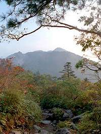
Chirisan is South Korea's 2nd Highest Peak.
The area is particularly scenic in the fall.
Chiri-san is located in the Chirisan National Park at the southern end of the Sobaek Mountain Range. It is the second highest mountain in South Korea with it's main peak Chonwangbong (which literally translates as "Sky King Peak") towering at 1,915 meters high. It is considered one of the three main mountains in South Korea, along with Halla-san (1,950 meters) and Seorak-san (1,708 meters).
Chiri-san is sometimes called "Pangjangsan" or "Turyusan"; and it is sometimes spelled in English as Jiri-san. With "San" being the Korean word for mountain.
Chirisan National Park was made Korea's first national park in 1967. The national park itself spans three provinces: North and South Jeolla as well as South Kyongsang. One of the closest cities to Chiri-san is the city of Chinju in South Kyongsang which offers bus services to the park.
There are seven temples on Chiri-san that are considered major Buddhist temples with Hwaeomsa temple being the largest and best known of them.
The Chirisan National Park can be accessed from several locations. Please click here to see a map marking five entrance points. The Sancheong entrance provides the shortest route to Chonwangbong.
Chiri-san is a popular mountain to climb with multiple routes, and multiple peaks. Routes range in distance from 5 km to 65 km. The route from Sancheong to the highest peak is the shortest at 5.4 km and might be called moderate, as no mountaineering equipment is required, but it is at times quite strenuous.
A prevalent activity is to climb to Chonwangbong to watch the sunrise.
Getting There

Road Map Showing Location of Chirisan National Park
From the city of Chinju in South Kyongsang province one can drive to the Chirisan National Park Sancheong entrance in less than one hour. There are also buses that go from the main bus station in downtown Chinju to the Sancheong entrance.
If you take city-bus 21 from the Chinju city center to Dong-Shin Apt, as I did, you will be on the highway that goes to Chirisan Park. From Dong-Shin Apt, you can do as I did and hitch a ride to the Sancheong entrance. Incidently, I was picked up by the first car that I pointed my thumb at.
Shortest Route to Peak

Once you arrive at the Chirisan Park via the Sancheong entrance, watch for the signs that point the way to Chonwangbong peak.
Chonwangbong
Chiri-sans main peak is named Chonwangbong (also spelled as Cheonwangbong) which literally translates as "Sky King Peak". The peak stands at 1,915 meters, making it the second highest in South Korea. On the highest peak of Chiri-san (S. Korea's 2nd highest mountain), one will find a large marker showing the elevation at 1915 metres. Image displayed from Flickr and belongs to Allanyeates. |
When To Climb
I recommend climbing in the spring or fall. Snow maybe a concern in the winter and rain is definately a concern in the summer. If avoiding crowds is something you wish to do, avoid hiking in the early morning as many people like to summit to watch the sunrise.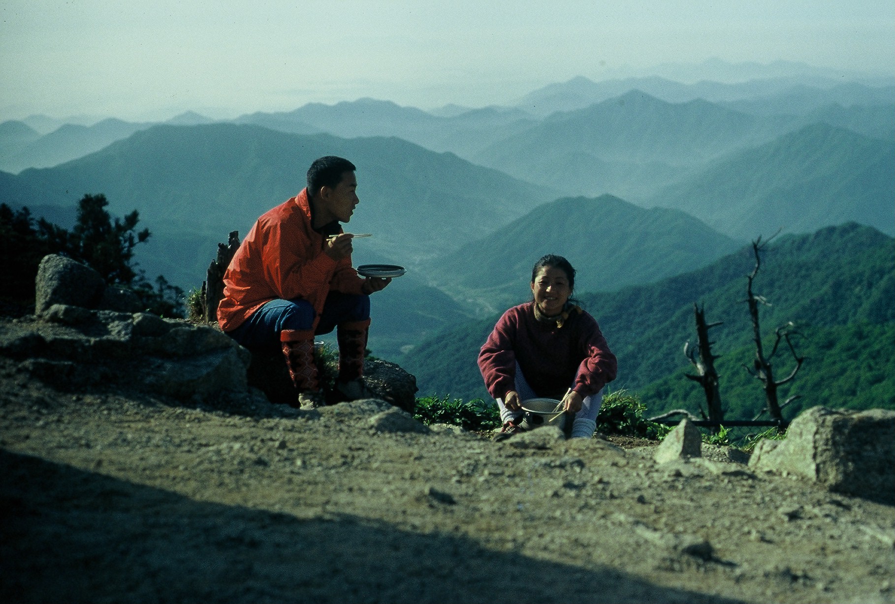 Korea is some times called the Switzerland of Asian and this 1994 picture makes the meaning of that nickname very clear. Image displayed from Flickr and belongs to Jens-Olaf. |
Weather
Chirisan enjoys four distinct seasons, marked by a wide range of temperatures.In the middle of July, at the foot of the mountain, daytime temperatures typically range 30-36 °C (80 - 97 °F ) where as at the top of the mountain daytime temperatures are closer to 19-22 °C (66 – 72)°F. In the winter the mountain sees heavy snowfall, as much as 1-2 m (3-6 ft) with temperatures dropping as low as -30°C (-22 °F ). The annual rainfall in Chirisan National Park is about 1,200mm (48 inches) with the bulk of the rainfall happening during the wet season of June through September. On the top of the mountain, the winds are sometimes quite strong at 20 to 30 m/s (45 to 65 mph).
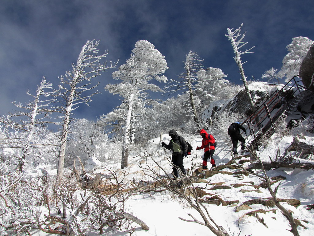 as much as 1-2 m (3-6 ft) with temperatures dropping as low as -30°C (-22 °F ). Image displayed from Flickr and belongs to Chrismockford. |