
-
 41442 Hits
-
 78.27% Score
-
 9 Votes
|
|
Mountain/Rock |
|---|---|
|
|
41.46119°S / 146.26624°E |
|
|
Hiking |
|
|
Spring, Summer, Fall, Winter |
|
|
4045 ft / 1233 m |
|
|
Overview
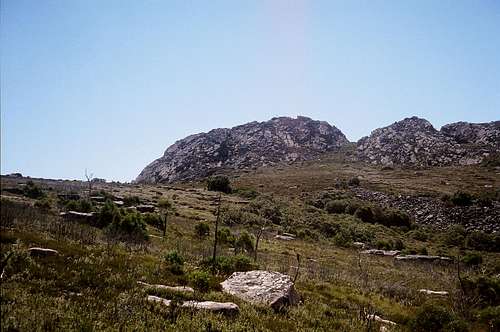
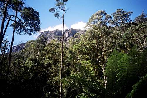 Mt Roland massif from the forest approach Mt Roland massif from the forest approach |
Mount Roland is found near the village of Sheffield on the northern edge of the Great Western Tiers region of Tasmania, Australia. Like many of its cousins, at first sight it would appear to be a difficult climb. From most angles it presents the onlooker with the steep bastions of seemingly impregnable cliffs. Moreover, these ramparts form the containment walls of a huge dolerite plateau of which the summit tor is but a small part. Half the time spent climbing Roland is spent on level or gentle uphill walking across the plateau to the summit. Perhaps this is the source of its attractiveness? The majority of Tasmanian mountains seem to conform to this geological pattern. Classic “sharp” summits like Barn Bluff or Cradle Mountain are a comparative rarity.
Although not exactly a challenge, Roland unquestionably offers a rewarding short day out. The lovely walk through scented eucalyptus forest with all that strange (to N.American ears) birdsong, the steep pull up onto the plateau to get the heart rate going, the stroll across the flats with the chance of seeing snakes (see the "cautionary note" below) and wallabies and the final views from the summit all combine to make Roland a worthwhile objective.
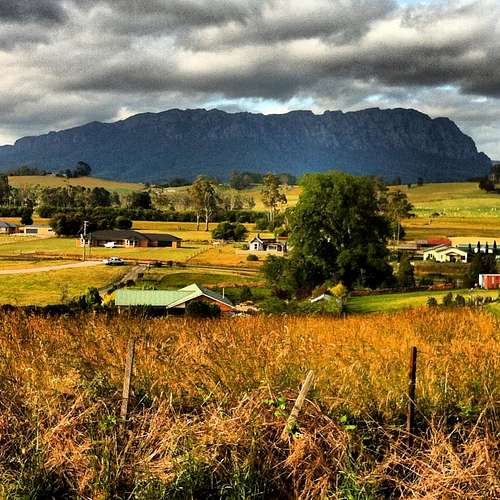 Mt Roland from Sheffield, Photo by forgues9999 Mt Roland from Sheffield, Photo by forgues9999 |
Getting There
Mt Roland is well off the usual tourist track in Tasmania and, as such, isn’t as easy to get to as say, the Lake St Clair or Cradle Mountain areas. I’m not aware of public transport options, so the following assumes you have a car available.From Launceston to the east approach the tiny village of Elizabeth Town on the A1. From Elizabeth Town take the B13 to Railton, then the B14 to Sheffield. From Devonport in the north travel directly to Sheffield on the B14. From Sheffield take the C136 to Claude Road and Gowrie Park. Go through Claude Road (from where there is also a route up Mt Roland) to the Gowrie Park’s campground on O’Neills Creek. Immediately after the campground turn left into O’Neills Road and drive 1km to the parking lot and new trailhead. All roads are sealed except for O’Neills Road.
Approach and Route
From the trailhead at 310m altitude walk 200m on the old once-upon-a-time sealed road to a track junction with a gravel forest road and turn left. Walk the forest road up through the lovely eucalyptus forest to its end in about 1 hour and at an altitude of 660m. Almost every hairpin on the road has a signboard with a name on it such as “Charlie’s Corner” etc. I don’t know the origin of this but am sure there’s a good story here somewhere. After the road peters out, go up a set of wooden steps onto an increasingly rough track, which takes you up through the last of the forest to a track junction at about 940m altitude. The right hand track goes up Mt Vandyke. Turn left (north) for Mt Roland. The trail soon emerges from the last of the trees and the high plateau opens up ahead of you. To your left, as you walk across the plateau are a series of apparent summits. These are all various high points on the ramparts you looked up at as you began the walk. The route gains the final ~300m of altitude very gently on a well marked trail, sometimes on old disintegrating wooden boardwalk and arrives in a little over an hour at a saddle where another trail comes up from the north. This is the route up Mt Roland from Claude Road. Note this point and then scramble up the bushy/bouldery summit tor with its trig in about 5 minutes from the track junction.
 Start of the route Start of the route |
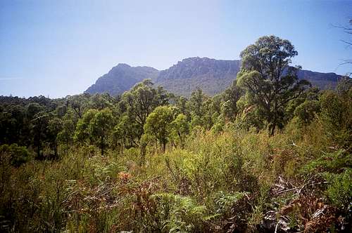
 View S from the plateau View S from the plateau |
 Summit from the plateau Summit from the plateau |
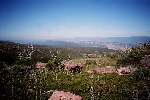
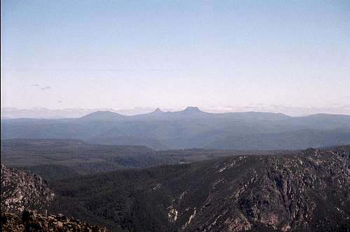 Summit view south west to Cradle Mtn Summit view south west to Cradle Mtn |
Descend by reversing the above. Or, if you don’t mind a road walk or hitching, go down to Claude Road from the track junction 5 minutes from the summit. It’s 5km on the road back to Gowrie Park from Claude Road and then another 1km up O’Neills Road to your car.
The total distance as an out-and-back from Gowrie Park is approximately 16km with an elevation difference of ~900m. Round trip time from the carpark; 5-7 hours including breaks.