
-
 8782 Hits
-
 83.69% Score
-
 17 Votes
|
|
Mountain/Rock |
|---|---|
|
|
49.89003°N / 126.4962°W |
|
|
Mountaineering, Scrambling |
|
|
Spring, Summer, Fall |
|
|
5318 ft / 1621 m |
|
|
Overview
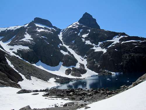 Mt Alava east aspect from Peter Lake Mt Alava east aspect from Peter Lake |
The mountain is found in the southwest sector of the Sanctuary, above and to the south of Peter Lake and is most conveniently climbed from there. For those based at Shangri La Lake, it’s a longer trip over the Peter/Shangri La pass and adds about 2-3 hours to the day, the most tedious aspect of which is the 250 metres plod back up to the pass after climbing the mountain.

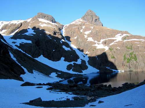
Mt Alava northeast aspect from Mt Grattan
The usual route to the summit is via the broad north east ridge which has its origins close to the west (outlet) end of Peter Lake. Easy snow slopes and rocky ridges of red/brown abrasive karmutzen pillow lava lead to the east side of the mountain from where the summit may be accessed via a Class 4 scramble.
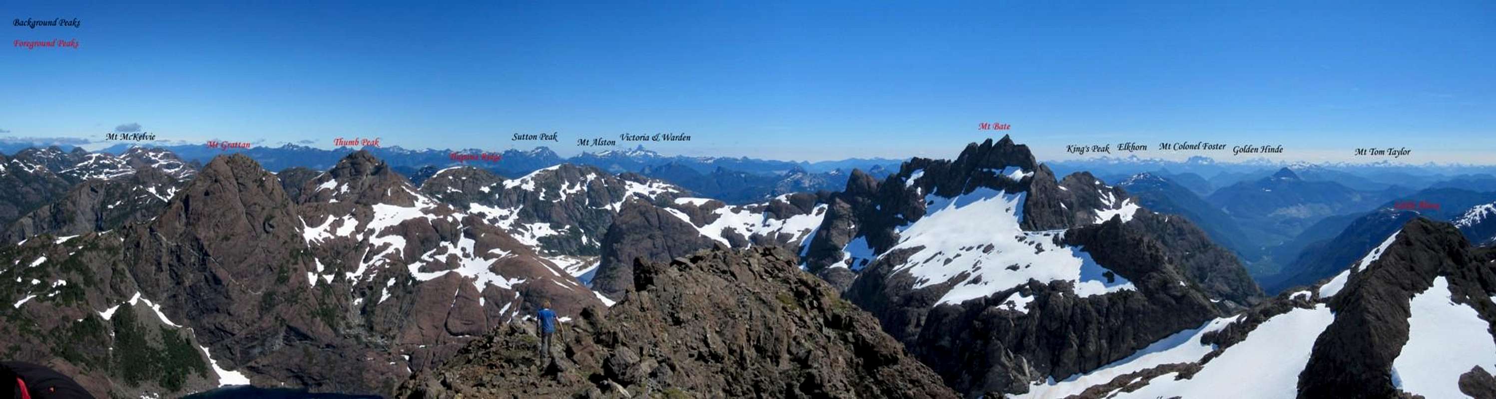
As with every high point in the Sanctuary, summit views both within the area and beyond to the Island ranges are stunning.
Although unknown to climbers until relatively recently, the Sanctuary and other nearby coastal ranges have long been used as navigation aids. Several local names reflect the significant history, maritime and otherwise, of the west coast of the Island.
Mt Alava is named for Brigadier-General Don Jose Manuel de Alava, the last commander of the briefly lived Spanish settlement on Nootka Sound. Brig. Alava it was who presided over the formal abandonment of the Spanish stronghold in March 1795 as required by the Nootka Convention. The political vacuum created by the Convention set the final stage in the contest for control of the Pacific northwest between the fledgling USA and the British Crown.
FRA: P Erickson and R Mcdonald, July 1980
Mt Bate morning shadow on Mt Alava
Getting There
Vancouver Island can be reached directly by air from Toronto, Vancouver, Seattle, Calgary, Edmonton and recently San Francisco to Victoria and by ferry from Port Angeles to Victoria on The Coho and on BC Ferries from Vancouver to Victoria or Nanaimo. Public transport on the Island is notoriously poor and anyone arriving by air would be advised to rent a car.Access to the main points of entry to the Sanctuary involves logging road travel but on main lines. A 2WD vehicle would normally be expected to suffice.
Although the Sanctuary has been approached from the north via Sebalhall Creek, the main points of access are off the Gold River/Tahsis Road and only these will be dealt with here.
From any point on southern Vancouver Island, drive north on the Island Highway 19 to Campbell River. From Campbell River take highway 28 west through Strathcona Provincial Park and onwards to Gold River. Just before entering the town of Gold River, watch for a right turn signed for Tahsis. It’s immediately after the tourist information office. Proceed 2 km on this road and across the bridge over the Gold River. Here the road splits. Right to Woss and left to Tahsis. Note this point on your odometer and turn left onto “Head Bay Road”. The pavement ends almost immediately, but this is good sealed or gravel road.
Drive about 27 km from the Gold River bridge and find Conuma Main on the right just after crossing the Conuma River. Drive this good main line about 11.5 km, passing the C15 access for Conuma Peak after 3.5 km and park at about N49 52.403 W126 24.954. The route to Shangri La Lake via the Conuma River approach starts here. Mt Bate towers above you to the northwest.
For the Perry Creek access to Alava and Peter Lakes continue 22 km past the Conuma/Head Bay junction and find Perry River branch road P15 on the right. Drive the road right to the back of the valley to where the creek crosses the road.
Approaches
Both approaches described below involve heavy bush and difficult travel particularly via the Perry River. These difficulties are in no small measure responsible for the few visitors that the Sanctuary has seen over the years.Shangri La
From the start point travel west and then follow the river north up the steep sided canyon. The route has been recently (July 2010) flagged. Beware of a dangerous river crossing at N49 52.753 W126 26.725. A ramp at N49 53.766 W126 27.450 is used to bypass a waterfall about half way up the canyon. Travel time to Shangri La 6-8 hours.Alava/Peter Lake
Follow the creek through dense bush into a steep sided canyon. The route makes its way up rock slabs before reaching Alava Lake. Continue up to Peter Lake on the opposite side of the river. This route has been included in the list of top ten bushwhacks on Vancouver Island, which is saying something. Don’t say you haven’t been warned!The Airborne Alternative
Over the years a number of visitors have accessed the area via helicopter. The local ecosystems in the Sanctuary are delicate and fragile and, in this case, an air assist might just be the least invasive way to reach and stay there. See the “Camping” section below.Summit Route
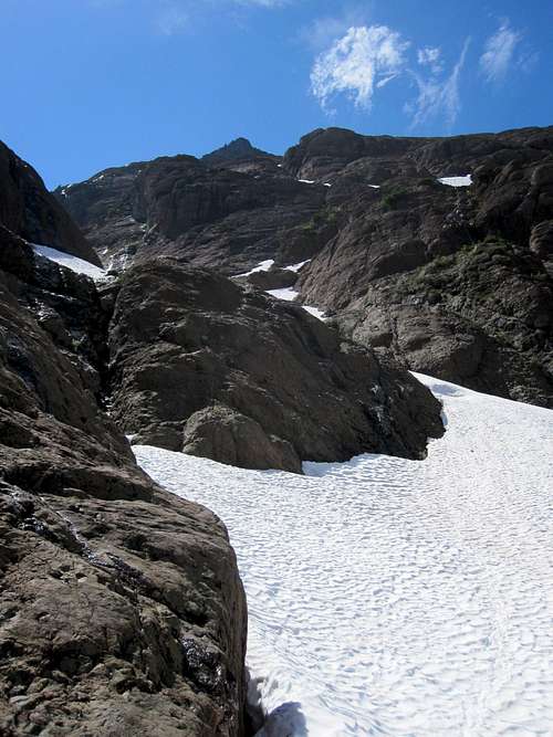
Alava summit from the base of the main gully
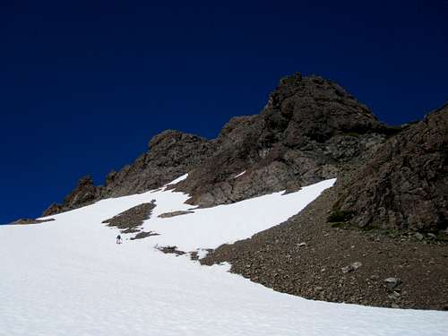
1.Head directly up the gully whose headwall pretty well butts into the Little Alava/Alava col. The gully is steep at the top, is subject to avalanche danger (one was apparent 2 days after we went this way) and icy cornices at the top may pose exit problems.
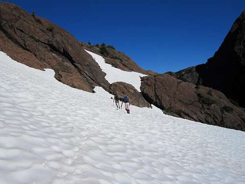
2.Climb the gully for about a quarter of its length until a rocky shelf exits on the right. A ~250 metres northwesterly traverse on snow and rock ledges leads to the northeast ridge proper. Turn left (southwest) here and climb easy snow and rock slabs to the Little Alava/Alava col ahead, a distance of about 600 metres.
From the outlet of Peter Lake, climb the northwest ridge directly to the col.
 Lower Northeast Ridge | 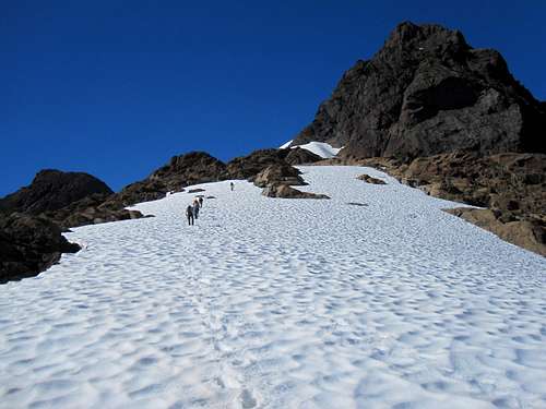 Upper NE Ridge | 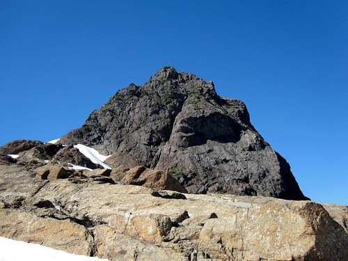 Mt Alava Summit Block | 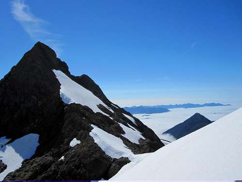 Little Alava Peak |
Avoid going down into the low point of the col and, instead, traverse snow slopes west until you can see the loose gully that leads up to the summit ridge. Turn north here up initial snow slopes until they peter out in the gully proper.
Climb very loose Class 4 ground to the summit ridge, turn left and walk 25 metres to the summit.
 Mt Alava Summit Approach | 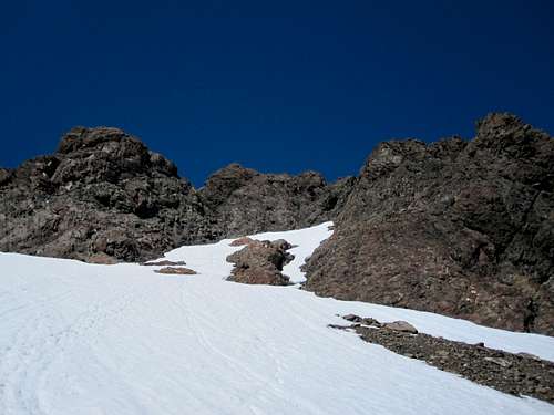 Mt Alava Summit Access Gully | 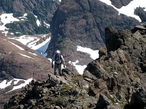 Mt Alava Summit Ridge | 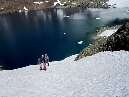 Descending Main Snow Gully |
Descend the way you came up.
Route summary from Shangri La:
Distance: ~ 8.5 km
Net elevation gain: ~ 450 metres
Total elevation gain: ~ 900 metres
Approximate time: ~ 9 hours return
As always a Garmin/Mapsource tracklog is available for the approach and climbing route on Mt Alava. Just ask for it via an email or PM.
Essential Gear
Ice axe recommended for snow travel, particularly if travelling the main gully west of Peter Lake.One 60 metres rope to use a handline, for short-roping or to rappel the loose Class 4 gully below the summit.
Helmet for the loose gully to the summit ridge
The usual selection of tape and slings.
A small rack of medium to large pieces, which you probably won’t use.
Red Tape/Safety Considerations
Mt Alava and the Alava Bate Sanctuary could not be more removed from the need to consider red tape. Almost no-one goes there and few outside the climbing fraternity know of its existence. With this caveat, therefore, comes the need to consider safety.Unless you’re supremely confident in your abilities to look after yourself come what may, I would consider a satellite phone mandatory for trips into this wild and remote area. Make sure that you have left a detailed trip plan with someone responsible. The appropriate SAR agency will respond in an emergency but it is up to you to have the mechanism in place that will initiate the call-out process if it becomes necessary. Know your exact coordinates at all times. Consider personal limited range radios for communication within your group.
Camping
Most visitors camp at the outlet of Peter Lake or on the extensive gravel flats at the outlet end of Shangri La Lake. These, and anywhere else in the Sanctuary, are areas which are delicate in the extreme. Fires are absolutely out of the question – there’s no wood anyway. Tread carefully amongst the acres of flowers. Try to keep your footprint as low as possible.Low to non-existent soil levels mean that disposal of human waste is a super critical issue. Above all other reasons (e.g. to avoid the difficult approach conditions) flying out waste and garbage is a strong argument in favour of keeping the area pristine by means of a helicopter assist and several parties have done just that.
Weather
Nearest point current conditions and forecast.East
West
Additional Information/Suggested Reading
As in the case of many objectives on Vancouver Island, Lindsay Elms, our local guru on all things obscure and hard-to-get-to, has written an excellent historical and geographical perspective of The Sanctuary, including Mt Alava, on his Beyond Nootka website. Don’t fail to visit this site before your trip.Island Alpine – A Guide to The Mountains of Strathcona Park and Vancouver Island, Philip Stone, Wild Isle Publications, 2003, ISBN 0-9680766-5-3 and/or visit Island Alpine Climbing Guide
An excellent guide to the back roads of Vancouver Island is Backroad Mapbook. Volume III: Vancouver Island
Map Issues
The map for this trip is the government 1:50 000 topographical map sheet 92-E/16, “Gold River”. Advance copies can be ordered on-line at this link. Copies are usually readily available in good bookstores and outdoor stores throughout the Island.
Be aware that many features of the Sanctuary are mislabeled on the government map. Mt Alava is placed where "Little Alava" is, in fact, found.
Sitting on the summit of Mt Alava my GPS and Garmin’s map showed me to be at 1,585 metres elevation and about 50 metres north of the summit. The map also showed a summit elevation of ~1,600 metres. By contrast, two separate altimeters showed a reading of 1,633 metres - in reasonable agreement with the true value of 1,621 metres. My in situ co-ordinates for the summit later agreed with those from Google Maps.
Summit Panorama
  |