Access from Lone Pine, CA:
Take Whitney Portal Road W from 395.
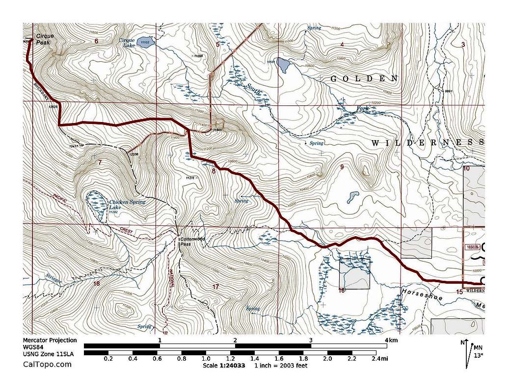
Take Horseshoe Meadows Road S to Cottonwood Lakes trailhead (9960').
I hiked up Cottonwood Lakes trail until I lost it. The road to the trailhead opened two days before, so there weren't many if any tracks up there. I continued north until I was east of Cirque Peak's south ridge. The sramble up the ridge (12300') was interesting; sand, loose rock and snow. The snow was too soft to skin up. I dropped my skis at the top of the ridge to summit Cirque Peak (12900') due to lack of consistent snow between there and the summit. I hiked back to the top of the ridge and skied down to ~10000'. The top of the run was steeper than 40 degrees, but quickly mellowed to about 35 degrees. The snow was a bit too firm at the top, but quickly became ideal and remained ideal the whole way.
Avalanche Conditions:
Spring conditions; saw old, small loose avalanches.
Distance: ~10 miles
Total Elevation: ~4000'
Skied Elevation: ~3000'
![Cirque Peak Ski Route]() Cirque Peak ski route. ~10 miles with ~4,000' of elevation gain.
Cirque Peak ski route. ~10 miles with ~4,000' of elevation gain.
Comments
No comments posted yet.