
-
 2623 Hits
-
 74.01% Score
-
 4 Votes
|
|
Route |
|---|---|
|
|
38.53165°N / 35.44707°E |
|
|
Hiking, Mountaineering |
|
|
Summer |
|
|
A long day |
|
|
Overview
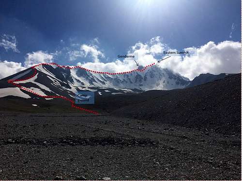
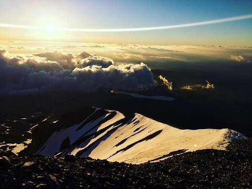
This a route report for the East Ridge on Mt Erciyes (3917m) undertaken in early summer 2017. There was significant snow cover on the east face above circa 3200m. Temperatures at the summit were forecast at -2 degrees C the morning we summited.The Approach
The ski resort of Erciyes, not to be confused with the village which Google Maps directs you to, is the best place to start from. It is necessary to register at the Jandarma office, who are the local military police and act as the mountain rescue service.There is a mountain hut just below one of the chair lifts where it’s possible to stay (the keys are held by Jandarma), and this is the best place to start the climb from. The hut can be reached either by 2 no. ski lifts – although only the bottom one was operating when we were there (priced at 7 Lira). Since we had a 4x4 with us, we were able to drive up to the hut ourselves.Route Description
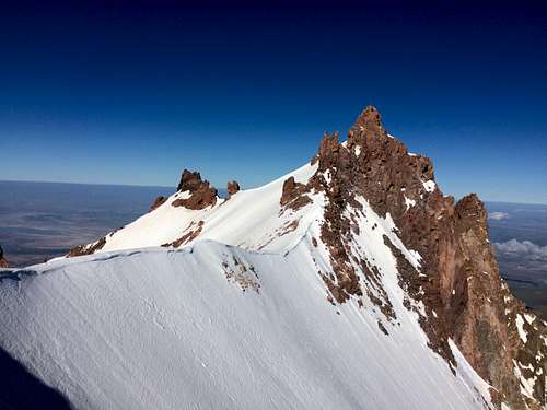
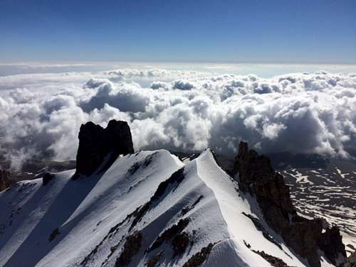
From the hut take the track up towards the top of the ski lift. The East Ridge is visible on your left and directly in front of you.There is a vague path that crosses grassy / rocky terrain to reach a camp. From here the path heads SSW to join the ridge. Having left in the early hours of the morning, we had been unable to follow the path to the ridge, but were able to make our own way without too much difficulty. The path then follows the crest of the ridge across various snow fields and scree. Being a cold morning, we put our crampons on and roped up fairly early, but in warmer conditions – and certainly with less snow cover, you may get away without using crampons for the majority of the ridge.Other than the effect of altitude making it a little more strenuous than normal, the traverse of the ridge is fairly straightforward, up to a point at which you meet a large gendarme blocking the ridge. The obvious route around this is to traverse underneath it on the right (eastern) side on a relatively steep snow slope (circa 45 degrees). It is apparently possible to pass the gendarme on the left, but there was nothing obvious that we could see. After re-joining the ridge on the other side of the gendarme, it’s a fairly short distance up to the eastern summit. If heading to the western summit a short snow ridge and some easy scrambling gets you to the base of a 10-15m pillar of horribly loose looking rock which is the true summit. I had read reports of their being a rope ladder in situ for this last step, although this was not the case. I’d also read there were pitons in place, but could not see these either. Nevertheless, we had brought the appropriate rock gear with us but decided against it on account of the exposure and the horribly rotten rock.
We were in pretty reasonable shape and the total ascent from the hut to the summit took us about four and a half hours, and about two and a half back down.
Objective Dangers
Other than the obvious climb on loose rock to the eastern summit, the main concern on this route is with rock fall when traversing under the gendarme. We made this traverse on the way up at around 7-7:30am and there was already rock fall, so leave early. There had been very little fresh snow and avalanches were not a concern.
Accommodation
As mentioned above, there is an unmanned, rudimentary mountain hut below the second ski lift at about 2700m (see map) with the key available from the Jandarma.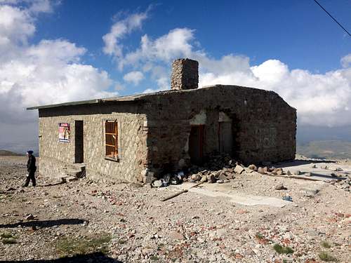
There is a camp above the mountain hut, which did not look particularly comfortable. I have read mixed reports on the availability of water (i.e. snow) here. Whilst there was plenty about at this time, this is apparently not always the case, and I can certainly imagine this later in the summer.
There is a higher, even more uncomfortable looking camp where the path joins the ridge.
Essential Gear
Crampons, ice axe, rope, helmet, and a selection of nuts and cams if attempting the eastern summit.A warm sleeping bag if camping by / sleeping in the hut.
Maps
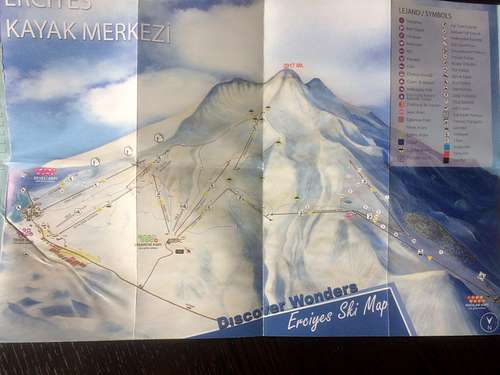
There was a useful office in an undercroft just off the largest car park at the bottom of the ski lift that provided free trekking and ski maps (as attached)

External Links
Brought to you by www.shotsatthemoon.com - Overland travels from Cornwall (UK) to Nepal. More climbing reports to follow.
Follow the trip on Facebook and Instagram.