-
 733 Hits
-
 72.08% Score
-
 2 Votes
|
|
Route |
|---|---|
|
|
Mountaineering |
|
|
Summer |
|
|
Most of a day |
|
|
Class 4 |
|
|
I |
|
|
Overview
Highest mountain in the Opal Range.Getting There
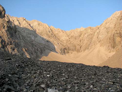
Park on the side of Highway 40 at Ripple Rock Creek, 46 km south of Highway 1. On the north side of the stream you`ll find a well used trail paralleling the drainage. Follow it and then contour on hillside around the south end of Grizzly Peak. Continue eastwardsinto a basin between Mt. Evan-Thomas and Mt. Packenham. Hike to the end of the basin, slowly gaining elevation until you arrive at the south coulouir which is located in between the two summits of Evan Thomas.
Route Description
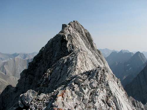
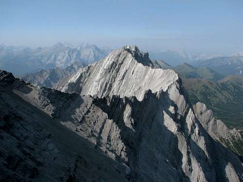
South coulouir/East ridge 4th Class. Follow the coulouir 3/4 of the way up and then exit into another gully which will take you to the main west summit. When you gain the ridge, head north on a wide ledge below the summit block until you get to an east facing gully. Follow it directly to the summit. There are some steep slabby sections with pebbles on it, so extra caution is advised. Return the same way.Essential Gear
Ice axe, crampons when snow encountered. Mostly scrambling when dry.Pictures![Unnamed Image]()
![Unnamed Image]()