
|
|
Mountain/Rock |
|---|---|
|
|
41.11660°N / 107.5378°W |
|
|
Carbon |
|
|
Hiking, Mountaineering |
|
|
Spring, Summer, Fall |
|
|
7904 ft / 2409 m |
|
|
Overview
Muddy Mountain is an isolated mountain tucked away in an almost unknown part of South Central Wyoming. The peak has some nice views, but few people will ever go there since it's such an out of the way location. The mountain itself isn't as spectacular as others in Wyoming, but the views from the summit area really good, especially of Battle Mountain and the Elkhead Mountains.The peak is just northeast of Baggs Wyoming. Baggs Wyoming is a tiny town with a colorful history. The town was named for Maggie Baggs, who although female was known as one of the meanest and most feared "cowboys" in the west. One of the ranch hands named two nearby hills "Maggie's Nipples" and when Maggie found out about it, she drug him behind a horse through town.
Baggs was also one of the hangouts of Butch Cassidy and the Wild Bunch and was a town known for harboring outlaws.
The area was also considered a "warring grounds" for Shoshone, Sioux, Utes, Arapaho, and Cheyenne tribes. By 1841, a large band of Sioux attacked a group of trappers gathered there.
Today things have quieted down and Baggs is a quiet ranching town with occasional boom and bust cycles from the oil industry. Few people will head out there to hike, but just in case you ever do, Muddy Mountain is a possible destination.
Don't expect to encounter any other people out here, though you may encounter deer, antelope, and in the cold season, elk. There are a lot of mountain lions in the vicinity as well, but you have to get lucky to sight one.
 Muddy Mountain from the north. This is in October. It would be much greener in the spring.
Getting There
Since few people will ever use this page, directions will be brief.Baggs is the main access point and town in the area and the only place to get fuel or basic supplies.
There are two main access routes used to access Muddy Mountain. The road from the west might be the easiest, navigation wise.
 Click for full size.Green = Western Access. Red = Eastern Access
From the West
From Baggs, head north along Sh 789 with a map in hand and turn east onto RD 702 just north of town, or better, Mesa Road a few miles to the north. From either location, follow the road north at the first real intersection and stay on the main road until you are in the vicinity of Muddy Mountain. Don't head out there without a map. The main roads, although unpaved are good for all vehicles, at least when dry. Don't attempt to drive them in wet weather.
 Muddy Mountain from the northwest and from the access road.
From the South
From Baggs, head east along SH 70 to Dixon. Once in Dixon, head north on County Road 503, also known as McCarty Canyon Road through the shallow canyon. Once you are due east of Muddy Mountain, take the road headed northeast and towards the area north of the mountain. There are several placed to park, depending on where you want to start your climb.
Routes Overview
Muddy Mountain isn't rugged, so it can be climbed from several directions. The north side is steep and as bushwhacking, but other than that, all routes are easy.We climbed the mountain from the east, but later we found that an old 4x4 track reaches the summit from the west. Either route is easy.
The climb only takes a few hours, no matter where you start. There are some nice views from the mostly flat summit.
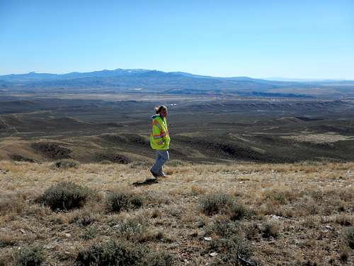 The summit ridge of Muddy Mountain on a breezy day.
Red Tape
There is no red tape, so please take care of the area. Some kind of old structure on the north side of Muddy Mountain. It could date to native American days or from a cowboy, but it looks old whoever built it. There is no red tape here, but please take care of the area.
When to Climb
Late Spring through Fall is reasonable, or anytime the roads are dry. Mid Summer can be quite warm and winters are very cold. You could ski or snowshoe to the summit, but it would be a long trip unless you have access to a snowmobile.Watch for rattlesnakes in the warm season. Ticks could be a problem in late Spring and early Summer. Also use caution during hunting season.
Camping
There are no camping restrictions on the public land in this area, so feel free to camp anywhere. Bring your own water though and please leave a clean campsite.Mountain Conditions
CLICK HERE FOR THE MUDDY MOUNTAIN WEATHER FORECASTBelow is the National Weather Service Climate Summary of Dixon/Baggs, on the Wyoming/Colorado border. The data is from 1922-201. This is the closest long term weather station, but be aware that higher elevations will be a little wetter and colder. Dixon/Baggs is at 6370 feet elevation, so expect the temperatures on Muddy Mountain to be about 5 degrees colder than in Dixon, except for on cold winter nights.
| MONTH | AVE HIGH | AVE LOW | REC HIGH | REC LOW | AVE PREC (in) |
| JAN | 32 | 3 | 55 | -55 | 0.89 |
| FEB | 36 | 8 | 61 | -47 | 0.72 |
| MAR | 43 | 16 | 75 | -31 | 0.96 |
| APR | 56 | 27 | 84 | -9 | 1.14 |
| MAY | 67 | 34 | 93 | 9 | 1.18 |
| JUN | 76 | 41 | 96 | 20 | 0.94 |
| JUL | 83 | 47 | 99 | 30 | 1.07 |
| AUG | 81 | 45 | 100 | 26 | 1.12 |
| SEP | 72 | 36 | 92 | 1 | 1.04 |
| OCT | 61 | 27 | 82 | -9 | 1.23 |
| NOV | 44 | 16 | 77 | -26 | 0.80 |
| DEC | 35 | 3 | 62 | -39 | 1.02 |