Toggle navigation
Mountains
Routes
Images
Trip Reports
Forum
What's New
People
Areas & Ranges
Articles
Trailheads
Canyons
Huts & Campgrounds
Albums
Logistical Centers
Fact Sheets
Lists
Custom Objects
Gear
Plans & Partners
WELCOME TO SUMMITPOST
SIGN IN
REGISTER
Munising Falls
Additional Parents
Image
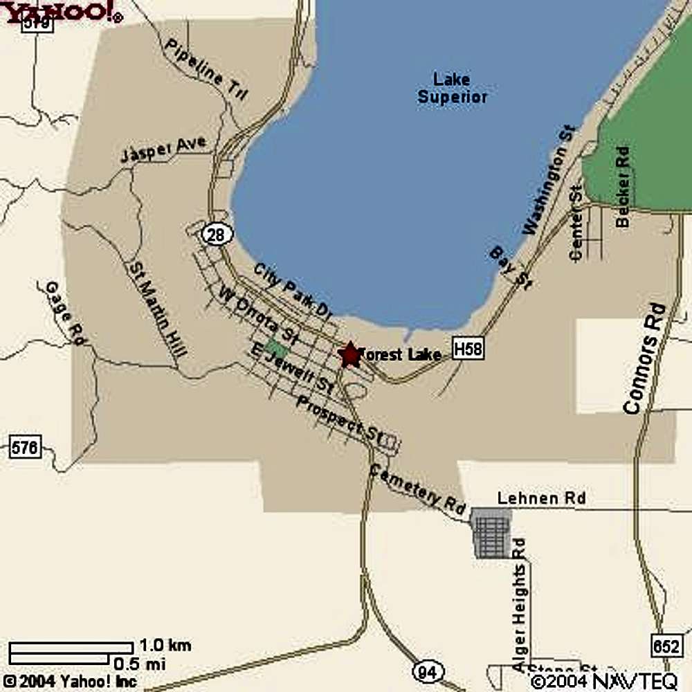
Munising level map Most...
View High-Resolution Image
Munising level map Most...
Munising level map Most climbs (e.g. The Curtains, The Dryer Hose, etc) are located on the Lake superior shore along H58 road
« PREV
NEXT »
sufferjoy
on
Mar 18, 2005 11:20 am
Comments & voting
Other parents
Lat/Lon:
46.42280°N / 86.6214°W
Image ID:
95516
2068 Hits
70.59
% Score
1
Votes
Log in to vote
Comments
No comments posted yet.
to post!
Don't have an account?
Munising Falls
(Custom Object)
You are at
the First
Image
Viewing
#1 of 1
GALLERY
You are at
the Last
Image
sufferjoy's Image Gallery
« PREV
Viewing
#33 of 40
GALLERY
NEXT »
×
You need to login in order to vote!
User Name
Password
Remember me
Forgot your password?
Log me out when I close my browser.
Keep me logged in all the time.
sign in as a user
Don't have an account?
Register now for FREE
Rating available
Suggested routes for you
People who climb the same things as you
Comments Available
Create Albums
Register Here


