
|
|
Mountain/Rock |
|---|---|
|
|
35.71345°N / 82.16595°W |
|
|
McDowell |
|
|
Hiking |
|
|
Spring, Summer, Fall, Winter |
|
|
3396 ft / 1035 m |
|
|
Overview
 Headed up!
The ridge leading up to the summit is, indeed, very narrow. The slopes fall off very steeply on either side of a knife's edge ridgeline. It's almost akin to hiking the Sawteeth in the Smokies, but without the denuded slopes nor the cliff faces.
 Panorama!
The hike in to Narrows Knob consists of a fair number of steep ups and downs with some very warm pulls over the intervening peaks. Keep in mind that there are absolutely no water sources along this ridge, so if traversing this part of the Mackey Mountain area, be sure to bring plenty of water.
In our latest hike to the peak it seems that most of the traffic is from
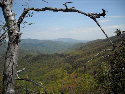
 Views.
Most of the ridge line along the old trail is socked in by the vigorous growth of hardwood forests. So if you arrive after springtime the views are few. However, there are some inspiring grandstands on the trail, mainly on the summit of Narrows Knob where some cliffs prevent many trees from finding purchase. Enjoy the views there of deep drainages clothed in one of North Carolina's finest forests. There are many patches of old growth timber in this part of Pisgah National Forest with some exceptionally large trees.
 Roadless.
Getting There
Access to most of the few trails in the Mackey Mountain area are via Forest Service Road 482.From I-40, take the exit at Old Fort. Go 0.2 miles through town and take US 70. Drive about one mile to the intersection of US 70 and Curtis Creek Service Road (SR 1227). Turn left onto 1227 which soon becomes FS Road 482 after about 3.5 miles. Look for the Curtis Creek Campground on the right. Trail access into the roadless area are located in and near the campground on either side of the road.
 Map.
Map.Red Tape
No red tape. National Forest land so you can camp just about anywhere you want to.Heavy bear population, so be very sure to practice safe bear country habits.
 Gnarly
Camping
There is semi-developed camping at the Curtis Creek Campground. This is a Pisgah National Forest facility. There are vault toilets, water pumps, and both tent and RV campsites. Mackey Mountain.
External Links
The Curtis Creek Campground.The Mackey Mountain Roadless Area.
 Overlook