Navajo Knobs-- Route Diagram for the Highest Knob

Navajo Knobs-- Route Diagram for the Highest Knob

Clean version Enlarge for better detail. Seen from the summit of the trail-accessible Navajo Knob. The climbing sections are short and are Class 4, and most of the cimbing is in cracks and gullies. The broken sections represent where the exact route is not visible. Notes Explanations: 1. Here, I struggled up this small outcrop, relying on friction. It may even have been Class 5 there, and when I think about it, it probably was. However, I stupidly did not inspect the outcrop fully, for up top, I found I could have walked around it on the right to get to the same place I had to scramble down to after climbing the outcrop. 2. What you can't see here are the trickiest parts of the climb. First, there is a descent on very loose slabs; the blocks actually started sliding under my feet as I was on them, starting me on a free ride to a gully bottom and then a drop. Then there is a traverse with some exposure, followed by a Class 4 crack up to the summit area. Navajo Knobs; Capitol Reef National Park, Utah-- October 2009
Bob Sihler
on Oct 30, 2009 12:28 pm
Image Type(s): Topo/Diagram,  Informational
Image ID: 568889

Comments

Post a Comment
Viewing: 1-2 of 2
chicagotransplant

chicagotransplant - Apr 19, 2016 2:30 pm - Voted 10/10
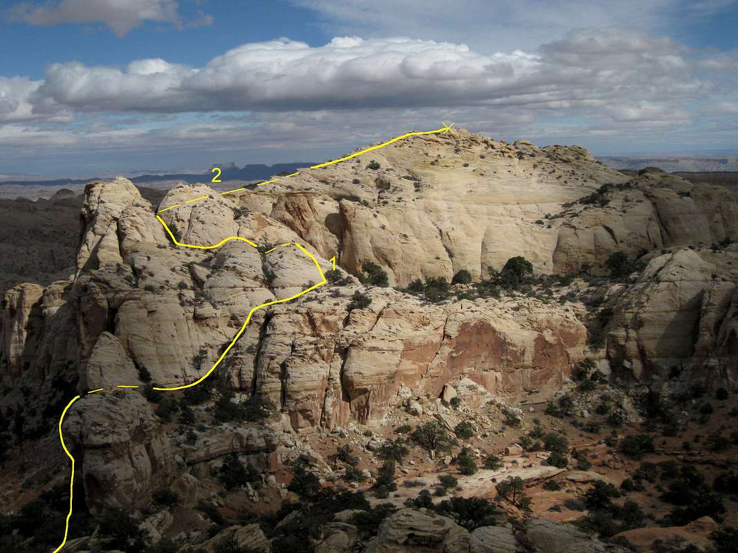
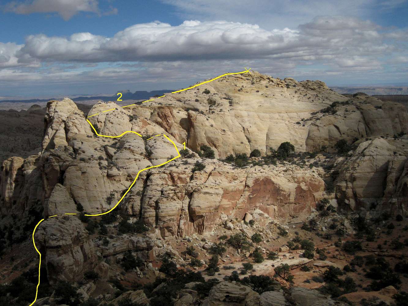
Thanks

We were admiring this from the trail knob but did not take the time to explore for a route. I didn't realize there was a page for it until I got back, will have to remember this for next time and give it a go! Thanks for sharing!

Bob Sihler

Bob Sihler - Apr 20, 2016 9:54 pm - Hasn't voted

Re: Thanks

Too bad you didn't give it a shot-- it's a very cool peak and a fun route. I hope you get back!

Viewing: 1-2 of 2