
-
 16506 Hits
-
 74.01% Score
-
 4 Votes
|
|
Route |
|---|---|
|
|
69.05976°N / 20.54755°E |
|
|
Download GPX » View Route on Map |
|
|
Hiking, Skiing |
|
|
Spring, Summer, Fall, Winter |
|
|
Expedition |
|
|
Class 1, some class 2 |
|
|
Overview
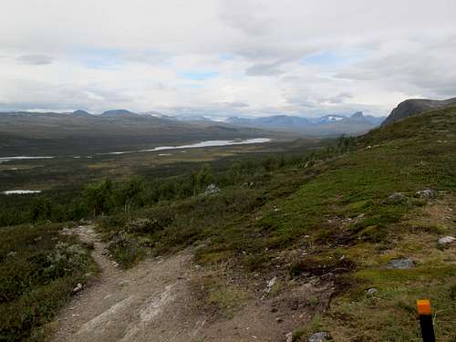
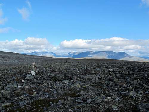
The Troms Border Trail includes 85 miles/137 km of the Nordkalottruta or Arctic Trail, which is an 800 km trail that passes through Norway, Sweden and Finland. The Troms Border portion is mainly in Norway but does include portions of Sweden and Finland. One highlight of the trip is the large yellow concrete monument marking the point where the three countries adjoin. The Troms Border Trail also passes through the Norwegian part of the Øvre Dividal National Park and the Malla Strict Nature Reserve in Finland. The scenery is outstanding, with rushing streams, reflective lakes, wide valleys and snow-capped peaks in the distance. For the most part the trail is very well marked and signed, although there were a few places where it was easy to deviate from the trail slightly. You can use the attached gpx track, even if you don't have a map of Norway loaded on your GPS.
Other literature may contain route descriptions that are slightly different from the one described here. This variation includes the 3-country marker along the route, and also saves this exciting landmark until the end of the trip. Other options for the route and extensions of the route will be noted in the appropriate areas of the Route Description. The trip could can be done in reverse, but the logistics for the return to civilization are slightly more difficult. However, in the north to south direction it is easier to include the boat trip across Lake Kilpisjärvi.
The cabins (hytta) along this trail are all considered "no service" huts, which means no food is served and no food supplies are available for purchase. However, the cabins have mattresses and pillows and are well supplied with wood to burn, so only a sleep sheet is needed for "camping". All the cabins along this route are in Norway and all are DNT (Den Norske Turistforening or Norwegian Trekking Association) huts.
This trail can be used all year, with hiking in summer and skiing in winter. However, people have been turned back as early as September in blizzards, and the track would be difficult to follow if covered in snow.
The hiking is mostly class 1 with a little class 2. There are abundant river crossings involving wading or rock-hopping. In general, the trail is wet as it rains quite a bit in this area of the world.
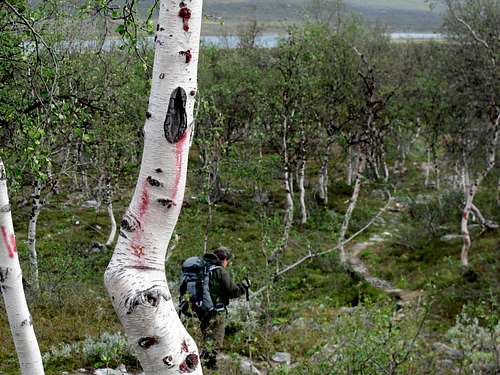
In Norway and Sweden the trail is marked with cairns, or red paint on rocks or trees. In Finland it is marked with orange-topped posts.
Water is plentiful along the trail.
 Some of the trail markings are faded
 The trail is marked with orange-topped posts in Finland
Getting There
From Tromsø or Narvik take the 100 bus to Setermoen. More information can be found at the Tromskortet web site with links to the bus page. Get off the bus at the Sentrum (city center) stop in Setermoen. If you have a phone or SIM card that works in Norway you can call a taxi yourself, or if not, you can walk across the street to the Co-op store and ask someone to do it for you. The Co-op also has a fast food restaurant upstairs.
The taxi company is Bardu Taxi, phone (47) 77181123. 47 is Norway's country code so if you are there you won't need that part of the number. In 2013 the bus cost NOK $255 NOK pp, the taxi cost NOK $859 for two people.
Another alternative is to find out when the weekly bus runs from Setermoen to Innset. Our taxi driver thought it runs from Innset to Setermoen Saturday morning and returns Saturday afternoon. It is route 19-219 (or lokalrute 219) and you can call (47) 907 99 318 in Norway to inquire about the schedule. If you plan to stay at the Husky farm, they may also be able to help with transportation.
Tell the driver you are going past Innset. You will drive on road 847. When you reach Innset, bear left onto road 166. Head towards the dam, following signs to Altevatnet, pass the turn-off on the left to Ørneberget and look for the labeled left turn to Altevasshytta. This is about 3 km past Innset. Turn left here and follow the road into a large parking lot. The trail starts at the far end of the parking lot on a road to the right (towards the lake). If you have stayed at the husky farm you can walk this part of the route. It was helpful to have a map of the area to show the taxi driver, who was unaware of this trailhead during my visit. See the maps section below for more information.
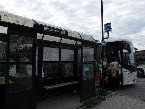 The Prostneset bus station near the Information Center in Tromso
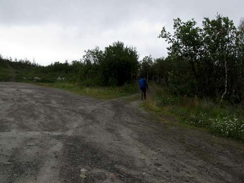 The trail starts at the far end of the parking lot, on a road to the right
Getting Back
The Oulu - Rovaniemi - Kittilä - Levi - Muonio - Karesuvanto - Tromsø bus runs from the Retkeilykeskus back to to Tromsø, usually once a day in the late afternoon. If you need to go elsewhere, you can transfer to another bus in Nordkjosbotn where there is also food and lodging.
Route Description
The route below was tracked with a GPS. The information from the track was used for mileage and elevation gains and losses. In addition, the distance in kilometers read from the trail signs, and other helpful information about the trail, cabins and water sources is also included.
The GPS track was modified in a few places to correct navigation errors on the original trip. Accuracy of these corrections to align with the actual trail is not guaranteed; however the track primarily follows the trail and could be used for navigation. In addition, the daily elevation gains and losses were obtained from the Garmin mapping program, and do not match the number displayed when the GPX track is viewed on this site.
In Norwegian, "hytta" means cabin. The "hytta" suffix on the huts has been omitted, as the Norwegians tend not to use it when talking about the route.
Day 1: Innset to Gaskas
- GPS distance: 7.8 miles
- Signed distance: unknown
- Elevation gain: 950'
- Elevation loss: 900'
- Number of cabins: 2
- Water source: Stream to east of cabins
- Special notes: The Gaskas cabins are the only ones having sink basins with drains inside the cabin and the only ones having toilet paper.
- Variations: If you arrive in Innset late in the day, you can stay at the Husky Farm (see Lodging section) or the Altevass cabin. The route can be extended from the south. It is approximately 30 km to Lappjord, the closest cabin south of Innset along the Nordkalottruta.
The trail starts at the parking lot past Innset as described in the Getting There section. After .1 mile you will arrive at the Altevass cabin. Continue along the trail. Immediately after you cross a small wooden bridge, turn left and ascend a small hill. There are heavily used trails to private cabins and it is easy to miss this turn. At about 2.5 miles the trail merges with some 4WD roads. Watch carefully for markers that head to the right. The GPS track may not be accurate in this area as the route to the next bridge is approximated. If you miss the trail you may need to wade across the river, then head back downriver to pick up the trail again. After the river crossing, the trail climbs gently into a lightly forested area and the remainder of the trail is marked well and easy to follow to the Gaskas cabins.
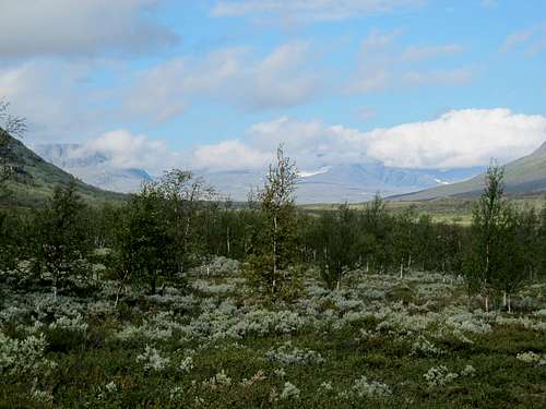
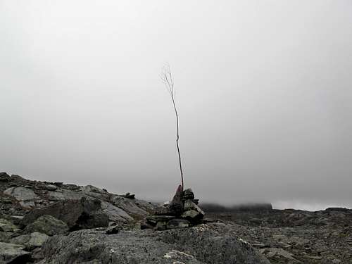
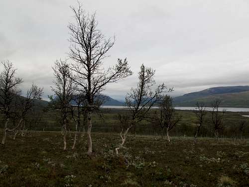 Sparse Trees between Altavass and Gaskas
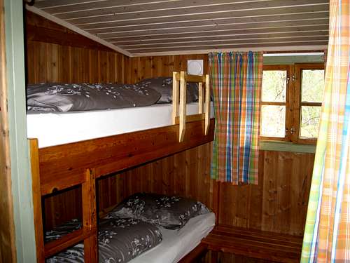 Gaskas cabin interior
Day 2: Gaskas to Vuoma
- GPS distance: 10.7 miles
- Signed distance: 17 km
- Elevation gain: 1840'
- Elevation loss: 1240'
- Number of cabins: 2
- Water source: Stream southwest of cabins
- Special notes: Enter Øvre Dividal National Park. Herds of reindeer graze in this area.
- Variations: No suggestions
Follow the sign outside the cabins to Vuomahytta. The trail soon crosses a bridge and ascends northeast following a stream, then gradually bends around to the east as it heads up to a rocky pass. It continues east as it descends towards the cabin and enters Øvre Dividal National Park. Most of the day is on fairly dry terrain above tree line and the trail is easily navigated with large cairns and good markings.
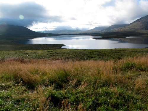 Vuomajarvi
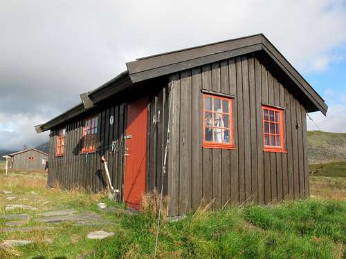 Vuoma cabin
Day 3: Vuoma to Dividal
- GPS distance: 11.5 miles
- Signed distance: 18 km
- Elevation gain: 1500'
- Elevation loss: 2050'
- Number of cabins: 2
- Water source: Covered well close to lower cabin. Possible water source for upper cabin is stream along trail to Dærta.
- Special notes: Follows a pretty, treed valley, great scenery. Gaiters or high boots recommended due to abundant boggy areas. Don't miss the sign at the end of the bridge.
- Variations: There is a road access 14 km from Dividal, north past the Anjavass cabins. For an alternate hiking route you can start out by heading southeast along the lake Vuomajávri around the mountain Blåfjellet Vuomavárri, then follow the Vuomajohka river down to the bridge. There are no marked trails in this area and it is even wetter than the marked trail.
Head north per the sign near the Vuoma cabins and ascend a fairly small hill. After reaching the high point of the day, descend back into the trees and follow the trail down the valley. Cross the wooden bridge over Vuomajohka and continue on the trail. The trail is easy to follow until you descend the stairs and cross the large wooden bridge 9.5 miles from Vuomahytta. At the end of the bridge is a sign ABOVE EYE LEVEL, which provides the direction to turn right for Dividal. The trail follows the river for a while, then turns left and ascends through a wet area to the cabins.
 The scenic valley between Vuoma and Dividal
 A lovely place for a rest
Day 4: Dividal to Dærta
- GPS distance: 15.4 miles
- Signed distance: 24 km
- Elevation gain: 2930'
- Elevation loss: 2420'
- Number of cabins: 2
- Water source: Stream very close to cabins.
- Special notes: The longest day. The newest cabin has one double bed. There are also large plastic jugs for carrying water.
- Variations: No suggestions
From the highest Dividal cabin, follow the signed trail on wooden planks to the east and leave the trees. The trail climbs fairly steeply at first, then levels out as it contours around Little Jerta. Be very careful here as the trail markers can be difficult to find. The GPS track in this area (about 2 miles from Dividal) may be too low. After 5.6 miles you will come to a stream crossing. If the water is a reasonable level it is possible to cross on rocks. It doesn't matter exactly where you cross the stream, as the trail resumes on the other side of it and is marked quite well. From that point on the rest of the trail is reasonably well marked and easy to follow. At the lake in front of the cabins, a large white swan was floating peacefully during my visit.
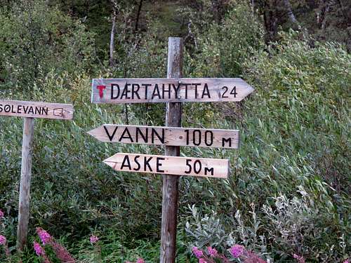 Distance to Daerta from Dividal, plus directions to water (Vann), the ash dump (Aske) and waste water dump (Solevann)
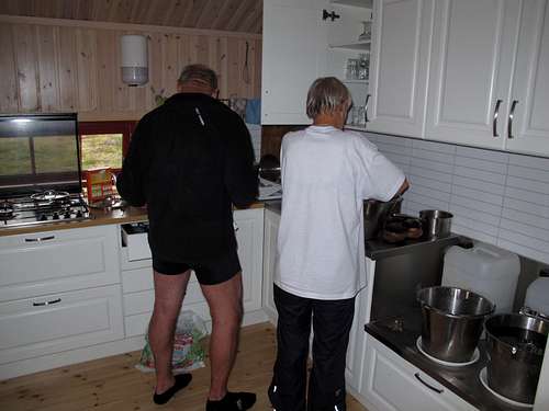 The new Daerta cabin is one of the most modern
Day 5: Dærta to Rosta
- GPS distance: 10.6 miles
- Signed distance: 17 km
- Elevation gain: 1650'
- Elevation loss: 2556'
- Number of cabins: 3
- Water source: River very close to cabins.
- Special notes: There is one double bed in the largest cabin.
- Variations: No suggestions
Head north from the cabins, climbing up to a long rocky section with plenty of class 2 hiking. The trail is very well marked. After the high point, descend northwest into a long valley. Cross a stream after 6.7 miles - it may require wading. Across the stream is a good sign showing the direction and remaining distance (6 km) to Rosta. The trail is marked well. Prior to reaching the Rosta cabins you will cross a bridge.
 Daerta to Rosta rocks
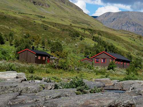 The Rosta cabins
Day 6: Rosta to Gappo
- GPS distance: 11.9 miles
- Signed distance: 20 km
- Elevation gain: 2420'
- Elevation loss: 1790'
- Number of cabins: 3
- Water source: Stream .3 mile away, 100' elevation gain on return from stream.
- Special notes: This is the worst hut for getting water. There are plastic jugs in at least one of the huts and you could borrow one if necessary, otherwise you risk losing the water as it bounces along in the buckets. The newest and smallest hut does not have an eating table, nor did it have drying racks, but was still under construction during our stay in 2013. Dogs are allowed in these cabins.
- Variations: The nearest road is 11 km from Gappo at Rognli. Also, instead of going to Gappo, you can travel to Pältsastugan which is the northernmost hut in Sweden.
From Rosta the trail follows a series of river valleys and gently ascends and descends over the course of the day. There are many river/stream crossings but all can be crossed without wading, although some of the rocks may be slightly under water. After 7.2 miles there are large piles of yellow-painted rocks marking the border with Sweden. About .3 of a mile farther along, to the right of the trail is a rocky outcrop with an overhang, a convenient place to stop for a break if it is raining. At 10.3 miles the border from Sweden back into Norway is crossed. The trail is well marked throughout the day.
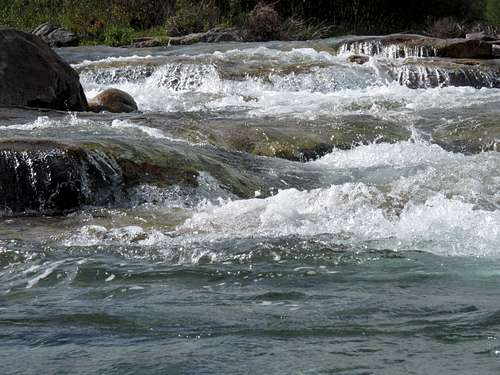
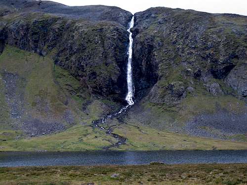 Waterfall en route from Rosta to Gappo
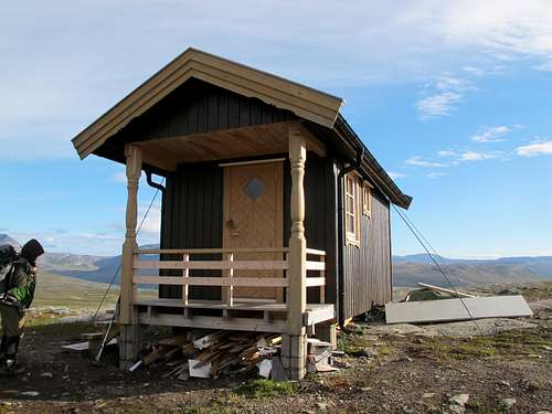 The newest hut at Gappo has kennels and only 4 beds
 Tree trail markers between Rosta and Gappo
Day 7: Gappo to Golda
- GPS distance: 7.7 miles
- Signed distance: 13 km
- Elevation gain: 740'
- Elevation loss: 1370'
- Number of cabins: 2
- Water source: Winter, covered well. Summer, small pool adjacent to well.
- Special notes: Easiest day
- Variations: Instead of Golda, you can head south to Pältsastugan. Or you could continue on to Kuohkimajärvi in Finland near Treriksrøysa. It is unlocked and can be used all year round but it is simply equipped with bunks without mattresses or bedding.
This is an easy day. The trail is well marked, the distance is short, and the elevation gain is minimal. The trail stays in Norway but the border with Sweden can be seen frequently throughout the hike. After 4.7 miles there is a wooden bridge, and another bridge at 6.1 miles.
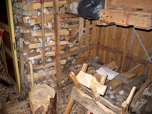 Wood shed at Golda
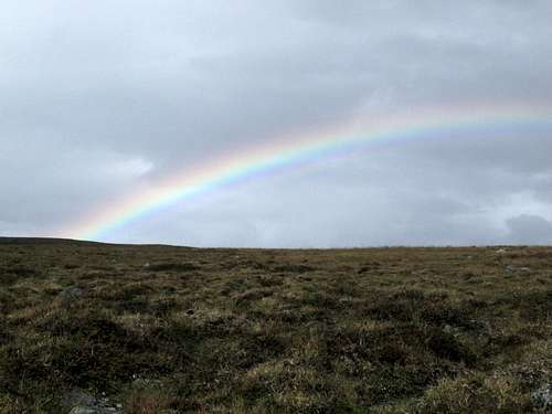 Norway - land of rainbows
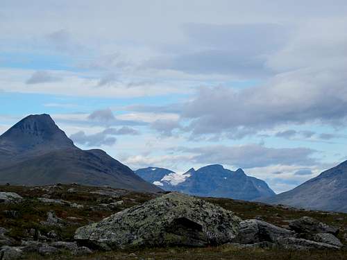 Great scenery on an easy day
Day 8: Golda to Kilpisjärvi
- GPS distance: 9.6 miles
- Signed distance: unknown
- Elevation gain: 1130'
- Elevation loss: 1250'
- Special notes: Route changes from red Troms Turlag markers to orange Finnish markers.
- Variations: Instead of following the Nordkalottruta into Finland, you can follow the signs to Galgugobba which will take you to the E8 highway in Norway. Or, after you visit the tri-border marker, you can continue to Treriksrøysa and take the ferry to Kilpisjärvi. If you plan to do this, you should call ahead to make sure the boat will meet you as it will not run if there are insufficient passengers. There are 2 possible numbers for the ferry. The Finnish number is (358) 0400-669-392. The Norwegian number is (47) 918-81-782. You can also continue along the Nordkalottrutainto Finland from Kilpisjärvi.
Follow the sign from the cabin toward Treriksrøysa. You will be able to see the yellow marker across the lake as you are hiking. Pass through the cloth border entrance and continue towards the marker. After you have seen it, go back to the land and pass through another cloth entrance. Look for trail markers that are small posts with orange paint on top and follow the Norway/Finland fence northeast for a short while. The trail then heads east high above Lake Kilpisjärvi. As the trail nears the highway E8 it drops down into the trees, then crosses over a large bridge. Along the E8 there is a large parking area. Exit from that, cross the road and walk the last 1.2 miles south along the road to the Retkeilykeskus where you can enjoy a large, filling meal at a high cost while you wait for the bus.
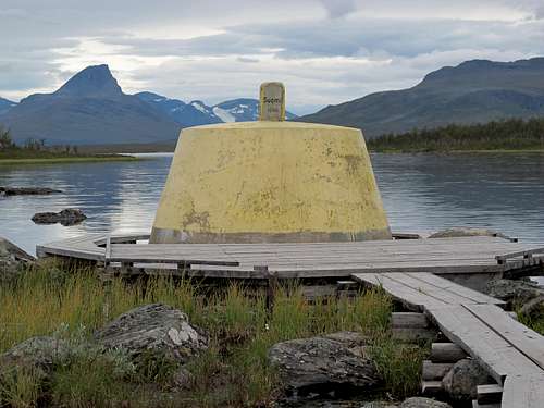 Tri border marker - Norway, Sweden and Finland
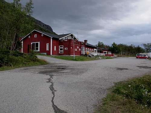 The Retkeilykeskus in Finland
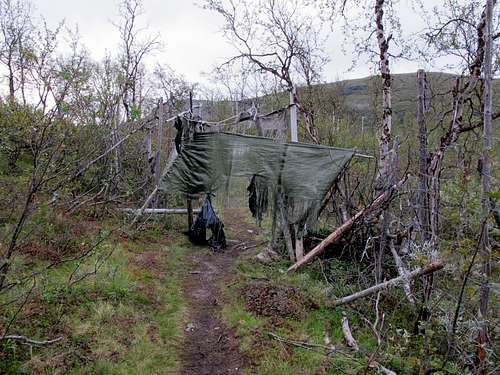 Cloth entrances at borders
Essential Gear
- Sleep sheet or sleeping bag (all huts on this route have comforters)
- Toilet paper sufficient for the entire trip
- Matches (the cabins usually have some but supplies are limited)
- Food, preferably in packages that will burn well
- Personal soap/washcloth
- Good rain gear and boots
- Clothing for wear in the huts, which can get very warm
- Trekking poles are helpful for water crossings
- Bug head nets in summer (after mid-August these are not necessary)
Red Tape
You will need to join the DNT (Norwegian Trekking Association) prior to doing this trek. Without this membership, cabins cost twice as much and the membership pays for itself in 3 nights, or less than that if you are a family member who joined as being associated with the primary member. You also need a membership to obtain a key to open the cabins. It takes about 2 months to get your membership cards, so either join well in advance or immediately prior to leaving. You will be issued temporary membership certificates when joining via the internet, and you should print these out and take them along with you.
You will also need a key to open the cabins. The Troms Tulag web site has information about where you can get a key. One place is the office in Tromsø in the same building as the Information building, at Kirkegata 2. Hours in this office are extremely limited. Another good place to get a key is at Andresens Vaabenforretning at Storgata 53 in Tromsø. There is a NOK $100 deposit for the key which is refunded when you return the key.
Maps
Norge-serien 1:50,000
- 10149: Skibotndalen
- 10144: Dividalen
- 10143: Setermoen
OR
- BD1 Treriksröset-Rostojá 1:100,000
- Statens Karverk's Turkart Indre Troms 1:100,000 (may be discontinued)
OR
Norwegian maps for Norwegian topographic maps with cabins
Swedish maps for Swedish topographic maps
Lodging
Setermoen
- Bardu Hotell
- Bardu Camping & Turistsenter A/S (June - Aug)
Innset
- The Husky Farm There is a kitchen for use of guests, a sauna, and you can rent bikes and canoes.
- Atelvasshytta - the first cabin near the start of the trail.
Kilpisjärvi
Kilpisjärvi Hiking Center (March - September)
Tips and other information
Tips
- To start a fire easily, peel the bark of some of the birch logs to use as kindling. The bark will burn well this way, but won't burn as well if left on the log.
- Most people do not filter the water. However, floating debris and bugs can get in the cabin water buckets or your water bottle occasionally so you can choose whether or not to bring a filter. Make sure you follow any instructions at the cabins regarding water sources.
- If you arrive at a place where the cabins are almost full, choose the newest/largest cabin as the common and cooking areas are larger.
Cabin contents
- Beds/mattresses
- Pillows
- Thick comforters
- Dish detergent
- Cooking and eating utensils
- Wash basins for personal hygiene
- Dish wash basins
- Water buckets (some also have large plastic jugs)
- Propane stove
- Wood burning fireplace
- Sølevann (waste water) bucket
- Aske (ash) bucket
- Each set of cabins has a wood shed with firewood, axe, saw, and pit-style toilets
- Matches (although the number of these may be limited)
- Drying hooks or racks near the wood burning stove (most)
Cabin duties
- Haul and leave water in the water buckets for the next occupants.
- Haul/split wood and kindling from woodshed.
- Clean out ashes, and deposit in the Aske area outside if the bucket is full.
- Empty the Sølevann (waste water) bucket in the Sølevann area outside.
- Tidy the bed.
- Brush your teeth in the Sølevann area, preferably outside.
- Wash and dry your own dishes. When the cabin is crowded, it may be easier for a few people to do everyone's dishes.
- Carry out all food and non-burnable garbage.