
-
 7005 Hits
-
 74.72% Score
-
 5 Votes
|
|
Route |
|---|---|
|
|
36.09358°N / 115.48491°W |
|
|
Scrambling |
|
|
Spring, Fall |
|
|
Half a day |
|
|
5.3 (YDS) |
|
|
Overview
This is one of the best, if not the best, scrambling routes in Red Rock Canyon-- scenic and fun scrambling on the approach, lots of Class 3 on the main route, some Class 4, a Class 5.3 crux pitch, and exposure with some decent pucker factor.
One-way distance is about 3 miles, with approximately 2400' of elevation gain. However, give yourself at least one hour per mile for this one; there is a trail hike of a mile or so, but the rest is clambering and scrambling over and around obstacles, and this will slow you down quite a bit from your regular pace.
Because it gets so hot out here in the summer, don't do this one June through August unless it's an overcast day or unless you're really fast and you start really early. Complicating the latter is that without taking a longer approach route from outside the Scenic Loop of RRCNCA, the earliest you're likely to start is about 6:30 since the gates don't open until 6 in the summer.
Follow the wash for 15-20 yards. Before the gravel ends and slickrock begins, start heading up and left on Class 2-3 slabs.
Getting There
Follow SR 159 (Charleston Boulevard) west from Summerlin or east from SR 160 to the well-signed entrance to the Scenic Loop of RRCNCA.
Turn onto the RRCNCA Scenic Loop (the one and only paved road looping through the NCA) and follow it for approx. 11 miles to the signed Oak Creek Canyon dirt road turnoff. Follow the well-maintained dirt road for a mile or two to a well-marked parking area. The parking area is spacious and even has a restroom. The trailhead, which is at the south end of the parking area, is signed for Oak Creek Canyon.
Or,
You can avoid the fee and the one-way loop drive by parking at the unmarked but easily seen trailhead for North Oak Creek Trail located along SR 159 a short distance west of the loop drive's exit. This, of course, adds some hiking distance each way-- 0.9 mi.
Hiking in from the signed Oak Creek Canyon TH off 159, which reaches the canyon via South Oak Creek Trail and the Chinle Trail, adds 1.5 mi each way-- definitely not recommended unless the other TH off 159 is closed for some reason.
Route Description
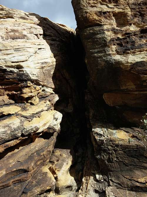
Hike about a mile to the mouth of Oak Creek Canyon and then drop into wash. From here on out, there is no longer a trail and there will be a lot of Class 2 and 3 terrain; you might wind up doing some Class 4 stuff as well. Cairns sometimes mark easier ways around obstacles, but it's not necessary to find and follow the cairns. The way is obvious: hike, scramble, and boulder your way up the canyon.
About a mile into the canyon, there is a prominent fork where a sandstone ridge from due west splits the canyon into two (this ridge is known as Oak Creek Peak). Go left here, staying in the main fork of Oak Creek Canyon. Shortly past that fork, notice another fork. You'll want to go left here as well, heading into a narrower canyon branching more or less due south/southwest. There's a bit of brush at the mouth, but it quickly disappears.
Once up the slabs, you should notice that cairns begin to appear. Follow them about 80 yards to a chute. Climb it (Class 3). Walk north on a wide ledge paralleling a wall to your right. Scramble up the wall (Class 3-4) at its first weakness; it should be cairned.
Class 3/4 Chimney
Now head south , mostly hiking but with some easy scrambling as well, on a use trail aiming for some ponderosa pines and a notch beyond them.
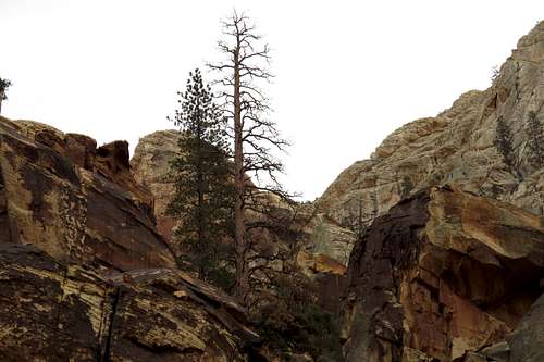
Aim for These Pines
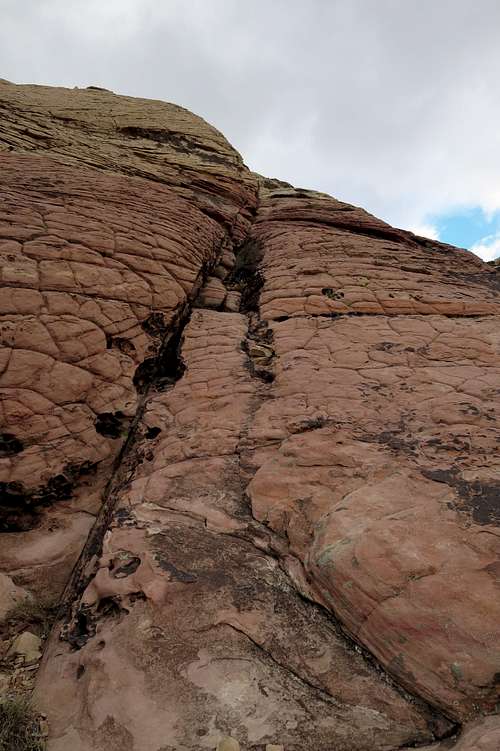
At the notch, climb the low wall there. Use either the obvious corner (harder) or the face to its right (Class 3+).
Key to the West Ridge
Now the route heads for the ridge, but the route can get tricky here. There are actually two cairned paths, and the more obvious one leads off to the left. That way is harder; it takes you to a steep, very narrow Class 5 chimney that is about as hard as the crux of this route; I had to remove my pack and deal with the hassle of hauling it as I climbed, and the climb included a chockstone that didn't seem too trustworthy but ended up holding just fine.
Instead, once you are a little above the notch and on your way again, look more straight/right for the chute pictured below. You might notice a cairn at its base. Going up this way is easier (Class 3) and more direct.
Instead, once you are a little above the notch and on your way again, look more straight/right for the chute pictured below. You might notice a cairn at its base. Going up this way is easier (Class 3) and more direct.
Chute
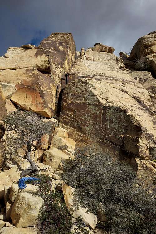
Continue over Class 3 terrain, sometimes on the crest of the ridge, past a notch between a false summit and the real peak to what is the crux pitch (5.3) of this route. It is a 40' face, exposed and definitely tricky as a scramble, and it is why relatively few climb this peak.
Either climb the face or the crack in the corner on the left side of the face (or use a combination of both). Then there is a short exposed traverse to the right, followed by a Class 4 pitch of about the same length as the crux (seen shaded section at upper right in the picture below).
The crack is large, and I advise that it will only accept very large cams and hexes. It seems almost everyone just solos this pitch.
There are rappel stations for both this pitch and the Class 4 one. You'll need at least a 50m rope. (You can see mine-- a 50m 8mm one-- near the bottom of the picture; it was just enough to get me back to level ground.)
Rappelling the crux is pretty complication-free, but I downclimbed the Class 4 pitch because following the rappel of it, I would have had to pull the rope through some brush and was afraid of the rope getting stuck.
Crux Pitch (5.3)
From there, the rest of the way is easy. Class 2 and 3 terrain awaits, without any significant exposure.
Essential Gear
At least 50 m of rope for the rappel back down the crux pitch and perhaps for the Class 4 pitch above it. In addition to obviously needing a harness and ATC or some other rappel device, bring at least two extra slings and rappel rings. When I rappelled back down the crux, there was a solid cord, with a ring, tied so as to create redundancy that I used as my anchor, but don't bank on the fact that the cord will still be there or will be in good condition when you go. I can't remember if there was a sling at the Class 4 pitch and what condition it was in since I didn't rappel that pitch.
Good hiking boots served me well for this climb, but some might prefer something like approach shoes although that increases the risk of turning an ankle during the boulder-hopping in Oak Creek Canyon. Packing along a pair of rock shoes would be overkill, in my opinion.