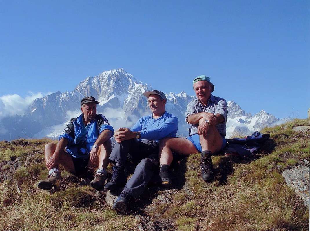
Ma in questa larga scelta che offre la Valle di Aosta cosa ricercare tra quanto conosciuto e no, tra vecchie escursioni dimenticate, altre di nuova scoperta ed altre ancora
e tornate nuovamente di moda. Diamo qualche suggerimento rivolto più alle passeggiate che non alle escursioni, oppure accennando a qualche ascensione diventata un
; altre gite, il nome delle quali é totalmente ignorato, misconosciuto oppure appena segnalato (vedi la Punta Leissé sopra Vetan) nelle Guide libro ed i vari Manuali Alpinistici che vanno per la maggiore, hanno completamente
con eccezionale frequentazione tante escursioni ritenute più degne di citazione. Partendo da Est con giro a 360° nella Valle, dividendo la medesima in due (Sud/Nord),
arrivando da Torino o dalla Pianura Padana, trovate ad Hône la deviazione per la
; passando sulla Dora Baltea (lo farete sempre per tutte le valli a Mezzogiorno) incontrate il famoso Forte di Bard e risalite a Pont Bozet. Qui merita una visita il vicino
in un'area pittoresca e ricca di flora. Continuando con la Strada Regionale si giunge al capoluogo di Champorcher-Château
, dure e lunghe escursioni ai suoi laghi e la possibilità di proseguire tramite la
). La successiva
. Siete nel Gruppo del Monte Avic ed all'interno dell'omonimo Parco Regionale. I successivi alti, lunghi e selavaggi Valloni di
, rispettivamente al di sopra dei Comuni di Pontey, Fénis, Saint Marcel, Grand Brissogne, Pollein, Charvensod, Gressan e Jovençan, offron lunghe escursioni ai colli (
2653 m; 3h'30). In questa vasta area sono interessanti anche le gite con racchette da neve, magari in quota non molto elevata, mentre lo Sci-Alpinismo si rivolge essenzialmente al Corquet ed alla zona di Pila. Da qui e sopra i Comuni di fondovalle di Aymavilles, Villeneuve, Arvier, Derby, Morgex e Pré Saint Didier per arrivare a Courmayeur s'aprono a guisa ventaglio le grandi valli perpendicolari alla Dora Baltea, ovvero
. Questa é una zona con belle escursioni a rifugi e bivacchi, molto adatta allo Sci-Alpinismo e, nella parte più Occidentale sotto i ghiacciai del Rutor, a passeggiate agli innumerevoli laghi (
). Siamo nell'area del Parco del Gran Paradiso, ai confini con le Riserve Naturali della Vanoise e Sassière e della Diga artificiale di Beauregard in Valgrisa. Numerose le facili ascensioni con percorsi varianti
. Gite classiche: (
) da Elévaz. Infine dal Rifugio Monte Bianco (
e dai quali dominerete i Versanti Brouillard/Frêney/Brenva della montagna più alta d'Europa.
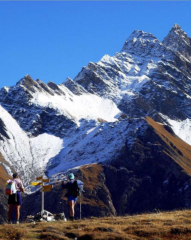
North sector
Passing on the other side of the valley to Courmayeur go upward to the
Val Veny; left down the small church of
"Notre Dame de la Guérison" (1379m), we reach the Visaille (
1660m; detour to the Franco Monzino Shelter 2561m; 2h'30; Equipped Route by chains on rocky band just under the refuge) and the Lochs Combal and du Miage (
1965m, 2020m; Walk; Elisabetta Refuge and the Col de la Seigne,2197m, 2514m; Excursion; 4h'00-5h'00 Courmayeur). From here begins the Chain of Mont Blanc, and we avoid it all the way down to the
Val Ferret with its two hills and Tête
(2490 m, 2537m, 2714m; 1h'30/1h'45/2h'10) from Pré de Bar. This is a
"Shrine Mountaineering" and we do not care. If you want to see go the Refuges Elena, Bonatti and Bertone
(2062m, 2025m, 1946m; from 2h'00 to 3h'00) on the watershed to the Mont de la Saxe (
2348m; beautiful Rock Gym at the base, with a performance of Mountain Guides on the day of the Assumption); these chain stretches from Aiguille des Glaciers up to Dolent, bypassing even the Grandes Jorasses. thing is not for walkers or hikers. Turning the corner we go to
Val Sapin and its hill
(2435m; ancient Roman gold mine known as the "Trou des Romains" anymore West from Tsapy Village 1635m) and admire the old and crumbling Grande Rochère, as in the following
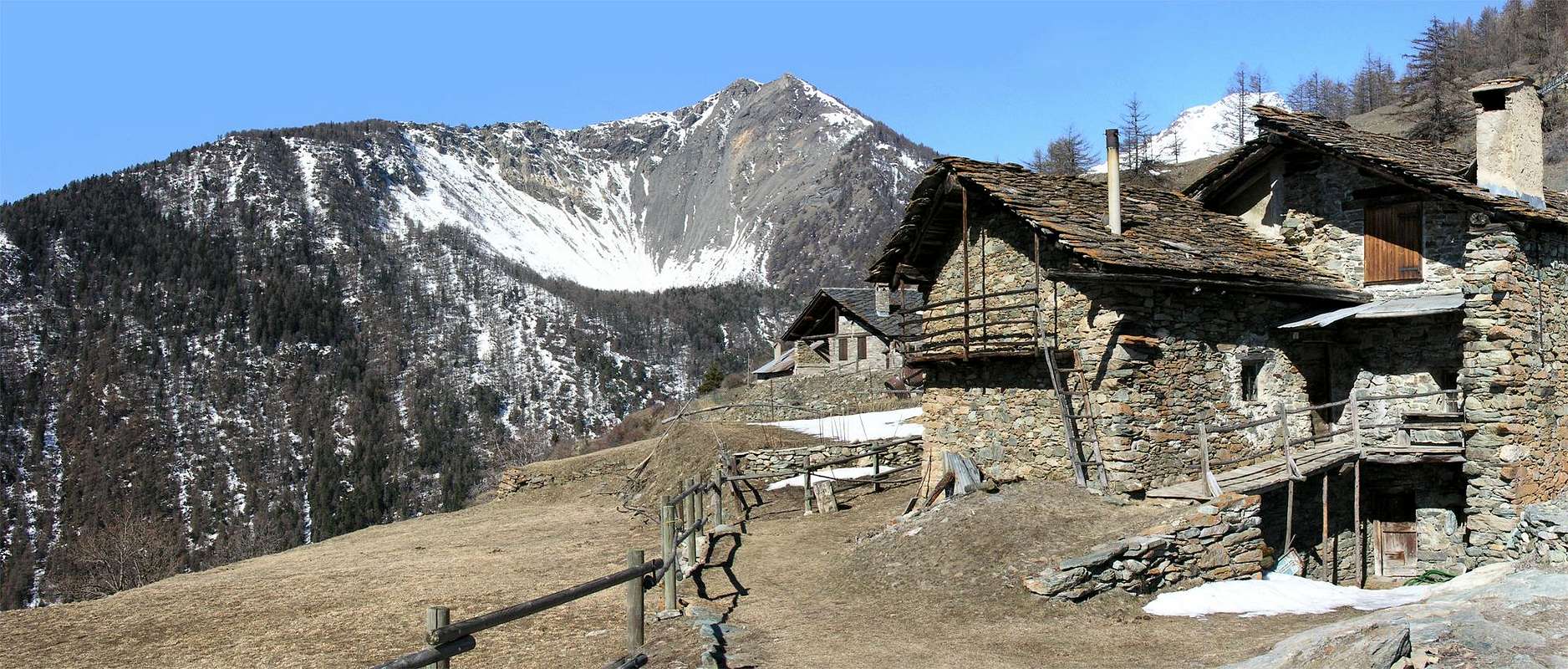
Liconi-Planaval Walloon (Excursion to Liconi Lake and Head 2555m, 2929m; 3h'30-4h'45; Ski-mountaieering to Aiguille d'Artanavaz 3071m; 4h'15 and Hike to Serena Hill 2547m; 2h'15) from Morge or Planaval. From this point and until Aosta we have a series of small walloons (
Vertosan, Verrogne, Vetan, Chiusella) that offer easy Hikes, Climbing, Ski-Mountaineering or by Snowshoe or simple and quiet Stroll to Court de Bard, Punta Felita, Aouillette, Punta Leissè, Monte Rosso, Mont Fallère, Becca France, Met and Chaligne Points
(2261m, 2618m, 2771m, 2943, 3061m, 2312m, 2553m, 2608m; at an average of 2h'00/3h'00) from various starts by the Villagges of Challancin, Vetan, Verrogne, Homené-Combelin and Thouraz. In this little village took place in the early morning of July 6th, 1564 the landslide from the Southeast Face Becca France, which killed all its 600 inhabitants; it can be seen from the promontory of the new Thora. This was a very important center in the
"Ancient Via delle Alpi", which connected Venice with Amsterdam; were carried out four major European Exhibitions, including the very important one of the
"Fair of the Seeds". The nearby Tsa de Met (
2261m; nice walk over Aosta in 2h'30 from Thouraz) has its own particular story: it seems that, at the beginnings of the past Century, the lightning came from a small window of time in the barn with characteristic stone has killed 50 cows on 100 with its sinusoidal shape. A yes and a no, passing alternately under the belly and on the back of the next, hence the name seems to derive Tza Ligne or Lightning Alp. A story that explains the frequency of severe thunderstorms, due to the nearby Lakes Fallère, Morto (
Dead; 2415m, 2638m, beautiful Walkings from Thouraz or Vetan in 1h'30-2h'00), under the M. Fallère
(3061m).
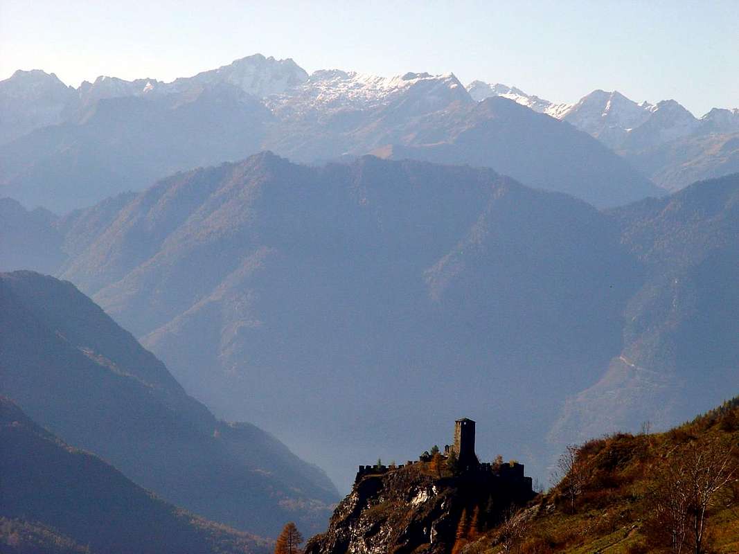
![]() "From New Thouraz or Ancient Thora to landslide on SE Face of Becca France",
"From New Thouraz or Ancient Thora to landslide on SE Face of Becca France",
by emilius
The great
Valley of the Gran San Bernardo offers everything divides into three main areas:
Merdeux-Malatrà-St. Bernard/By Basin-Ollomont/Valpelline. In the first long or short Trips to the hills
(Malatrà 2928m; 4h'00 Bosses; St. Rhémy 2540m), the second beautiful Alpine Skiing
(Aiguille de Leisache 3015m; Pain de Sucre 2900m; Mont Fourchon 2902m; Hill and Lakes Fenêtre 2698m; average 1h'45 from Praz de Farcoz or Montagna Baou 2223m, 2356m on State Road n° 27) and a small
Via Ferrata from Petite Chenalette to Drône
(2664m, 2949m; 1h'40), St. Bernard Lake. Otherwise classic Excursion from Bosses Fractions to the Tête Crevacol
(2610 m; 3h'15). Also
"mystically" by snowshoes from St. Rhémy to Hill of Great St. Bernard
(2469m; Ancient Canons Hospice and famous dogs; 3h'15/4h'15). Also at the beginning of this part of the valley to Aosta the
"Via Francigena", passing through Gignod
(994m), with a nice walk through the woods, reach the town of Etroubles
(1280m). On the other side instead of from the San Bernardo drops the
"Napoleonic Route" of the 1800s for the
"Campaigns of Italy's by the Big Corsican". From Etroubles you can climb the
Menouve/Molline Walloon to get to Hannibal Pass
(2992m), where is was found in 1901 by a spear Cibrario of
22 centimetres a valid witness to the passage of the Carthaginian General with elephants across the Alps in the
"Punic Wars". The himself, to go down against Rome, he had shed his Army through all the steps near the Great. Magnificent views of the walls of the Velan and the giant Valsorey and Grafeneire Combins. To go from this lonely walloon
(Walk from Etruoubles-Prailles Dessous 1600m to 2415m Molline new Bivouac; 3h'00) to the next
Basin By await four more interesting routes:
1)- a short walk from St.-Oyen
(1373m) in Plan Puitz
(2127 m; 1h'45) reaching the
"Way of Napoleon";
2)-; Tour Snowshoes from Eternon-Essanaz
(1645m, 1820m) at Mount Paglietta
(2476 m; 3h'30). Then, more to the East,
3)- by Allein-Orgières
(1253m, 1950m) Hiking or Ski-Mountaineering to Mont Saron
(+; 2681m; from 3h'00 to a 4h'00) and finally and already within the Conca
4)- Walk to the Letey Shelter
(2430m; 1h'20) or to overhanging Champillon Hill, can also be reached by
Menouve Walloon or Menovy (2709 m; 1h'10; great view over Mont Blanc and Grand Combin), as well as Ski-Mountaineering nice Trip.
![]() "Walking from Drone & above Fenetre Hill with Great St. Bernard Dog",
"Walking from Drone & above Fenetre Hill with Great St. Bernard Dog",
by Osw
In the last or
Valpelline, Bivouacs and refuges, easy climb to Tête Blanche de By
(3413m; 1h'30 from Refuge Amiante-Chiarella 2979m; 4h'00) and Mont Avril
(3347m; 1h'30 by Fenêtre Durand 2797m 3h'30), with splendid Excursion to the Lakes Baseya, Leitou, Incliousa e Cornet
(2513m, 2538m, 2418m, 2335m), starting always from Glacier Village
(1549m), under the jagged mountain that reaches from Mont Gelé to Morion's Group. From Ollomont-Cognen
(1536m) Walking the Berrio Dèsott, Damon and the Tsa de Berrio Pastures
(1720m, 1932m, 2165m; 1h'45), under the West Wall of Monte Berrio, or continuing, Excursion to Cormet Col
(2354m; 0h'45), Cormet and over Lakes, to the Nino Regondi Bivouac
(2599m; 2h'30), under the Mont Clapier and towards the Mont Gelé. From Alpe Berrio Damon
"rustic" Hike to Breuson or Brison Pass
(2194m; 1h'00), just above the Valpelline Municipality.
Valpelline Valley is wild and mysterious: the North side is aimed at Explorers of Klondike with hocks of steel; recommend the shelter at the beginning of Crête Sèche
(2389m; 2h'00) and Prarayer
(2005m; 1h'00) in the bottom of the big Dam Places Moulin. Opposite the one facing the South is formed by
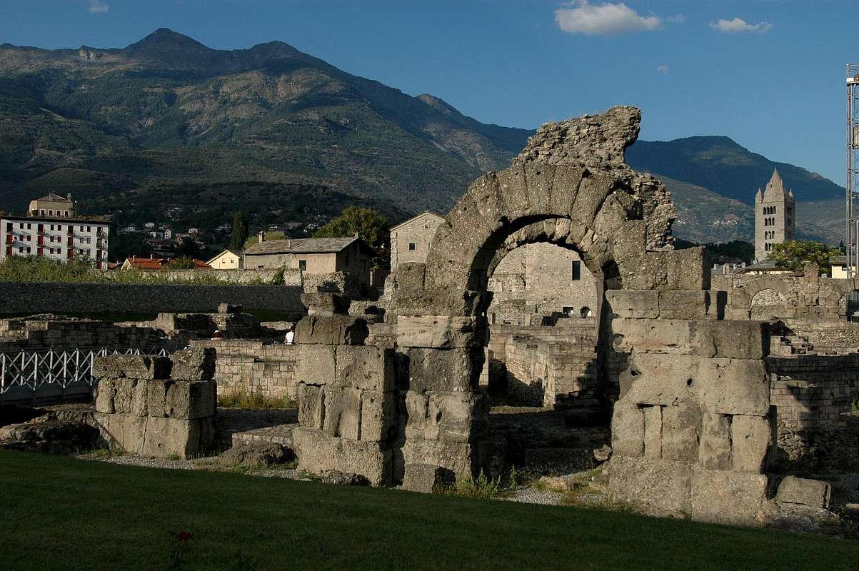
"rough" and wooded walloons that stretch to the North on the Buthier Torrent: is place for drovers high altitude and sincerely do not send anyone there. Returning to Aosta, is obliged to go from Blavy
(1475m) to easy Becca of Viou
(2856m; 3h'30); Summit dominated by the Town as if you were the
Roman Emperor Gaius Octavian Caesar Augustus (to Augusta).
![]() "From here you dominated the Roman Urbs, as did Gaius Octavian Caesar Augustus",
"From here you dominated the Roman Urbs, as did Gaius Octavian Caesar Augustus",
by om
Basin Sénevé brings you back to reality by bringing you into another world. Let us confine ourselves to the beautiful walk from Trois Villes to the Croix of Fana
(2212 m; 3h'00).
While the next
Valley of Saint Barthélemy invites us, after a visit to the Lignan Astronomical Observatory, on the path
(Salvé or Chaleby Hills 2568m, 2683m, 1h'00), to the Sanctuary and Refuge of Cuney
(2656m; 4h'00) or from Praz
(1737m) on walley floor towards the Becca Luseney to the Praterrier last Alp
(2057m: 1h'50) and to Reboulaz Bivouac, neighbor the Luseney Loch
(2590m; 1h'10 m). From this Excursions towards Luseney, Livournea Passes and Fenêtre de Cian
(3162m, 2858m, 2734m; 2h'15-1h'00).
The solar
Basin Verrayes/St. Denis gives you beautiful spring outings to Becca d'Aver
(2469m; 3h'00) and the nearby Cima di Longhede
(2416m; 3h'30), even by snowshoes.
After salt
Valley Marmore or Valtournanche, which ends with the Matterhorn. Do you want to go there? Never mind, I have already climbed in 1865, things old! Instead, we go to see him from Motta di Pleté
(3018m), and if we want to continue to Grand Sometta
(3166m; 0h'45) and the underlying Cime Bianche Southern Hill
(2894m; 0h'40). Also from Valtournanche
(1581m) go to Cignana Loch
(2158 m; 1h'45). But the
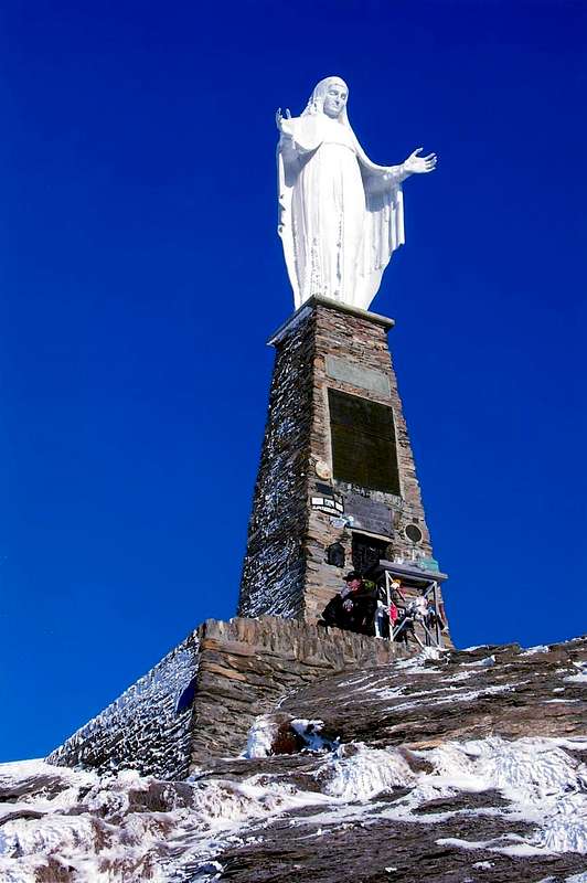
"Great Exploit" waiting for us down there: Mount Zerbion
(2720m; high statue of the Virgin Mary); the climb by Promiod
(1505m; Camping Dalai Lama) or Nissod Villages
(1371m; better; 4h'00), above Châtillon/St. Vincent Municipalities. This last
(575m; spa town famous for its Casinò) is at the foot of the Tête Comagna
(2106m; 1h'15; Roman gold mine on the side of Ayas), short and easy Hike among the Hills of Joux and Zuccore or Tzècore.
From this
(1607m) off to Arbaz in
Val Ayas to visit the village with ancient
"rascards" in stone-wood. From Verrès, after two beautiful
"Medieval Walks" to famous Castle
(550m; 0h'30) and to Saint-Gilles Collegiate Church
(700 m; 1h'00), this valley climbs reaching Brusson
(1332m; gold mines neighbor Fenilliettaz Village, closed as hazardous).
To the right in
Vallon Estoul Walk to Ranzola Hill
(2170m; 1h'00) and Excursions in South to the neighbor Punta della Regina
(+; 2387m; 0h'30), North to Mont Ciosé
(+; 2647m; 1h'30). Also easy Ascent of Bussola Horn
(+; 3023m; 4h'30), among numerous Lakes Brenguez, Palasinaz, Freide
(2529m, 2632m; 3h'00) or Estoul
(2451m; 1h'30).
Further down South, in the
Vallon of Frudière, Walk to Graines Castle
(1365m; 0h'30) and Excursion to the Lakes, Pass Frudiera
(2035m, 2230m, 2265m; 2h'45). From Champoluc
(1586m) Exccursion to Perrin or Pinter Lakes and Pass
(2633m, 2689m, 2776m; 3h'30), below Testa Grigia. From St-Jacques
(1697m), in the bottom of the valley, short Walk to Lake Blue
(2211m; 1h'00), where already breathe the cold air of the glaciers of Castor/Lyskamm. Brrrr, it's cold! Let stand and limit yourself to contemplation.
From Pont St. Martin salt the last
Lys Valley or Gressoney. Arrive in Gressoney St. Jean and La Trinité Communes
(1385m, 1637m), without achieving anything. opposite is true: you can make small walks to the Savoy Castle, the Barons Beck Peckoz Hunting House and go to Lake Gabiet
(2363m; 2h'00) and from there to the Corno del Camoscio
(3026m; 1h'00). For East the watershed descends along the border of the Piedmont to the Colma of Mombarone
(2300m; 3h'30; shelter on Summit) above Carema
(379m).
But remember that here you are outside your home ...
![]() "Graines Castle at the beginning of Frudière Vallon into the Val d'Ayas",
"Graines Castle at the beginning of Frudière Vallon into the Val d'Ayas",
by emilius
Settore Nord
Passando sull'altro lato della Valle da Courmayeur andiam sù per la
Val Veny; lasciata in basso la piccola Chiesa di "Notre Dame de la Guérison"
(1379 m), raggiungiamo La Visaille (
1660 m; deviazione per il Rifugio Franco Monzino 2561m; 2h'30; Escursione impegnativa con Via Attrezzata tramite catene su d'una fascia rocciosa appena sotto il medesimo) ed i Laghi Combal e du Miage (
1965 m, 2020 m; Passeggiata), il Rifugio Elisabetta ed il Col de la Seigne (
2197 m, 2514 m; Escursione; 4h'00-5h'00) da Courmayeur. Da qui s'inizia la Catena del Monte Bianco e noi l'evitiamo in toto fino in fondo alla
Val Ferret con i suoi due colli e Tête
(2490 m, 2537 m, 2714 m; 1h'30/1h'45/2h'10) da Pré de Bar. Questo é un
"Sacrario Alpinistico" ed a noi non interessa. Se vogliamo ammirarlo andiamo ai Rifugi Elena, Bonatti e Bertone
(2062 m, 2025m, 1946 m; mediamente dalle 2h'00 alle 3h'00) sullo spartiacque fino al Mont de la Saxe (
2348 m; bella Palestra di Roccia alla base con esibizione delle Guide Alpine nel giorno di Ferragosto); da questi la catena si distende dall'Aiguille des Glaciers fino al Mont Dolent, scavalcando le Grandes Jorasses. Non é cosa per Camminatori od Escursionisti. Girando l'angolo andiamo in
Val Sapin ed al suo colle (
2435 m; antica miniera romana di oro detta "Trou des Romains" più ad Ovest dell'Alpe Tsapy 1635 m) ed ammiriamo la vecchia e sgretolata Grande Rochère, come nel successivo
Vallone di Liconi-Planaval (Escursione al Lago e Testa Liconi 2555 m, 2929 m; 3h'30-4h'45; Sci-Alpinistica all'Aiguille d'Artanavaz 3071 m; 4h'15 ed Escursione al Col Serena 2547 m; 2h'15) da Morge o Planaval. Da questo punto e fino ad Aosta abbiamo una serie di valloncelli (
Vertosan, Verrogne, Vetan, Chiusella) che offron facili Escursioni, gite Sci-Alpinistiche o con Racchette da neve o semplici e tranquille Passaggiate alla Court de Bard, Punta Felita, Aouillette, Punta Leissé, Monte Rosso, Fallère, Becca France, Punte di Met e Chaligne (
2261 m, 2623 m, 2618 m, 2771m, 2943, 3061m, 2312m, 2553 m, 2608 m; in media 2h'00/3h'00 con varie partenze dai Villaggi di Challancin, Vetan, Verrogne, Homené-Combelin e Thouraz). In questo piccolo villaggio si verificò al primo mattino del 6 Luglio 1564 la grande frana della Parete Sudest della Becca France, che uccise tutti i suoi 600 abitanti; la si può osservare dal promontorio della nuova Thora. Questa era un centro molto importante nell'
"Antica Via delle Alpi", collegante le Venezie ad Amsterdam; s'effettuavano quattro grandi Fiere Europee, tra le quali molto importante quella delle
"Sementi". Anche la vicina Tsa de Met (
2261 m; bella Passeggiata sopra la Città di Aosta in 2h'30 dal bivio dopo Thouraz) possiede una sua storia particolare: par che, agli inizi del passato Secolo, il fulmine entrato da una finestrella della caratteristica stalla con volta in pietra abbia ucciso 50 mucche su 100 con andamento sinusoidale. Una sì ed una no, passando alternativamente sotto la pancia e sopra la schiena della successiva, donde sembra derivi il toponimo Tza Ligne od Alpeggio del Fulmine. Storia che par spiegar la frequenza di forti temporali, dovuta molto probabilmente alla vicinanza dei Laghi Fallère e Morto (
2415 m, 2638 m, belle Passeggiate dai Villaggi di Thouraz oppure Vetan in 1h'30-2h'00), sotto al Mont Fallère
(3061 m).
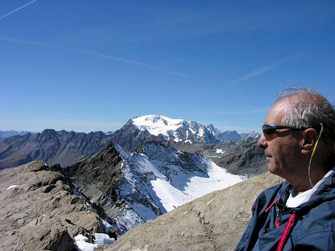
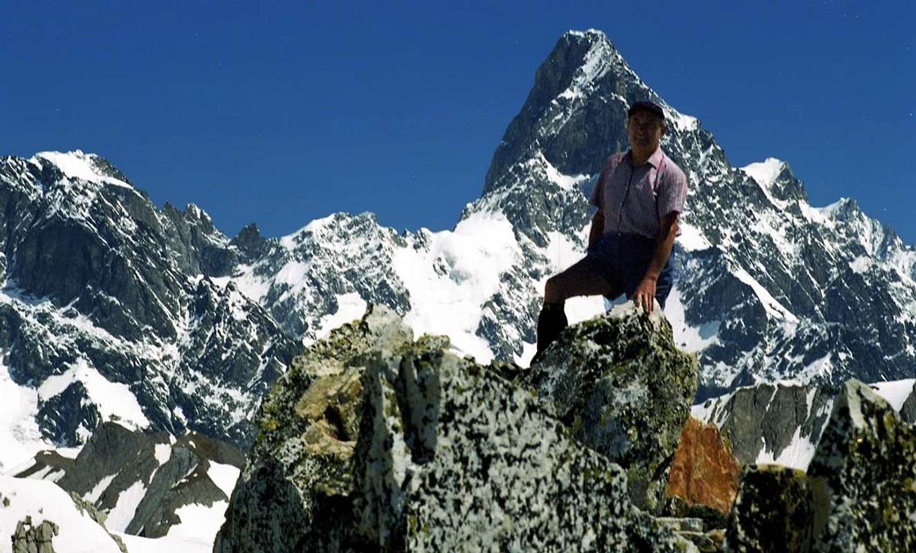
![]() "Emilius from Pain de Sucre Summit to Grandes Jorasses",
"Emilius from Pain de Sucre Summit to Grandes Jorasses",
by Osw
La
Valle del Gran San Bernardo ostenta di tutto dividendosi in tre grandi aree:
Merdeux-Malatrà-San Bernardo/Conca di By-Ollomont/Valpelline. Nella prima lunghe o corte Escursioni ai colli (
Malatrà 2928 m; 4h'00 da Bosses; St. Rhémy 2540 m; 1h'15), nella seconda belle Sci-Alpinistiche (
Aig. de Leisache 3015 m; Pain de Sucre 2900 m; Mont Fourchon 2902 m; Colle e Laghi Fenêtre 2698 m; mediamente 1h'45 dalla Statale n° 27) ed una piccola
Via Ferrata dalla Petite Chenalette
(2664 m; 0h'30 dal Grande) al Drône
(2949 m; 1h'40), passando per la Grande. Altrimenti classica Escursione dalle varie Frazioni di Bosses a Tête Crevacol
(2610 m; 3h'15). Oppure
"misticamente" con racchette da neve da St. Rhémy
(1632 m) al Colle del Gran San Bernardo (
2469 m; Antico Ospizio dei Canonici con vicina "Morgue" ed esposizione dei famosi cani; 3h'15/4h'15). Inoltre all'inizio di questa valle parte da Aosta l'antica
"Via Francigena" che, passando per Gignod
(994 m), con una bella camminata tra i boschi, raggiunge il Comune di Etroubles
1280 m). Sul lato opposto invece dal San Bernardo scende la "Via Napoleonica" del 1800 per le "Campagne d'Italia del grande Corso". Da Etroubles si può salire il Vallone di Menouve/Molline per arrivare al Colle di Annibale (2992 m), ove é stata ritrovata nel 1901 dal Cibrario una lancia di 22 centimetri, a valida testimonianza del passaggio del Generale Cartaginese con gli elefanti attraverso le Alpi nelle "Guerre Puniche". Lo stesso, per scendere contro Roma, aveva sparso la sua Armata attraverso tutti i passi vicini al Grande, dai Barasson ai Menouve e più ad Occidente Fenêtre e Ferret. Per passare da questo solitario vallone (Passeggiata da Etruoubles-Prailles Dessous 1600 m al nuovo Bivacco di Molline 2415 m; 3h'00) alla successiva Conca di By vi attendono ancora quattro itinerari interessanti: 1)- breve Passeggiata da St.-Oyen (1373 m) a Plan Puitz (2127 m; 1h'45) raggiungendo la "Via di Napoleone"; 2)-; Gita in Racchette da neve da Eternon-Essanaz (1645m, 1820 m) al Mont Morteret e Monte Paglietta (2307 m, 2476 m; 3h'30). Poi, più ad Oriente, 3)- da Allein-Orgières (1253 m, 1950m) Escursione o Sci-Alpinistica al Mont Saron (+; 2681 m; da 3h'00 a 4h'00) ed infine e già dentro la Conca 4)- Passeggiata dal grande parcheggio presso Notre Dame de la Neige-Champillon (2072 m, 2050 m) al Rifugio/Alpe Letey (2430 m; 1h'20) o al soprastante Col Champillon, raggiungibile anche dal Vallone di Menouve o Menovy (2709 m; 1h'10; grande panorama sul Bianco e sul Grand Combin), anche come bella gita Sci-Alpinistica.
![]()
"Velan West Face from Testa Grisa just above Hannibal Pass",
by Osw
Nell'ultima o di Valpelline, Bivacchi e Rifugi, facili salite a Tête Blanche de By (3413 m; 1h'30 dal Rifugio Amiante-Chiarella 2979 m; 4h'00) e Mont Avril (3347 m; 1h'30 dalla Fenêtre Durand 2797 m; 3h'30), con splendida Escursione ai Laghi Baseya, Leitou, Incliousa e Cornet (2513 m, 2538 m, 2418 m, 2335 m), sempre partendo da Glacier (1549 m), sotto la frastagliata catena che dal Mont Gelé raggiunge i Morion. Da Ollomont-Cognen (1536 m) Passeggiate alle Alpi Berrio Dèsott, Damon ed alla Tsa de Berrio (1720 m, 1932 m, 2165 m; 1h'45), sotto il Monte Berrio oppure, continuando, Escursione al Col Cormet (2354 m;), laghi, fino al Bivacco Nino Regondi (2599 m; 2h'30), sotto il Mont Clapier e verso il Gelé. Dall'Alpe Berrio Damon "rustica" Escursione al Col Breuson o Brison (2194 m; 1h'00), sopra il Comune di Valpelline. La Valpelline é selvaggia e misteriosa: il lato Settentrionale é rivolto ad Esploratori del Klondike con garretti d'acciaio; consigliamo i Rifugi di Crête Sèche all'inizio (2389 m; 2h'00) e di Prarayer (2005 m; 1h'00) in fondo alla grande Diga di Places Moulin. L'opposto rivolto a Sud é formato da "selvatici" e boschivi valloni che si distendono verso Nord sul Torrente Buthier: é posto per mandriani d'alta quota e sinceramente non mandiam colà nessuno. Tornando ad Aosta, é fatto obbligo d'andar da Blavy alla facile Becca di Viou (2856 m; 3h'30); dalla Sommità dominate la città, come foste l'Imperatore Romano Caio Ottaviano Cesare Augusto (Augusta Praetoria Salassorum donde Aosta). Oppure dal colle in cresta al vicino Mont Mary (2815 m; 0h'25).
![]()
"Mont Mary above the lonely & wild Senevé Basin from Croix de Fana",
by emilius
Ma subito dopo la Conca di Senevé vi fa tornar alla realtà portandovi in altro mondo. Basta la bella, panoramica passeggiata da Trois Villes alla Croix de Fana (2212 m; 3h'00).
La successiva Valle di San Barthélemy c'invita, dopo la visita a Lignan dell'Osservatorio Astronomico, a percorrere il sentiero (Colli Salvé o Chaleby, 2568 m, 2683m, 1h'00), per il Santuario e Rifugio del Cuney (2656 m; 4h'00) o da Praz (1737 m) quello sul fondovalle verso la Becca di Luseney fino all'Alpe di Praterrier (2057 m; 1h'50) ed al Bivacco Reboulaz, presso il Lago Luseney (2590 m; 1h'10 m). Da questo Escursioni ai Colli di Luseney, Livournea ed alla Fenêtre de Cian (3162m, 2858 m, 2734 m; 2h'15-1h'00).
Il solare Bacino di Verrayes/St. Denis vi concede gite primaverili alla Becca d'Aver (2469 m; 3h'00) ed alla vicina Cima di Longhede (2416 m; 3h'30), pur con racchette da neve.
Dopo sale la Valle del Marmore o Valtournanche, che termina col Cervino. Volete andare lì? Lasciate stare, l'han già scalato nel 1865. Cose vecchie! Noi invece ci rechiam vederlo dalla Motta di Pleté (3018 m) e, se abbiam voglia, continuiamo verso la Gran Sometta (3166 m; 0h'45) ed il sottostante Colle Sud di Cime Bianche (2894 m; 0h'40). Oppure da Valtournanche (1581 m) andiamo al Lago di Cignana (2158 m; 1h'45). Ma la "Grande Impresa" ci aspetta là in fondo: lo Zerbion (2720 m; grande statua della Madonna); saliamo da Promiod (1505 m; Camping del Dalai Lama), oppure da Nissod (1371 m; meglio; 4h'00), sopra Châtillon/St. Vincent. Quest'ultima (575 m; cittadina termale famosa per il Casinò) é sita ai piedi della Testa di Comagna (2106 m; 1h'15; miniera d'oro romana sul versante d'Ayas), facile Escursione tra i Colli di Joux e Zuccore.
![]()
Lac Bleu at the end of Verra's Tableland & under Lyskamms Refuges,
by Camillo Roberto Ferronato
Dallo Tzècore (1607 m) scendete ad Arbaz in Val di Ayas a visitar il villaggio con antichi "rascards" in pietra e legno. Da Verrès, dopo due belle "Passeggiate Medievali" al famoso Castello (550 m; 0h'30) ed alla Collegiata di Saint-Gilles (700 m; 1h'00), salite la valle raggiungendo Brusson (1332 m; miniere d'oro a Fenilliettaz, chiuse perché pericolose).
A destra Vallone d'Estoul con Passeggiata al Colle della Ranzola (2170 m; 1h'00); a Sud Escursioni alla Punta della Regina (+; 2387 m; 0h'30), a Nord al Mont Ciosé (+; 2647 m; 1h'30). Oppure facile Ascensione del Corno Bussola (+; 3023 m; 4h'30), tra i Laghi di Brenguez, Palasinaz e Freide (2529 m, 2632 m; 3h'00) o d'Estoul (2451 m; 1h'30).
Più in basso a Sud, nel Vallone di Frudière, Passeggiata al Castello di Graines (1313 m; 0h'30) ed Escursione ai Laghi e Colle di Frudiera (2035 m, 2230 m; 2265 m; 2h'45). Da Champoluc (1586 m) Escursione ai Laghi e Colle Pinter (2689 m, 2776 m; 3h'30) sotto la Testa Grigia o al Lago Perrin (2633 m; 3h'15). Da St.-Jacques (1697 m), in fondo alla valle, facile Passeggiata al Lac Bleu (2211 m; 1h'00), ove già respirate l'aria fredda dei ghiacciai del Lyskamm. Brrrr, che freddo! Lasciate stare e limitatevi alla contemplazione.
Da Pont St. Martin risale l'ultima Valle del Lys o Gressoney. Arrivate a Gressoney St.-Jean e La Trinité (1385m; 1367 m), senza aver combinato niente. Non é vero: potete fare piccole passeggiate al Castello dei Savoia (1438 m; 0h'35), alla Casa di Caccia dei Baroni Beck Peckoz ed andare al Lago del Gabiet (2363 m; 2h'00) e da lì al Corno del Camoscio (3026 m; 1h'00). Ad Est scende serpeggiando il lungo spartiacque col Piemonte fino alla Colma di Mombarone (2300 m; 3h'30; rifugio in Cima) sul Comune di Carema (379 m).
Ricordatevi però che qui siete già fuor di vostra casa ...
![]()
"To Testa of Comagna, between Emarese-Erésaz/Brusson Communes",
by emilius
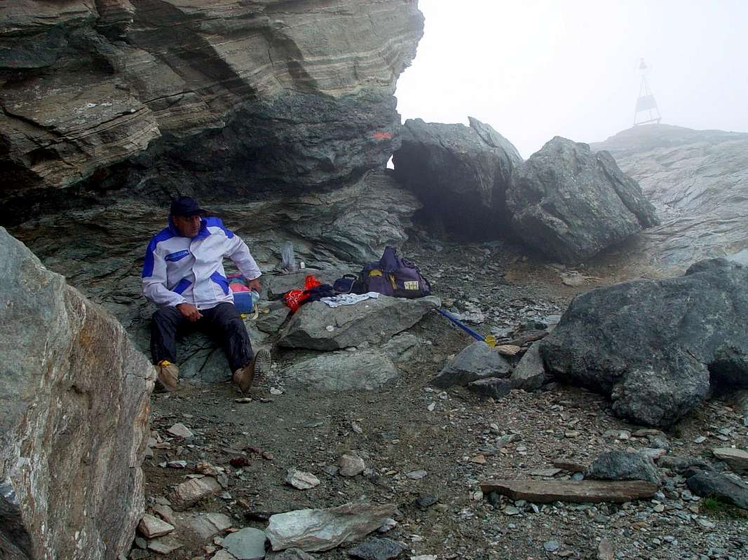
Conclusions & Recommendations respect of Tours
![]()
"A man destined to die frozen",
by Ilario Antonio Garzotto
Certainly for a route described five other we have forgotten, but it was a deliberate choice in order not to make too much work and its reading. But you can not say and do. This is only a track to introduce you to beautiful Walking and Hiking in the entire Valley of Aosta, then leaving the option to follow or diversify the various routes. For example, we purposely neglected descriptions to numerous shelters and camps, for visiting the most important valleys are already abundant reports, usually with inscriptions in black on yellow panels and circular (local routes), rectangular (inter valleys) or triangular (Aosta Valley High Routes n° 1 and 2), the via with relative travel time. It thus leaves to the imagination and the desire to discover everyone the right to choose their own Way.
But sometimes we want to give the recommendation and advice:
1)- :
always lots of good time; so you have more time to resolve any problems that may arise during the excursion (move away from at night).
2)- : Prepare ye
the backpack the night before; you will be sure, contrary agitation in the morning, not to forget anything and you'll be more prepared and calm at the start.
3)- : Inquire ever in the area, if possible, the route to be taken and on the conditions; in any case
always have a Map and, better, even a Compass.
4)- : check the equipment, keeping in mind that even in the summer
the Weather can change suddenly: better to have more a sweater rather than less.
5)- : try to always have a
cap, gloves and goggles are always needed; you do not need to go on a glacier to receive damages from the rays of the hot summer sun.
6)- : clothing anti rain
(kay-way or anoraks) are needed, because the storms are unpredictable, even in spite of the Weather, and the wind is always annoying.
7)- : still consult the
Meteo, whereas for the Aosta Valley is the most reliable one on the Swiss Channel; nevertheless
"the effect of the Alps" can play tricks.
8)- : always stay
on marked trails without looking for shortcuts or improvised variations; the same ruin themselves and can lead to unknown places and dangerous.
9)- : if You find to be in a state of insecurity
go back; better to carry a cell phone and call for help early rather than go out one night.
10) -: if faced pathways also partially equipped, search you always have
a lanyard and 2 or 3 carabiners. There are many avoidable accidents that occur, even on the trails.
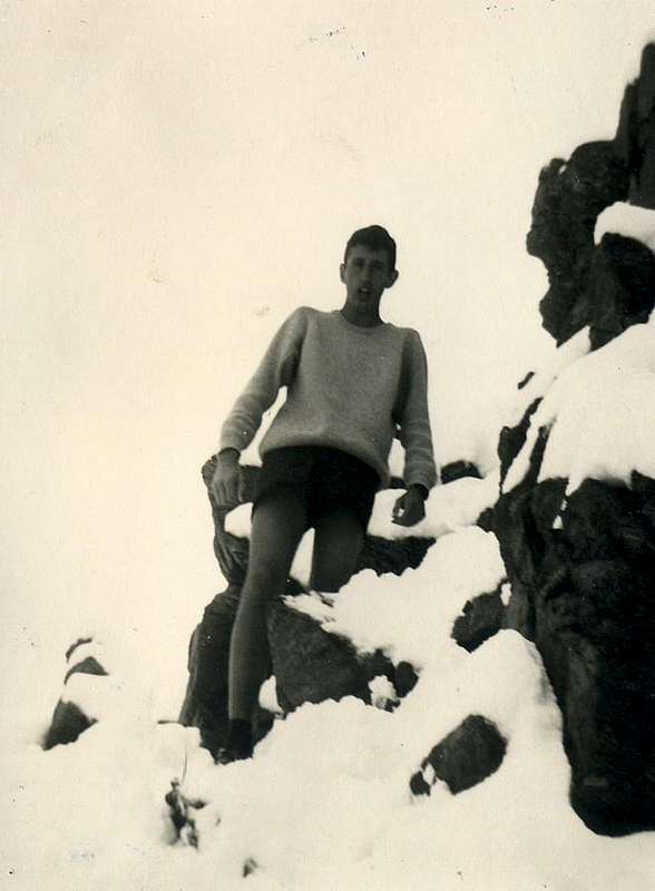
11)- : do not like this gentleman over here and below,
that preaches evil good and scratching. He has always gone well but you never know.
The female of cat goes so much at the lard, that it leaves its handle ...
![]() " A Gypsy returning in Rainstorm from Mount Roisetta",
" A Gypsy returning in Rainstorm from Mount Roisetta",
by emilius
Sicuramente per un itinerario descritto altri cinque ne abbiam dimenticati, ma s'è trattato d'una scelta voluta onde non appesantire troppo il lavoro e la relativa lettura. Ma non si può dir e far sempre ognicosa. Questa rimane esclusivamente una traccia per introdurrVi a belle Passeggiate ed Escursioni in Valle di Aosta, lasciando poi la facoltà di seguire o diversificare i percorsi. Ad esempio abbiamo appositamente trascurato le descrizioni verso rifugi e bivacchi, poiché visitando le valli più importanti si trovan già abbondanti segnalazioni, in genere con iscrizioni in nero su pannelli gialli e circolari (percorsi locali), rettangolari (inter vallivi) o triangolari (Alte Vie), dell'itinerario con relativo tempo di percorrenza. Si lascia quindi alla fantasia ed alla voglia di scoperta di ognuno la facoltà di scegliere la propria Via.
Ma qualche raccomandazione e consiglio la vogliam dare:
1)- :
partite sempre di buon'ora; così avrete più tempo per risolvere eventuali inconvenienti che possono insorgere durante la escursione (allontanatevi dalle ore notturne).
2)- : preparate
lo zaino la sera precedente alla gita; sarete sicuri, contrariamente all'agitazione del mattino, di non dimenticar nulla e sarete più pronti e sereni alla partenza.
3)- : informatevi sempre sul territorio, qualora possibile, del percorso da compiere e sulle condizioni; in ogni caso abbiate
sempre una Mappa e, meglio, anche una Bussola.
4)- : controllate l'equipaggiamento, tenendo bene a mente che anche nella bella stagione
il tempo può repentinamente cambiare: meglio un maglione in più che in meno.
5)- : all'uopo
berretto, guanti ed occhiali sono sempre indispensabili; non c'é bisogno d'andar su d'un ghiacciaio per ricevere danni da parte dei raggi del caldo sol estivo.
6)- : indumenti anti pioggia
(kay-way, giacche a vento) son necessari, perché i temporali son imprevedibili, anche a dispetto del Meteo, ed il vento é sempre fastidioso.
7)- : consultare sempre la
Meteo, considerando che per la Valle di Aosta la più affidabile risulta quella svizzera; ciononostante
"l'effetto Alpi" possa giocar brutti scherzi.
8)- : restate sempre sui
sentieri segnalati senza cercar scorciatoie o varianti improvvisate; le stesse li rovinano e posson condurVi in pericolosi luoghi sconosciuti.
9)- : accorgendovi d'esser insicuri
tornate indietro; meglio avere con sé un cellulare e chieder soccorso tempestivo piuttosto che passar una notte all'addiaccio.
10)- : se affrontate vie anche parzialmente attrezzate, curateVi d'aver sempre
un cordino e 2/3 moschettoni. Molti gli incidenti evitabili, anche sui sentieri.
11)- : non fate come sto signor qua sopra e sotto, che
predica ben e poi non fa che razzolar mal. Gli é sempre andata ben ma non si sà mai.
Tanto và la Gatta al lardo che ci lascia lo zampino ...
![]() "A pinguine transported here from Antarctica",
"A pinguine transported here from Antarctica",
by Ilario Antonio Garzotto
Comments
No comments posted yet.