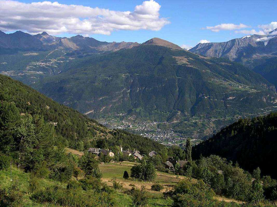
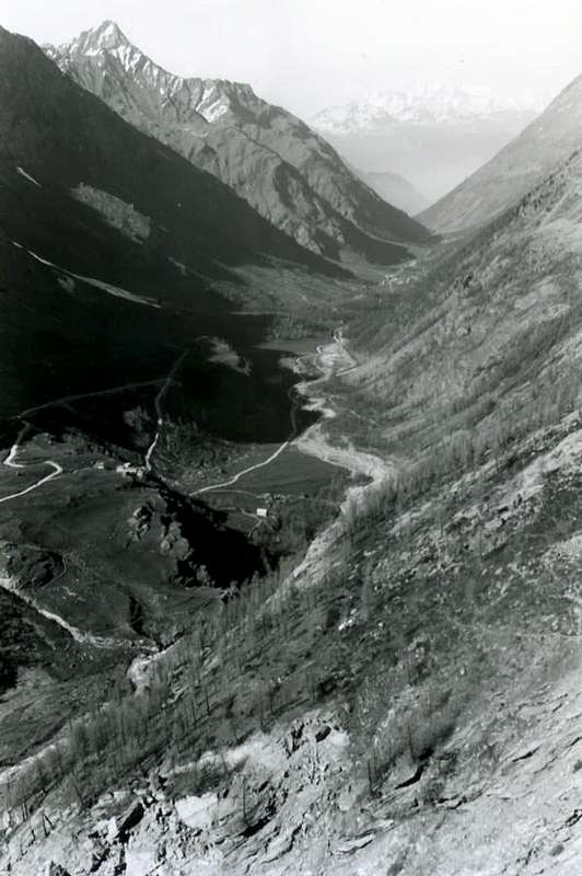
L'Area integralmente comprende 12/13 Comuni; può essere visitata con percorso di 2 giornate, facendo notare che per "Adret" s'intende la zona più esposta al sole e viceversa. Il rientro ad Aosta avviene lungo il lato orografico ed idrografico sinistro della Dora Baltea, oppure, dopo aver attraversato la medesima sul ponte verso Aymavilles, sullo opposto detto "Envers" anticipando parte della tappa del giorno dopo ma con percorso al contrario, cioé da Ovest verso Est.
o Comuni di Sarre, St. Pierre, St. Nicolas, Aymavilles ed attraversando parzialmente Villeneuve):
nella prima tappa possiamo consigliare di partire dalla Città di Aosta ad Ovest con la Strada Statale n° 26 verso il Monte Bianco ma, giunti presso il Comune di Sarre-Chesallet, abbandonarla e salire verso la collina con la Strada Regionale raggiungente la soprastante
. Salendo tra numerosi piccoli villaggi sparsi nelle medio-bassa collina fino a raggiungere il bivio di Callod
). Dopo una breve visita, si ritorna ad Ovest e poi Nordovest raggiungendo l'
nonché ai piedi della grande frana dalla Becca France del 6 Luglio 1564. Qui conviene fare una sosta, soprattutto se avete fatto la salita a piedi con il sentiero
. Da questo punto si scavalca con la strada in asfalto il Torrent de Clusellaz e, tramite due tornanti seguiti da un lungo diagonale a Sud-sudovest, si raggiunge il Villaggio di Bellun (
; 0h'30, oppure in auto). Una
consiste nel, da Ville sur Sarre, continuare verso Nordest e poi ovest e, passando dai Villaggi di Moulin, Mondache, Salet e Chavalançon, raggiungere
, oppure in auto).
Ritornando a Bellun, un lungo diagonale decisamente ad Occidente conduce ai piccoli Villaggi di Homené Dessous e Dessus (
), dove arriva anche un'altra strada asfaltata da St. Pierre-Château presso il Comune passando dai Villaggi di la Croix (
anche da Sarre con una connessione ad Ovest), Praulin, Torretta, Babelon, Orléans con la soprastante ex Chiesa di
. Due sentieri segnalati
per entrambi). Da Homené, lasciando in alto una breve deviazione per il Villaggio di Combelin (
; fontana) alle pendici Meridionali della Becca France, si prosegue a Nordovest o con la Strada Regionale oppure tramite il sentiero
) all'ingresso dell'omonimo vallone. Continuando con la strada in asfalto e passando sopra il Torrent de Méod, si raggiunge l'omonimo Villaggio Damon (
, dove ha termine la Strada Regionale. Al ritorno coviene utilizzare ancora un'altra strada: da Vetan si scende di nuovo al Petit Sarriod (1444 m; questo tratto può essere percorso con il sentiero
(0h'15) ma, abbandonata ad Est la Strada Regionale per Méod e Verrogne, si scende verso i Villaggi di Persod (
. Rientrando da questa deviazione sulla Strada Regionale in breve tempo si raggiunge il Villaggio di Lyveroulaz (
), ormai nel Comune di Villeneuve. Da quest due piccoli villaggi esistono due possibilità per raggiungere la Strada Statale sul fondovalle:
da Lyveroulaz continuare verso Est con la Regionale e, passando per i Villaggi di Evian
, presso la Strada Statale n° 26. Tramite la medesima si raggiunge il bivio
ed Aosta.
al di là della Dora Baltea e verso i Comuni di Jovençan, Gressan e Charvensod presso il Pont Suaz, donde ad Aosta. Questa seconda scelta la riserviamo per la seconda tappa partendo dal Comune di Quart.
This complete Area which includes 14 Commons, can be visited with a course of 3 days, noting that "Envers" means the less exposed to the sun and vice versa. On the second day, leaving from the Commons of Quart or Grand Brissogne, it takes the "Envers" through Pollein and then climb to Charvensod up to Pila Basin and, after descending to Gressan, continue towards Jovençan, Aymavilles and Cogne Valley. The third day will be devoted to Savarenche and to Val di Rhêmes.
Day Two the interior of 7/8 also 11/12 Municipalities (Area
"du Sud Envers" or Quart, Gr. Brissogne, Pollein, Charvensod, Gressan, Jovençan, Aymavilles and Cogne also Valsavarenche and Rhêmes Valleys with 5 Commons starting by Villeneuve or Introd, Valsavarenche, Rhêmes St. Georges and Notre Dame):
if the first stage we have not made the return with the opportunity
2)- returning to AymavillesCommon with his
Castle along the
"Via de l'Envers" beyond the Baltea and towards the Municipalities of Jovençan, Gressan and Charvensod at the Pont Suaz Hamlet with stone bridge, whence in Aosta, in this we travel back this way. If instead we have already traveled this route from the bridge of Pont Suaz
(564m), on the outskirts of Aosta, climb directly in Pila Basin. Let's see in detail: from the Municipality of Quart (
546/56m; Church of San Eusebio, "Camping Aosta") to leave the National Road No. 26, crossing the bridge over the Dora Baltea in locality Villefranche of Quart
(557m), immediately to the East; reach a roundabout you leave momentarily the Regional Road along the course of Baltea going instead to the South in the direction of the Municipality of Grand Brissogne (
906/19m, Château de Brissogne; Churches of "Madonna of Oropa", Santa Caterina and S.S. Fabiano Sebastiano). A brief and
"winding" descent through a small road Municipal reports on Regional Road to the Municipality of Pollein, passing the village of les Ayettes
(849m) to those of Chaney, Château and Petit Pollein ((
557m; Church "Marriage of the Virgin"). Continuing to the West, it passes the Villages of Grand Pollein ((
547m; Votive Chapel), Prefieur, Tharençan reaching Pollein Commune (
546m; Church of San Giorgio). A brief digression in the Southwest to reach the Hamlet of Chenaux (
656m; Church of Santa Barbara), at the entrance of the Dard Gorge, while a connecting road to reach, passing over the Torrent de Comboé, those Roulaz and High Félinaz ((
591m; Church of Santa Anna), now in Charvensod.
Neighboring Grand Pollein, Pollein, Chenaux and St. Bénin Commune & Fractions,
by Osw
With short descent on Regional will reach the Fraction of Pian Felina
(565/8m) , above which you will come to Pont-Suaz (
564m; Little Church of "Nostra Signora della Pietà"). From this point, a choice must be made:
A)- or continue, the same street and the same direction along the Dora Baltea, gradually reaching the Municipalities of Gressan, Jovençan, Aymavilles and then goes up in Cogne Valley; or
B)- momentarily abandon this and go back to the Municipality of Charvensod (
610m, Church of Sts Fabian and Sebastian and just above the trail
n° 14L Sanctuary of Santa Colomba 924m;
0h'50/1h'00), below the wide
Basin Pila. In the latter case extends the stage half-day but making the same certainly more
"rich" and suggestive. Continuing from the common to the East you reach the junction
951 metres, where a small deviation with Municipal Road in asphalt leads to the Pastures of Reverier or Rayer
"du Tzat" and Dessous (
1042m; Chapel of Sainte Margaret and Saint Joseph). Returning to the Regional is beyond the small Villages Vagères, Bondine (
1018m; here also from Santa Colomba Sanctuary with the path
n° 14D; 0h'15), Roncogner, Lexeret, Reverier Marendet and Dessus, la Rochette, Saint Salò, Plan de Sérémont (
1382m; Church of San Pantaleone), Peroulaz and Les Fleurs (
1414m;
*** here comes another Regional Road alternative by Gressan, then useful for our descent from Pila). Passing at the next Chacot, Large Cerise, Eaux-Froides, Charémoz (
1662m; Church of "Our Lady of the Snows"; fountain), Rossellin, Mozod, in order to expose, Chacard you reach Pila-Resort (
1803m; Churches "Christ Transfiguration", San Lorenzo, 18km from Pont-Suaz). From Pila-Center you can with the path-farm road to the East
n° 14I reaching the famous
Hermitage San Grato (
1787m;
0h'45); by other paths
n° 20/102; 19, 14/16/19A to Comboé (
2114m; Little Church of Santa Maddalena; 1h'15/1h'30), right at the Western foot of Becca di Nona
(3142m) and the beautiful
Monte Emilius (3559m) Group.
From Pila Resort towards Gressan Commune with alternative road more in West,
by Osw
The descent by Pila, takes us back to the crossroads of Les Fleurs Hamlet, where we can get down with the Regional alternative, passing by Villages Balza Gerdaz (
1340 m; Church of San Rocco), Tivet, Barrier (
1238 m, Church of S.S. Peter and "Maria Assunta"), Champlan Damon and Dèsott, Leysettaz-Dessous, Perrial, Cotes, Palathiau, Fontane, Clapey (734 m;
Church "Our Lady of Sorrows"), Moline (
Church of S.S. Peter and Paul), Jacquin au Chabloz (
Château Tour de Villa), Vignettaz (
Church of Santa Maria Maddalena of 1200) and the Chief-town Gressan (
1238m; Church of S.S. Anna, Sebastiano). Just further East to Chevrot or Tzevrot with
San Giovanni Church and Romanesque Bell Tower). After to the next Municipality of Jovençan (
632m; Church of S. Orso). While in the surroundings
Church of San Giorgio, Château de Jovençan and Church of San Gottardo, Tour de la Planta of XII° Century) and at Pompiod Hamlet (
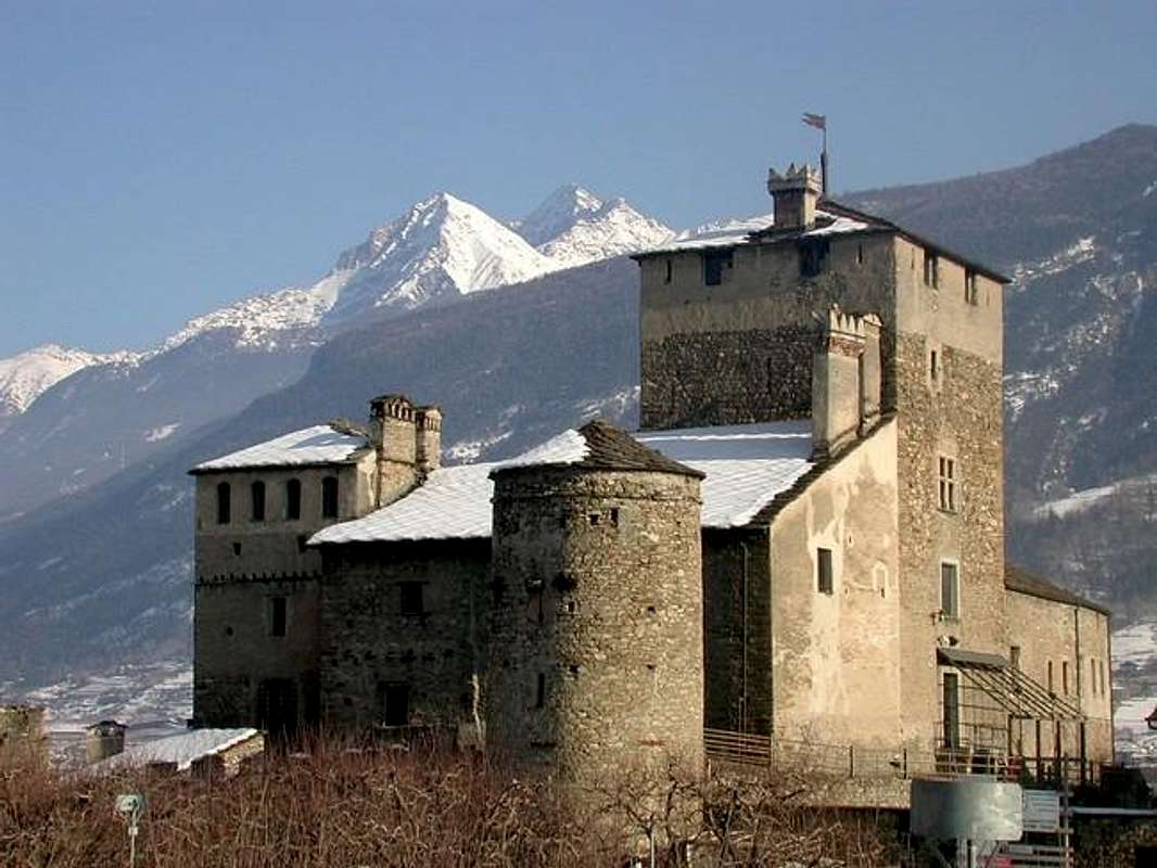
666m; Church of Santa Barbara). Bypassing over a hill between beautiful vineyards, so we arrive at Aymavilles (
640m; Church of "Christ the King"; while near
Churches of Santa Barbara, San Leodegardo and Château de Aymavilles with four towers; "Wine cellar of the Eleven Municipalities"); just above Southeast Oratory du Berrio Blanc
1075m, reached by the path
n ° 1 from the Village of Chabloz (
762m;
1h'15) and in the Southwest to the Comba (
1027m; Church of "Sorrows) drive from the junction of Caou small Village
(827m), now definitely at the entrance to Valley of Cogne. Almost immediately after one another crossroads on the other side it allows the descent towards Pondel or Pont d'Ael small Village (
893m, 880m; Church of Sant'Andrea and Roman Bridge, built by Patricians Aimo and Avilius to transport water but above all, very few people know, for the search of gold into Grand'Eyvia Stream.
Continuing to climb the Val de Cogne, after the old wooden bridge Chevril (
961m; now collapsed after various floods and rebuilt) to reach the Village Vieyes were only 14 people now and where Mass is celebrated one once in a year (
1158m; Church of San Grato with frescoes on the front); at the foot of the Grivola
(3969m) nearby the Village of Sylvenoire (
1331m;, Little Church). Many galleries and the next Bridge Laval
(1364m) leading to two Fractions of Epinel (
1436m; Parish Church) and Crétaz (
1494m; Sancte Paule Church), leaving at the top on the other side of the Grand'Eyvia
Maison-Forte de Tarambel of the XIII° Century (1518 m), reached from the fork
1491 metres with trail
unnumbered and by Epinel for Gimillan (
1788/1814m; Church of St. Pantaleon with Steeple and bell), through
n° 23. Then, in short time, you reach Cogne Common.
From Pila Resort towards Saint Lèger "Leodegardo" (Aymavilles Common)
by Osw
Cogne and its Villages
Once over the new bridge again, you reach the Center (called as
"La Ville") of the Municipality of Cogne (
1531/63m; Km. 27,6 from Aosta, 20,2 by Aymavilles Parish Church with high Steeple of 1202, restored in XV° Century and in 1822;
iron fountain 1800; various constructions of the XII° Century; Square tower called "House of the Plague 1630; graffiti the interior"; Casaforte-Castle of the Bishops of Aosta, then Royal Hunting House by Kings of Italy, Tour de Villette, built by Bishop Umberto II° in 1272,
Gran Paradiso National Park since 1922;
"Sant'Orso Meadow" formerly known as
"Vela"), located in the East of the latter and facing the majestic Chain of the
Gran Paradiso (4061m). Cogne has several Fractions: in addition to those of Epinel, Crétaz and Gimillan or Dzimillan already mentioned; but for the latter to remember to add the possibility of a walk with route
n° 8/TVC towards Tarabouc Pasture (
1831m; now deconsecrated
Church of San Bernard; 0h'15) and, after the remains of Reventis or Révènti small Alp
(+; 1895m), reach the little
Votive Chapel of Ecloseur and the next trail
n° 8D/TVC Bridge and Pastures of Tchezeu and Ecloseur (
T; 0h'35). Wanting to continue the hike you reach the Alp Pila with nearby beautiful Waterfall, the Créuzet and then a
Votive Chapel dedicated to the Virgin Mary, Cross 2296 metres and the very ancient Village/Alpages Grauson-Vieux (
2273m;
1h'45). Gimillan is reached or crossing Cogne to the
Little Church of Saint Antoine, or with the ring road to the North, passing through the
Château Royal (1532m) reaches the same point at the roundabout above the union of Torrents Urtier and Lussert-Doreire-Gru. From this point the Regional Road up towards the
Little Church of Montroz (1681m) nearby the Village of the same name after reaching four bends Gimillan Hamlet
2.1 Km. from Cogne. Always by crossing
"St. Antoine" is continue Eastward and over Grand'Eyvia first reaching the Village of Moline (
1539m; under the Mines of Magnetite Veins "Larsinaz", "Costa del Pino") and then the next Champlong (
1596m; below the Loadstonemines Mother lodes of "Colonna", "Liconi"; Church of Saint Pierre). A final stretch leads straight to the more important Lillaz Fraction (
1612/31m; Church of Santa Anna then called of
Clément, three renowned Waterfalls; "Camping Les Salasses and Al Sole". In addition, it opens the great Vallon of Urtier, where there, protected from floods, the old Cogne or
"Conia" of the Romans, but more likely from the Celtic-Ligurian-Salassian dialect
"Coing", or angle of the valley. A farm dirt road or the trail underlying
n° Alta Via n° 2/10H/10A/10, through Goilles Dessous and Dessus Pastures, lead with nice excursion to the small
Church of Crest or Crêt (2020/24 m; wooden fountain;
1h'30/1h '45), near the homonymous Alpe ruined. The Last Village is located immediately to the South of Cogne and Valnontey in the direction of the same name at the foot of the giant
Glacier of the Tribulation. Starting from the center of Cogne (in the square sundial by the Alberti, the Castle, now Hotel, plaque of the C.A.I. reminiscent of Vittorio Emanuele II°, the
"King Hunter Toio" of Italy Kingdom and the City Hall in front of the memorial tablet for the stay of the 1841 Duke Ferdinando of Genoa) the Regional Road reaches the Village of Valnontey (
1674m; Alpine Garden "Paradisia" in altitude
1704 metres, reached from the stone bridge over the Torrent de Valnontey with short walk and through the path
18/n° Alta Via n° 2; 0h'15;
"Camps Bouva, Stambecco and Gran Paradiso").
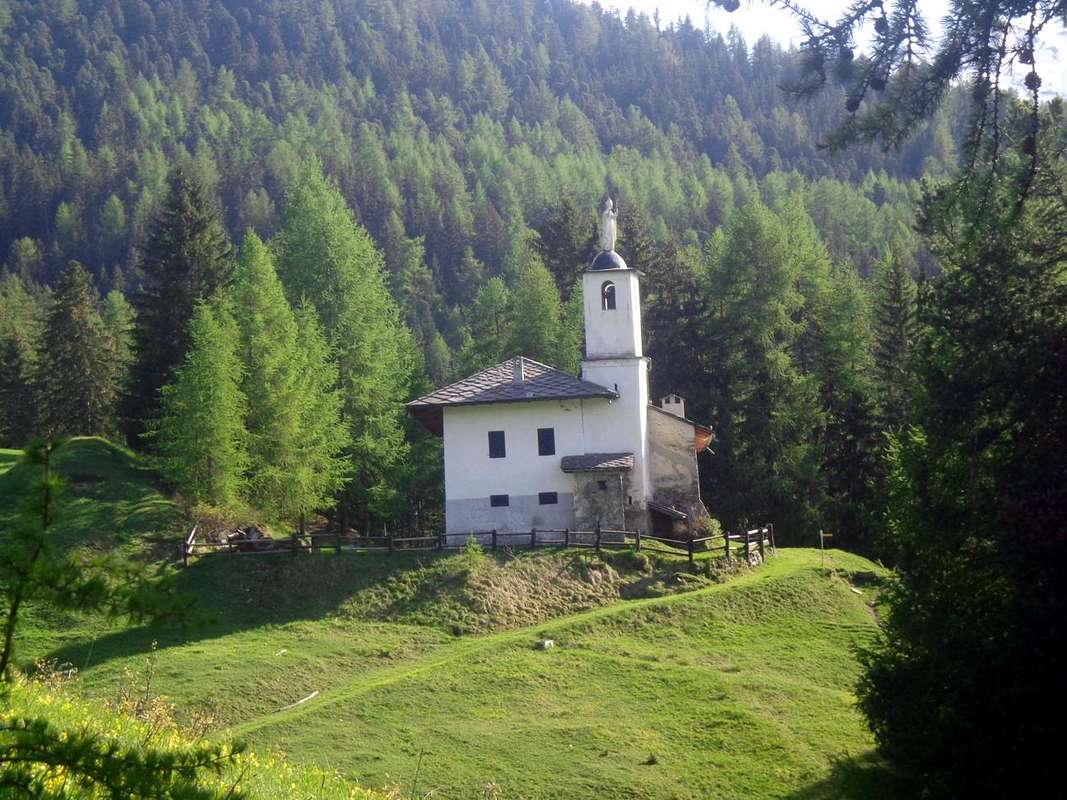
![]() Crest or Crêt Chapel above Cogne at the entrance on Urtier Vallon,
Crest or Crêt Chapel above Cogne at the entrance on Urtier Vallon,
by emilius
L' Area comprende 14 Municipalità; può essere visitata in 3 giornate, facendo notare che per "Envers" s'intende la zona meno esposta al sole e viceversa. Nella seconda giornata, con partenza dai Comuni di Quart o Grand Brissogne, si percorre lo "Envers" attraversando Pollein e fino a Charvensod per poi salire a Pila e, dopo la discesa a Gressan, continuare verso Jovençan, Aymavilles e la Valle di Cogne. La terza giornata sarà dedicata alla Valsavarenche ed alla Val di Rhêmes.
Secondo giorno tra 7/8 Comuni oppure 11/12 (Area "de l'Envers Meridional" o Quart, Grand Brissogne, Pollein, Charvensod, Gressan, Jovençan, Aymavilles, Cogne altrimenti le due Valli di Savara e Rhêmes con 5 Comuni partendo da Villeneuve ovvero Introd, Valsavarenche, Rhêmes St. Georges and Notre Dame):
se nella prima tappa non abbiamo effettuato il rientro con la possibilità 2)- rientrando verso Aymavilles con il suo Castello percorrere la "Route de l'Envers" al di là della Dora Baltea e verso i Comuni di Jovençan, Gressan e Charvensod presso il Pont Suaz, donde ad Aosta, in questa percorriamo a ritroso questa strada. Se invece abbiamo già percorso questo itinerario dal ponte del Pont Suaz (564 m), alle porte di Aosta, si sale direttamente nella Conca di Pila. Vediamo nel dettaglio: partendo dal Comune di Quart (546/56 m; Chiesa di San Eusebio; "Camping Aosta") si abbandona la Strada Statale n° 26 attraversando il ponte sulla Dora Baltea in località Villefranche (557 m), subito ad Est; giunti ad una rotonda si lascia momentaneamente la Strada Regionale lungo il corso della Baltea salendo invece a Mezzogiorno in direzione del Comune di Grand Brissogne (906/19 m, Château de Brissogne; Chiese di "Madonna d'Oropa", Santa Caterina e S.S. Fabiano e Sebastiano). Una breve e "tortuosa" discesa tramite una Stradina Municipale riporta sulla Strada Regionale per il Comune di Pollein, passando dal Villaggio di les Ayettes (849 m) a quelli di Chaney, Château e Petit Pollein ((557 m; Chiesa "Sposalizio della Vergine"). Continuando verso Ovest si oltrepassano i Villaggi di Grand Pollein ((547 m; Cappella Votiva), Prefieur, Tharençan raggiungendo Pollein ((546 m; Chiesa di San Giorgio). Una breve divagazione a Sudovest permette di raggiungere la Frazione di Chenaux ((656 m; Chiesa di Santa Barbara ), all'imbocco della Gorgia del Dard, mentre una strada di collegamento permette di raggiungere, passando sopra al Torrent de Comboé, quelli di Roulaz ed Alto Félinaz ((591 m; Chiesa di Santa Anna ), ormai nel Comune di Charvensod. Con corta discesa sulla Regionale si raggiunge la Frazione di Pian Felina (565/8 m), oltrepassata la quale si perviene al Pont-Suaz (564m; Chiesetta "Nostra Signora della Pietà"). Da questo punto una scelta s'impone: A)- o continuare, stessa strada e stessa direzione lungo la Dora, raggiungendo progressivamente i Comuni di Gressan, Jovençan, Aymavilles per poi salire in Valle di Cogne; oppure B)- momentaneamente abbandonare questa e risalire verso il Comune di Charvensod (610 m; Chiesa dei S.S. Fabiano e Sebastiano ed appena al di sopra con il sentiero n° 14L al Santuario di Santa Colomba 924 m; 0h'50/1h'00), sottostante la Conca di Pila. In questo secondo caso si allunga la tappa di mezza giornata ma rendendo la stessa sicuramente più "ricca" e suggestiva. Continuando dal comune verso Oriente si raggiunge il bivio 951 metri, dove una piccola deviazione con strada in asfalto conduce agli Alpeggi di Reverier o Rayer "du Tzat" e Dessous (1042 m; Cappella di Santa Margherita e Saint Joseph). Rientrando sulla Regionale si oltrepassano i piccoli Villaggi di Vagères, Bondine (1018 m; qui anche da Santa Colomba col sentiero n° 14D; 0h'15), Roncogner, Lexeret, Reverier Dessus, la Rochette, Saint Salò, Plan de Sérémont (1382 m; Chiesa di San Pantaleone), Peroulaz e Les Fleurs (1414 m *** qui arriva anche un'altra Strada Regionale alternativa da Gressan, utile poi per la nostra discesa da Pila). Passando presso i successivi Villaggi di Chacot, Grande Cerise, Eaux - Froides, Charémoz (1662 m; Chiesetta di "Nostra Signora delle Nevi"; fontana), Rossellin, Mozod, Perchu, Chacard si giunge a Pila (1803 m; Chiese di "Trasfigurazione del Signore" e San Lorenzo; 18 Km dal Pont-Suaz). Da Pila é possibile con il sentiero-poderale ad Est n° 14I all'Eremitaggio di San Grato (1787 m; 0h'45) e da questo o con altre vie e sentieri n° 20/102; 19, 14/16/19A al Comboé (2114 m; Chiesetta di Santa Maddalena; 1h'15/1h'30), giusto ai piedi di Becca di Nona (3142 m) ed il bel Gruppo del Monte Emilius (3559 m).
From Brissogne towards Jovençan, passing Pollein, Charvensod and Gressan Communes,
by Osw
La discesa ci riporta al bivio di Les Fleurs, dove possiamo scendere con la Regionale alternativa che, passando dai Villaggi di Balzà, Gerdaz (
1340 m; Chiesa di San Rocco), Tivet, Barrier (
1238 m; Chiesa di S.S. Pietro e "Maria Assunta"), Champlan Damon e Dèsott, Leysettaz-Dessous, Perrial, Cotes, Palathiau, Fontane, Clapey (
734 m; Chiesa "Madonna Addolorata"), Moline (
Chiesa di S.S. Pietro e Paolo), Jacquin au Chabloz (
Château Tour de Villa), Vignettaz (
Chiesa di Santa Maria Maddalena del 1200) ed il Capoluogo di Gressan (
1238 m; Chiesa di S.S. Anna e Sebastiano; appena più ad Est a Chevrot o Tzevrot
Chiesa di San Giovanni con Campanile Romanico). Il successivo Comune di Jovençan (
632 m; Chiesa di S.Orso). Mentre nei dintorni
Chiesa di San Giorgio e Château de Jovençan; Chiesa di San Gottardo, Tour de la Planta del XII° Secolo ed a Pompiod (
666 m; Chiesa di Santa Barbara). Scavalcando una collina tra splendidi vigneti, si arriva così ad Aymavilles (
640 m; Chiesa di "Cristo Re"; nentre nei dintorni
Chiese di Santa Barbara, San Leodegardo e Château d'Aymavilles; "Cantina degli Undici Comuni"); appena sopra a Sudest
Oratorio du Berrio Blanc 1075 m, raggiungibile con sentiero
n° 1 dal Villaggio di Chabloz (
762 m;
1h'15 ed a Sudovest a la Comba (
1027 m; Chiesa della "Addolorata" in auto dal bivio di Caou
(827 m), ormai decisamente all'ingresso in Val di Cogne. Subito dopo un'altro bivio sul lato opposto consente la discesa verso Pondel o Pont d'Ael (
893 m, 880 m; Chiesa di Sant'Andrea e Ponte Romano), costruito dai Patrizi Romani
"Aimo et Avilius" pel trasporto d'acque ma soprattutto, in pochi lo sanno, per la ricerca dell'oro drenando il Torrent Grand'Eyvia.
Continuando a risalire la Val de Cogne, dopo l'antico ponte in legno di Chevril (
961 m; ormai crollato dopo le varie alluvioni e ricostruito) si raggiunge il Villaggio di Vieyes, dove sono rimaste solo 14 persone ed ove ormai si celebra la Messa una sola volta in un anno (
1158 m; antichissima Chiesa di San Grato con affreschi affronte e Rettoria dapprima nel 1788 e poi nel 1845); vicino, ai piedi della Grivola
(3969 m) il Villaggetto di Sylvenoire (
1331 m, Chiesetta). Molte gallerie ed il successivo Ponte di Laval
(1364 m) conducono alle Frazioni di Epinel (
1436 m, Chiesa Parrocchiale) e di Crétaz (
1494 m, Chiesa Sancte Paule), lasciando in alto sull'altra sponda della Grand'Eyvia la
Maison-Forte de Tarambel del XIII° Secolo e di proprietà dei Vescovi d'Aosta (1518 m), raggiungibile dal bivio
1491 metri con il sentiero
non numerato e da Epinel per il Villaggio di Gimillan (
1788/1814 m; Chiesetta di Saint Pantaleon e Campanile, campana ed antica fontana), col
n° 23, poi con la Regionale, in breve, s'arriva in Cogne.
From Aymavilles towards Vieyes (Aymavilles Commune), Epinel, Crétaz Hamlet & Cogne Municipality with St. Antoine Church",
by Osw
Cogne ed i suoi Villaggi
Passato il ponte nuovo, si raggiunge il Centro (
La Ville; Km. 27,6 da Aosta) del Comune di Cogne (
1531/63 m; Chiesa Parrocchiale con alto Campanile del 1202; fontana in ferro dell'800; varie costruzioni del XII° Secolo; Torre quadrata detta "Casa della Peste"; Castello Casaforte dei Vescovi di Aosta e poi Casa Reale di Caccia dei Re d'Italia; Tour de Villette, costruita dal Vescovo Umberto II° nel 1272;
Parco Nazionale del Gran Paradiso dal 1922;
"Prato di Sant'Orso" conosciuto anticamente come
"Vela"), sito ad Oriente di quest'ultimo e di fronte alla maestosa Catena del
Gran Paradiso (4061 m). Cogne possiede diverse Frazioni: oltre a quelle di Epinel, Crétaz e Gimillan o Dzimillan già citate; ma per quest'ultima c'é da aggiungere la possibilità d'una passeggiata con sentiero
n° 8/TVC fino a Tarabouc (
1831 m; Chiesetta di Saint Bernard ormai sconsacrata;
0h'15) e, dopo i ruderi del Reventis o Révènti
(+; 1895 m), raggiungere la
Cappelletta Votiva dell'Ecloseur e con il successivo sentiero
n° 8D/TVC il Ponte e gli Alpeggi di Tchezeu e dell'Ecloseur (
T; 0h'35; volendo proseguire l'escursione si raggiunge l'Alpe Pila con bella Cascata, il Créuzet e subito dopo una
Cappella Votiva dedicata alla Madonna, la Croce 2296 metri e l'antico Villaggio di Grauson-Vieux (
2273 m;
1h'45). Gimillan si raggiunge od attraversando Cogne fino alla
Chiesa di Saint Antoine, oppure con la circonvallazione a Nord che, passando per il
Château Royal (1532 m) raggiunge il medesimo punto alla rotonda sopra l'unione dei Torrents Urtier e Gru. Da questo punto la Strada Regionale sale verso la
Chiesetta di Montroz (1681 m), che precede l'omonimo Villaggio, raggiungendo successivamente con quattro tornanti Gimillan a
2,1 Km. da Cogne. Sempre dall'incrocio di
"St. Antoine" si prosegue verso Est e sopra la Grand'Eyvia raggiungendo dapprima il Villaggio di Moline (
1539 m; sotto le Miniere di magnetite dei Filoni "Larsinaz" e "Costa del Pino") e quindi il successivo di Champlong (
1596 m; sotto le Miniere di magnetite delle Vene di "Colonna" e "Liconi"; Chiesetta di Saint Pierre). Un ultimo tratto più rettilineo conduce all'importante Frazione di Lillaz (
1612/31 m; Chiesa di Santa Anna poi Clément; tre famose Cascate; "Campings Les Salasses ed Al Sole"). Oltre, si apre il grande Vallone dell'Urtier, dove esisteva, al riparo dalle alluvioni, l'antica Cogne o
"Conia" dei Romani, ma molto più probabilmente dal dialetto Celtico-Ligure-Salasso
"Coing", ovvero angolo. Una strada poderale od il sottostante sentiero
n° Alta Via n° 2/10H/10A/10, passando per le Alpi Goilles Dessous e Dessus, conducono con bell'escursione alla
Chiesetta del Crest o Crêt (2020/24 m; fontana in legno;
1h30/1h'45), presso l'omonima Alpe diroccata. L'ultimo Villaggio si trova subito a Mezzogiorno di Cogne in direzione dell'omonima Valnontey ed ai piedi del gigantesco
Ghiacciaio della Tribolazione. Partendo dal Centro di Cogne (sulla piazza meridiana dell'Alberti, sul Castello, attualmente Albergo, lapide del C.A.I. che ricorda Vittorio Emanuele II°, il
"Re Cacciatore" e sul Municipio a fronte lapide per il soggiorno in Cogne del 1841 da parte del Duca Ferdinando di Genova) la Strada Regionale raggiunge la Frazione di Valnontey (
1674 m; Giardino Alpino "Paradisia" a quota
1704 metri), raggiungibile dal ponte sul Torrent de Valnontey con passeggiata e sentiero
18/n° Alta Via n° 2 (0h'15; "Campings Bouva, Stambecco e Gran Paradiso").
From Montroz toward Gimillan Hamlet and Tarabouc Alp & by Champlong Village to Lillaz Fraction,
by OswThird trip towards Savarenche & Rhêmes Velleys
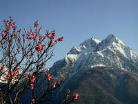
Valsavarenche up to the "Madonnina" of Gran Paradiso
The third day will include, starting from Villeneuve, the visit of the Valleys Savarenche and Rhêmes. But it can become the second performing different solution.
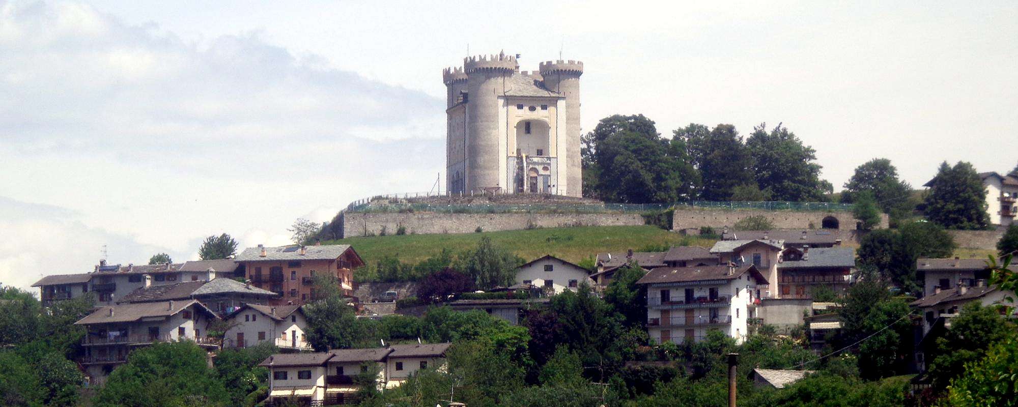
If you choose instead of the Basin of Pila and Cogne Valley alternatively you can visit the Valleys Savarenche and Rhêmes. With this second chance, arrived in Aymavilles, you have to keep going to the West reaching the adjacent Municipality of Villeneuve (
656/65m; current
Church of Santa Assunta of 1782), while the ancient
Parish with Romanesque bell tower is of 1400. But most of the
Châtel Argent above the XI° Century with its
walled in ruins but with the
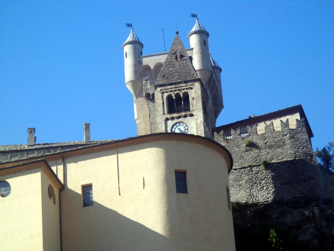
cylindrical Tower still present. It constructed of materials that came from the Roman road to Petit Saint Bernard. Owned by the Lords of Bard, then those of St. Pierre and the 1605 Leonardo Roncas, he was dismantled in the eighteenth Century to rebuild homes after a violent storm. From the square of the Church apart from the Regional Road to the municipality of Introd, reached just after the bridge is
70 metres above a frightful ravine (
872m; magnificent
Château d'Introd of 1260 with internally Square tower and Roman Barn; Church of 1500 and Bell Tower 1600). The castle was built by Peter Introd Bard and restored in the twentieth Century. But before we get to Introd and after the Hamlet of Junod in that of Villes are in the feature Dessous (
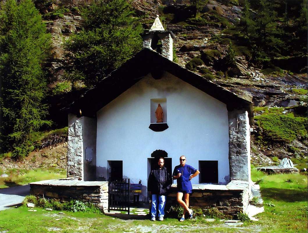
806m; Chapel of St. James of 1867 with three mini Bell Towers topped by many Crosses) while proceeding as well as the Dessus (863 m; Church San Ilario). While over the common, left in the Southwest the detour to the Valley of Rhêmes, near the roadside to Buillet (
1030 m; tiny Church of San Defendente). Continuing on the road to Valsavarenche you reach the Villages Chevrère (
1108m; little Church), Molere (
1108m; little Church) to above winding road
1132 metres Fenille (
1304m; Chapel); then continuing to the east of Dora Savara and exceeded the Hamlets of la Ramou and Bois de Clin reach Rovenaud (
1462m; little Church). Soon we arrive at the Chief-town of Dégioz-Valsavarenche (
1525/47m; Parish Church and near Campanile with Meridiana 1802; Centre for the visit P.N.G.P.), located at the foot of the
"arduous beautiful Grivola" (3969m) by the Poet Giosué Carducci. From here on, the Religion gradually gives way to the
"Civilization" but there is still something: the detour to the South of Dégioz to Toulaplana and Creton Villages (
1613m; little Church), Bien (
1629m; small Church), little more than
"Camping Grivola" and before the
"Agriturismo Lo Mayen" and finally, after the
"Camping Gran Paradiso" and the departure of the route
n° 5/5A/10A the
Refuge Federico and Renato Chabod (2710m). Finally in Pont of Valsavarenche-Breuil (
1952/69m; little Church) with great parking and the trail
n° 1 to the
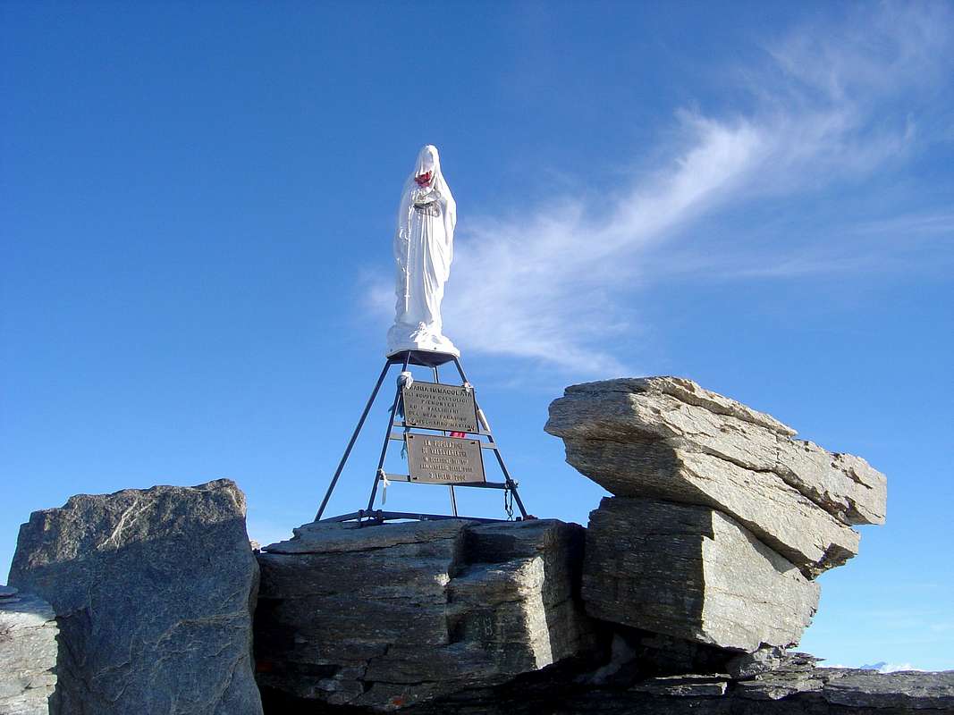
Vittorio Emanuele II° Refuge (2734m). But if you want to achieve the ultimate signal of
Christianity there remains that go up and then climb to the
Gran Paradiso (4061m) on the Summit where you will find the
"Madonnina" highest of all Graians, Chain of Mont Blanc excluded. But in this case, going from Hiking to Mountaineering,
stretch your week of a day and maybe two ...
La Valsavarenche fino alla Madonnina del Gran Paradiso
![]() "Granpa Madonnina" since 1954 until 2015,
"Granpa Madonnina" since 1954 until 2015,
by Huberschwiller
La terza giornata prevede, partendo da Villeneuve, la visita delle due Valli Savarenche e Rhêmes. Ma può diventare la seconda effettuando una soluzione diversa.
Se si sceglie invece del Bacino di Pila e la Val di Cogne in alternativa si possono visitare le Valli Savarenche e Rhêmes. Con questa seconda possibilità, arrivati al Comune di Aymavilles, bisogna proseguire sempre ad Ovest raggiungendo l'adiacente di Villeneuve (
656/65 m; attuale
Chiesa di Santa Assunta del 1782), mentre l'antica
Parrocchia con Campanile Romanico é del 1400. Ma soprattutto il soprastante
Châtel Argent del XI° Secolo con la sua
cinta di mura in rovina e la
Torre cilindrica ancora presente; costruito con materiali romani che provenivano dal disfacimento della strada
"Consiliare" del Piccolo San Bernardo. Di proprietà dei Signori di Bard, poi di quelli di St. Pierre e dal 1605 di Leonardo Roncas, venne smantellato nel XVIII° Secolo per ricostruire le case dopo un violentissimo uragano con grandi distruzioni. Dalla piazzetta della Chiesa parte la Strada Regionale per il Comune di Introd, che si raggiunge subito dopo il ponte alto
70 metri sopra uno spaventevole orrido nella Dora (
872 m; splendido
Château d'Introd del 1260 con internamente Torre quadrata e Granaio Romano; Chiesa del 1500 e Campanile del 1600). Il Castello venne costruito da parte di Pietro Introd di Bard e restaurato nel Secolo XX°. Ma prima di arrivare ad Introd e dopo la Frazione Junod in quella di Villes troviamo a Dessous la caratteristica (
806 m; Cappella di San Giacomo del 1867 con tre mini campanili sormontati da altrettante Croci) mentre procedendo oltre a Dessus la (
863 m; Chiesa di Sant'Ilario). Mentre oltre il comune, lasciata a Sudovest la deviazione per la Val di Rhêmes, sul ciglio della strada a Buillet (
1030 m; Chiesetta di San Defendente). Continuando sulla strada per Valsavarenche si raggiungono i Villaggi di Chevrère (
1108 m; Chiesetta), Molere (
1108 m; Chiesetta) al tornante
1132 m e Fenille (
1304 m; Chiesetta); poi continuando ad Oriente della Dora di Savara ed oltrepassati i Villaggi di la Ramou e Bois de Clin si raggiunge Rovenaud (
1462 m; Chiesetta). Ben presto si arriva al Capoluogo di Dégioz-Valsavarenche (
1525/47 m; Chiesa Parrocchiale e vicino Campanile Romanico con Meridiana del 1802; Centro di visita del P.N.G.P.), situato ai piedi dell'
"ardua Grivola bella" (3969 m) di Giosué Carducci. Da qui in avanti la Religione progressivamente cede il passo alla
"Civiltà" ma troviamo ancor qualcosa: dalla deviazione a Sud di Dégioz verso i Villaggetti di Toulaplana ed il Creton (
1613 m; Chiesetta), a Bien (
1629 m; Chiesetta), poco oltre il
"Camping Grivola" e prima dell'
"Agriturismo Lo Mayen" ed infine, dopo il
"Camping Gran Paradiso" e la partenza del sentiero
n° 5/5A/10A per il
Rifugio Federico e Renato Chabod (2710 m); infine a Pont di Valsavarenche-Breuil (
1952/69 m; Chiesetta) con grande parcheggio e partenza del sentiero
n° 1 per il
Rifugio Vittorio Emanuele II° (2734 m). Ma se volete raggiungere l'estremo segnale della
Cristianità non rimanvi altro che di salire proseguendo per l'ascensione del
Gran Paradiso (4061 m) sulla cui Vetta troverete la
"Madonnina" più alta di tutte le Graie, Catena del Monte Bianco esclusa. Però in questo caso dovrete, passando dall'Escursionismo all'Alpinismo,
allungare la vostra settimana d'una giornata e forse anche due ...
From Aymavilles towards Dégioz-Valsavarenche, passing Villeneuve and Introd Municipalities,
by Osw
Along the Val de Rhêmes
In addition to Valsavara you can from the junction above Introd visit to Rhêmes. A trip completely doable in a day, devoting the morning to the first part and, after the descent to the junction above the Common of Introd, in the afternoon to the second. Rhêmes Valley denotes signs of
his "Christianity" a little bit everywhere, starting from the small village of Branloz at its entrance (
1050m; Chapel ) to that of Sarral (
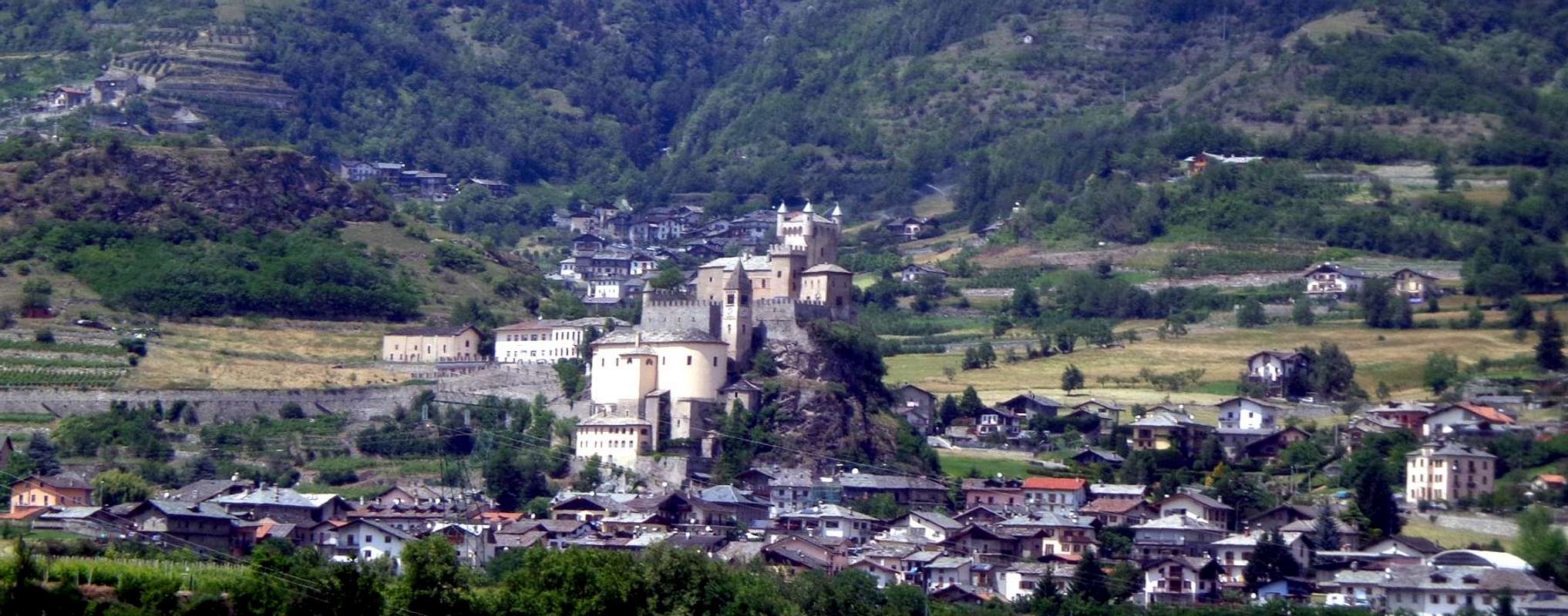
1093m; Chapel ), just before the Municipality of Rhêmes- Saint-Georges. A short climb with detour first to the South and then to the North leads to the Town Hall
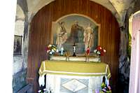
(1234/5m), next to which we find the beautiful
Church of St. George of 1500 , rebuilt over a
Chapel of the XII° Century. Then transformed into a Rectory and Parish, has inside
wooden Altars of the seventeenth Century and a painting of the Death of St. Joseph; outward instead the adjoining ancient cemetery with burials on a single green grass and topped by old and artistic
wrought iron Crosses. Going up the valley floor, two short detours to the West lead to Frassiney (
1315m; Chapel) and Proussaz (
1445m; Chapel), two Villages perched at the foot of the wild
Grand Revers (3163m)). After the subsequent of Creton, Barmaz, Melignon, Brennan, Artalle, Carré (
1664m; Chapel) and Chanavey you reach the Capital of Rhêmes-Notre-Dame (
1722/5m; Parish Church of Breuil and Romanesque Bell tower with the interior of the loudest bells in all the Aosta Valley), located at the foot of the large (
almost 2000 metres) Eastern Wall of the
Grande Rousse (3607m). Immediately following ancient cemetery with
wrought iron Crosses, which also rests
Casimire Thérisod (* 1858 + 1921), famous and first Mountain Guide of the Rhêmes Valley; a plaque, placed in 1921 by his Friends Mountaineers of Turin C.A.I. Giovanni Bobba Francesco Quaini, remembers him in main face of Town Hall right in front.
![]() Middle and Lower Rhêmes Valley,
Middle and Lower Rhêmes Valley,
by Marco Cossard
Percorrendo la Val de Rhêmes
Oltre alla Valsavara si può dal bivio sopra Introd visitare anche quella di Rhêmes. Una gita completamente fattibile in una giornata, dedicando la mattinata alla prima parte e, dopo la discesa verso il bivio soprastante il Comune di Introd, il pomeriggio alla seconda. La Valle di Rhêmes denota segni della
sua "Cristianità" un pò dovunque, incominciando dal piccolo Villaggio di Branloz al suo ingresso nella parte inferiore (
1050 m; Cappella) per arrivare a quello di Sarral (
1093 m; Cappella), appena prima del Comune di Rhêmes-Saint-Georges. Una breve risalita con deviazione dapprima a Meridione e poi a Settentrione conduce al Municipio
(1234/5 m), accanto al quale troviamo la splendida
Chiesa di San Giorgio del 1500, ricostruita sopra una
Cappella del XII° Secolo. Trasformata successivamente in Rettoria e Parrocchia, presenta al suo interno splendidi
Altari in legno del XVII° Secolo ed una tela rappresentante la Morte di San Giuseppe; all'esterno invece l'attiguo antico cimitero con sepolture su di un unico verde prato e sormontate da vecchie ed artistiche
Croci in ferro battuto. Risalendo il fondovalle, due brevi deviazioni ad Occidente conducono a Frassiney (
1315 m; Cappella) ed a Proussaz (
1445 m; Cappella), due Villaggi abbarbicati ai piedi del selvaggio
Grand Revers (3163 m). Dopo i successivi Villaggi e Frazioni di Creton, Barmaz, Melignon, Brenan, Artalle, Carré (
1664 m; Cappella) e Chanavey si raggiunge il Capoluogo di Rhêmes-Notre-Dame (
1722/5 m; Chiesa Parrocchiale del Breuil con Campanile Romanico con all'interno le campane, dicono, più sonore di tutta la Valle di Aosta), posta alle pendici della grande (
quasi 2000 metri) Parete Orientale della
Grande Rousse (3607 m). Subito appresso antico cimitero con
Croci in ferro battuto, nel quale riposa anche
Casimire Thérisod (* 1858 + 1921), famosa e prima Guida Alpina della Valle di Rhêmes; una targa, posta nel 1921 dai suoi Amici Alpinisti torinesi del C.A.I. Giovanni Bobba e Francesco Quaini, lo ricorda nella facciata del Municipio giusto affronte alla Chiesa.
From Rhêmes-St.-Georges towards Rhêmes-Notre-Dame with Casimire Thérisod plaque,
by Osw


Comments
Post a Comment