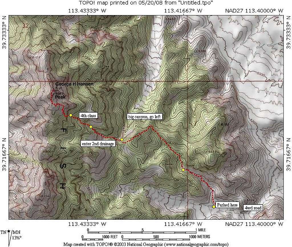
I've tried to make this map as close to our route as possible and at least this map will give you a feel for the way we went. Many thanks to giegiels (Greg) for his map and pics that aided us on our efforts. Please note the
additional remarks about the map by Andy Martin:
" 2. Our route
Looks OK from first yellow dot to second.
From second to third (third dot is at the saddle
where we left water) the route is drawn going
up and over a hill, but should be drawn
further south, staying in the drainage all the
way to the saddle.
Also, on our return we crossed the saddle a bit west
of spot elevation 6464, and then hiked out on
flat country back to the vehicles. I think this is a
better route than the gully bottom we went up.
