Toggle navigation
Mountains
Routes
Images
Trip Reports
Forum
What's New
People
Areas & Ranges
Articles
Trailheads
Canyons
Huts & Campgrounds
Albums
Logistical Centers
Fact Sheets
Lists
Custom Objects
Gear
Plans & Partners
WELCOME TO SUMMITPOST
SIGN IN
REGISTER
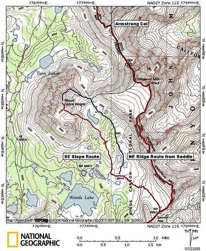
Outline of the basic routes...
View High-Resolution Image
Outline of the basic routes...
Outline of the basic routes up and down the Mountain. Easiest route is in red, calss 3 routes in blue/black. Many variations are avaliable for all routes.
« PREV
NEXT »
thebeave7
on
Jul 22, 2005 3:19 am
Comments & voting
Other parents
Lat/Lon:
36.90390°N / 118.3878°W
Image ID:
116028
3206 Hits
74.01
% Score
4
Votes
Log in to vote
Comments
No comments posted yet.
to post!
Don't have an account?
Mount Cedric Wright
(Mountain/Rock)
You are at
the First
Image
Viewing
#1 of 1
GALLERY
You are at
the Last
Image
thebeave7's Image Gallery
« PREV
Viewing
#152 of 376
GALLERY
NEXT »
Mount Cedric Wright
(Mountain/Rock)
Loading....
South East Slope
(Route)
Loading....
×
You need to login in order to vote!
User Name
Password
Remember me
Forgot your password?
Log me out when I close my browser.
Keep me logged in all the time.
sign in as a user
Don't have an account?
Register now for FREE
Rating available
Suggested routes for you
People who climb the same things as you
Comments Available
Create Albums
Register Here


