Toggle navigation
Mountains
Routes
Images
Trip Reports
Forum
What's New
People
Areas & Ranges
Articles
Trailheads
Canyons
Huts & Campgrounds
Albums
Logistical Centers
Fact Sheets
Lists
Custom Objects
Gear
Plans & Partners
WELCOME TO SUMMITPOST
SIGN IN
REGISTER
Pilis and Visegrád Mountains
Additional Parents
My informational images
Image
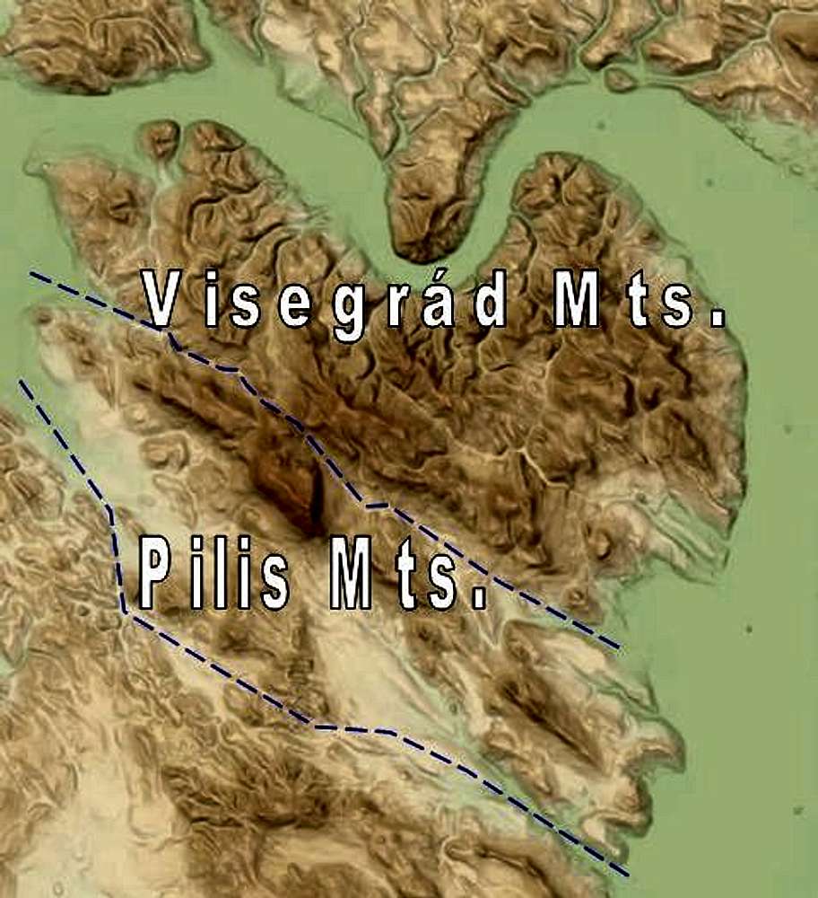
Overview map of Pilis and Visegrád Mountains
View High-Resolution Image
Overview map of Pilis and Visegrád Mountains
Illustration for area page. North is up, the "green channel" is the riverbed of the Danube.
See the original map here
.
« PREV
NEXT »
peterbud
on
Jan 25, 2010 11:31 am
Comments & voting
Other parents
Lat/Lon:
47.72270°N / 18.94867°E
Image Type(s):
Informational
Image ID:
591925
3241 Hits
71.06
% Score
1
Votes
Log in to vote
Comments
No comments posted yet.
to post!
Don't have an account?
Pilis and Visegrád Mountains
(Area/Range)
« PREV
Viewing
#95 of 100
GALLERY
NEXT »
peterbud's Image Gallery
« PREV
Viewing
#688 of 733
GALLERY
NEXT »
My informational images
(Album)
Loading....
×
You need to login in order to vote!
User Name
Password
Remember me
Forgot your password?
Log me out when I close my browser.
Keep me logged in all the time.
sign in as a user
Don't have an account?
Register now for FREE
Rating available
Suggested routes for you
People who climb the same things as you
Comments Available
Create Albums
Register Here


