Toggle navigation
Mountains
Routes
Images
Trip Reports
Forum
What's New
People
Areas & Ranges
Articles
Trailheads
Canyons
Huts & Campgrounds
Albums
Logistical Centers
Fact Sheets
Lists
Custom Objects
Gear
Plans & Partners
WELCOME TO SUMMITPOST
SIGN IN
REGISTER
Oz
Additional Parents
Image
P. 1
View High-Resolution Image
P. 1
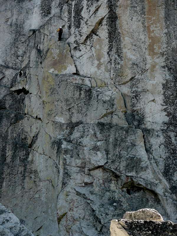
The arch is visible near the sunlit rock bottom right. The route then ascends the flake system to where the belayer is standing.
« PREV
NEXT »
MichaelJ
on
Sep 16, 2007 6:00 pm
Comments & voting
Other parents
Image ID:
337608
1702 Hits
74.01
% Score
4
Votes
Log in to vote
Comments
No comments posted yet.
to post!
Don't have an account?
Oz
(Route)
« PREV
Viewing
#6 of 13
GALLERY
NEXT »
MichaelJ's Image Gallery
« PREV
Viewing
#151 of 282
GALLERY
NEXT »
×
You need to login in order to vote!
User Name
Password
Remember me
Forgot your password?
Log me out when I close my browser.
Keep me logged in all the time.
sign in as a user
Don't have an account?
Register now for FREE
Rating available
Suggested routes for you
People who climb the same things as you
Comments Available
Create Albums
Register Here


