
-
 1100 Hits
-
 75.67% Score
-
 6 Votes
|
|
Mountain/Rock |
|---|---|
|
|
40.44040°N / 105.31118°W |
|
|
Larimer County |
|
|
Hiking, Mountaineering, Trad Climbing |
|
|
Spring, Summer, Fall, Winter |
|
|
8264 ft / 2519 m |
|
|
Overview
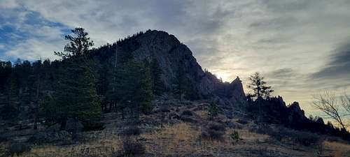
Palisade Mountain
Elevation: 8264 ft // 2519 m
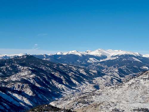
Range: Front Range, Colorado

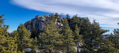
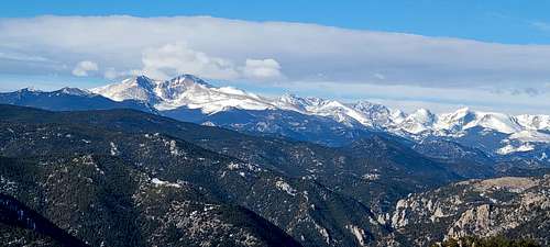
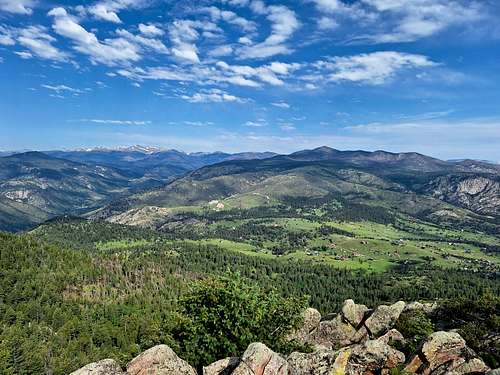
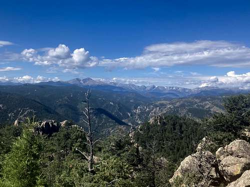
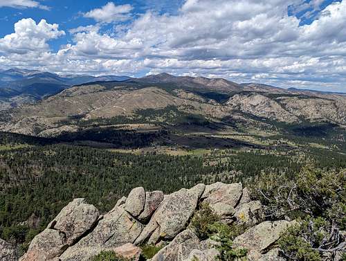
Palisade Mountain Trail to an epic overlook of the surrounding mountainous landscape and Continental Divide. Guaranteed you will break a sweat on this short, but steep hike up the granite summit of Palisade Mountain. Hike up the isolated trail and enjoy expansive views of the mountainous horizon and the forested valleys below. If you are seeking a challenge that won’t take up the whole day, consider the Palisade Mountain Hike. This steep trail is fairly primitive, marked only by rock cairns at the summit. We suggest having the trail GPS handy in case you find yourself off course. Additionally, you will have to do some scrambling up to the summit. Ensure you are prepared to climb and note that even older children may have difficulty navigating the rocky cliff. The steep climb and high altitude will tire you, so make sure to pack plenty of water to refuel!
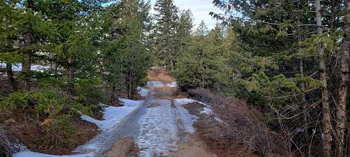
When you are ready to roll, depart from Palisade Mountain Trailhead and Parking Lot. The trail begins at the forest service gate off the car park. Hike along the Powerline Road through a grassy meadow while keeping your eyes peeled for grazing deer. Track up the path through the grasslands and the trail will eventually guide you beneath tree coverage. Hike amongst the towering trees and enjoy the increasingly scenic views peeping through the foliage. Ascend the woodland path and it will become more primitive and harder to follow. At this point you will want to closely follow the cairns up to the summit. The route will become rockier as you climb, and you will have to navigate two granite canyons.
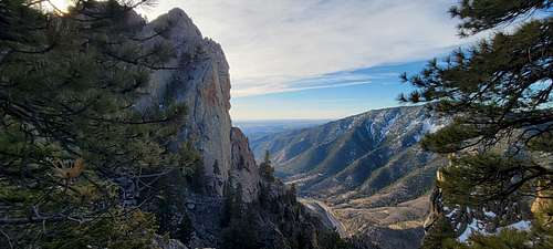
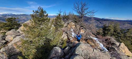
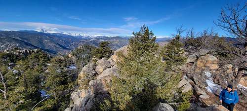
Climb up the canyons and scramble up the boulder cliff to the summit. From the peak of Palisade Mountain you will enjoy panoramic vistas of the Continental Divide and its mesmerizing ridges. The mountain top is rocky so mind your footing to avoid rolling an ankle. Explore the summit and revel in the breathtaking views of the Continental Divide before beginning your descent. To get back to the trailhead, simply retrace your steps down the trail.
|
|
|
|
Getting There
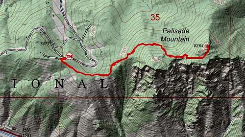
Palisade Mountain is located on US Highway 34 west of Loveland. From the Beige Siphon tube in the Narrows it is 6 miles, just a mile short of the town of Drake. The mountain is the obvious rocky crag hundreds of feet up the north side of the road. Park in the paved lot at Nancy's Rock and start on that trail. After 100 feet break off right and trail blaze up and right. I recently discovered some quartz cairns midway marking a pseudo trail.
Route
The Palisade Mountain trail begins at a Forest Service gate. There is a small parking area along Snowtop Drive with room for 3-4 vehicles. Do not park at the Forest Service gate! The trail begins with an easy 0.2 mile run through a pretty meadow where wildlife can often be seen. This area also has many wildflowers during the warmer months. Just past the meadow, the trail begins to climb more steeply on an easy-to-follow route. Continue on this route for approximately 0.75 miles through beautiful forest land. At this point, you'll need to follow cairns closely as the trail become harder to follow. This area also includes two small but steep rocky canyon sections that are a little more difficult. Within 0.1 miles from the summit, you run through a small level burn area. From here, the way to the summit is only clear by following cairns. The final 25 yards is a fairly steep scramble over large boulders to the summit. The views from here are incredible in all directions. There is a pvc tube containing a summit register at the top.
|
|
|
|
Red Tape
Weather and Snow National Weather Service Forecast NOAA Snow Depth Map
When to Climb
All four seasons.
|
|
|
|
Camping
Read National Forest rules and Regulations
Flora & Fauna
Many wildflowers, including indian paintbrush and columbine, can be seen during the warm summer months. Many times deer can be seen along the way. Palisade Mountain is a fairly active area for black bears and mountain lions as well, so be alert. Rattlesnakes have also been seen in the area. Many types of birds are in the area as well.
External Links
https://www.peakbagger.com/peak.aspx?pid=40412
https://listsofjohn.com/peak/4976
https://www.alltrails.com/trail/us/colorado/palisade-mountain