
|
|
Area/Range |
|---|---|
|
|
4.88330°N / 75.3667°W |
|
|
Hiking, Mountaineering, Trad Climbing, Big Wall, Mixed, Scrambling |
|
|
Winter |
|
|
17470 ft / 5325 m |
|
|
Overview
Parque National Los Nevados is said to cover an area of 583 square kms. The park consists of five main volcanoes, and many smaller volcanic cones. The main volcanoes, north to south are; Nevado Ruiz 5325 meters/17,470 feet, El Cisne 4750 meters/15,584 feet, Santa Isabel 5100 meters/16,732 feet, El Quindio 4750 meters/15,584 feet, and Nevado Tolima 5274 meters/17,303 feet.
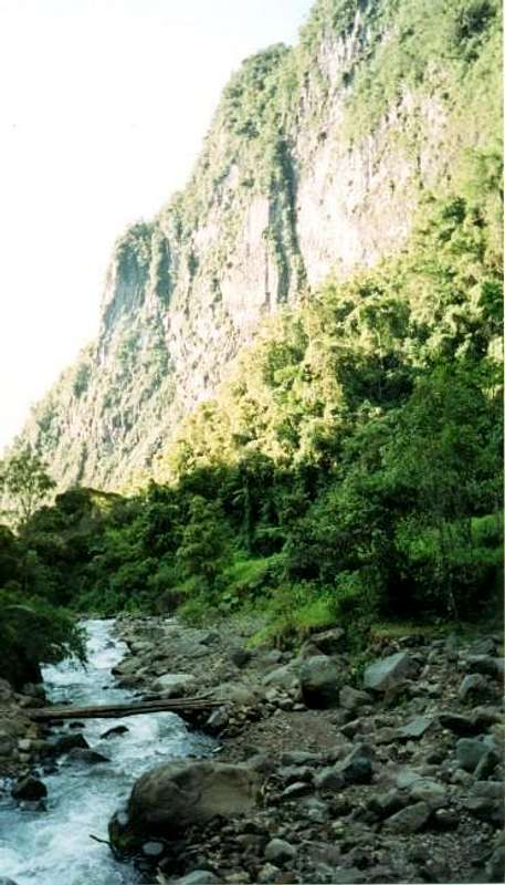
The national park boast high mountains and beautiful scenery. There are many high altitude lakes, deep gorges, rainforest, glaciers, hot springs, and many waterfalls. The southern end of the park, and especially the area around Nevado Tolima is the most spectacular of all. Thick jungles cover the lower slopes of the mountains, and there are steep valleys, raging rivers, waterfalls, some large glaciers, and the perfectly symmetrical cone of Tolima itself.
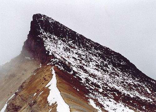
 Nevado Tolima.
Volcanic Eruptions and Earthquakes
Nevado Ruiz is the most massive of the volcanoes and it looks like the upper part of Kilimanjaro. Nevado Ruiz is also one of the deadliest mountains in the world, as a single eruption killed over 23,000 people on November 13, 1985. The eruption wasn't huge, but it melted a good portion of the once huge icecap within a matter of seconds. The resultant flood completely destroyed the town of Amero, burying the town in 100 meters of mud. The last previous eruption was in 1845.
Unfortunately, volcanic eruptions aren’t the only natural disasters common to the area. Only days after we finished our climbs and just after we returned to the United States (January 1999), an earthquake destroyed many of the towns surrounding the national park. Thousands were killed.
Nevado Tolima had its last eruption in 1943. Many scientists consider the volcano to be dead, but others aren’t too sure. Needless to say, the area of the national park is very active, geologically.
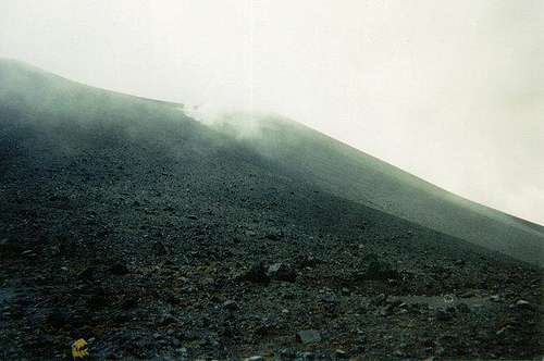
 Nevado Ruiz.
Getting There
The two main routes to reach the national park are from the north and from the south. The northern route is covered here under the Nevado Ruiz Page. The southern route is covered here under the Las Latas Page.
There are two other ways to access the national park from the west. There is a trail entering the park from Pereira and then to Parque Ucumari, Refugio Pastora, and Lago Otun. There is another trail farther south and from the Reserva del Canyon del Alto Quindio, Guayquill, and to near Nevado El Quindio. I am unfamiliar with both of these routes, so inquire locally. (If you have any information on either route, please post here).
Unless things have changed since the late 1990’s, access from the east side of the national park isn’t practical because of all the devastation fro the Ruiz eruption. See above.
 South entrance of the national park.
Introduction to Climbing and Hiking
Nevado Tolima and Santo Isabel are the only peaks that require an ice axe and crampons, though Ruiz may require one in the future if the glacier reforms after being melted away by the eruption. The other peaks usually don’t require an ice axe and crampons, but they may after a stormy period, or during the wet season. Tolima has some very difficult snow and ice routes, as well as at least one technically easy one.
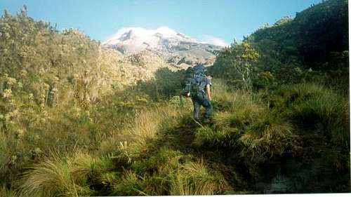
Besides the above, most of the other peaks, besides are hikes and scrambles, and don’t require any special equipment. While you can drive to high elevations from the north, entering the park from the west or south requires beginning in the jungle and lots of elevation gain.
In bad weather (very common), navigation is a serious concern. Although this area is near the equator, whiteouts are a serious problem. Go prepared.
If you are a trekker, you can make a traverse of the range from north to south of vice versa. Climbers can also make a similar trip and bag all the major summits in the park along the way. Plan on taking 7 days of trekking, and 10 days if climbing. Traveling from north to south involves less elevation gain, but acclimatization is a serious concern since the northern trailhead is so high. You must be acclimatized before setting out from the northern trailhead.
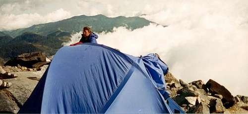
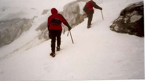 Climbing Tolima.
Acclimatization
As with any moderately high mountains, acclimatization is important. This is especially true if you enter the park from the north. It is too easy to get too high too fast on these volcanoes, and this is a serious concern. If climbing any of these peaks, you should plan on spending at least a few days between 3000-4000 meters/10,000-13,000 feet before attempting to climb to the summits.
 El Quindio.
Camping
If camping at high elevations, make sure to bring a four-season tent that can withstand high winds and storms. Guy lines are recommended. There are no real mountain huts in the park, though one did exist near Nevado Ruiz at one time. The hut on Nevado Tolima at Las Cuevas was in pretty poor condition in 1998.
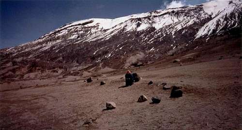
 Camp at Las Latas 4600 meters/15,091 feet.
Red Tape
A permit is supposed to be required for all climbs and treks in the national park. We did have to pay a fee to enter the north end of the park, but no one asks for one in the south end, though we did sign in. This was in 1998-1999.
Nevado Ruiz is often closed due to volcanic eruption danger. Inquire at the national park office just north of the mountain, and along the access road.
 The active Ruiz is sometimes officially closed to climbing.
Seasons
The best months for climbing or trekking are January and February. December and March can be good as well. Sometimes July and August can have good weather. The rest of the year is very wet. Even in the so-called “dry” season, the area is very wet and storms and whiteouts are very common. This mountain area is known for bad weather, but at least it makes for many waterfalls and rainforest on the lower slopes, as well as glaciers at higher elevations. Go well prepared for bad weather at any time of year.
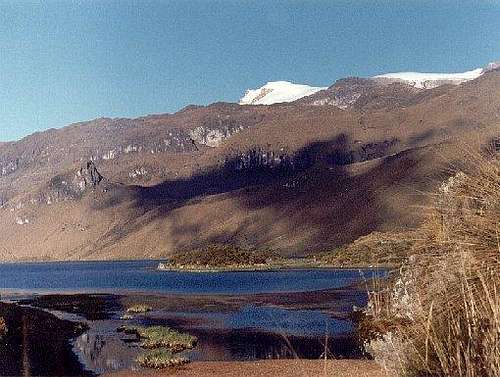 Nevado Isabel. January and February typically offer the best weather in the park.