Hiking in Pemberton Area
Year 2008 was my first year in British Columbia (BC), and my first time hiking experience ever. I didn't know much about Pemberton before we started to hike there. I knew only that when the gold dried up, people in Pemberton Valley started to grow today’s world famous virus - free seed potatoes. I read that in an ad in travel magazine advertising for organic vegetable food production in beautiful BC.
Pemberton is located on Highway 99, southwest of Lillooet and 35 km north of Whistler. For over a century, Pemberton existed in isolation from the rest of the lower mainland, and could be accessed only by train. That changed when a highway 99 was built in 1975. According to many people we talked to, the hiking opportunities in this area were endless. One of the most spectacular features in this area is the 2438 meter high Mount Currie. Nevertheless, we decided to climb Peak 8700.
Peak 8700
Matt Gunn, the author behind the book
'Scrambles' that we're using a lot, said that Downtown Creek was one of his favorite areas and suggested that we should check it out. So, Aida, Alen, me and Magnum, our beast of burden, went there. It’s a long 4 hour drive from Vancouver.
Note: after you turn off the highway on the gravel road, there is an intersection at approximately 7 km that is not mentioned in the book. It might be a new logging road that wasn’t there when the book was written. Don’t turn right to go uphill; continue straight and further follow the instructions in the “Scramble”.
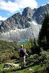
We started around 11:30 am. There is a good trail that begins at the right side of the end of the road, just before a creek.
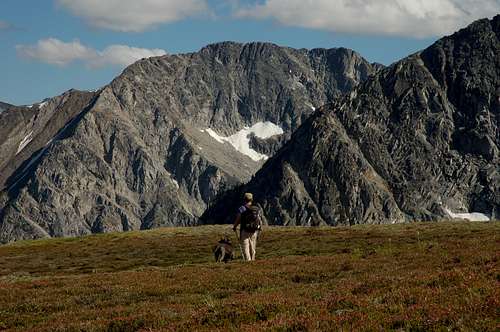
![peak 8700]() We didn't find out who he was.
We didn't find out who he was.![Peak 8700]() "Hurry up guys, hurry up!"
"Hurry up guys, hurry up!"
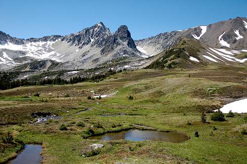
After 45 minutes or so, when you reach the meadows, you will get to an intersection. Left leads to a lake, the right to Peak 8700.
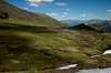
The alpine scenery is gorgeous. What an amazing valley.
Too bad there are not other known scrambles in the area; those peaks are so inviting. I hope somebody will find an easy "scramble" way to climb some of them soon, if not, I'll do it myself for sure next year.
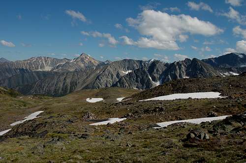
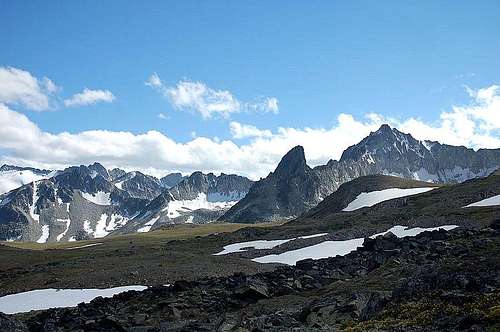
The peak 8700 is not very attractive; you climb it by going up a long scree which is of course very tiring.
The views from the top, however, are magnificent - Lost Valley Creek on the opposite site and summits such as Joffre, Whitecap and Wedge.
We reached the top in approximately 3 hours (which is less time than the book says and we were not going that fast), so we had time to go to the lake.
It was a good thing to do; the lake is really beautiful.
Is there any bad thing I can say about this hike?
Yes, mosquitoes!
General Information
summit: 2631 m
difficulty: easy, hiking
ascent time: 3-4 ½ hours
elevation gain: 854 m
vehicle required: 2WD
driving from Vancouver: 4 hours
(Scrambles, Matt Gunn, page 216) Photos
Comments
No comments posted yet.