


nader - Aug 1, 2006 2:30 pm - Voted 10/10
Ganj Nameh?Is this Ganj Nameh? Thanks for posting. Is this near the trailhead? If not, how far is it from Alvand? Sorry about all the questions.

Damavand - Aug 2, 2006 2:12 pm - Hasn't voted
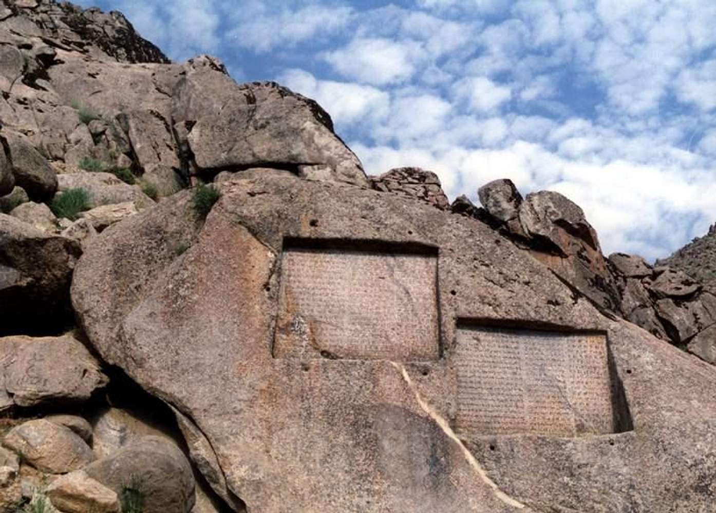
Ghanj NamehDear Nader, This rock is placed the end point of Ganj-Nameh narrow, at the end of the new road, and we start climbing to Alvand in this point.This point was a point of The King-Way near to the last guard station of the capital (Hamedan)where all travelers were reading them.
Each of these international petrographies was in three old languages; Old Persian, Eilamate and Babilon. So The King-Way was following in the other narrow ( Tarik-Darreh) to behind the Alvand mountain to the west to Mesopotamia, and to north west to Asia Minor and the city of Sard was the last point of The King-Way and Persian Empire. The starting point of The King-Way was in Pasargad and Persepolis (their main capital)in south of Iran.
From this point to the top of Alvand is about 3.5 hours, in 3 steps, first to Meydan-Mishan flat, second to Takhte-Nader flat and third to the top of Alvand. In Meydan-Mishan flat there are two shelters for climbers. I've added some maps of Alvand and its routes in Summitpost dot com.
nader - Aug 3, 2006 5:14 pm - Voted 10/10
Re: Ghanj NamehThanks.


Comments
Post a Comment