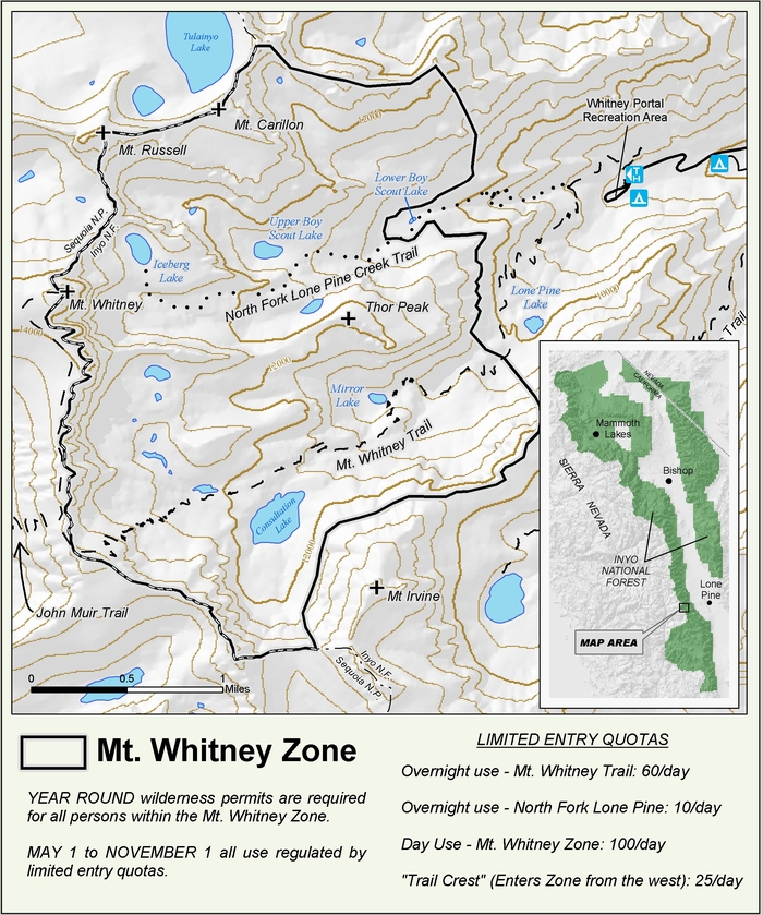
I've noticed on the map that there could be an alternative to the North Fork trail. Just after the picnic area at around 8,300ft near the Portal, a smaller stream splits off to the right (N) and then curves towards the NW and eventually W. This seems like a gully or canyon by looking at the map, but I don't know what it looks like in real life, whether it's drowned in willows, too steep, too loose or whatever.
My intention is to head to Cleaver Col, so I am wondering whether one can take this path instead, avoid the North Fork quota and LBSL, pass the Ledges on the left and join the standard route that heads up towards the Cleaver at around 11,000ft. Here's an illustration of what I mean:
- NForkAlternative.jpg (104.62 KiB) Viewed 4248 times