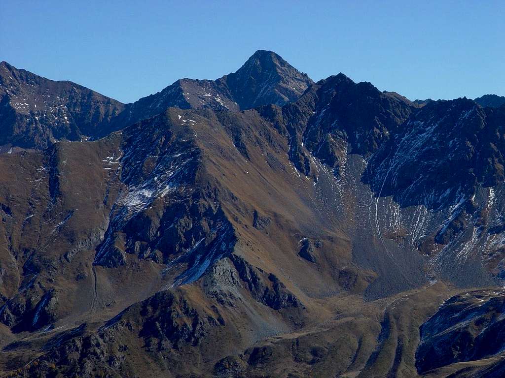
Pic Garin & Punta della Valletta from P. del Drinc 2003
In background: Emilius's Punta Rossa (3401m, left or North), Pas du Valaisan & Mont Valaisan (3210m, 3307m), Pic Garin (3451m)
In foreground: watershed Pila Basin/Arbolle Vallon with Mont Bellefaçe (2970m), Punta della Valletta (3090m) and Soulder 3002/7 metres.
In distance right or South: watershed between Arpisson Grauson Valleys from Punta Fiorito or Fleurie (3256/60m) until Arpisson Tower (3227m).
In the midst outline left or Northern: the Standard Route towards Testa Nera (2820m) also said the "Via degli Alpini".
October 12th, 2003
Photo
by
emilius


