
-
 527 Hits
-
 79.04% Score
-
 10 Votes
|
|
Mountain/Rock |
|---|---|
|
|
35.67864°N / 105.88686°W |
|
|
Hiking |
|
|
Spring, Summer, Fall, Winter |
|
|
8577 ft / 2614 m |
|
|
Overview
Picacho Peak
Elevation: 8577 ft / 2614 m
Total Distance: 3.88 miles
Elevation: start 7,318 ft, maximum 8,528 ft, minimum 7,318 ft
Gross gain: 1,210 ft. Aggregate ascending 1,865 ft, descending 1,876 ft
Maximum slope: 62% ascending, 59% descending, 15.7% average
|
|
|
Getting There
|
|
|
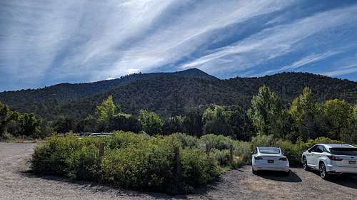
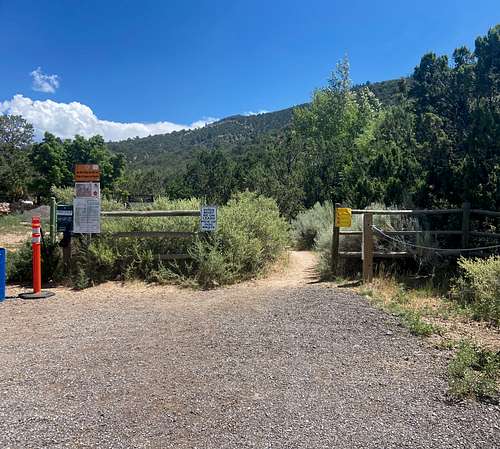
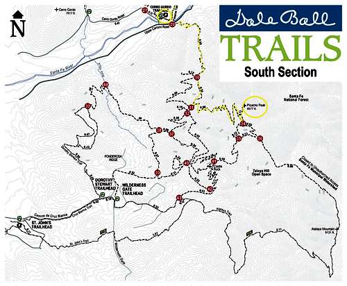
At the intersection of Upper Canyon and Cerro Gordo roads, there is a trailhead that is a crossroads for multiple trail systems in the Santa Fe area.The Cerro Gordo Trailhead is unique within this system because it provides access to three very different ecosystems. The trailhead sits between two major segments of the Santa Fe Dale Ball Trails, which extend for more than 25 miles through the Sangre de Cristo foothills on the east side of the city. The Dale Ball Trails are multi-use trails popular with hikers and bicyclists.In 2016, city and county trail volunteers, with assistance from other volunteer organizations, placed new trail junction markers throughout the Dale Ball Trail system. Santa Fe County staff installed new maps at the system trailheads to make it easy to navigate the trails. A map of the system is available on the Santa Fe Conservation Trust website tinyurl.com/mc235w3.The southern segment of the system, which extends from the Cerro Gordo Trailhead south to the Talaya Hill open space, is predominantly mixed piñon-juniper woodland and Ponderosa pine forest in mountainous terrain. The northern segment, which extends to the La Piedra Open Space and connects to Little Tesuque Trail and the trail system in the Santa Fe National Forest, is mostly piñon-juniper shrubland in lower, dryer terrain.The trailhead is also the entrance to the Nature Conservancy’s Santa Fe Canyon Preserve.
There is a1.5-mile trail through the 525-acre preserve, which is a conservation jewel along the Santa Fe River (bicycles and dogs are not allowed on the preserve trails in order to minimize visitors’ disturbance to wildlife). This trail connects to the entrance to the Randall Davey Audubon Center and Sanctuary, which has its own trail system. The Audubon Center is closed Sundays.
At its northwestern end, preserve trail also reconnects to the Dale Ball Trails just south of Trail Marker No. 28.
The Cerro Gordo Trailhead is also the intersection of many interests in the Santa Fe community.
On any given day, the trails host to people getting exercise or walking their dogs, the gathering of friends and what at times may be someone’s last desperate scrabbling for solace and healing in relative solitude.
The expectations and experiences of each group are different, and it’s important for all to remember that each of us is part of the larger community, which includes wildlife and the plant communities upon which they depend, sharing the same resources.
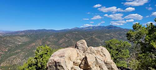
The segment of the Dale Ball Trails that runs from the Cerro Gordo Trailhead south to the junction with the trail to Picacho Peak is a relatively short hike in beautiful scenery, with spectacular vistas along the way.
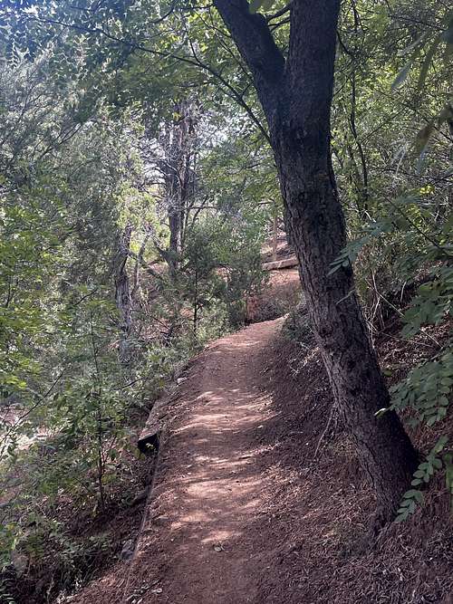
From the Cerro Gordo trailhead, after a very brief route through the riparian habitat in the Santa Fe Canyon bottom, the trail crosses Upper Canyon Road and moves into piñon-juniper woodland, beginning at the marker for Trail Junction No. 29.
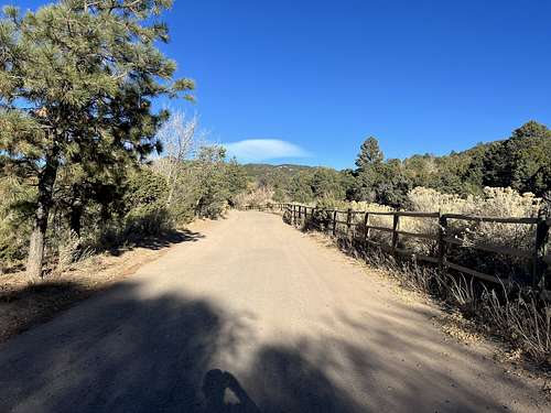
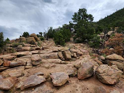
A short distance beyond this marker, there is a lookout just off the trail, with a plaque describing the “hydropower” history of the Santa Fe River. From 1895 through 1926, there was a hydroelectric plant providing Santa Fe’s electricity, and the remains of the intake and some of the old cast iron piping for the plant still remain along the sides of the trail. After about a quarter-mile, the trail begins climbing the western flank of Picacho Peak, paralleling and sometimes crossing a ravine that dominates the topography of this section of the trail. The dynamic forces shaping this terrain are evident in the enormous boulders littering the bottom of the ravine, washed down from above by the occasional torrential rainfall.
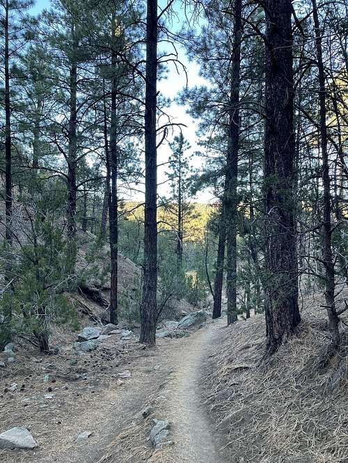
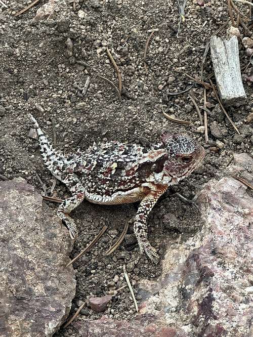
As you walk along, you will see Ponderosa pines and their companion plants begin to appear among the piñones. The wildlife you may see also changes with elevation, with desert cottontail rabbits and rock squirrels giving way to the occasional deer or Abert’s squirrel.
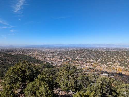
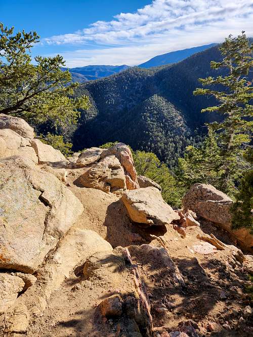
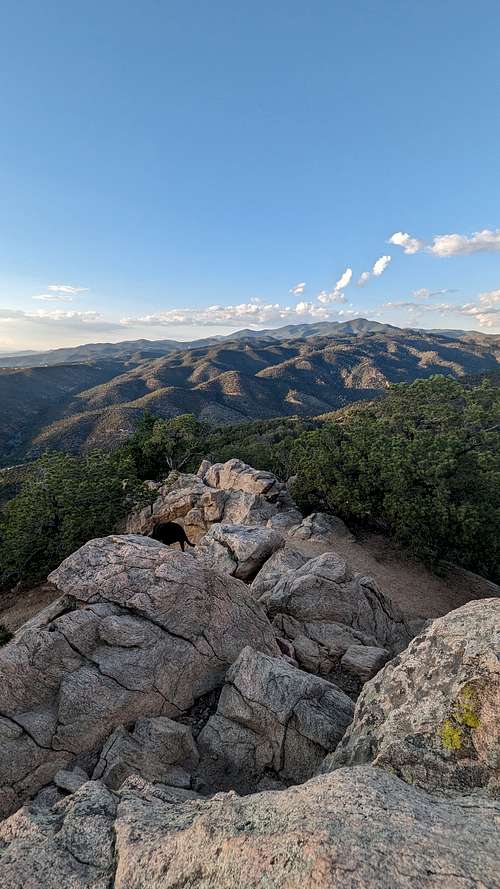
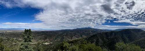
At about six-tenths of a mile, this trail segment makes a short, steep climb to top out on a ridge, at the marker for trail junction No. 30. There is a short spur trail to the top of a hill at the west end of the ridge with outstanding views of the city below, west to the Jemez Mountains and southwest to Mt. Taylor. To the south, Cerro Bonanza and the Cerrillos Hills stand in front of the Ortiz and San Pedro Mountains. From trail marker No. 30, it’s a short quarter-mile walk in easy terrain to junction No. 31. This junction includes the beginning of a trail to Picacho Peak (nine-tenths of a mile with many switchbacks) and an option to loop west for six-tenths of a mile to return to trail junction No. 30, for a return to the Cerro Gordo trailhead.
Trail junction No. 32 lies a short distance beyond junction No. 31. From this junction, there are connections to two routes leading to Wilderness Gate trailhead and the Dorothy Stewart trailhead on Camino de Cruz Blanca.
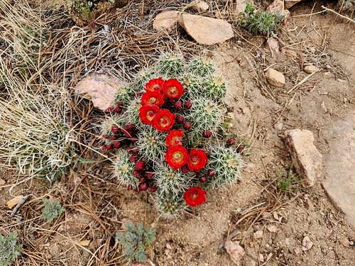
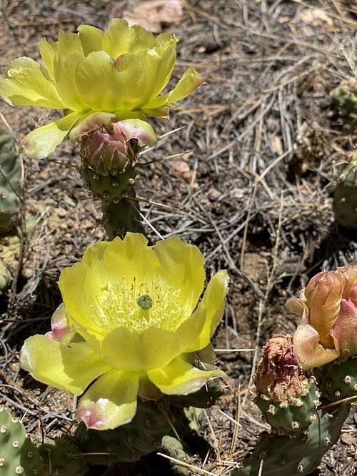
Wildflowers are abundant from early spring through late fall, the views never fail, there’s enough shade to keep you from broiling in the summer, and unless the trails are muddy, these trails are an excellent way to leave our mechanized world behind for a few hours.
|
|
|
Route
|
|
|
The start of the trail passes through private property so stay on it. It is a well used trail and is easy to follow and to tread upon. Some 700 feet into the hike the trail takes to the top of a high berm, what appears to be the downhill edge of an acequia. Along the way we encountered a sign that explained some history of this “Hydropower Ditch”. The trail then turns into an arroyo and begins the climb towards Picacho Peak. It is a reasonably steady climb, rising the 1,210 feet in 2 miles; up the arroyo, over a ridge and across another arroyo, then up a ridgeline to the peak.
|
|
|
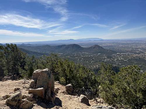
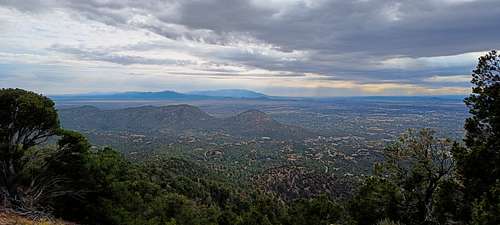
The trail is in good condition throughout; only a few sections that are steeper over large rocks. A couple of places where the trail topped a ridge, the views across Santa Fe to the Jemez Mountains were great (‘tho haze restricted the scenic-ness of the views on this day). This should be a great trail for winter hiking (avoiding recent snowfall), but is quite exposed and I expect it would be hot in the summertime.
Red Tape
|
|
When to Climb
All four seasons.
Camping
Santa Fe National Forest isn’t just a cool spot in New Mexico, it’s a place that painters, poets, photographers and adventurers have waxed poetic about since...well, forever. It’s easy to see why, with over 1.6 million acres and over 1,000 miles of trails to explore. Whether it’s an autumn day trekking under trees blazing gold, or taking turns down the slopes at Santa Fe Ski Basin, the forest is a year round wonderland! Spring and Summer offer thrilling whitewater rafting down the Rio Grande, trout fishing, hunting, and nights under the stars. It’s easy to set up camp here too in one of the forests many campgrounds, and if you plan on staying away, be sure visit the town of Santa Fe, one of the most artistic and beautiful towns in America.
External Links