Pila Comboé & "Becca": a Tourist-Cultural Walk for Kids Teens & Adults / 3

Pila Comboé & "Becca": a Tourist-Cultural Walk for Kids Teens & Adults / 3

Page Type Page Type: Article
Activities Activities: Hiking

Tourist/Cultural/Historic & Religious Walk Overview


Reading this Article is Absssolutely obliged to children, Boys & Adults or to the entire Families. In the same we will not talk of Summits, Spiers & Spurs, Buttresses, Hills & Passes, Lakes, Refuges & Bivouacs, etc . But we want to take a walk together with you without a definite goal or targeted. Wandering together into the Pila Conca or Basin, above the small City of Aosta and the Municipalities of Charvensod, Gressan, Jovençan, Aymavilles and up to the entrance of Aymavilles Common in Cogne Valley. Find something interesting and maybe discover old things and unknown, or simply abandoned to neglect. Yes, because going in Mountain often forget all past Historic, Cultural and also Religious,e that has long been part of the Life of the same, intricately connected with its History. A story within a story that for centuries, even millennia, preceded that of Mountaineering and Hiking and the Discovery of the Alps. A story which saw peoples and generations live at the base of the same, at least since he started to retreat the great Glacier Balteus that, flowing from Mont Blanc Mountain Chain to the Po Plain near Ivrea little City, has left its traces almost eternal with lakes, moraines and glacial terraces that highlight their mark to a height of 1800 metres about neighbor Pila Basin. This was therefore the thickness of the ice during the ice age. For us, no, it is a real goal ...


"... Comboé or Combuì a Paradise Lost? ...", by Antonio


La lettura di questo Articolo é Assssolutamente obbligata ai Bambini, Ragazzi & Adulti o dalle intere Famiglie. Nello stesso non parleremo di Sommità, Guglie, Contrafforti, Speroni, Colli, Laghi, Rifugi, Bivacchi ecc.; bensì vogliamo fare una passeggiata insieme a Voi senza una meta ben definita o mirata. Vagabondiamo insieme nella Conca di Pila, sopra la Città di Aosta ed i Comuni di Charvensod, Gressan, Jovençan e fino a quello d'Aymavilles all'entrata della Valle di Cogne. Qualcosa di interessante troveremo e magari scopriremo cose vecchie e sconosciute, oppure semplicemente abbandonate all'incuria. Si, perché andando in Montagna spesso dimentichiamo tutto un passato Storico, Cultutale ed anche Religioso che ormai da lungo tempo fa parte della vita della medesima, intricatamente connesso con la sua Storia. Una storia nella storia che per lunghi secoli, anzi millenni, ha preceduto quella dell'Alpinismo e della Scoperta delle Alpi. Una storia che ha visto popoli e generazioni vivere alla base delle medesime, almeno da quando ha iniziato a ritirarsi il grande Ghiacciaio Balteo che, scorrendo dalla Catena del Bianco insino alla Pianura Padana, ha lasciato le sue tracce quasi eterne con laghi, morene e terrazzamenti glaciali che evidenziano il loro segno fino all'altezza della Conca di Pila a 1800 metri circa. Tale era quindi lo spessore dei ghiacci durante la glaciazione.
Per noi no, é vera e propria meta ...


"... By Charvensod Hills over Aosta City ...", by Antonio Giani


Looking at an old B&W photograph, found by accident in a drawer, rediscover many things that you had forgotten or simply shelved in the Mind. Rediscover the traces of a little past that is quickly spent, with nothing that apparently change, as if just us to transform us. Instead, if you look carefully between the lines, everything, perhaps inadvertently, changes along with us. Did you smoke one brand of Cigarillos that not smoke more, listened by Walk-man music of Purple, U2 and Dire Straits not listen anymore, climbed walls that did not stop more, you did not do that bivouacs to open more. Maybe finding shelter in the hen-house of an old alp. Even the old dirt road from Reverier du Tzat (Cat) reached the Reverier Dessous, passing at the Chapel of St. Joseph, has changed; is now covered by a sneaky asphalt and mules do not spend more, giving way to modern transportation. Up above there is always the "Becca", which seems not to be changed. While the waters of Ponteilles throw themselves beautifully in a vacuum. Always the same. All this comes down to the North, to the City, with woods now uncultivated alongside the steep Gorge du Dard up above the Fractions Roulaz, Alto Felina and Piano Felina Felina at the limit of the Eatern Municipality of Charvensod. More to the west rises the regional road to Pila that, after passing the Baltea on the Bridge of Pont-Suaz, comeback the hill to the Chief-town; from this is directed to the East, reaching to about 1000/100 metres the four Reverier with its annoying and inevitable noises.
Unfortunately always present. As long as this has given us right time to reflect, observe the right things better ...

Rest, relax, music and pause after North Face
REVERIER du TZAT ANCIENT ALPAGE & Old Fountain under the NONA s BECCA
Adults / 3 Reverier du Tzat above Pian Felina 1969
Emilius s in  SUMMIT and Surroundings EMO & SUGG REVERIER of WILD CAT &  the FOUNTAIN & the little old WOMAN & the water BUCKET
Curt. VII° Neighbor Ponteilles after North Wall 1996


"... Reminiscences towards Reverier du Tzat, Ponteilles & Comboé ...", by Ines Alasonatti & Ilario Antonio Garzotto


Guardando una vecchia fotografia in B&W, ritrovata per sbaglio in un cassetto, riscopri molte cose che avevi dimenticato oppure semplicemente accantonato nella Mente. Riscopri le tracce di un piccolo passato, che é velocemente trascorso, senza nulla in apparenza cambiare, come se siamo solo noi a trasformarci. Invece, se guardi bene tra le pieghe, tutto, magari inavvertitamente, cambia insieme a noi. Fumavi una marca di Cigarillo che non fumi più, ascoltavi con il Walk-man la musica dei Purple, U2 e Dire Straits che non ascolti più, scalavi pareti che non scali più, facevi bivacchi all'aperto che non fai più. Magari trovando riparo nel pollaio d'una vecchia alpe. Anche l'antica strada sterrata che dal Reverier du Tzat (del Gatto) raggiungeva il Reverier Dessous, transitando presso la Cappella di San Giuseppe, é cambiata; ora é ricoperta da un subdolo asfalto ed i muli non passano più, lasciando spazio ai mezzi di trasporto moderni. Lassù in alto c'è sempre la "Becca", che sembra non esser cambiata. Mentre le acque di Ponteilles si lanciano stupendamente nel vuoto. Sempre uguali. Tutto questo scende verso Settentrione, verso la Città, con boschi ormai incolti affianco alla Gola del Dard fin al di sopra delle Frazioni di Roulaz, Alto Felina e Pian di Felina al limite Orientale del Comune di Charvensod. Più ad Ovest sale la Strada Regionale per Pila che, dopo aver oltrepassato la Dora sul Ponte del Pont-Suaz, rimonta la collina sino al Capoluogo; da questo s'indirizza ad Est raggiungendo a circa 1000/1100 metri i quattro Reverier con i suoi fastidiosi inevitabili rumori.
Sfortunatamente sempre presenti. Tutto ciò ci ha dato il tempo adatto per riflettere, osservando meglio le giuste cose ...


"... But this time we go up from the Aosta Town ...", by Antonio


If a Child or a Family wants a beautiful Walks where you wear them? Looking from Aosta, where they left the car, upwardly see the Emilius (3559m) and just below the Becca di Nona (3142m): they want to go there? No, they just want to make a simple walk so know the area and its main characteristics. Then you have to make them look more at the bottom, under the blinding lights that mark a new Dawn. Below, where it still remains the Shadow of the Night. Below, where among the Basin Pila (1900/800 metres about) and the City of Aosta (560/80 metres about), down a steep hill to the North up to the plains lapping in South the course of Baltea among the Municipalities Charvensod, Gressan and, farther West, Jovençan then finally Aymavilles. From the Town Centre you can go up to Pila with a Regional Road, starting at Midday of the same, crosses the river at Pont Suaz and reaches the District-Resort after about twenty Kilometres; or by a large parking lot, between the City and the river, go up by cable-car. From the Village of Pont-Suaz (567m) a junction to the West side of the proceeds Dora first reaching the Gressan Common (603m; 4 Km. from Aosta) and then to Jovençan (631m; 5 Km. Aosta). From the first, in the locality Chez le Ru, an alternative road asphalt reaches the crossroads between Gerdaz/Les Fleurs (1414m) in rejoining the one that goes from Charvensod Commune (746m). A farm dirt road goes up from the Municipality of Gressan entering in that of Jovençan in Fraction Montrosset (831m) to the South, reaching the Alpe Bren di Milieu (1642m; from this point cartel ban) and then continue Eastward in the direction of Pila-Pesein From the village of Pont-Suaz (567m) a junction to the West side of the proceeds Dora first reaching the Gressan (603m; 4 Km. from Aosta) and then to Jovençan (631m; 5 Km. Aosta). From the first, in the resort Chez le Ru, an alternative road asphalt reaches the crossroads of Les Fleurs (1414m) in rejoining the one that goes from Charvensod (746m). A farm private dirt road goes up from Municipality of Gressan entering into these of Jovençan in Fraction Montrosset (831m) to the South, reaching the Alp Bren di Milieu (1642m; from this point cartel ban) and then continue Eastward in the direction of Pila-Pesein (1677m), just below Pila. Towards Bren Pastures also comes from the private road Turlin of Aymavilles Dessus (1536m), the last village after the one-Ozein Voella (1439m) in the Municipality of Aymavilles (646m), accessible on the Regional Road to Cogne Valley from the junction 958 metres after the diversion towards Pondel or Pont d'Ael (839/73m), always by road asphalt. By the Municipality of Jovençan, now at the foot of the Punta de la Pierre (2653m), on the other hand go up, in addition to the initial part of the farm above, only mule tracks or trails. But also in other sectors, now "cut" from these roads, rising from the valley floor several paths, which often connect to each of them. They offer beautiful walks in the woods, or higher, with beautiful Hiking even in crossings between dense forests. In addition to the mountain pastures, which mark the rhythm of pastoral life, it is not difficult to find some ancient Sanctuary, old Little Church or simple Chapel Votive, such as to indicate the Religiosity in Centuries passed by the local inhabitants, traditionally very "connected" to Christianity; so much so that at almost every one of alp we find the outside of the large wooden Crosses, sufficient to remove the Devil and all Spirits Villains. An expression spread across the Valley of Aosta and remarkable well in this Area. All that remains is to gear backpack, boots, a stick and a lot of good will, starting in search of our goals. Along the way, we will surely meet many interesting.


"... The last Paradise ...", by emilius


Se un Bambino od una Famiglia voglion far una bella Passeggiata, dove li portate? Guardando da Aosta, dove han lasciato l'auto, verso l'alto vedon l'Emilius (3559 m) e subito sotto la Becca di Nona (3142 m): voglion andar lì? No, vogliono soltanto effettuare una semplice passeggiata onde conoscere il territorio e le sue principali caratteristiche. Allora dovete fare guardare loro più in basso, sotto quelle luci accecanti che segnano una nuova Alba. Sotto, dove ancora permane l'Ombra della Notte. Sotto, dove tra la Conca di Pila (1900/800 metri circa) e la Città di Aosta (560/80 metri circa), scende verso Nord una ripida collina fino a quelle pianure che lambiscono a Sud il corso della Dora Baltea tra i Comuni di Charvensod, Gressan e, più in là ad Ovest, Jovençan ed infine Aymavilles. Dal Centro della Città potete salire a Pila con una Strada Regionale che, partendo a Mezzogiorno della medesima, scavalca il fiume al Pont Suaz e raggiunge il Comprensorio dopo una ventina di Kilometri; oppure da un grande parcheggio, tra la Città ed il fiume, salire tramite la Funivia. Dal Villaggio del Pont-Suaz (567 m) un bivio verso Ovest procede a fianco della Dora raggiungendo dapprima il Comune di Gressan (603 m; 4 Km. da Aosta) e poi quello di Jovençan (631 m; 5 Km. da Aosta). Dal primo, in località Chez le Ru, una strada alternativa in asfalto raggiunge il bivio di Les Fleurs (1414 m) ricongiungendosi a quella che sale da Charvensod (746 m). Una strada poderale sale da Gressan entrando nel Comune di Jovençan, in Frazione Montrosset (831 m), verso Sud raggiungendo l'Alpe di Bren di Milieu (1642 m; da questo punto cartello di divieto) per poi proseguire verso Est in direzione di Pila-Pesein (1677 m). A Bren arriva anche la poderale da Turlin d'Aymavilles Dessus (1536 m), ultimo Villaggio dopo quello di Ozein-Voella (1439 m) nel Comune di Aymavilles (646 m), raggiungibile su Strada Regionale per la Valle di Cogne dal bivio 958 metri dopo la deviazione per Pondel o Pont d'Ael (839/73 m), sempre tramite strada in asfalto. Dal Comune di Jovençan, ormai alle pendici della Punta de la Pierre (2653 m), invece salgono, oltre alla parte iniziale della poderale di cui sopra, esclusivamente mulattiere o sentieri. Ma anche negli altri settori. ormai "tagliati" dalle suddette, provengon dal fondovalle numerosi sentieri, spesso tra lor collegati. Offrono belle Passeggiate tra boschi o, più in alto, stupende Escursioni anche con traversate in fitte foreste. Oltre agli alpeggi, che segnano il ritmo della vita pastorale, non é difficile incontrare qualche Santuario, Chiesetta o Cappella votiva, tali da indicare la Religiosità nei Secoli passati da parte degli abitanti locali, tradizionalmente molto "legati" al Cristianesimo; tant'é che presso quasi ognuna delle alpi ritroviamo all'esterno grandi Croci in legno, atte ad allontanar il Diavolo e tutti gli Spiriti Cattivi. Un'espressione diffusa in tutta la Valle e notevole pure in quest'Area. Non riman che attrezzarsi di zaino, scaponi, un bastone e tanta buona Volontà partendo alla ricerca dei nostri obiettivi. Strada facendo, ne incontreremo sicuramente molti interessanti.


"... On Emilius's Summit? No!...", by Osw


You pass from Alp Chamolé (2152 m)
. If we talk about the high area we need to talk Alpage of Chamolé, because, even more Pila, the pin must be considered important for many walks. Located on the edge of the forest, called Bois du Jardin Public, and above a beautiful prairie, is facing North, ie above the City of Aosta. You can reach from Pila-Resort with several departures differentiated through the various paths n° 14/16/19/19A, who gather near the junction 2049 metres at the exit of the forest; a wide circle semicircular towards Southeast, past the ruins of Alpe Chanté (2114m; between the stones pell-mell piled, attention to the viper!), leads to the beautiful stone fountain just South of Alp. Absolutely not cross the great lawn! Here also comes a private road concomitant with the trails n° 19/19D/20/102, that goes from the Hermitage of San Grato (1787m; fountain and several stone barbecue) and, overcoming the eponymous mountain pasture just behind, goes back towards South so steeply in East of Torrent Vernaillère coming to ' alp right at the fork where the trail n° 20/16 begins to Colle Fenetre Plan (2229m) and the Vallon of Comboé. To get to San Grato using a comfortable farm private dirt road attendant with the trail n° 14Lthat, starts just above the large parking lot at the "Restaurant Lyon Noir", goes on a slight slope to the East through the forest. This is a classic walk for families, while in past centuries was the culmination of a great popular Procession that starts from Aosta, dated the entire hill of Charvensod by the path n° 14L/102passing first to the Shrine of Sainte Colombe (915m). Here was honored the Patron Saint of Aosta Town. If you do not want to reach the Comboé or Combuì (2114m; private retreat of the Canons of St. Orso with adjacent mini Church, just above the Alp of Comboé Dessus or Upper with rustic fountain), you can reach the Chamolé Lake (2325m), under the Testa Nera (Black Head; 2820m) and just to the East of the arrival Stationl of the Chair lift with the same name (2311m).


"Lake at the fork towards Chamolé & Replan Hills", by Antonio


The use of this and its crossing to the East via easy trail- muletrack is a popular revolt to the mass
, whereas on the deep small vallon above the Alpe di Chamolé you make a beautiful Walk-Hike. There are three possibilities: 1)- reached the ruins of Alp Chanté, instead of reaching that of Chamolé, continue straight to South by means of a clear path not numbered, in the middle of the Bois du Jardin Public and between wide expanses of violets, the trail reaches above a little further away from the lake. 2)- reached the Chamolé Pasture climb above the water intake, directly behind the fountain, and the route n° 14/19A/102 and path almost parallel to the previous one reaches the same. 3)- Or, and even more to the East through the trail n° 19 that passes beneath the watershed with Comboé, reaches the emissary of the same, just at the point where the branches start to the Chamolé Pass South (2641m; to the Refuge Arbolle 2516m) and the two Hills South and North of Replan. Other options to reach the lake are represented by the trail n° 19B, that from Pila-Gorraz Dèsott (1930m), after a voyage to the East, the interior rooms of the Bois de Chanté passing below the Chairlift; or more to the West, but by far the most laps with wide paths 19C/22 typically concurrent or near the ski slopes "of the Wood or Renato Rosa, of Fagiani or Nouva". The same do not recommend it either too steep or definitely "dispersive" forcing strenuous climbs or too out of the ideal line of ascent, although you can get more of the same experiences to learn more about the entire Area of Pila in its upper-middle part and to the base of its mountains. This applies to the industry's most Eastern and Central part that concerns the most vital part of the Resort, that from the watershed with the Vallon of Comboé, in the Common of Charvensod, reaches the opposite over the Municipality of Aymavilles at the border with Cogne Valley. From the industry's most popular tourist fact "open" Westward great forests, unfortunately crossed by too many ski lifts for Skiing and traversed by a disproportionate number of farm roads that respectively reach Punta del Couiss (2611m) and the average altitude of the mountain pastures in 2200/300 metres around. A trip "classic" and quite popular is the one that, by starting from the Upper Station of the Cable Car Chamolé diagonally in the Southwest through the farm dirt road concomitant with the trail 19C/TVC, reaches slightly downhill the turnoff 2231 metres, where they arrive also the private dirt roads "poderali" coming from the runs Skiing of the "Nouva and Leissé". From this, turning to the South with the trail 22/TVC, you reach the renovated Pasture of Plan de l'Eyvie or Eyve (2253m; Ground Water), located at the foot of the West Ridge of Mont Bellefaçe (2970m), as well as at the beginning of the path that leads to the Tsa Sètze Hill (2815m), between Pila and Cogne Valley. From this point begin walking "most Western" that run through the area that reaches the watershed with the initial part of the Valley of Cogne, in succession, of Punta Montpers, Piatta of Grevon, Punta del Couìss with Bivouac "Arno", Punta del Drinc or Drink and Punta de la Pierre, known locally as "La Pera", and their necks. Nevertheless, even in this area there are beautiful walks that reach through the path-farm road n° 19C/22 the Pastures of Gorraz Damon (1962m), Plan Perdu (2000m), Chatelaine (2102m), La Pera (2149m) and Nouva (+; 2170m). Or more to the West with the trail n° 22/22A towards the Alps Chalechémoz (2031m), Champ Vert (2071m), Leissé (2126m) with its pond below, today transformed from an artificial barrier. Progressing more and more towards the West also in the direction of travel, always starting from the upper parking Gorraz, we find a number of beautiful walks which can be summarized as follows: a)- by Gorraz towards the Alps of Prendir (1976m), Lap (2076m), crossroads 2112 metres, Bois (Wood) de Lap up to three Grimod (Dessous 2158m, Grand Grimod 2193m, Dessus 2232m), at the end of this part of the lifts through the trails n° 23/23A. Returning from this last verse Southeast with the trail n° 22B can reach the Alp Leissé Damon (2163m), arriving back at the lake of the same name and so making a circular path. b)- Again with the previous route to the junction 2112 metres and from this with the last path concomitant to farm, but in the opposite direction or Northwest, can be reached by crossing the Grand Bois, Laffranc Pasture (2105m) and immediately below the most important one of Grimondet (2105m) as well as the latest in Chaz-Liautaysaz (2077m). Over the path to becoming n° 23B through the Bois de Champchenille North, at the foot of the Northern Slope of the "Pera", reaching the same name alp (2212m), now beyond the watershed and above Ozein Hamlet in the Municipality of Aymavilles. This last part is not always easy to follow because of the vegetation and requires good knowledge of territory and orientation ability. Definitely to be avoided in the presence of snow. c)- Still to Gorraz you can, with the path n° 23B and decidedly path to the West, reaching, crossing the Torrent de Fernier before Alpe Grivel (1910m), Chaz-Liautaysaz reconnecting in such a way to the previous route. d)- Finally, the last part a little walk in Pila, in the locality Pesein (1766m), with the farm dirt road to the concomitant ancient path-mule track n° 21, which crosses towards West the entire walloon and in succession the Torrents Plan and Fernier other side, reaches with gentle descent path in the Pastures of Alpettaz (1718m) and Bren of Milieu (1642m), arrives Grand Pailler, just below la Premu (1554m), and soon after Turlin Dessus (1536m), now in Aymavilles Common. This farm road, which in winter becomes a cross-country Skiing, is somewhat known and traveled in the summer where it is easy to meet large groups of families with children as well as the very elderly. Typically this is the most frequented route starting from Turlin Aymavilles Dessus with achieving Pila-Pesein and back, rather than in the opposite direction; however also the journey beginning opposite knows a good attendance. Furthermore, the same fits very practice of mountain bikes and is easy to meet many Bikers that, reached Bren of Milieu, crossing towards Turlin of Aymavilles Dessus then down to the valley with the Roads Regional Ozein and Cogne Valley, or from this point opt for a descent "more rustic" towards Gressan with the private dirt road.


"... The entire Upper Part of Pila Conca or Basin above Aosta City ...", by livioz


Passate dall'Alpe di Chamolé (2152 m), sotto al Colle Plan de Fenetre. Se parliamo della zona alta dobbiamo parlare dell'Alpe di Chamolé, perché, ancora di più di Pila, deve essere considerata il perno importante per molte passeggiate in diverse direzioni. Situata al limite del bosco, chiamato Bois du Jardin Public, e sopra una bella prateria, é rivolta verso Settentrione, cioé sopra la Città di Aosta. La potete raggiungere da Pila con diverse partenze differenziate per mezzo dei vari sentieri n° 14/16/19/19A, che si riuniscono nei pressi del bivio 2049 metri all'uscita del bosco e prima del grande prato sottostante l'alpe; un largo giro semicircolare verso Sudest, oltrepassando le rovine dell'antica Alpe Chanté (2114 m; tra le pietre disordinatamente ammucchiate, attenti alla vipera!), porta alla bella fontana in pietra subito a Sud della stessa. Non attraversate assolutamente il grande prato! Qui giunge anche una strada poderale concomitante con i sentieri n° 19/19D/20/102, che sale dall'Eremitaggio di San Grato (1787 m; fontanella e diversi barbecue in pietra) e che, superando l'omonimo alpeggio subito alle spalle, risale in modo ripido con stretti tornanti verso Sud ad Est del Torrent Vernaillère giungendo all'alpe proprio presso il bivio, dove inizia il sentiero n° 20/16 indirizzato al Colle Plan Fenêtre (2229 m) ed il Vallone di Comboé. Per arrivare a San Grato si utilizza una comoda strada poderale in simbiosi col sentiero n° 14L, che, partendo appena sopra il grande parcheggio presso il "Ristorante Lyon Noir", si dirige in falsopiano verso Est attraversando il fitto bosco. Questa é una classica passeggiata per famiglie, mentre nei secoli passati costituiva punto di arrivo d'una grande molto nota Processione popolare che, partendo dalla Città di Aosta, risaliva dal vicino Pont-Suaz col sentiero n° 14L/102 l'intera collina al di sopra del Comune di Charvensod passando dapprima al famoso
Santuario di Sainte Colombe (915 m). Quivi veniva onorato il Santo Patrono della Città d'Aosta.


"... Towards San Grato Hermitage? Yes! ...", by livioz


Se non volete raggiungere il Comboé o Combuì
(2114 m; rifugio privato dei Canonici di Sant'Orso con attigua mini Chiesetta appena sopra l'Alpe di Comboé Dessus con appresso rustica fontana), potete raggiungere il Lago di Chamolé (2325 m), sotto la Testa Nera (2820 m) nonché subito ad Oriente della Stazione d'arrivo della Seggiovia omonima (2311 m). L'utilizzo di questa e relativa traversata ad Oriente tramite comoda mulattiera é una meta rivolta alla massa, mentre invece risalendo il valloncello soprastante l'Alpe di Chamolé si effettua una splendida Passeggiata-Escursione. Tre sono le possibilità: 1)- arrivati all'alpe diroccata di Chanté, invece di raggiungere quella di Chamolé, si continua direttamente verso Sud per mezzo di un evidente sentiero non numerato che, in mezzo al Bois Jardin du Public e tra ampie distese di campi di violette, raggiunge la mulattiera di cui sopra a non molta distanza dal lago. 2)- raggiunta l'Alpe di Chamolé si sale alla soprastante presa dell'acqua, subito dietro alla fontana, e con il sentiero n° 14/19A/102 e percorso quasi parallelo al precedente si raggiunge il medesimo. 3)- Oppure ed ancora più ad Est tramite il sentiero n° 19 che, passando al di sotto dello spartiacque col Comboé ed il Segnal Sismonda, raggiunge l'emissario dello stesso, proprio nel punto dove si dipartono le diramazioni per il Colle di Chamolé a Sud (2641 m; verso il Rifugio di Arbolle 2516 m) ed i due Colli Sud e Nord di Replan. Altre opzioni per raggiungere il lago sono rappresentate dal sentiero n° 19B, che da Pila-Gorraz Dèsott (1930 m), dopo una traversata ad Est, sale all'interno del Bois de Chanté passando al di sotto della Seggiovia; oppure più ad Occidente ma tramite giri ben più larghi con i sentieri n° 19C/22 in genere concomitanti o vicini alle piste da sci "del Bosco o Renato Rosa, dei Fagiani o della Nouva". Le sconsigliamo perché o troppo ripide o decisamente "dispersive" costringenti a salite faticose oppure troppo fuori della linea ideale di salita, anche se si posson dalle stesse avere ulteriori esperienze per conoscere più a fondo l'intera Area di Pila nella parte medio-alta. Dal Centro Turistico più frequentato infatti si "aprono" grandi foreste verso Occidente, esageratamente attraversate nella parte più elevata da troppi impianti di risalita atti alla pratica dello Sci e percorse da un numero eccessivo di strade poderali rispettivamente raggiungenti la Punta del Couiss (2611m), nonché gli alpeggi di montagna insino alla quota media di 2200/300 metri circa. Una gita "classica" ed abbastanza frequentata é quella che, tramite partenza dalla Stazione Superiore della Funivia di Chamolé in diagonale a Sudovest tramite la strada poderale concomitante con il sentiero n° 19C/TVC, raggiunge in leggera discesa il bivio 2231 metri, dove arrivano anche le strada poderali provenienti dalle piste da Sci della "Nouva e Leissé". Da questo, volgendo a Mezzogiorno con il sentiero n° 22/TVC, si raggiunge l'Alpe ristrutturata di Plan de l'Eyvie od Eyve (2253 m; Piano dell'Acqua), situata ai piedi della Cresta Ovest del Mont Bellefaçe (2970m), nonché all'inizio del sentiero che conduce al Colle Tsa Sètze (2815m), tra Pila e la Valle di Cogne. Da questo punto iniziano le passeggiate "più Occidentali" che percorrono il settore raggiungente lo spartiacque con la parte iniziale della Valle di Cogne con, in successione, Punta di Montpers, Piatta di Grevon, Punta del Couìss con il Bivacco "Arno", Punta del Drinc o Drink e Punta de la Pierre, conosciuta in loco come "La Pera", e relativi colli. Tutte queste sono abbastanza lunghe Escursioni con partenza, in genere, da Pila. Ciononostante anche in questa zona esistono delle belle passeggiate che raggiungono tramite il sentiero-poderale n° 19C/22 gli Alpeggi di Gorraz Damon (1962 m), Plan Perdu (2000 m), Chatelaine (2102 m), La Pera (2149 m) e la Nouva (+; 2170 m). Oppure più ad Ovest con il sentiero n° 22/22A le Alpi di Chalechémoz (2031 m), Champ Vert (2071 m), Leissé (2126 m) con appresso il suo laghetto, oggi trasformato da uno sbarramento artificiale. Progredendo sempre più verso Ovest anche nel senso di marcia, partendo sempre dal Parcheggio superiore di Gorraz, troviamo una serie di belle passeggiate che si possono riassumere in questo modo: a)- da Gorraz verso le Alpi di Prendir (1976 m), Lap (2076 m), bivio 2112 metri, Bois de Lap fino ai tre Grimod (Dessous 2158 m, Grand Grimod 2193 m, Dessus 2232 m), al termine di questa parte degli impianti di risalita tramite i sentieri n° 23/23A. Ritornando da questo ultimo verso Sudest con il sentiero n° 22B si può raggiungere l'Alpe di Leissé Damon (2163 m) arrivando nuovamente all'omonimo lago e così compiendo un percorso circolare. b)- Sempre con l'itinerario precedente fino al bivio 2112 metri e da questo con l'ultimo sentiero concomitante alla poderale, ma in direzione opposta ovvero Nordovest, si raggiungono, attraversando il Grand Bois, l'Alpe Laffranc (2105 m) e subito appresso quella più importante del Grimondet (2105 m) nonché l'ultima di Chaz-Liautaysaz (2077 m). Oltre il sentiero diventando n° 23B attraversa a Nord il Bois de Champchenille, ai piedi del Versante Settentrionale della "Pera", raggiungendo l'omonima alpe (2212 m), ormai al di là dello spartiacque e sopra Ozein nel Comune di Aymavilles; quest'ultimo tratto non é sempre facile da seguire a causa della vegetazione e richiede buona conoscenza del territorio e capacità di orientamento. Sicuramente da evitare in presenza di neve. c)- Ancora da Gorraz si può, con il sentiero n° 23B e percorso decisamente ad Ovest, raggiungere, attraversando il Torrent de Fernier prima dell'Alpe Grivel (1910 m), Chaz-Liautaysaz ricollegandosi in siffatto modo al precedente. d)- Infine l'ultima passeggiata parte un poco sotto Pila, in località Pesein (1766 m), con la strada poderale concomitante all'antico sentiero-mulattiera n° 21, che, attraversando lo intero vallone Occidentale ed i successione i Torrenti Plan, Fernier ed altri secondari, raggiunge con percorso in dolce discesa gli Alpeggi di Alpettaz (1718 m) e Bren di Milieu (1642 m), arriva a Grand Pailler, appena sotto la Premu (1554 m), e subito dopo Turlin Dessus (1536 m), ormai nel Comune d'Aymavilles. Questa strada poderale, che in inverno diventa una pista da Sci di fondo, é alquanto conosciuta e percorsa nella bella stagione, ove é facile incontrare gruppi numerosi di famiglie con bambini ed anche persone piuttosto anziane. In genere questo percorso viene maggiormente frequentato partendo da Turlin di Aymavilles Dessus con raggiungimento di Pila-Pesein e ritorno, piuttosto che nel senso inverso; comunque anche il tragitto con partenza opposta conosce buona frequentazione da parte di gruppi numerosi o famiglie. Inoltre lo stesso si adatta molto alla pratica delle mountain-bikes ed é facile incontrare molti gruppi di Bikers, che, raggiunto Bren di Milieu, attraversano verso Turlin d'Aymavilles Dessus per poi scendere a valle con le Strade Regionali di Ozein e della Valle di Cogne, oppure da questo punto optano per una discesa "più rustica" verso le frazioni di Gressan con la sottostante strada poderale.


"... By Pila-Skiing Resort towards North...", by sarme


Walking in the Middle-Lower Hills: by Charvensod Gressan Jovençan Aymavilles


"... Reaching an ancient sacred destination ...", by maria grazia s


Abandoning the goals medium-high, we turn to the medium-low starting by Charvensod, Gressan, Jovençan and Aymavilles, all the South margin of Dora Baltea. These municipalities line-up, after that of Pollein (575m; 5 Km. by Aosta City), from East to West by following in reverse the course of the river most of the Valley of Aosta. A long but narrow plain separates them from the woods where it takes to climb the hill in the direction of the Gorge of Dard (East) and the Basin Pila; many of these areas, before the construction of the villages, flood plains were the same who, during the frequent floods, expanded towards the South. Not for nothing the Romans had built in 25 BC, the ancient Augusta Praetoria Salassorum or Aosta, on the opposite bank or Northern, higher than twenty metres (about 580) and then apparently safer. On the foundations of even older Cordelia, kingdom of Population Celtic of the Salassians. But beyond the threat came from the East, where the Torrent de Buthier, descending from the Valleys of the Gran San Bernardo and Valpelline, often overflowed near the Arch of Augustus, erected in honor of the Emperor Gaius Octavian Augustus, flooding the Eastern part of the Town. From here departed the Legions towards Gaul and Elvezia and this, after the Town of Ivrea, with its features red towers built with bricks, almost at the end of the Po Plain, was the most important outpost. A walled stone, which still exists today, separated the same with its four input ports facing the four cardinal points, from Baltea flowing among those who then were nothing more than large uncultivated meadows. Tradition makes sure that the Romans are expanded beyond the Dora Baltea constructing Villages Polleno, Calvetianus, Gratianus, Joventianus, Aymus and Avilius and probably in search of wood to make fire, to cultivate land or orchards to build. So it makes reference to these Patrician or some Legionnaire, rewarded for his exploits, which was assigned a Peasantry to give rise to the same; actually, but one written with "Aymus et Avilius" at Pondel or Pont d'Ael Aymavilles indicating the property and the construction of the aqueduct, anything we find that we can bring to this conclusion a little forcibly graceful. Indeed Pollein, as they say cards not too old, comes from "Pouleins" or Foals, as stated in the coat of arms, while for Charvensod we find in old maps as that vulgar name of "Chiavasodo" (see the splendid book "The Great Alps mapping past centuries 1482-1865 with the routes of passes between the Aosta Valley Savoy and the Valais and considerations on the area of ​​the Gran Paradiso", published by Priuli & Verlucca in Ivrea 1974). Actually this rude place names and Medieval comes closest, albeit similar by Boccaccio, in what was to be the substrate of the population consists of farmers, probably enslaved after the battle with the Romans. While expanding the Roman World, simultaneously spread Christianity, indeed, while this latest find their mark, the first we find little or nothing to show that the Romans had little interest in this area (not so in Cogne with its iron mines) directed exclusively to the above and much more exposed to the "whims" of Baltea. They could thus find more space locals, turned to livestock and therefore more masters of the territory. Bishop of Aosta, Clergy (see the two localities of Clerou at Pian Felina Fraction and Clérod nearby Gressan) and Squires local permitting. Still today in fact many properties of the plain, the hill and the same Comboé belong, at least in part, to the Canons of St. Orso.


Abbandonando le mete medio-alte, ci rivolgiamo allee medio-basse partendo da Charvensod, Gressan, Jovençan ed Aymavilles, al bordo Sud della Dora.
Questi Comuni s'allineano, dopo quello di Pollein (575 m; 5 Km. da Aosta), da Oriente verso Occidente seguendo in senso inverso il corso del maggior fiume della Valle di Aosta. Una lunga ma ristretta pianura li separa dai boschi ove prende a salire la collina in direzione della Gorgia del Dard (Est) e la Conca di Pila; molte di queste zone, prima della costruzione dei villaggi, erano golene della medesima che, in occasione delle frequenti alluvioni, si espandeva verso Meridione. Non per nulla i Romani avevano costruito nel 25 avanti Cristo l'antica Augusta Praetoria Salassorum, ovvero Aosta, sulla sponda opposta o Settentrionale, più elevata d'una ventina di metri (580 circa) e quindi apparentemente più sicura. Sulle fondamenta della ancor più antica Cordelia, regno della Popolazione Celtica dei Salassi. Di là però la minaccia veniva da Est, dove il Torrent de Buthier, scendendo dalla Valle del Gran San Bernardo e dalla Valpelline, spesso straripava nei pressi dell'Arco di Augusto, eretto in onore dell'Imperatore Caio Ottaviano Augusto, inondando la parte Orientale della Città. Da qui partivano le Legioni verso le Gallie e l'Elvezia e questo, dopo la Città di Ivrea al termine della Pianura Padana, costituiva l'avamposto più importante. Una cinta di mura in pietra, ancora oggi esistente, separava la medesima con le sue quattro porte d'ingresso rivolte ai quattro punti cardinali, dalla Baltea che scorreva in mezzo a quelli che allora non erano altro che grandi prati incolti. La tradizione fà sì che i Romani si siano espansi al di là della Dora costruendo i Villaggi di Polleno, Calvetianus, Gratianus, Joventianus ed Aymus ed Avilius probabilmente alla ricerca della legna per fare il fuoco, terreni da coltivare o frutteti da costruire. Quindi si fà riferimento a questi Patrizi od a qualche Legionario, premiato per le sue imprese, al quale veniva assegnato un Contado per far sorgere i medesimi; in realtà, tranne una scritta con "Aymus et Avilius" presso Pondel ad Aymavilles indicante la proprietà e la costruzione dell'acquedotto, nulla troviamo che ci possa portare a questa conclusione un pò forzatamente aggraziata. Anzi Pollein, come dicono carte neppur troppo vecchie, deriva da "Pouleins" ovvero Puledri, come recita lo stemma del Comune, mentre per Charvensod troviamo in antiche carte il più che volgarotto nominativo di "Chiavasodo" (vedi lo splendido volume "Le Grandi Alpi nella cartografia dei secoli passati 1482-1865 con gli itinerari dei valichi tra la Val d'Aosta la Savoia e il Vallese e considerazioni sulla zona del Gran Paradiso", edito da Priuli & Verlucca in Ivrea 1974). In realtà questa toponomastica villana e Medioevale s'avvicina maggiormente, anche se in maniera un pò Boccaccesca, a quello che doveva essere il substrato della popolazione formato da contadini, probabilmente ridotto in schiavitù dopo gli scontro coi Romani. Mentre si espandeva la Romanità, simultaneamente si diffondeva la Cristianità, anzi, mentre di quest'ultima troviamo notevoli tracce, della prima riscontriamo poco o nulla a dimostrazione che i Romani eran scarsamente interessati a quest'area (non così a Cogne con le sue miniere di ferro) rivolta esclusivamente a quanto detto sopra e sempre molto esposta ai "capricci" della Dora. Potevano in questo modo trovare più spazio gli abitanti locali, rivolti all'allevamento del bestiame e quindi maggiormente padroni del territorio. Vescovo di Aosta, Clero (vedi località di Clerou presso Pian di Felina e Clérod a Gressan) e Signorotti locali permettendo. Ancor oggigiorno infatti molte proprietà della pianura, della collina e lo stesso Comboé appartengono, almeno in parte, ai Canonici di Sant'Orso.

Kids & Teens / 2 On Plan Fenêtre Hill &  Becca  1978
The  Sacre...
Emilius & Surr. An Old Cross as in Ancient Times ...
Christ Chamolé PERSECUTED & CRUCIFIED Winter 1969
The artistic Christ of Chamolè


"Every now and then you meet Mountaineers that starting to climb or return to resting ...", by emilius, livioz, Ilario Antonio Garzotto & Osw


Deliberately discarding the Pollein Common, in the foothills of the Northern Slope of Mount Emilius and the Walloon Arpisson and then out of this specific zone, we turn to the other four municipalities starting from Charvensod, Gressan, Jovençan and Aymavilles and see what opportunities walks offer the same towards the Pila Conca or Basin. In fact, the only path n° 14A which connects the middle hill of Pollein with the Walloon of the Dard, starting from La Barma (1255m; up to here comes a private dirt road that then goes to the three Martsaouchy Pastures 1420/30 metres about, at the entrance on Arpisson Walloon), is currently dangerous since collapsed in several areas and therefore is totally inadvisable. There is another path n° 15A/15 which connects this high walloon that, starting from the two Alps to Arpisson (Lower 1951m, Upper 2005/10m) and passing through the ancient Alp Moriond at the foot of Northern Wall Becca di Nona ((1948/52m; perimeter ruins), reaches Ponteilles and its waterfall, but alien to the goal here considered. Furthermore, the same was interrupted from the large landslide, coinciding with the Flood of Year 2000, and, as restored, is still dangerous and not suitable for inexperienced Hikers or with little knowledge of the area. So these two paths should be excluded from our discussion that instead start by Charvensod Common.

Evitando il Comune di Pollein, ai piedi della Parete Nord dell'Emilius ed il sottostante Vallone dell'Arpisson ormai completamente esterni al settore specifico, ci indirizziamo agli altri quattro comuni da Charvensod a Gressan, Jovençan ed Aymavilles osservando quali opportunità di passeggiate possano gli stessi offrire in direzione della Conca di Pila. Infatti l'unico sentiero n° 14A che "lega" la media collina di Pollein con il Vallone del Dard, partendo da La Barma (1255 m; sino a qui arriva una poderale che poi prosegue per le tre Alpi di Martsaouchy 1420/30 metri circa, all'ingresso del Vallone d'Arpisson), risulta attualmente pericoloso poiché franato in diversi settori e pertanto é del tutto sconsigliabile. Esiste un altro sentiero n° 15A/15 collegante quest'alto vallone che, partendo dalle due Alpi d'Arpisson (1951 m, 2005/10 m) e transitando per l'antica Alpe del Moriond ai piedi della Parete Nord della Becca di Nona ((1948/52 m; rovine perimetrali), raggiunge Ponteilles e cascata, ma risulta estraneo all'obiettivo qui considerato. Inoltre lo stesso é stato interrotto salla grande frana, coincidente con l'alluvione del 2000, e, per quanto ripristinato, risulta pur sempre pericoloso e non adatto ad Escursionisti poco esperti, oppur semplicemente con scarsa conoscenza del territorio. Quindi questi due sentieri debbono esser esclusi dal nostro discorso che invece iniziamo col Comune di:

Charvensod


Avoiding of Pollein Common, in the foothills of the North Slope of Emilius and Arpisson Walloon and then out of this specific zone
,
we turn to the other four starting from Charvensod and on to Gressan, Jovençan and Aymavilles and see which offer the same opportunities for walks. Its boundaries are bordered to the East by the Walloon-Gorge of Dard from "Crestone" North-northeast of Becca di Nona (3142m), the inside of which flows the Torrent de Comboé, and opposite from Torrent Vernaillère comes to Dora in the Villages of the Girada, Clérod and Borrettaz the border with the Common of Gressan. Its apex is reached with the Summit of Mount Emilius (3559m) in the Walloon Arbolle, purchased by the Municipality for about twenty years since Mr. Quendoz Gressan; in earlier times the same coincided with the Testa Nera (Black Head; 2819/20m), formerly called Auille Nera (Sheet XXX of the "Charter of Staff by Sardinian" 1852) and above the Chamolé Lake (2825m). The waters of this, along with those that come from the rocky-wooden promontory of Moriond (1948/52m) at the base of the North Face of "Becca", quench the complete Municipality.
Composed of several villages in addition to the Chief-town (766m), including Roula(z), Alto Felina/Créton, Pian Felina/Valpetta(z), Pont-Suaz, la Girada(z), Ampaillan(t) and the Villages of Sainte Colombe, Le Raffort, Bondine, Pointier and various Reverier before we get to those higher Lassaley, Le Champé, St. Salò, Les Gorres, Sérémont before reaching the final Fraction of Péroulaz (1359m), right on the border with Gressan. the entire population now numbering more than 2410 inhabitants (1480 in 1964), with the most populated centers in the Fractions, in addition to the Chief-town, of Pian Felina (565m) and the Pont Suaz (567m). Predominantly agricultural center (famous for its wine "Torretta") lying on a hill just south of Aosta, has an area of 25.86 sq km. Its name, "Tsarveunsoù" in patois or dialect by Aosta Valley is said to derive from the Latin Carvantium or Fundus Calvetianus (see the above considerations about). Owns monuments and landmarks with religious architecture and military, such as: 1)- the Chapel of St. Anne in Félinaz, 2)- the Hermitage of San Grato, in honor of San Grato Aosta, 3)- Sanctuary Notre-Dame-de-Pitié (XVI Century) to Pont-Suaz, 4)- the Parish Church of Sainte-Colombe, 5)- the Chapel of Saint-Jocond, 6)- that Fabien et des Saints-Sebastien, in center of Charvensod and also those located at 7)- Reverier Dessous (1042m; Saint Joseph), 8)- Saint-Pantaléon and 9)- to Comboé (2114m; Canons of St. Orso property). Other interesting works are made up of military architecture, as 10)- the ruins of the Castle of Charvensod and 11)- the base of the tower signaling Medieval town Tornettes (or La Tornettaz). You can visit with individual small walks, with pairings between sites but, if desired, even with a single hike that by Pont Suaz, reaches in succession La Tornettaz, Charvensod, Santa Colomba, Pila, San Grato and finally Comboé before falling to Reverier Dessous with the way of Ponteilles and waterfalls. Or in reverse by first reaching Charvensod various Reverier to get off at Pont Suaz neighbor Aosta Town.


Pila Basin above Charvensod & Gressan, by maria grazia s


Charvensod


Volutamente scartando Pollein, ai piedi del Versante Settentrionale dell'Emilius e del Vallone di Arpisson e quindi fuori da questa specifica area,
ci rivolgiamo agli altri quattro iniziando da Charvensod per poi proseguire verso Gressan, Jovençan ed Aymavilles e vedere quali opportunità di passeggiate offrano i medesimi. I suoi confini sono delimitati ad Est dal Vallone-Gorgia del Dard sottostante al "Crestone" Nord-nordest della Becca di Nona (3142 m), all'interno del quale scorre il Torrent de Comboé, ed all'opposto dal Torrent Vernaillère che arriva alla Dora presso le Frazioni di la Girada, Clèrod e Borrettaz al confine con il Comune di Gressan. Il suo apice viene raggiunto con la Sommità dell'Emilius (3559 m) nel Vallone d'Arbolle, acquistato da parte del Comune da circa un ventennio dal Signor Quendoz di Gressan; precedentemente coincideva con la Testa Nera (2819/20 m), anticamente chiamata Auille Nera (Foglio XXX della "Carta dello Stato Maggiore Sardo" del 1852) e soprastante il Lago di Chamolé (2825 m). L'acque, insieme a quelle provenienti dal promontorio roccioso-boschivo del Moriond (1948/52 m) alla base della Nord della "Becca", dissetano l'intero Comune.
Composto da diverse frazioni oltre al Capoluogo (766 m), tra le quali Roula(z), Alto Felina/Créton, Pian Felina/Valpetta(z), Pont-Suaz, la Girada(z), Ampaillan(t), Saint-Pantaléon nonché i Villaggi di Sainte Colombe,le Raffort, Bondine, Pointier ed i vari Reverier precedenti quelle superiori di Lassaley, Le Champè, St. Salò, Les Gorres, Sérémont prima di giungere all'ultima Frazione di Péroulaz (1359 m), giusto al confine con Gressan. L'intera popolazione supera attualmente i 2410 abitanti (1480 nel 1964), con i centri più abitati nelle Frazioni, oltre al Capoluogo, di Pian Felina (565 m) e del Pont Suaz (567 m). Centro prevalentemente agricolo (famoso per il suo vino "Torretta") adagiato sulla collina subito a Sud di Aosta, possiede un'estensione di 25,86 kmq. Il suo toponimo, "Tsarveunsoù" in patois valdostano viene fatto derivare dal latino Carvantium o Fundus Calvetianus (vedi precedenti considerazioni in merito). Possiede monumenti e luoghi d'interesse con architetture religiose e militari quali: 1)- la Cappella di Sant'Anna a Félinaz, 2)- l'Eremo di San Grato, in onore di San Grato d'Aosta, 3)- il Santuario di Notre-Dame-de-Pitié (XVI° Secolo) al Pont-Suaz, 4)- la Chiesa Parrocchiale di Sainte-Colombe, 5)- la Cappella di Saint-Jocond, 6)- quella des Saints-Fabien et Sebastien, nel centro di Charvensod ed inoltre quelle dislocate a 7)- Reverier Dessous (1042 m; di Saint Joseph), 8)- a Saint-Pantaléon ed 9)- al Comboé (2114 m; dei Canonici di St. Orso). Altre opere interessanti sono costituite da architetture militari, come 10)- le rovine del Castello di Charvensod e 11)- il basamento della torre di segnalazione Medievale in località Tornettes (o La Tornettaz). Da visitarsi con singole passeggiatine, con abbinamenti tra i vari siti ma, volendo, anche con un'unica bella escursione che dal Pont Suaz raggiunge in successione La Tornettaz, Charvensod, Santa colomba, Pila, San Grato ed infine il Comboè per poi scendere a Reverier Dessous con la via di Ponteilles e cascate. Oppure nel senso inverso raggiungendo dapprima da Charvensod Reverier per indi scendere al Pont Suaz.


Gressan


This Municipality is as owner of most of the Basin Pila.
In fact from the previous border Charvensod Common sweeps Westward to reach the Punta de la Pierre (2653m) on its Northern Side and from this move towards the Alps Liautaysaz (2077/82m) and Bren du Milieu (1642m; Middle Bren), and almost straight down to reach the Dora Baltea at the extreme Fraction of Plattaz (639m). His vertex is formed by the Punta della Valletta (3090m), which is the triple borders between the Basin Pila (Northwest), the Walloon Arbolle of belonging to the Municipality of Charvensod (Northeast) and Cogne Valley with the Walloon of Tsa-Sètse Arpisson (South-southeast). From the valley floor, in addition to Regional Road in asphalt that arrives to Gerdaz and Les Fleurs (1386m, 1414m) Villages and the farms private dirt road that reaches Bren of Milieu Alpage, goes up, starting from the Village of Tornettaz (678), just above Gressan, the trail n° 21B, that passes the Pastures of Chanté Dessous and Dessus in West of the Torrent Vernaillère, reaches the Village of Leysettaz (1049m; old downhill by Ski to Aosta) and from this towards Gerdaz, the first station of the Cable car for Pila. This is located just below Les Fleurs and at the trasmitting antenna of the R.A.I., in the junction of the two Main Roads from Charvensod and Gressan Commons. From here you can continue with various opportunities and in different directions with a number of other trails. Bren of Milieu you can get even from Gressan-Plan David (742/5m) with a mixed path between paths and various dirt roads: starting to Southeast with the trail n° 20/21 you reach the Village Perriail (957m), where changing direction towards the Southwest and only with the path n° 21 to reach the Village of Champlan Dessous; this through the same concomitant with a private road to reach the Dessus. The same ends just beyond becoming again only path, flowing into another farm from Champlan (1092m; the Middle Champlan) to the fork at 1295 metres to the Torrent de Plan de l'Eyve which, more in bottom, then becomes Torrent de Gressan. Forded the same that goes above the locality Verron, connecting with the one that comes from Montrosset Hamlet (831m, now in Jovençan Municipality), first reach Bren Dessous (1600 metres about) and immediately after Bren du Milieu, right on the border between the Municipalities of Gressan and Jovençan.
Formed of several villages in addition to the Chief-town of Taxel (603/26m), amongst which Les Fleurs Hamlet and Pila-Resort the higher. It has an area of 25.3 km square with at December 31th, 2010 3327 inhabitants (currently 2015, around 3135) and consists of very many other Fractions: The Bagne, Barral, Barrier, Bénaz, Bonella, Borettaz, Bovet, La Cerise, Chamen, Champlan, Chanté, Chérémoz, Chez le Rû, Ciel-bleu, Clair, Clerod, La Cort, Crétaz, the Cure de Chevrot, Eaux-Froides, Échandail, Étrepiou, Favret, Fontaine, Gerdaz, the Giradaz, Gorret, Grand-Cerise , Impérial, Jacquin, Letey, Leysettaz, La Magdeleine, Moline, Naudin, La Palud, Pâquier, Perriail, Pilet, La Piscine, Plattaz, Plein Soleil, Rémaz, La Roche, Ronc, Surpillod, Taxel (Capital), Tour de Ville , Vignettaz, Vilvoir, Viseran. Good agricultural production especially in the culture of the apple, grown in large areas. It has significant monuments and places of cultural interest: 1)- a fresco painting of St. Anselm of Aosta; ome historians think he was born in 1033 in the Tower of St. Anselm, and many religious buildings such as monuments and places of interest: 2)- the Church of the Madeleine in Fraction Magdeleine, with its Romanesque Bell tower enclosed externally by a massive wall, the apse almost certainly prior to the year 1000. Furthermore, always at the outer two Benedictine Monks in stone; moreover presents the beautiful painted façade of 1463, 3)- the Church Madeleine, dedicated to Sainte Marie Madeleine, has a Romanesque Bell tower of the most beautiful of the Aosta's Valley, 4)- the Parish Church of St. Jean Chevrot or in dialect patois Tzévrot, 5)- the Parish of Gressan, which was built between 1871 and 1879 reusing the stones of the castle ruins De Graciano (or Casaforte Lords of Gressan), which is no longer visible. Whose bell tower still rests on the foundations of the Medieval Castle, 6/11)- Chapels of Barrier, Charémoz, Plan-David, Moline, Gorret, Colombier and 12)- the Oratory Chapallin. Among the military constructions: 13)- an overview of the winter Castle Tour de Villa, from the Western side, 14)- in La Bagne, Tower of St. Anselm or Casaforte La Bagne (Family De Balnea, and later the summer residence of the Anselmo Family (according to the renowned Historian of the Aosta Valley Jean-Baptiste de Tillier), 15)- the Casaforte de La Cour, the XIV° Century, 16)- Castle Tour de Villa of XII° Century (formerly also called "Tour des Pauvres"), where the side of the tower still exists today a Gothic hall with paintings in its perimeter highest crests of the blazon as many as of 22 Noble Families of the Aosta Valley (National Monument, but privately owned); 17)- the Tour de la Plantaz. Regarding military structures 18)- in places Chez-Le-Ru are the remains of the fortified house of Du Ru with basements and cellars dating back to the fourteenth Century, and for a time used as a Mairie (Town Hall), 19)- the stately Medieval House fortified town Chevrot. Also existed in the past, the fortified house of the "Signori (Lords) of Gressan", currently missing. In this regard we find civil Architecture 20)- the Villa of the XVI° Century, in locations Ronc, 21)- the Magnetite mine of Chanté, 22)- in locality Moline, Maison Montel (or Rascard de Moline) and finally 23)- the Maison de Saint Anselme, at La Bagne. Regarding Areas are 24)- the little Nature Reserve on the Côte de Gargantua, hill formed by the frontal moraine of the great Glacier Balteo that from Pila Basin reaching up to the Plains Municipal Gressan. The ancient popular Legend identifies it as the remains of the Giant Gargantua (Gargantua and Pantagruel is a series of five novels written by François Rabelais in the first half of the sixteenth Century); overridden by a small path, is worth at least a quick visit Sunday above the quiet wooded promontory.


Pila-Resort Skiing Western Kingdom, by Antonio


Gressan


Questo Comune risulta come proprietario della maggior parte della Conca di Pila.
Infatti dal precedente confine con Charvensod spazia verso Ovest fino a raggiungere la Punta de la Pierre (2653 m) sul suo versante Settentrionale e da questa indirizzarsi verso le Alpi di Liautaysaz e Bren di Milieu, e con discesa pressocché rettilinea raggiungere la Dora Baltea presso la Frazione di Plattaz (639 m). Il suo vertice é formato dalla Punta della Valletta (3090 m), che costituisce il triplice confine tra la Conca di Pila (Nordovest), il Vallone di Arbolle di appartenenza al Comune di Charvensod (Nordest) e la Valle di Cogne con il Vallone di Tsa Sètse-Arpisson (Sud-sudest). Dal fondovalle, oltre alla Strada Regionale che arriva ai Villaggi di Gerdaz e Les Fleurs e la poderale raggiungente Bren di Milieu, sale, partendo dal Villaggio di Tornettaz (678 m) appena al di sopra di Gressan, il sentiero n° 21B che, passando gli Alpeggi di Chanté Dessous e Dessus ad Ovest del Torrent Vernaillère, raggiunge il Villaggio della Leysettaz (1049 m) e da questo quello di Gerdaz (1386 m). Questi é sito prima stazione della Funivia per Pila, appena al di sotto di Les Fleurs e presso l'antenna della R.A.I. alla congiunzione delle due Strade Regionali provenienti da Charvensod e Gressan. Da qui si può proseguire con varie opportunità ed in diverse direzioni con una serie d'altri sentieri. A Bren di Milieu si può arrivare anche partendo da Gressan-Plan David (742/5 m) con un percorso misto tra sentieri e strade poderali: iniziando a Sudest con il sentiero n° 20/21 si raggiunge il Villaggio di Perriail (957 m), donde, cambiando direzione verso Sudovest e solo col sentiero n° 21, si raggiunge il Villaggio di Champlan Dessous; da questo con il medesimo concomitante con una strada poderale si raggiunge il Dessus. La stessa termina poco oltre diventando nuovamente ed esclusivamente sentiero che, confluendo in un'altra poderale che proviene da Champlan (1092 m), raggiunge il bivio 1295 metri presso il Torrent de Plan de l'Eyve poi Torrent de Gressan. Guadato il medesimo, prosegue sopra la località Verron e, connettendosi con quella proveniente da Montrosset (831 m), raggiunge prima Bren Dessous (1600 metri circa) e subito dopo Bren du Milieu (1642m), proprio al confine.
Formato da diverse frazioni oltre al Capoluogo (603/26 m), tra le quali Les Fleurs e Pila le più elevate. Possiede una superficie di 25,3 km quadrati con al 31 Dicembre 2010 3327 abitanti (3135 attualmente) ed é composto da molte numerose altre Frazioni: La Bagne, Barral, Barrier, Bénaz, Bonella, Borettaz, Bovet, La Cerise, Chamen, Champlan, Chanté, Chérémoz, Chez le Rû, Ciel-bleu, Clair, Clérod, La Cort, Crétaz, La Cure de Chevrot, Eaux-Froides, Échandail, Étrepiou, Favret, Fontaine, Gerdaz, La Giradaz, Gorret, Grand-Cerise, Impérial, Jacquin, Letey, Leysettaz, La Magdeleine, Moline, Naudin, La Palud, Pâquier, Perriail, Pilet, La Piscine, Plattaz, Plein Soleil, Rémaz, La Roche, Ronc, Surpillod, Taxel (Capoluogo), Tour de Ville, Vignettaz, Vilvoir, Viseran. Buona la produzione agricola in particolare nella cultura della mela, coltivata in grandi estensioni. Possiede notevoli Monumenti e luoghi d'interesse storico-culturale-religioso: 1)- un affresco pittorico su Sant'Anselmo d'Aosta; alcuni storici pensano sia nato nel 1033 nella Torre di St. Anselmo, nonché molteplici architetture religiose quali monumenti e luoghi d'interesse: 2)- la Chiesa della Madeleine in Frazione Magdeleine, con il suo campanile romanico recintato esternamente da un massiccio muraglione, l'abside quasi certamente anteriore all'anno 1000 ed inoltre, sempre all'esterno due Frati Benedettini in pietra; perdipiù presenta la splendida facciata dipinta con affreschi del 1463, 3)- la Chiesa della Madeleine del 1200, dedicata a Sainte Marie Madeleine, presenta un campanile romanico tra i più belli della Valle d'Aosta, 4)- la Chiesa Parrocchiale di St. Jean di Chevrot o Tzévrot, 5)- la Parrocchiale di Gressan, che venne edificata tra il 1871 e il 1879 riutilizzando le pietre del rudere del Castello De Graciano (o Casaforte dei Signori di Gressan), oggi non più visibile, il cui campanile poggia ancora sulle fondamenta del Castello Medievale, 6/11)- le Cappelle di Barrier, Charémoz, Plan-David, Moline, Gorret, Colombier e 12)- l'Oratorio Chapallin. Tra quelle militari: 13)- una panoramica invernale del Castello di Tour de Villa, dal lato Occidentale, 14)- in località La Bagne la Torre di St. Anselmo o Casaforte di La Bagne (della Famiglia De Balnea, e successivamente residenza estiva della Famiglia Anselmo (secondo il famoso Storico valdostano Jean-Baptiste de Tillier), 15)- la Casaforte de La Cour, del XIV° Secolo, 16)- il Castello di Tour de Villa del XII° Secolo (chiamato anticamente anche "Tour des Pauvres"), dove affianco della Torre esiste ancor oggigiorno una sala in stile gotico con dipinti nel suo perimetro più elevato gli stemmi del blasone di ben 22 Famiglie Nobiliari della Valle di Aosta (Monumento Nazionale, ma di proprietà privata); 17)- la Tour de la Plantaz. Per quanto concerne le strutture militari 18)- in località Chez-Le-Ru si trovano i resti della Casaforte dei Du Ru con fondamenta e cantine, risalenti al XIV° Secolo e per un certo periodo adibito a Mairie (Municipio), 19)- la Casa signorile Medievale fortificata in località Chevrot. Inoltre esisteva nel passato la Casaforte dei Signori di Gressan, attualmente scomparsa. A riguardo dell'Architettura civile riscontriamo 20)- la Villa del XVI° Secolo, in località Ronc, 21)- la Miniera di magnetite del Chanté, 22)- in località Moline, la Maison Montel (o Rascard de Moline) ed infine 23)- la Maison de Saint Anselme, in località La Bagne. Per quanto concerne le Aree Naturali troviamo 24)- la Riserva Naturale sulla Côte de Gargantua, collina formata dalla morena frontale del grande Ghiacciaio Balteo che dalla Conca di Pila raggiungeva l'attuale Gressan. La Leggenda popolare la identifica come i resti del Gigante Gargantuà (Gargantua e Pantagruel è una serie di cinque romanzi scritti da François Rabelais nella prima metà del Cinquecento); scavalcata da sentierino, merita almeno una rapida visita domenicale.


"Becca" from the big parking of Gressan, by sarme


Jovençan


Is compressed between the end of the Western Basin Pila and the Municipality of Aymavilles.
From the previous border with the Municipality of Gressan splits from that of Aymavilles, always starting from the triple border with Punta de la Pierre, rising from Villages Savoyon, La Prému, Turlin de Jovençan (1456m), Mont-Corvé to achieve that of Pompiod (655m), just above the Regional Road of the "Envers" and not far away from the Dora Baltea. From the valley floor rooms the farm road from Turille Hamlet (670m) reach first Montrosset Village and then, passing through the Municipality of Gressan, the Chavanasse Pasture (1155m) and then that of Bren of Milieu. A trail n° 2A/21B, starting from Pingaz and Les Adams Hamlets (641m) arrives to the Village Montrosset (831m) and later as a path n° 21B, tilting more toward Southeast to that of Noveilloz (981m); from this point to the South reaches Chavanasse Pasture and going up at the border between the two municipalities reach of Bren Milieu Alp. Just over Chavanasse a detour to the Southwest with trail n° 21C goes up to the Villages Champailler (1469m) and Turlin Dessous and Dessus (1466m, 1521m); from these in a short time to Turlin of Aymavilles or on private dirt road that heads to Bren of Milieu and finally, always through the same concomitant with the old path-muletrack n° 21 that crosses the great forest, towards Pila-Pesein (1766m). It is also possible to follow a path n° 21 which, starting from Bren Dessus (1672m), reaches through the Bois de Brin (+; altitude 1776 metres) the path n° 1 that comes from Savoyon (1611m), just above the two Hamlets of Turlin Aymavilles Dessous and Dessus (1456m, 1546m). The same continues Southward always as path n° 1 and, across the great Bois (Forest) Liautaysaz, reaches the same name Chaz (2077/82m), on the edge of the Western Basin Pila.
Jovençan or Joventanum (631m; by "Fundus Joventianus" also called Dzouènçan in patois dialect), is the Municipality with 747 inhabitants (384 in 1964, 765 in 31th December 2010), located between the Southern shore of Baltea and the Grand Bois de Champchenille at the foot of the wide Northern Slopes of Punta de la Pierre. It has a surface area of 6 square kilometres on which are located several Fractions: Bren, Champailler, La Prému, Turc, Verméneusaz, Pré Cognein, Turlin, Rollandin, Mont-Corvè, Plot de la Corne, Montrosset, Pendine, Gros Beylan, Les Adam (Chief-town), Jobel, Turille, Pompiod, Pingaz, Grummel Dessous, La Plante, Le Clou, Pessolin, Étral, Rotin, Chandiou. Jovençan is a predominantly agricultural Municipality in particular for viticulture with quality vines of Petit Rouge, Gamay and Pinot Noir; also important trees growing with fruit plants and since 1967 there is a "Société Coopérative des Fruits de Jovençan". Significant economic activity consists in raising cattle and sheep, with its good cheese production. There are few monuments and places of historical and cultural interest-religious: 1)- in the Village of Pompiod is a furnace of 1893 and, always in the same 2)- the Chapel of Santa Barbara, also is found 3)- Chapel Saint-Gothard the end of the seventeenth Century, 4)- the Bell Tower and the Romanesque Parish Church, rebuilt in 1452 for the Cure Sulpice de la Tour de Gressan, and frescoed by the brothers Artari: the same has been restored and enlarged in the late nineteenth Century. We still have, on the side of the Northern Regional Road No. 20 to Aymavilles, above the small promontory grassy-wooded Châtelair the 5/7)- Tower of Salassi or "Tower la Plantà" twelfth Century, the base of the Castle Tyrants of 1400 and the Church of St. Georges en Châtelair. This, as it wants the legend, was to be the place where fù built the Capital of Salassians People, founded by the great Captain Cordelo or Cordelus of the local Celtic Population and then destroyed by the Romans (Cordèle or Cordelia, but others identify with the area around St. Martin de Corléans West of Aosta). On the same is still in evidence and not long restored the Church of St. Georges en Châtelair, built in 1661, after the plague of 1630, as a chapel to serve the castle owned by the "Lords of Jovensano". Next to it stands the Tower of Salassi or Casaforte of Pompiod, a ruin often confused with the Castle of Jovençan, located immediately above; built in the thirteenth Century and also known as the "Castle of the Tyrants", was razed to the ground in the fourteenth Century by the Count of Savoy. Today we retain only the base of a round tower and the remains of thick walls designed to indicate the major expansion the original site. All the cape was the subject of a partial recovery by the municipality in the mid two thousand. See of archaeological finds and equipped with lighting, however, is still in a state of deterioration and partial semi abandonment; may be intended to garden botanical medicinal plants as a complement of the "Maison des Anciens remèdes". Regarding the buildings for civil exist 8)- the remains of the Old Mill, now owned by the Common, fed from irrigation Canal de la Riva, while in resort Les Adam(s) is located 9)- the building of rural architecture of the "Baou de la Cura", which, after the restoration of 2009/10, since February 2011 houses the Museum of the "Maison des Anciens Remèdes".


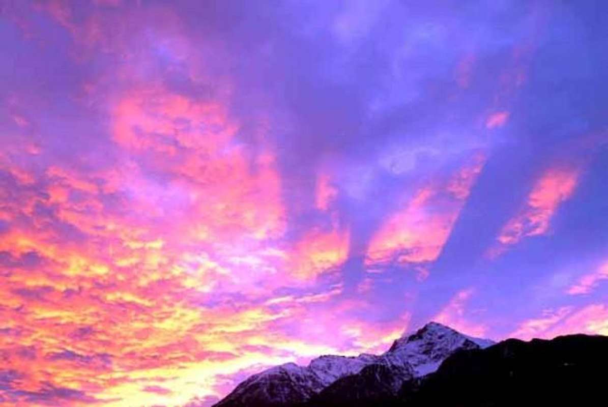
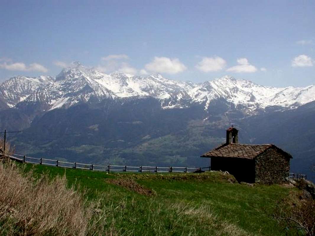
Bois (Forests) of Brin & Liautaysaz above Jovençan, by livioz


Jovençan


Risulta compresso tra l'estremità Occidentale della Conca di Pila ed il Comune di Aymavilles.
Dal precedente confine con il Comune di Gressan si divide da quello di Aymavilles, sempre partendo dal triplice confine con la Punta de la Pierre, passando dai Villaggi di Savoyon, La Prému, Turlin de Jovençan (1456 m), Mont-Corvé per raggiungere quello di Pompiod (655 m), appena al di sopra della Strada Regionale "dell'Envers" ed a non molta distanza dalla Dora Baltea. Dal fondovalle sale la strada poderale che da Turille (670 m) raggiunge dapprima Montrosset e poi, passando attraverso il Comune di Gressan, l'Alpe di Chavanasse (1155 m) ed indi quella di Bren di Milieu. Un sentiero n° 2A/21B, partendo tra i Villaggi di Pingaz e Les Adams (641 m), arriva a quello di Montrosset (831 m) e successivamente come sentiero n° 21B, piegando più verso Sudest, a quello di Noveilloz (981 m); da questo punto procedendo a Sud raggiunge Chavanasse e, salendo presso il confine tra i due comuni, raggiunge Bren di Milieu. Appena oltre Chavanasse una deviazione verso Sudovest con sentiero n° 21C raggiunge i Villaggi di Champailler (1469 m) e di Turlin Dessous e Dessus (1466 m, 1521 m); da questi in breve tempo a Turlin d'Aymavilles o all'odierna poderale dirigentesi a Bren di Milieu ed infine, sempre tramite la medesima coincidente con il vecchio sentiero-mulattiera n° 21 attraversante la grande foresta, a Pila-Pesein (1766 m). Inoltre é possibile percorrere un sentiero n° 21 che, partendo da Bren Dessus (1672 m), raggiunge attraverso il Bois de Brin (+; 1776 m) il sentiero n° 1 che arriva da Savoyon (1611 m), appena al di sopra dei due villaggi di Turlin d'Aymavilles Dessous e Dessus (1456 m, 1546 m). Lo stesso continua verso Sud come sentiero n° 1 e, attraversata la grande Foresta di Liautaysaz, raggiunge l'omonima Chaz (2077/82 m), al margine Occidentale della Conca di Pila.
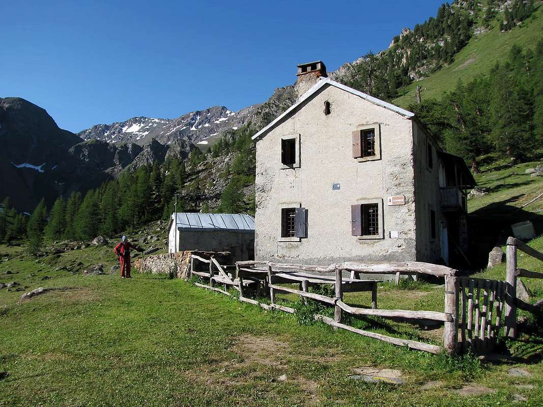
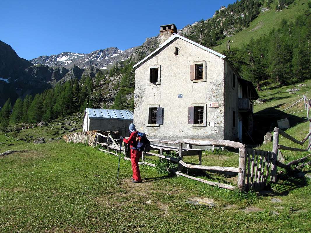
Jovençan o Joventanum (631 m; da "Fundus Joventianus" o Dzouènçan in patois) è Comune con 747 abitanti(384 nel 1964, 765 al 31 Dicembre 2010), situato tra la sponda Meridionale della Dora Baltea ed il Grand Bois de Champchenille alle falde del largo Versante Settentrionale della Punta de la Pierre. Possiede una superficie di 6 km² sulla quale sono dislocate diverse Frazioni: Bren, Champailler, La Prému, Turc, Verméneusaz, Pré Cognein, Turlin, Rollandin, Mont-Corvè, Plot de la Corne, Montrosset, Pendine, Gros Beylan, Les Adam (Chef-lieu), Jobel, Turille, Pompiod, Pingaz, Grummel Dessous, La Plante, Le Clou, Pessolin, Étral, Rotin, Chandiou. Jovençan è un Comune prevalentemente agricolo in particolare per la viticoltura con i pregiati vitigni di Petit rouge, di Gamay e Pinot Noir; importante anche l'alboricoltura con le piante da frutto e dal 1967 esiste la "Société Coopérative des Fruits de Jovençan". Attività economica rilevante consiste nello allevamento di bovini e di ovini, con relativa buona produzione casearia. Esistono alcuni monumenti e luoghi d'interesse storico-culturale-religioso: 1)- nel Villaggio di Pompiod si trova un forno del 1893 e, sempre nel medesimo 
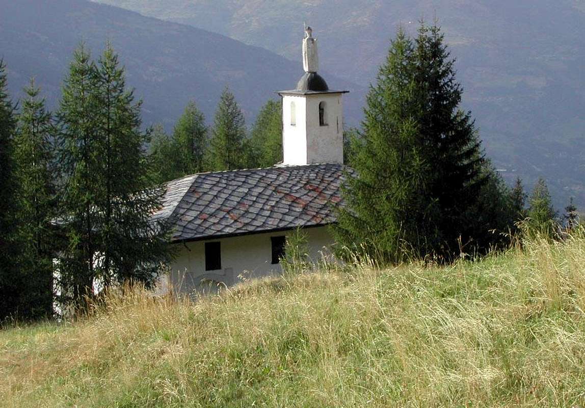
2)- la Cappella di Santa Barbara, inoltre si riscontra 3)- la Cappella di Saint-Gothard della fine del XVII° Secolo, 4)- il Campanile e la Chiesa Parrocchiale romanica, ricostruita nel 1452 per il Curato Sulpice de la Tour de Gressan, e affrescata dai fratelli Artari: la medesima è stata restaurata ed ingrandita a fine Ottocento. Abbiamo ancora, sul lato Settentrionale della Strada Regionale n° 20 verso Aymavilles, al di sopra del piccolo promontorio prativo-boscoso di Châtelair la 5/7)- Torre dei Salassi o "Torre la Plantà" del XII° Secolo, il basamento del Castello dei Tiranni del 1400 e la Chiesetta di St. Georges en Châtelair. Questo, come vuole la Leggenda, doveva essere il luogo in cui fù edificata la Capitale dei Salassie, fondata da Cordelo grande Capitano della locale Popolazione Celtica e poi distrutta dai Romani (Cordelia o Cordèle, che però altri identificano con la zona di St. Martin de Corléans ad Ovest di Aosta). Sullo stesso é ancora in evidenza e da non molto tempo restaurata la Chiesetta di St. Georges en Châtelair, costruita nel 1661, dopo la peste del 1630, come cappella al servizio del Castello di proprietà dei "Signori di Jovensano". A fianco della medesima si eleva la Torre dei Salassi o Casaforte di Pompiod, un rudere spesso confuso con il Castello di Jovençan, sito appena al di sopra; costruito nel XIII° Secolo e conosciuto anche come il "Castello dei Tiranni, fu fatto radere al suolo nel XIV° secolo dal Conte di Savoia. Oggigiorno si conservano solo il basamento di una torre circolare e i resti delle spesse mura atte ad indicare la maggiore espansione del sito originario. Tutto il promontorio è stato oggetto di un recupero parziale da parte del Comune a metà degli anni duemila. Sede di ritrovamenti archeologici e dotato di illuminazione, risulta però ancora in stato di degrado e parziale semi abbandono; potrebbe essere destinato ad orto botanico di piante officinali come complemento della "Maison des Anciens remèdes". Per quanto concerne le costruzioni ad uso civile esistono 8)- i resti del vecchio mulino, oggi di proprietà del Comune, alimentato dal Canale d'irrigazione de la Riva, mentre in località Les Adam(s) si trova 9)- l'edificio di architettura rurale del "Baou de la Cura", che, dopo il restauro del 2009/10, da Febbraio 2011 ospita il Museo della "Maison des Anciens Remèdes".


Aymavilles


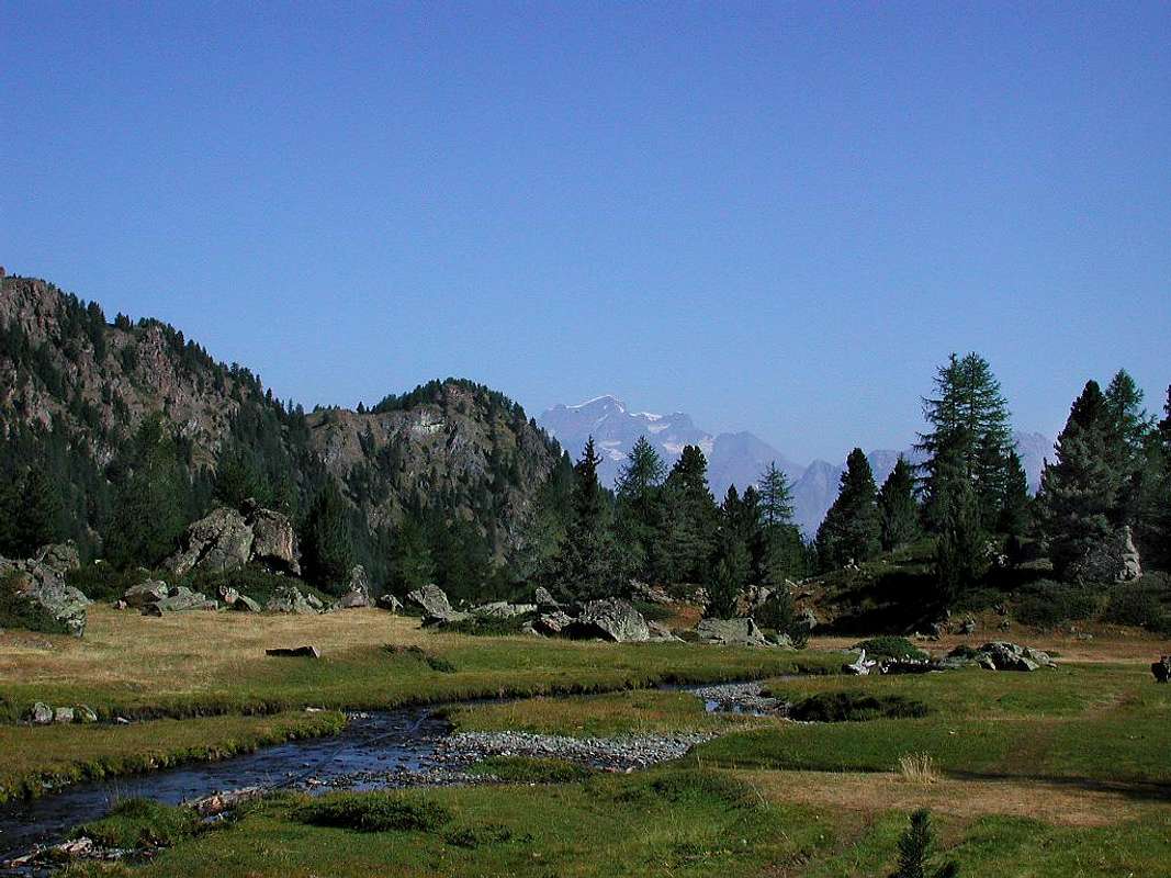
Now at the end of Basin Pila, up the other side to where Vieyes Hamlet (1158m) puts its border with Cogne and it Valley.
This Municipality (646m) is now virtually outside the Basin Pila, but is included here for a logistics paths having many connections with those of the same. Actually its borders, in addition to the above with the Municipality of Jovençan, ranging West towards the Common of Villeneuve (670m), from which is divided by the important Torrent Grand'Eyvia, while to the South you forward in the first part of the Cogne Valley reaching the Villages of Pondel (646m) and Vieyes, at the foot and to the West of the watershed dividing the Basin Pila. Regarding this Municipality, we report a farm dirt road which, starting from the Regional Cogne immediately after the Villages Caouz (827m) and Poyaz, reaches the Hamlet Chevry (922m; here comes a unnumbered path that comes from Aymavilles). At the first bend and before the Village of Les Combes, at a Cross, part Southward path n° 8, going near Noveillo and Dessus Dessous and crossing four times overlying other farm dirt roads, arrives, having also crossed twice the road asphalt for Ozein reaches Veulla (1349m), at the center of this great village. By the same road in asphalt continues towards East-northeast and, passing through the localities of Belley, La Charrère, Vers le Pré, Chantel, Léonard, Murace reaches neighbor the Village of Dailleuy (1480m). From the junction immediately after this goes up to the South a private dirt road that will then approach the Pastures of the Premou (1685m), Rontsaille (1762m), Titeun (1760m), Rompérein (1867m), La Ruì (1923m), Bardoney (1896m), Borbolet Viou (2072m) and finally the most important Alpage of la Pierre (2119m). Here comes also the path n° 8, from La Ruì, continuing between Torrents Pépin and Montgovernaz; the same then continue from la Pierre towards Southeast towards the Pointe de Vadaille (2383m; nice walk excursion), from which turning to the Northeast reaches the Col de la Pierre (2584m), the crossing of which leads to the Grand Grimod (2211m), into the Pila Basin. From Rompérein instead rises to the Southeast the path n° 1 reaching the last Pastures Champchenille (2212m; nice walk by snowshoes); here comes from Chaz-Liautaysaz also the trail n° 23B completing the connection always with Pila. How path doubly numbered 1/23B continues to the Punta de la Pierre also called by inhabitants "La Pera" (2653m) with beautiful summer excursion and splendid and popular outing Ski-Mountaineering in winter. This whole area on the Western and Northern Slopes of the "Pera" is located outside of the Basin Pila real, but intimately connected with the same. Watching at the bottom of this sector, is yet to recommend a nice walk to the small Village of Sérignan (1193m) with its tiny Church, right on top of a cliff overlooking Pondel or Pont d'Ael: from the junction 1274 metres, just before reaching Ozein-Veulla, the most important Hamlet, falls in the middle of meadows an asphalted road that reaches him. Nothing prevents you to walk the same mini excursion and then up to the same, perhaps with a Sunday stroll leading to visit the rocky promontory-forest (beautiful and wide area Picnic) just North of the same with great views of Mont Blanc. From Sérignan dominates instead Grand'Eyvia (Great Water) at the entrance of the Valley of Cogne, while the front rises towards the South-southeast the long divide that by the Mont-de-Poignon (1567m), above the Common of Villeneuve, first reaches the Pointe Valletta (2794m), the Mont Favret (3171m), the fantastic spiers of the Grand Nomenon (3488m) and immediately below The Grivola (3968/9m), from here really great view with its two icy Walls Northwest and Northeast and its big three ridges (Northwest or Belleface, North also known as the "Scimitar", between Northeast Northwest Faces, and East also called "des Clochettes".
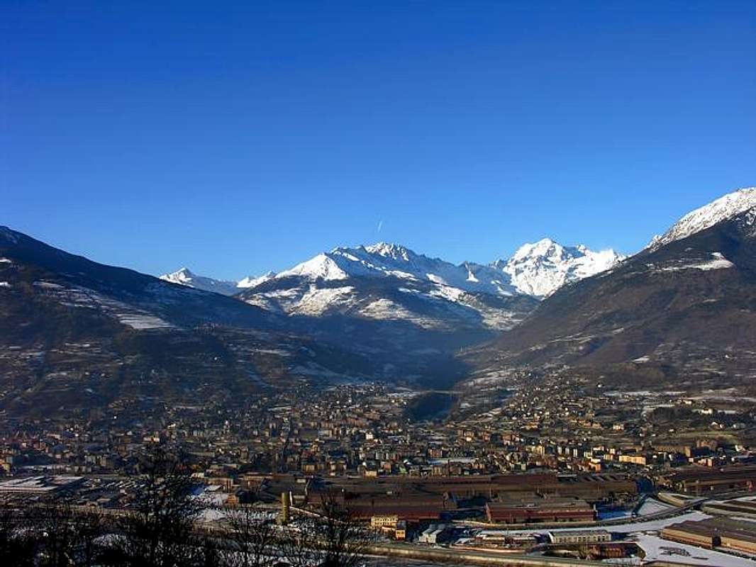
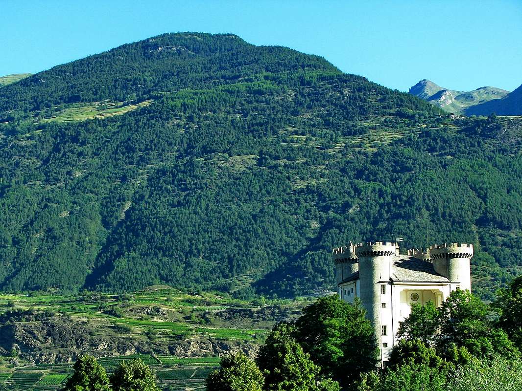
Aymavilles (646 m) or Lé-z-Amaveulle in patois and renamed Aimavilla (from Aymus et Avilius)
, during the Fascist period, is a small town of 2031 inhabitants (1360 in 1964) next to the Dora Baltea. Comprising more Fractions (Bettex, Caouz, Cerignan, Chabloz, Champessolin, Champlan, Champleval-Dessous, Château, Chef-Lieu, Cheriettes, Chevril, Clos-Savin, Crétaz-Saint-Martin, Croux, Dialley, Ferrière, Folliex, Fournier, Glassier, La Camagne, La Cleyvaz, La Poyaz, La Roche, Micheley, Montbel, Moulins, Ozein con Belley, Chantel, Dailley, La Charrère, Murasses, Vers-les-Prés, Ville, Pesse, Pompiod, Pont d'Aël, Saint-Léger, Saint-Maurice, Seissogne, Sylvenoire, the various Turlin with Chanabertaz, Turlin-Dessous and Turlin-Dessus, Urbains, Venoir, Vercellod, Vieyes, Villetos) is dominated by its beautiful Castle with four towers located on the hill above and at the entrance of the Val de Cogne, which extends to the Villages Pondel to the West and Vieyes in Southeast. It covers an area of 53.24 km. square and its economy is based on agriculture. In the area there are several varieties that are used locally to produce very fine local wines (also the first prizes at the World) that are related to the "Coopérative des Onze Communes" (Cooperative Society of the Eleven Municipalities), located near the castle and surrounded by a series of beautiful vineyards. In addition to farming and agricultural activities, there is also an important Hydroelectric Power plant that uses the waters of the Torrent Grand'Eyvia; this eponymous central, always at the inside of the municipality, uses the waters of Baltea and the unloading of the Central Champagne One, Champagne Two and Chavonne. In this regard, Monuments and places of religious interest we have 1)- the Church of Saint-Léger; worthy of note the two Churches: historically for many centuries the municipality had two parishes, that of Saint-Léger and that of Saint-Martin, were unified in 1926. As for the architecture and historical military, 2)- highlights the beautiful castle with four towers, placed on a moraine hill in a dominant position. The earliest records date back to 1278; in the thirteenth century tower remain the strong walls of context in 1357, when Aimone of Challant gave way to works of defensive reinforcement of the structure. It is now owned by the Autonomous Region of the Aosta Valley, who made major renovations, 3)- the Strong house of the Lords of Allian, still present in 1722, was built to the west of the Parish Church of San Martino, produced with the use Material of Casaforte now in ruins, 4)- to find another Montbel Casaforte, now converted into a rural residence, also 5/6)- Aymavilles there were building today no longer present, as the Castle of Châtellet that was part reconnaissance feudal Giacometto Aymaville of 1297, and the Tower du Bois, mentioned in a document of 1308. Among the civil structures is evident 7)- the Pont d'Aël in Fraction Pondel, aqueduct bridge of the Roman road from Aosta led to the Little St. Bernard Pass, while in the above Village Ozein is 8)- the home of the Bishop or Tornalla. Along the Regional Road No. 47 to get to 9)- Bridge Chevril "thrown" on Torrent Grand'Eyvia. Collapsed December 23th, 2011, was one of the architectural wonders of the Val de Cogne and very important for the connection to the valley floor; designed by the Royal Corps du Génie Civil Turin in 1865 to merge Cogne with Aosta. The work, of which you can still see the remains of the wooden structure, from the engineering point of view represented of great technical and important historical find the Kingdom of Italy. Very important are the areas with Naturalistic primarily the 10)- National Park of Gran Paradiso (P.N.G.P.), while the 11)- abandoned mines of Pompiod constitute the habitat par excellence of bats with different species: the site, together with the Castle of Aymavilles where for several years a colony of Myotis myotis has found the right place to play, is recognized as a site of community interest. And yet 12)- to be recorded as the natural environment of the Pont d'Aël is recognized as a site of community interest.


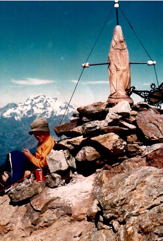
Between Pointe de la Pierre & his Hill, by Ilario Antonio Garzotto


Aymavilles


Ormai al termine della Conca di Pila, risale il versante opposto dove a Vieyes (1158 m) pone il suo confine con Cogne e la sua Valle.
Questo Comune (646 m) é ormai praticamente al di fuori dalla Conca di Pila, ma viene qui inserito per una logistica di sentieri avendo molte connessioni con quelli della medesima. In realtà i suoi confini, oltre a quello suddetto con il Comune di Jovençan, spaziano ad Ovest verso il Comune di Villeneuve (670 m), dal quale é diviso dall'importante Torrente Grand'Eyvia, mentre verso Meridione si inoltrano nella prima parte della Valle di Cogne raggiungendo i Villaggi di Pondel (646 m) e di Vieyes, ai piedi ed ad Ovest dello spartiacque divisorio con la Conca di Pila. Per quanto concerne questo Comune, segnaliamo una strada poderale che, partendo dalla Regionale per Cogne subito dopo i Villaggi di Caouz (827 m) e Poyaz, raggiunge il Villaggio di Chevry (922 m; qui giunge anche un sentiero non numerato che proviene da Aymavilles). Al primo tornante e prima del Villaggio di Les Combes, presso una Croce, parte verso Sud il sentiero n° 8 che, passando a fianco di Noveillo Dessous e Dessus ed attraversando quattro volte altre soprastanti strade poderali, arriva, dopo avere anche superato due volte la strada in asfalto per Ozein, arriva a Veulla (1349 m), al centro di questo grande Villaggio. Dal medesimo la strada in asfalto prosegue verso Est-nordest e, transitando per le località Belley, La Charrère, Vers le Pré, Chantel, Léonard, Murace raggiunge il vicino Villaggio di Dailleuy (1480 m). Dal bivio subito dopo questo sale verso Sud una strada poderale che raggiunge in successione gli Alpeggi di la Premou (1685 m), Rontsaille (1762 m), Titeun (1760 m), Rompérein (1867 m), La Ruì (1923 m), Bardoney (1896 m), Borbolet Viou (2072 m) ed infine la Pierre (2119 m). Qui giunge anche il sentiero 
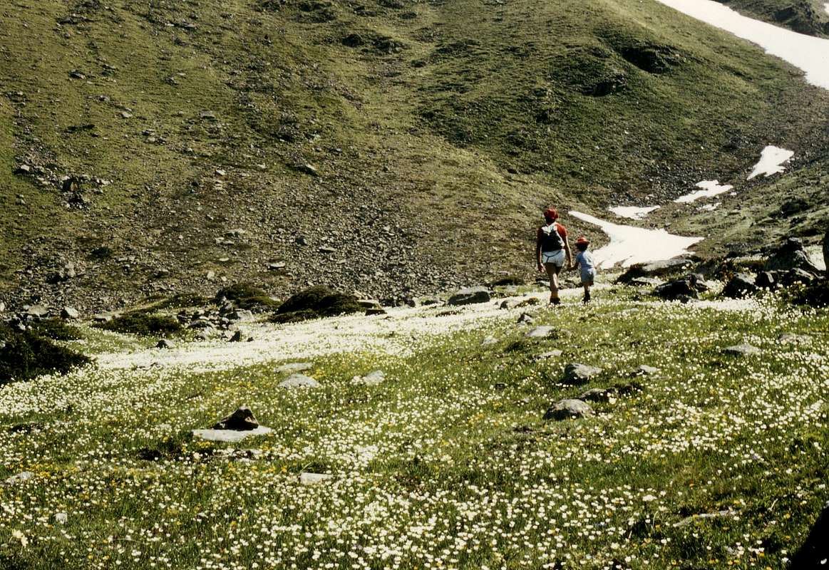
n° 8 che, passando da La Ruì, sale tra i Torrents Pépin e Montgovernaz; lo stesso poi continuerà da la Pierre verso Sudest in direzione della Pointe de Vadaille (2383 m; bella passeggiata escursione), dalla quale voltando a Nordest raggiunge il Col de la Pierre (2584 m), la traversata del quale porta al Grand Grimod (2211 m) nella Conca di Pila. Da Rompérein invece sale verso Sudest il sentiero n° 1 che raggiunge l'ultimo Alpeggio di Champchenille (2212 m; bella passeggiata con le racchette da neve); qui arriva da Chaz-Liautaysaz anche il sentiero n° 23B, completando il collegamento sempre con Pila. Come sentiero doppiamente numerato 1/23B prosegue verso la Punta de la Pierre o "La Pera" (2653 m) con bella escursione estiva e splendida e frequentata gita di Sci-Alpinismo in inverno. Tutta questa area alle pendici Occidentali e Settentrionali della "Pera" si trova al di fuori della Conca di Pila vera e propria, ma risulta intimamente connessa con la stessa. Guardando alla parte inferiore di questo settore, viene ancora da consigliare una bella passeggiata verso il Villaggetto di Sérignan (1193 m) con la sua Chiesetta, proprio al di sopra d'un precipizio che domina Pondel o Pont d'Ael: dal bivio 1274 metri, appena prima di raggiungere Ozein-Veulla, scende in mezzo ai prati una strada in asfalto che lo raggiunge. Nulla vieta di percorrerla a piedi per poi risalire al medesimo, magari con una passeggiata domenicale che porta a visitare anche il promontorio roccioso-boschivo (bella area da Picnic) subito a Settentrione della stessa con grandi vedute sul Monte Bianco. Da Sèrignan si domina invece la Grand'Eyvia all'ingresso della Valle di Cogne, mentre frontalmente si eleva il grande spartiacque che dal Mont-de-Poignon (1567 m), sopra il Comune di Villeneuve, raggiunge prima la Pointe Valletta (2794 m), il Mont Favret (3171 m), le fantastiche guglie del Grand Nomenon (3488 m) e subito appresso La Grivola (3968/9 m), da qui veramente in grande vista con le sue due ghiacciate Pareti Nordovest e Nordest e le sue tre grandi creste (Nordovest o di Belleface, Nord conosciuta anche come la "Scimitarra" ed Est detta "des Clochettes".
Aymavilles (646 m) o Lé-z-Amaveulle in patois nonché ribattezzato Aimavilla (da Aymus et Avilius)
, durante il periodo fascista, è un Comune di 2.031 abitanti (1360 nel 1964) posto accanto alla Dora Baltea. Composto da più Frazioni (Bettex, Caouz, Cerignan, Chabloz, Champessolin, Champlan, Champleval-Dessous, Château, Chef-Lieu, Cheriettes, Chevril, Clos-Savin, Crétaz-Saint-Martin, Croux, Dialley, Ferrière, Folliex, Fournier, Glassier, La Camagne, La Cleyvaz, La Poyaz, La Roche, Micheley, Montbel, Moulins, Ozein con Belley, Chantel, Dailley, La Charrère, Murasses, Vers-les-Prés, Ville, Pesse, Pompiod, Pont d'Aël, Saint-Léger, Saint-Maurice, Seissogne, Sylvenoire, i vari Turlin con Chanabertaz, Turlin-Dessous e Turlin-Dessus, Urbains, Venoir, Vercellod, Vieyes, Villetos) viene dominato dal suo splendido Castello con quattro torri posto sulla soprastante collina nonché all'ingresso della Val de Cogne, dove si estende fino ai Villaggi di Pondel ad Ovest e di Vieyes a Sudest. Si estende su di un'area 53,24 Km. quadrati e la sua economia é basata sull'agricoltura. Nel territorio sono presenti vari vitigni che vengono utilizzati localmente per la produzione di vini locali alquanto pregiati (anche dei primi premi a livello Mondiale) che sono legati alla "Coopérative des Onze Communes" (Società Coperativa degli Undici Comuni), sita nei pressi del castello e contornata da una serie di splendidi vigneti. Oltre all'allevamento ed alle attività agricole, esiste anche un'importante Centrale Idroelettrica utilizzante le acque del Torrent Grand'Eyvia; questa omonima centrale, sempre all'interno del territorio comunale, sfrutta le acque della Dora Baltea nonché quelle di scarico delle Centrali di Champagne Uno, Champagne Due e Chavonne. Al riguardo di Monumenti e luoghi d'interesse religioso abbiamo 1)- la Chiesa di Saint-Léger; degne di annotazione le due Chiese: storicamente per lunghi secoli il comune ha avuto due parrocchie, quella di Saint-Léger e quella di Saint-Martin che vennero unificate nel 1926. Per quanto concerne le architetture storico-militari, 2)- s'evidenzia lo splendido Castello a quattro torri, posto su una collina morenica in posizione dominante. Le prime notizie risalgono al 1278; della torre duecentesca rimangono le grosse murature d'ambito nel 1357 allorché Aimone di Challant diede via ad opere di rinforzo difensivo della struttura. Ora è di proprietà della Regione Autonoma della Valle di Aosta, che ha effettuato importanti interventi di ristrutturazione, 3)- la Casaforte dei Signori di Allian, ancor presente nel 1722, era edificata ad Ovest della Chiesa Parrocchiale di San Martino, realizzata con l'utilizzo dei materiali della casaforte ormai in rovina, 4)- a Montbel troviamo un'altra Casaforte, oggi trasformata in abitazione rurale, inoltre 5/6)- ad Aymavilles esistevano delle costruzioni oggi non più presenti, come il Castello di Châtellet facente parte della ricognizione feudale di Giacometto d'Aymaville del 1297, e la Torre du Bois, citata in un documento del 1308. Tra le strutture civili si evidenzia 7)- il Pont d'Aël nella Frazione di Pondel, ponte acquedotto della strada romana che da Aosta conduceva al Colle del Piccolo San Bernardo, mentre nel soprastante Villaggio di Ozein si trova 8)- la Casa del Vescovo o Tornalla. Percorrendo la Strada Regionale n° 47 si arriva al 9)- Ponte di Chevril "gettato" sul Torrent Grand'Eyvia. Crollato il 23 dicembre 2011, costituiva una delle meraviglie architettoniche della Val de Cogne e risultava molto importante per il collegamento con il fondovalle; progettato dal Corps Royal du Génie Civil di Torino nel 1865 per unire Cogne con Aosta. L'opera, di cui si possono ancora vedere i resti della struttura in legno, dal punto di vista ingegneristico si presentava come di grande tecnica e importante reperto storico del Regno d'Italia. Molto importanti sono le Aree Naturalistiche con "in primis" il 10)- Parco Nazionale del Gran Paradiso (P.N.G.P.), mentre le 11)- Miniere abbandonate di Pompiod costituiscono l'habitat per eccellenza dei pipistrelli con diverse specie di chirotteri: il sito, insieme al Castello di Aymavilles in cui per diversi anni una colonia di Myotis myotis ha trovato il luogo adatto alla riproduzione, è riconosciuto come sito d'interesse comunitario. Ed ancora 12)- da annotare come l'ambiente naturale del Pont d'Aël è riconosciuto quale sito d'interesse comunitario.


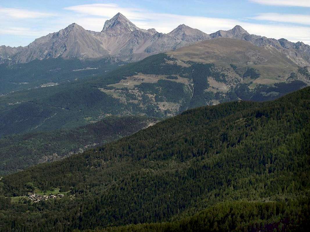
Aymavilles Castle below Pointe de la Pierre, by Konrad Sus


Getting There Towards Pila Conca

By car:

  • From TORINO, MILANO, etc: Motorway A5. Exit at IVREA or Quincinetto (PIEDMONT)

    From IVREA Town: Charvensod, Gressan, Jovençan, Aymavilles Municipalities.


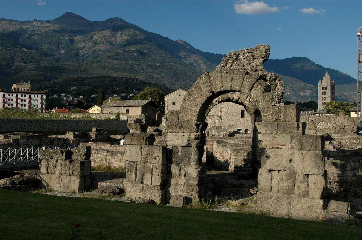
    Roman Aosta Town, by om


    From Charvensod to Dard-Comboé-Arbolle Walloons towards Ponteilles (1697m) Alp & Waterfall, through dirt road, Comboé Alp & Saint Ours private Shelter (2114m), through dirt road, and Arbolle Refuge (2516m), nearby Lakes (2495m, 2497m), by Chair Lift to Chamolé Station (2309m), Lake (2325m) and muletrack.
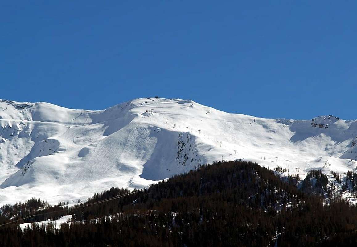
    From Charvensod (main road from Pont Suaz 567m) or Gressan (603m; alternative road) to Tivet, Les Fleurs Hamlets (1292m, 1414m) Pila Basin and Resort (low parking nearby Cableway 1800m; upper parking 1850m). Arno Shelter (2660m), always open but unguarded, nearby Couiss Summit on watershed Pila/Cogne Valley.
    From Jovençan (631m) to Western Pila Conca, exclusively through path-muletrack to Tourlin Dessous (1466m) and by dirt road to Pila-Posse Tennis (1776m).
    From Aymavilles (646m) to Western Pila Conca, through Main Road to Cogne Valley, alternative road to Ozein/Turlin Dessus Hamlets and dirt road to Pila-Posse.


    Pila Basin from Northwest, by livioz


  • From FRANCE: through the Mont Blanc Tunnel to Entrèves-crossroads to Vény/Ferret Valleys - Mountain Guides of Courmayeur - La Saxe Rock Gym - Courmayeur. By Little Saint Bernard Pass, closed since November until half May to La Thuile Valley - Pré Saint Didier - Courmayeur.

    It is not necessary to take Motorway A5: you can drive on State Road n° 26, in the direction of AOSTA - IVREA - TURIN.


By plane:
  • Aeroporto Internazionale "Corrado Gex" Saint Christophe (Aosta)


Comments

No comments posted yet.