
|
|
Mountain/Rock |
|---|---|
|
|
35.27354°N / 82.86728°W |
|
|
Transylvania |
|
|
Hiking |
|
|
Spring, Summer, Fall, Winter |
|
|
5080 ft / 1548 m |
|
|
Overview
Please do not confuse this Pilot Mountain with the more well known Pilot Mountain in NC's Surry County. There are, to my knowledge, four Pilot Mountains in NC. In addition to the one in Surry county they are located in Rudolph County, Henderson County, and the on described on this page, Transylvania County.
Pilot Mountain (Transylvania County, NC) tops out on the 5,080 foot contour and holds 521+ feet of prominenece. It ranks as the 159th highest mountain in NC, and is one of 185 5,000 foot peaks in NC. The mountain is located near Brevard, NC within the Pisgah Ranger District of Pisgah National Forest. The mountain is crossed by the Art Loeb Trail. Because of its proximity to the Blue Ridge Parkway and Looking Glass it is seen by many, many people, but few probably ever know its name.
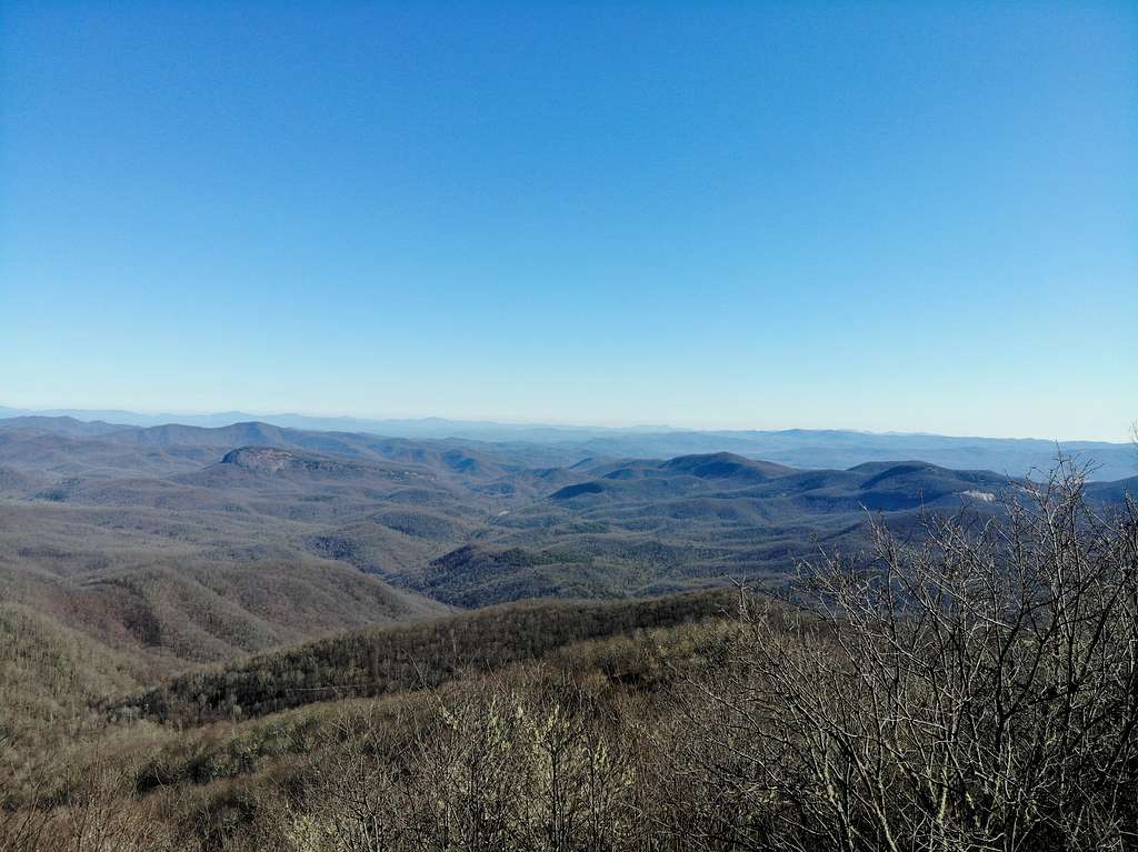
Views from the top of Pilot include Looking Glass and much of the Black Balsams.
Getting There
I placed Gloucester Gap, Brevard, NC into Google Maps and followed the directions. This will take you to the coordinates of 35.265840, -82.846827 and is where the Art Loeb trail crosses a National Forest Rd. 475. Of course there is potential to hike this peak from any access to the Art Loeb trail (ALT) or any trail that can be connected. Gloucester Gap provides the shortest option, approximately 2 miles of hiking one direction, to my knowledge.
If you chose to hike this mountain from the opposite side the ALT can be accessed from Blue Ridge Parkway Art Loeb Trailhead. The coordinates here are 35.307191, -82.880826. From the Parkway to the top of Pilot Mountain would be approximately 3 miles of hiking one direction.
Route
Beginning from Gloucester Gap head WNW on the ALT. The trail enters the forest, nearby is a gated forest road which the trail remains within earshot of for a while. For roughly 3/4 of a mile the ALT gains elevtaion at a relaxing rate before getting quite a bit steeper. About a mile in there a rocky area allowing nice views to the south.
After the rocky area the trail gets flatter again gaining 200 feet in 0.3 miles, then again gets steeper in the last 0.45 feet gaining 450 feet. Here, at the top, is a small clearing that allows some nice views including good views of Looking Glass. This is around 2 miles of hiking from Gloucester Gap.
After reaching the top there are several options. You could return the way you came up, or you may continue on the ALT to Deep Gap or beyond. From Deep Gap you could create a loop back to Gloucester Gap by using Deep Gap Rd (not much more than a path now-a-days), then Pilot Mountain Rd., which is the graveled gated forest road mentioned earlier.
Many other routes could be created depending on where you want to join the ALT.
Lookout Tower
Previously Pilot Mountain held a lookout tower. It has since been removed. I found little history on the tower other than a brief paragraph from the Asheville Citizen-Times on November 23, 1922. "Owing to the peak-like contour of Pilot Knob in Transylvania County, this point for lookout purposes is regarded as ideal, and in fact makes necessary the construction of a steel tower. A cabin, in which the windows entirely surround the structure, is planned here, according to Verne Rhoades, Supervisor of the Pisgah Forest."
The lookout tower is still labeled on many maps, though it is no longer present.
Red Tape
None to my knowledge
When to Climb
Any time
Camping
There was a shelter at Deep Gap. I don't recall many other opportunities for camping.
External Links
https://peakbagger.com/peak.aspx?pid=18511