

-
 18944 Hits
-
 84.82% Score
-
 19 Votes
|
|
Mountain/Rock |
|---|---|
|
|
46.49097°N / 9.75993°E |
|
|
Hiking, Mountaineering |
|
|
Summer, Fall |
|
|
11089 ft / 3380 m |
|
|
Overview
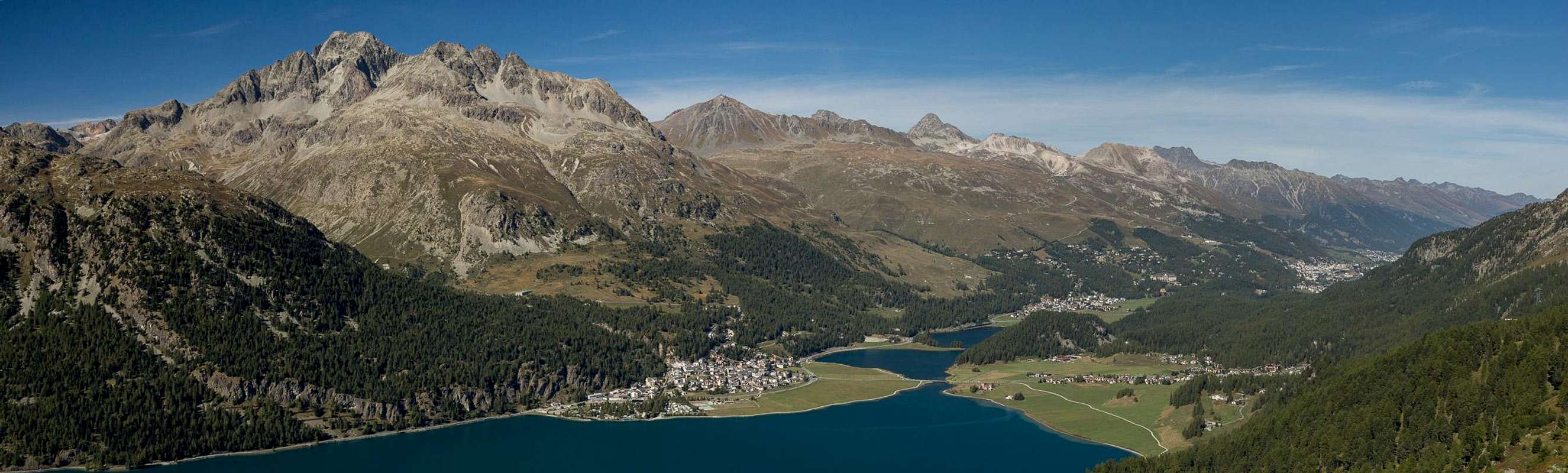
 Piz Platta and Piz Julier seen from Piz Languard Piz Platta and Piz Julier seen from Piz Languard |
Piz Julier is one of the most important mountains of the Swiss canton of Grischun / Grisons / Graubünden. It belongs to the Albula Alps and together with Piz Ot heads one of the two subgroups of that range. At 3380m it is lower than Piz Kesch and Piz Calderas but thanks to its central but solitary location it is one of the best lookout mountains in this part of Switzerland. While best known under its German name, in the local rhaetoromanic language it is also called Piz Güglia (Puter dialect) and Piz Gelgia (Sumiran dialect).
 |  |  |
Piz Julier is known as the highest mountain in Grischuns / Graubünden, which can be reached by a marked path. Senda Enferrada is a difficult and exposed but well protected hiking route along the east ridge (Crasta da la Senda) of the mountain. It is sometimes classified as a via ferrata, which it isn't. Cables and chains protect some sections at the top of the route, which makes Piz Julier one of the most coveted 3000ers of the region. However, the route is not a hiking route and many aspirants turn around after encountering its seriousness.
 |  |  |
Piz Julier is made up from granite. Although it looks like a giant monolith from afar, up close the rock reveals itself to be broken and brittle. There is much scree on the normal route which suggests wearing a helmet when sharing it with other parties. Also, the approaches to the normal route run through scree and boulder fields, a further indication for the quality of some of the sections. Naturally there are more routes along the other ridges of the mountain. All are rated AD and contain scary, rockfall-prone sections.
 |  |  |
Last - but not least - Piz Julier carries a small glacier on its north-eastern side: Vadret Güglia. In some sections, where the normal route avoids obstacles on Crasta da la Senda, it moves out to the north face, precariously negotiating ledges high above this glacier and thus offering spectacular view down upon it.
Getting There
  |
There are two trailheads for the normal route: on is above St. Moritz, near the road to Suvretta Pass at about 1900m, the other at Chamanna del Stradin near Pass dal Güglia / Julierpass at 2160m. Both trailheads can be easily reached from St. Moritz, which itself can be reached by
- B27 from Zernez in the north
- B29 from Valtellina (Italy) across Berninapass from the south-east
- SS37 / B3 through Val Bregaglia / Bergell from Chiavenna (Italy) in the south-west
- B3 from Chur in the north-west.
Normal Route
 The south-east ridge with the summit of Piz Julier
As mentioned above, there are two trailheads for the normal route along Crasta da la Senda, the east ridge of the mountain. They lie on opposite sides of Piz Güglia / Piz Julier, in St. Moritz in the east and Pass dal Güglia / Julierpass in the south-west.
From St. Moritz you can use a cable-car to start above the actual trailhead and sthe first 900m are well marked and straightworward until you reach Fuorcla Albana. The route from Chamanna del Stradin has similar difficulty but is rather uncomfortable as a large scree and boulder field needs to be crossed. However, the elevation gain to Fuorcla Albana is 200m less.
 |  |
From the saddle the route, called Senda Enferrada, changes in character. It follows the east ridge of Piz Güglia / Piz Julier, avoiding obstacles on the crest by passing them to the north or south. It is very exposed, mainly in the detours around the obstacles. Starting from 3000m onwards more and more chains and cables protect the most difficult and exposed passages. The summit is hidden from view for most part of the route but apart from this views are exceptionable. The route is perfectly marked by white-blue-white marks so orientation is not an issue. Overall the route is rated PD.
Accommodation
 Piz Julier above Silvaplana
Weather Conditions
Maps & Books
Maps
Digital Maps
Regular Maps
- Julierpass
Swisstopo Map LK 268 T
1:50000
ISBN: 978-3302302683
- St. Moritz
Swisstopo Mao LK 1257
1:25000
ISBN: 978-3302012575
- Oberendagin / Alta Engadina
Kompass Verlag
1:40000
ISBN: 978-3850269094
Books
- Bündner Alpen 6
Manfred Hunziker
Sac Schweizer Alpenclub
ISBN: 978-3859021877
- Oberengadin - St. Moritz, Zuoz, Pontresina
Rudolf Weiss, Siegrun Weiss
Rother Verlag
ISBN: 978-3763340422
- Unterengadin. Scuol - Zernez - Münstertal
Rudolf Weiss, Siegrun Weiss
Rother Verlag
ISBN: 978-3763340439
- Skitouren Graubünden Süd: Oberhalbstein / Albula / Davos / Engadin
Vital Eggenberger
Sac Schweizer Alpenclub
ISBN: 978-3859023017
In Memory of Cyrill Rüegger
 A note from the SP staff
Cyrill Rüegger, the member we all used to know as Cyrill and Digitalis, died on June 13th 2009 in an avalanche on the summit ridge of Piz Palü together with his wife Tanja and a common friend. They were swept down by the avalanche into a couloir underneath the east summit and died instantly. Their bodies were retrieved from the Palü Glacier by helicopter a day after the accident.
Cyrill joined SP in March 2006 and soon was one of the most prolific contributors on the site with almost 70 mountain and 5 range pages to his profile. He was an accomplished climber, bagging almost 1000 summits in not quite seven years. Among them are 35 4000ers and 272 3000ers, almost all of them in his home country Switzerland.
While contributing a lot on SP, Cyrill's real internet home was www.hikr.org where he contributed 585 mountain profiles and reports in his native language German. Cyrill also posted on www.bergsteigen.at and other climbing sites, often under his real name but also under the pseudonym Digitalis. He was a botanist by profession and also contributed his knowledge about medical plants to different websites. Cyrill will be greatly missed by all.
This page will be kept in honour of Cyrill, one of SP's most prolific members and most active mountaineers.
Rest in peace, brother!
The picture above was taken on the summit of Matterhorn on July 28th 2007.