
|
|
Mountain/Rock |
|---|---|
|
|
47.77193°N / 121.85653°W |
|
|
King |
|
|
1011 ft / 308 m |
|
|
Overview
Here is a page dedicated to an obscure summit and former lookout located just outside of the Seattle Metropolitan Area. Platts Lookout is a smaller summit located in the foothills just east of Redmond, Washington. The summit itself was home to a fire lookout and a camp in the 1930's. There is very little evidence of that now because the forest is rapidly growing in. There is still some fair views from the west ledge of downtown Seattle and the Olympics but as of 2015 there are no views on the northern and eastern side of the summit rock. These views have filled from the growth of the forest.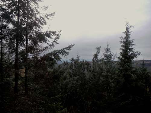
The view on a cloudy day
One would think that with such a short distance and elevation gain that this would be ideal for children. That is not the case for this lookout because last hundred yards requires bushwhacking through very thick canopy and second growth forest to the base of the and then going up steep terrain with iffy footing to the true summit. Expect fallen logs, sticker bushes and other canopy to act as a barrier to your trip. This is not a hike for your family unless your family can tolerate short but very thick bushwhacking. As of 2015 there is no element of a trail or a boot-path to the true summit. It is best to approach the summit from the south side. Otherwise you are looking at a Class 2 or greater mossy scramble coming up from the western cliffs.
 The summit register (Thank you Eric Willhite) |  Views through the trees |  Downtown Seattle through the trees |
It should be noted that this is state DNR land and this area gets forested very often so expect information on this hike to change from year to year.
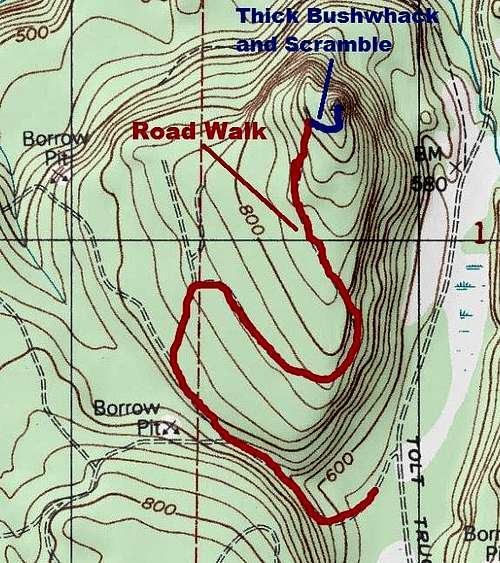
![Map of the Route]()
Map of the Route
The map above pretty much explains the route. Head up through the road maze by using the red line on the map to guide you. The road itself is in very good condition until the fallen tree located right at the 840 foot contour. From there the road is rapidly growing in with sticker bushes. There is some potential that in 5 years this section will be far worse than it is right now but right it is very easy to travel through and there appears to be a bit of a boot-path developing on the road. Once the road is you will then want to bushwhack through very thick canopy to the base of the western cliffs. From there to get to the easiest technical route you will want to travel to the southern slope where the travel is the least steep.
Getting There
FROM Highway 203 in STILLWATER, WASHINGTON: Turn north onto Kelly Road NE at the Cheveron Gas Station. After a 2 miles make a right on the well marked NE Stossel Creek Road NE. Follow the mainline for about 4 miles of gravel driving after entering the Marckworth State Forest. Make a left and parking a couple yards from the gate where there is small area for one car to park.Route
Map of the Route
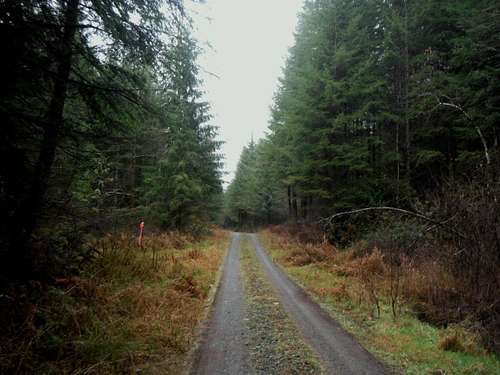
Standard road walk for the first part of the trip
Red Tape and Camping
This is state DNR land so no camping is permitted and you must have a Discover Pass on your car.When to Climb
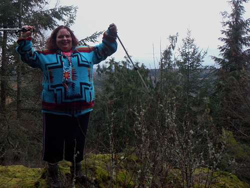
BearQueen finds success