
|
|
Mountain/Rock |
|---|---|
|
|
39.50701°N / 120.05069°W |
|
|
Sierra |
|
|
Hiking, Scrambling |
|
|
Fall |
|
|
7776 ft / 2370 m |
|
|
Overview
Beacon Point 7501' and Point 7776 are two summits along the Verdi Ridge in California.The Verdi Ridge extends north from I-80 on the Nevada/California state line to Dog Valley Road (aka Henness Pass Road) northwest of Verdi, Nevada. Its southern summits (Verdi Peak 8444’ and Ladybug Peak 8380’) are primarily accessible from the California side, from the Stampede Reservoir. Their east face is covered in thick mahogany and a road from the east within 900’ of the saddle between these peaks is restricted by private landowners.
The northern summits of the Verdi Ridge, however, are accessible from the east, via dirt roads. These northern summits are not as high as their southern counterparts, but have excellent views and are more accessible for day hikes from Reno/Sparks, and especially Verdi, Nevada residents.
Although they reside almost 2 miles apart, these summits are included on the same page, because they share a saddle, and are the only destination from the same two starting points from the east, and therefore justify a shared page.
Neither of these actually have a prominence of much more than 200’. Point 7776 rises only about 200’ above its saddle with Ladybug Peak, and Beacon Point only rises about 200’ above its saddle with Point 7776. However, they are prominent points when hiking in this area, and worthy of a page, both to clarify hiking from Verdi, and to explain what is not feasible from Verdi (i.e. Verdi Peak and Ladybug Peak).
It is possible to hike just up to Point 7776 from the west side, via the Verdi Peak Road. That is also described below.
There are tremendous views in all directions from this ridge. It is best hiked when dry and when not too warm. Fall is the best time for this. October/November in particular.
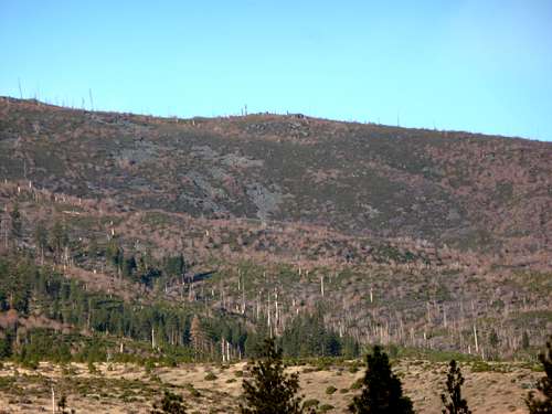
Point 7776 from the valley
The coordinates for Point 7776 are the ones given for this page. The coordinates for Beacon Point are: 39.533366, -120.049544
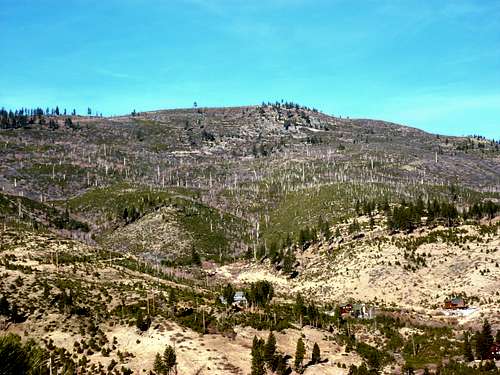
Beacon Point from the Valley
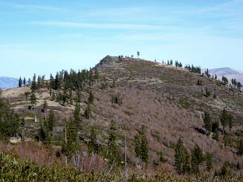
Beacon Point from the saddle
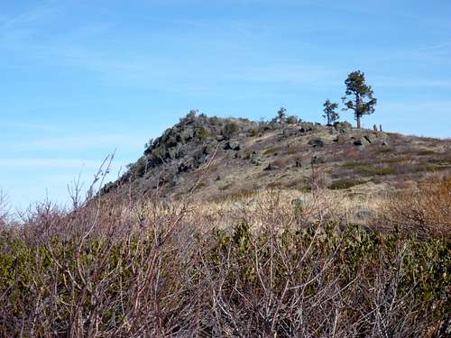
Almost at the Beacon Point summit
Getting There
There are two prospective routes to take from the east. For passenger cars, there is the route from the substation. This is longer, but is a great fitness challenge; a scenic slog from the valley floor. Then there is the route from Dog Valley Road (becomes Henness Pass Road in California). This is for High Clearance 4WD vehicles.For either route, you must head to Verdi, Nevada near the California/Nevada State Line.
For the longer route, from Reno, Nevada take I-80 West towards California, and get off on Exit 2 still in Nevada. Head north and turn left onto Trelease Lane, and then take a quick right onto Hill Lane. Follow Hill Lane for a little over a mile. Shortly after the road goes from paved to dirt, take a left on an unmarked road which leads to an electrical substation. The land is owned by the power company, and is not closed to the public.
For the shorter route, bring a 4WD and take Exit 3 to Verdi, Nevada. Take the road north into town and take a left on Bridge Street. You will soon pass an elementary school and then cross the Truckee River. After crossing the river, look for the intersection to Dog Valley Road, which soon crosses into California. Follow it through a residential neighborhood, and then you will see a National Forest sign. From here it is 2 ½ miles or so of dirt road to the starting point at a clearing and a turnabout with room for several cars. From here a dirt road heads up towards the ridge, called Sunrise Creek Road. This is different than the road accessible from the valley.
From the west, Point 7776 is reachable via a scramble route. Take exit 194 off of I-80. About 25 miles west of Reno, Nevada and 107 miles northeast of Sacramento, California. Pass the train tracks and pass the Boca Reservoir on the left. Head past the turn off to Stampede Reservoir and end at a dirt road, which is Henness Pass Road. This intersection, also a large parking area, with campgrounds and dirt roads going in all different directions, is 10.4 miles from I-80.
Longer Route from substation
From the substation at about 5045’, follow the road below the power lines. It goes uphill, then descends, and soon after curves to the left (south). About ¼ mile or so after it curves left, the road ends at another road. Take a right and follow the road as it heads southwest. It then dead ends in about 1/3rd mile at another road. Take a right and continue up the road as it heads north back towards the power lines. After about 2/3rds of a mile, the road heads back below the power lines. Look for a road on the left just before the power lines. This road is at about 5720’. This road switchbacks steeply up to the ridge in about 1 ¾ miles.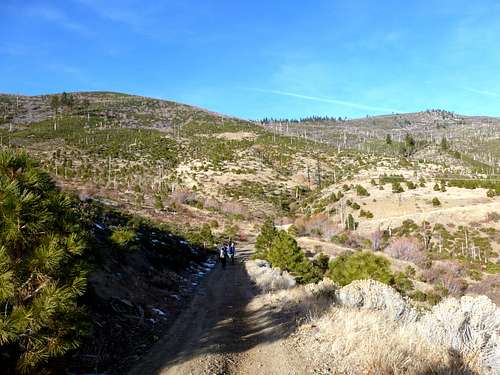
Group heading up the approach road towards the saddle
After about 3 ½ miles from the start of the hike, a road near the top of the ridge heads north towards Beacon Point, which is clearly visible to the north at this point. It is about a mile and 220’ of elevation gain to Beacon Point from this spot. If you want to summit only Beacon Point, there are good views. The hiking is easy and straightforward. This is a solid day hike.
If you are adventurous, you can head back south to the main road, and continue up to the point where the road starts descending to the back side of the ridge. There is a large rock formation to the south of the road. You have to bushwhack through some mahogany to get there. It isn’t terrible, but a pure bushwhack for a few minutes. Climb the rocks and gain the ridge about 150’ above the road. Take the ridge, which is meadow-like at points, requires crossing more rock formations at others, and sometimes has run-ins with mahogany – but nothing too bad. It is about a mile from the road to the summit. There is a false summit that is nearly the same height as the actual one. But you have to continue to a rock about 5 minutes further. It would be easy if not for the rocks and mahogany in the way. But if you have come this far, it is worth going a little further. The views atop this ridge are excellent. Descend the way you came.
If hiking both summits, it requires 11 ½ miles of round trip distance and an elevation gain of approximately 3,000’. If just doing Point 7776, it is about 9 ½ miles round trip and 2780’ or so. I recommend hiking Beacon Point via this route. It is a very worthwhile hike, and not too difficult. Point 7776 is tough and not for the armchair hiker. For those who like a great challenge and hunger for fall colors, but do not want to drive too far from the comforts of Northern Nevada – Point 7776 on the Verdi Ridge is for you.
Shorter route from Henness Pass Road
Take the road towards the ridge. It climbs up below the east face of Beacon Point. Routes straight up the peak are tricky due to brush. After about 2 miles on the road, you can cut back north for about ¾ miles to the summit. The elevation gain is 1325’. If climbing up to Point 7776, you have to go within 1/3rd of a mile of the Beacon Point summit. Then take the road that heads up to the saddle between the peaks, and head to the power lines. Then take the route described above.Both peaks can be hiked in less than 9 miles round trip from this route. If you love bushwhacking, you can grab Point 7776 first, and then get on top of Beacon Point, and head straight down to Henness Pass Road and cut off more than 2 miles. This is only recommended on the descent, because mahogany is nastier going up than down. Whatever the case, the elevation gain is 1850’ or so.
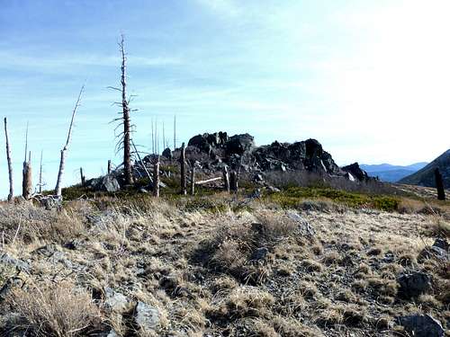
Approaching the true summit of Point 7776
From the west - Point 7776
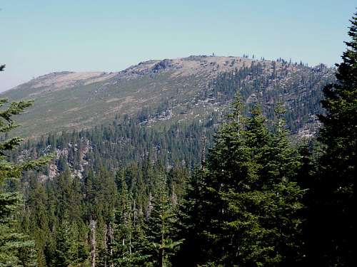
Point 7776 from the west
For 2WD, the shortest route for passenger cars is from the Northwest near the intersection with Stampede Dam Road and Henness Pass Road. Once at the intersection, take a right and head about 200 yards up the road. There is a well-graded dirt road. Passenger cars can go another 1/2 miles, passing some power lines, and there are campgrounds in the vicinity. Park and continue to an intersection. Two roads go steeply up. Take the one on the right. It terminates close to a series of large power lines. But it doesn't go all the way up. A use trail heads towards the power lines. Some minor bushwhacking is possibly required if you get off track. Once at the power lines, head about 1/3rd mile down and up steep hills to the intersection with Verdi Peak Road or "Forest Route 72". This is the road to the saddle. There are numerous side roads, but stay on the obvious road.
At about the 7,000' mark, about 2 1/2 miles up, there is an intersection with one road heading left, and the other right - both going up. Take the road on the left. You are below Point 7776 with a big rock formation in view. Scramble, through some brush, but stay well to the right of the rock, and then on to the summit.
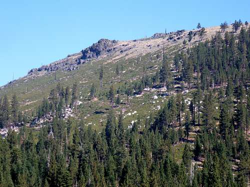
The west side route to Point 7776. Follow the more forested section.
This route is only about 3 miles one way, gaining a little over 1,700'. The section of brush is tricky, although if you try and gain the ridge through a more forested section (i.e. not too far north), it probably isn't too terrible.
A 4WD can easily reach the intersection, where you have less than a 1/2 mile bushwhack. Keep in mind, this is a steep bushwhack, at least 700' up from the side road once you leave it. A 4WD must approach from 2 miles up Henness Pass Road from the intersection, at the start of Forest Route 72 (Verdi Peak Road)