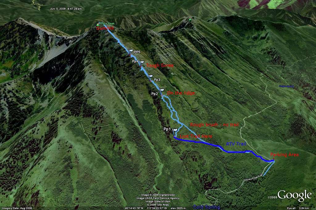
Provo Peak Route - West Ridge
I thought I'd make a quick route image using the GPS tracklog to help future hikers to the summit. There's a pretty clear parking area, from which an ATV trail goes north and a little east. You can follow this for a while before heading to the ridge. We followed it a bit too far, and had a rough time cutting back across snowfields and scrub (with same nasty thorns) before we hit the right route. My PP1 marker in the image shows where we started our correction.
Gradually, as you move up the ridge, a light use trail appears. It was most clear at my PP2 marker, and we were able to follow it to the summit. It does branch in the scree, so you're left to choose your own path.
PP3 is a set of dead trees that are something of a landmark along the ridge, and there are some spots to sit and catch your breath.
PP4 was probably the roughest area; I was glad for trekking poles in the high wind and the rough scree there.
PP5 is something of a "false summit", though that's too generous. From this point you can actually see the summit, though; the slope lessens a bit, too.
On the way down, we cut a more straight path and hit the ATV trail quite a bit closer to the parking area. This would be the easier route up, to, as there are more aspens and less brush. We couldn't see any clear path through, though.
Anyway, I hope that's helpful to someone.


Comments
Post a Comment