

|
|
Mountain/Rock |
|---|---|
|
|
33.93610°N / 111.8795°W |
|
|
Maricopa |
|
|
Hiking |
|
|
Spring, Fall, Winter |
|
|
4884 ft / 1489 m |
|
|
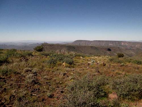
Overview
 View from the summit
| Quien Sabe Peak is a principal summit in the Cave Creek-Skull Mesa hills about an hour north of Phoenix. A number of trails circle and cross the area, which is dominated by 4,884-foot Quien Sabe Peak lying atop Skunk Ridge (mesa), the slightly-lower Skull Mesa, and New River Mesa, all contained within the Tonto National Forest. However, the forests here are about shin high, the lands being higher-elevation Sonoran Desert, featuring a mix of cactus, grasses and woody scrub. The Seven Springs-CCC Campground is a small but popular camping spot located near the Cave Creek Trailhead, one let-in point for the hike. Despite the proximity to Phoenix, it appears not many people hike these trails, as we found them a little overgrown and faint in sections. The hike from the Cave Creek Trailhead covers about 5.9 miles each way, the last mile being easy cross country to the summit. |
 Quien Sabe Peak as seen from FR-24B Quien Sabe Peak as seen from FR-24B |
Getting There
 Nice view of the Skunk Ridge
Locate yourself at the intersection of Scottsdale Road and the Carefree Highway. Scottsdale Road becomes Tom Darlington Road here, heading north, now within Carefree city limits. Go north about two miles to Cave Creek Road. Turn right (east) and go about seven more miles to where the road splits, a right leading to Bartlett Dam, and a left (straight) leading into the hills. This is now Forest Road 24.
Drive about 11 miles to the Seven Springs-CCC Campground, where the parking lot for the Cave Creek Trailhead is found about 0.3 mile north of the campground. From downtown Phoenix, this is about a 40-mile drive. Forest Road 24 is paved most of the way, and wide, graded hardpack dirt the rest. Any vehicle can manage this road. However, if it is raining hard, there are a couple of creek fords that could be swollen.
Route
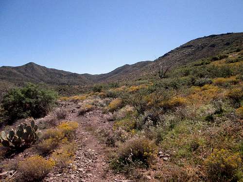
Hike south on Cave Creek Trail #4 about two-thirds of a mile to where it intersects Forest Road 24B which comes in from the campground (this means you could start from the campground if you choose to camp there). Trail #4 continues downhill into Cave Creek drainage. You'll see buildings belonging to the Cartwright Ranch across the way. Now in the trees, cross a fence, and soon, the trail comes to the Cave Creek drainage. Trail #4 bends west, but you want to cross Cave Creek drainage for the banks on the other side. There is a sign telling you to do this. This part is kind of a mess, as large cairns guide the way, but rains have obliterated any sense of a trail here. The continuation of the route does become easy to follow, and ascends up onto higher land and leads to a junction with the Skunk Trail, #246, which is basically a dirt road.
Follow Trail #246 as it contours with the hillsides. That's Skunk Ridge directly ahead. The trail gains and drops along the way, passing by Quien Sabe Spring. Eventually, this trail intersects with Trail #250, Quien Sabe Trail. This is about 4 miles from the Cave Creek Trailhead.
Head south now, paying attention to the trail as it gets a little overgrown here. You aim for a 4,400-foot saddle on the west slopes of the main mass of Skunk Ridge. Just before you come to this saddle, angle left and start the off-trail segment, hiking up easy slopes about 400 feet to gain the main ridge, then southeast down and up to the summit itself. This off-trail segment is grassy and brushy, but easy to navigate.
There is a small hump that is set apart from the summit that appears to be higher as you approach it, but when you get to the summit, this hump is noticeably lower by a few feet. The true summit is topped by a jumble of rocks, while the hump is just a few hundred feet east and easy to gain. I visited both but could not find a register at either location. The views are excellent, with mesas to the west and north, Butte, Bronco and Continental Peaks to the south, some of the homes and streets of Cave Creek to the southwest, and great views of the mountains looking east, with Weavers Needle and the Superstitions way off to the southeast.
The net gain from the trailhead to the top is a little over 1,500 feet, but there is a lot of up and down along the way, so the actual gross gain (including regains on the exit) is in excess of 2,300 feet.
Wear long pants, long shirt and sun hat. Wear gloves and carry hiking poles or a staff. If the weather is warm, be on the lookout for snakes. Javelina are also common in the area.
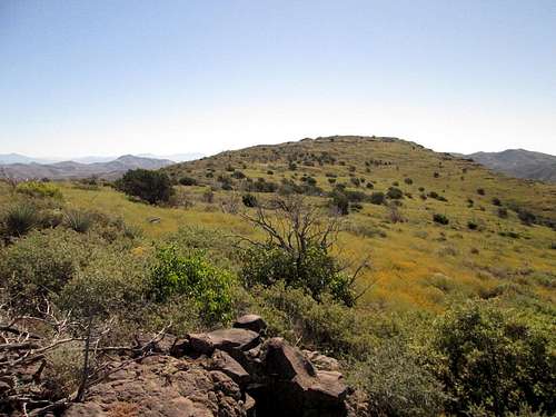 The highpoint is up ahead, now atop Skunk Ridge
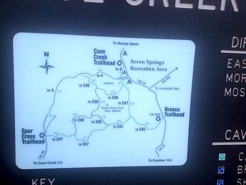 Map of the area at the trailhead
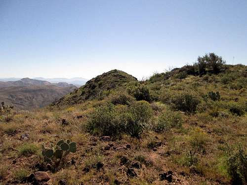 View of the "hump" from the actual summit.
Red Tape
There is no red tape in particular.
When to Climb
When the weather cools, about mid-October to about early April. Summer is too hot, and occasionally, these hills get snow, but mostly, the weather conditions are very good in the winter and shoulder months.
Camping
The CCC camp is the most logical place. There is a fee. Here is the website.
External Links
 Skull Mesa and behind it, New River Mesa, as seen from the top of Quien Sabe Peak.
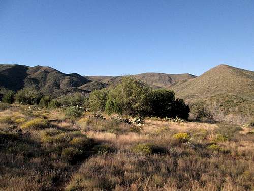
 The "hump" and Quien Sabe Peak as seen from Skunk Trail.