
|
|
Mountain/Rock |
|---|---|
|
|
46.75665°N / 121.82241°W |
|
|
Pierce |
|
|
Hiking |
|
|
Spring, Summer, Fall, Winter |
|
|
4100 ft / 1250 m |
|
|
Overview
Rampart Ridge is the southern high point on the Rampart Ridge loop trail in Mount Rainier National Park. Though it only has about 250 of elevation gain and is technically not even the true high point on the ridge connecting to Mount Rainier it is still a very significant bump in terms of popularity. This is an easy hike with a total elevation gain of 5 miles and 1500 feet of gain and can take even the more casual hiker less than a half day to summit. The actual true summit requires about 100 feet of simple offtrail walking to the high point. That point is a pretty field hidden within the forest and there is hardly a view up top except for the very top of Mount Rainier. Far better views are to the south which looks over at Longmire and to the northeast which has an excellent shot of Mount Rainier.
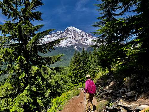 Heading on the trail
Getting There
From Puyallup and the Seattle and Tacoma Metro Area: Take WA-161 South "Meridian Ave" for 23 miles until you reach Eatonville. Once in Eatonville turn left onto Center St and go a 1/2 mile. From there continue onto Alder Cutoff Rd for 6.5 miles. You want to then turn left onto WA-7 Mountain Highway. This road will turned to National Park Highway for 18.5 miles. Stay on Washington 706 "Paradise Rd" for 7 miles to the town of Longmire. Once you are in Longmire look for parking on right by Guest Lodge. Walk across the street for the trailhead.
Route
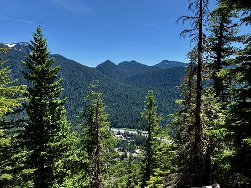 The view from a lookout point
This description is the loop from south to north. From the trailhead parking area go across the street and take the trail as it goes downhill to a bridge. It will cross the bridge and start to head uphill. At 0.3 miles you will hit a trail junction with a sign point to go to Rampart Ridge to your left. Take the well graded trail uphill as it rises in a moderate pitch through the large and open forest. Some sections will be steeper but some other grades will be less steep. Take the trail as it goes predominately west until near the ridgeline and then north all of the way to within 100 horizon feet of the summit. You will know that you are getting near the summit because there is a very pernounced view a quarter mile before the summit. Once you are near summit just bushwhack up and you will be in a field that is covered in trees. Views are minimal here. Head back to the trail and go one hundred more feet and you will run into another far better view of Mount Rainier to the northeast and Pyramid Peak to the west.
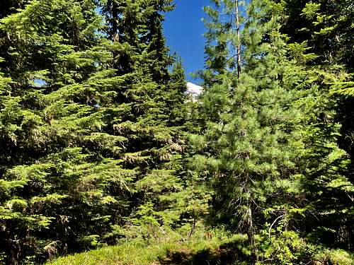 Not much of a view from the true summit
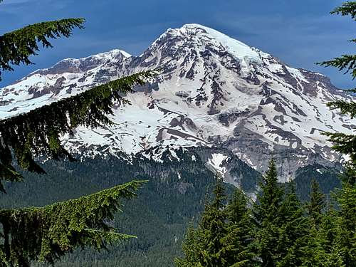 Much better view to the north
From there either go back the way you came or complete the loop. From the northeast viewpoint to the another trail junction is 1.1 miles. At that junction make a right toward the sign that say Longmire 2.2 miles. Take the trail as it at first decends somewhat steep down followed by a much more moderate grade. You will then cross Paradise road roughly 0.3 miles before you back at Longmire.

Red Tape
There is admission in order to get into Mount Rainier National Park. This varies by the year and as of 2018 can go from $30 to $80 for just a one day visit. This park also accepts the Golden Eagle Pass which is very good deal.
When to Climb
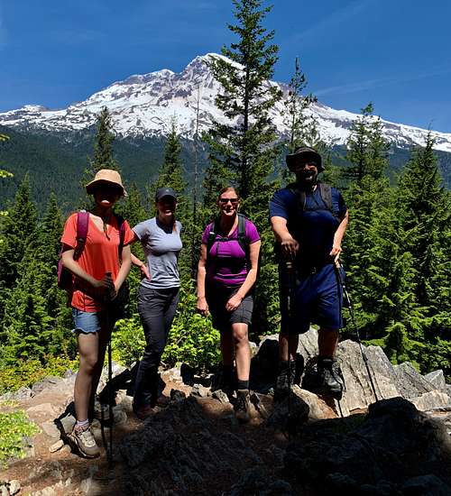 Group photo
This is a year round mountain. This peak would make a great snowshoe destination for anyone in the area.
Camping
This is a very short and heavily travelled trail so camping is not recommended here. There is logging though right at the trailhead in Longmire and logging and camping all over Mount Rainier National Park which requires a a wilderness permit is required for camping in the national park. For more information about back-country camping at the national park CLICK ON THIS LINK
External Links
Another page noting the trailhead loop