
|
|
Mountain/Rock |
|---|---|
|
|
40.40815°N / 111.0084°W |
|
|
Wasatch |
|
|
Hiking |
|
|
Spring, Summer, Fall |
|
|
10595 ft / 3229 m |
|
|
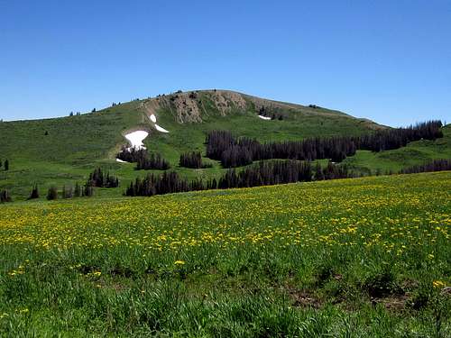 Red Creek Mountain and a floral display
Overview
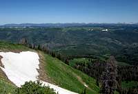
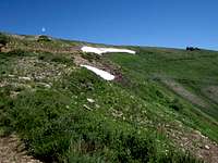
An interesting area is the high country east of Heber City Utah. A large plateau area that rises to over 10,000 feet in elevation and is really off of the beaten track and rarely visited by anyone but hunters, ATV'ers and campers. It is well worth a visit and has, if you are interested in peaks with more than a thousand feet of prominence, several to choose from. Two are very close together and can be visited easily on the same day. These two are Current Creek Peak (see SP page) and Red Creek Mountain. Due to the high elevation of the plateau, it is often late spring or mid summer before the snow leaves and allows the roads to dry out enough to get close. Those who are interested in snowshoeing or skiing adventures, can find their way into this high country much earlier in the year. Snowmobiliers can also gain access when the snow still blankets the area.I first learned of the area when I read SP member Eric Willhite's trip report about Red Creek Mountain on his web page that provides some nice information, pictures and maps of the area. I would recommend that you utilize his information to supplement what is found on this page. To find Eric's information, click on this link. Eric has also put up summitpost pages for Current Creek Peak, Bald Knoll and Racetrack BM (another peak with over 1000' of prominence).
Getting There
From Heber City, take East Center street and head east. It will become Lake Creek road and head up into the hills east of town. It goes from being pavement to a dirt/gravel road but doesn't require 4WD at any time. After the road enters the National forest (FS 083), it becomes better again and at between 16-17 miles, a junction is reached at 9700' (lat/long 40.4215 111.1768) Take the right fork (still FS 083) that heads south and drive another 3.4 miles and take a left turn onto FS road 080. This road isn't as good as the one you just left but continue on it for about 10 miles where you get very close to Red Creek Mountain. There is no trailhead, just choose a spot where you want to hike from. Do not attempt to drive the road that leads up the side of the mountain as it isn't in very good condition.I'd recommend the Utah Benchmark map book (see page 52 for the area) Also, Eric Willhite has created maps for access to this peak which he has provided on the trip report mentioned above.
Red Tape
This is U.S. Forest Service land and there are no red tape issues that I am aware of. For more information on the Uinta-Wasatch-Cache National Forest:Salt Lake Office
(801) 236-3400
125 South State Street
Salt Lake City, UT 84138
Mon-Fri: 8:00am - 4:30pm
 |  |  |
Camping
There are a couple campgrounds in the area as well as places where you could camp just off the road. If you do car camp, remember to practice leave no trace ethics.Heber City has plenty of motels and Provo and Park City are within easy driving distance.
Mill Hollow CG
Current Creek CG
 |  |  |
Weather
Heber City weather0ther nearby summits with SP pages
Current Creek Peak is another peak with over a thousand feet of prominence and can easily be combined with a visit to Red Creek Mountain. The summit of Current Creek Peak is a bit more like a summit should be, not flat and rounded like Red Creek Mountain's summit area.Bald Knoll could also be done on the same day as Red Creek Mountain and Current Creek Peak. It has some sweet views to the west and in my opinion should be included in a nice day's outing.
other nearby summits with over 300' of prominence
Buck Knoll 9101' 321'Wolf Creek Peak 9949' 409'
Duchesne Ridge 10140' 440'
Heber Mountain 10207' 505'
Peak 9780 9780' 400'
Lightning Ridge 10175' 555'
Peak 8500 8500' 480'
Peak 8777 8777' 397'
There are many more and lists of john makes it very easy to find them.